sholomar
-
Posts
31 -
Joined
-
Last visited
Everything posted by sholomar
-
3/24-3/27 Midwest/Plains Colorado Low(s)
sholomar replied to Minny_Weather's topic in East of the Rockies
precip has been nonexistant so far. This is really what I've come to expect from all major storm predictions. Like every single one. They almost always underdeliver. I'm adding to my list of things I read daily to not overly anticipate these storms anymore and just live in the moment. No looking at forecasts or weather models a week out anymore. That said, I'm gone. Take care, all. -
3/24-3/27 Midwest/Plains Colorado Low(s)
sholomar replied to Minny_Weather's topic in East of the Rockies
Looking to be a garbage sleet/freezing rain storm... Usually what happens. . Weather models disappointing as usual. -
3/24-3/27 Midwest/Plains Colorado Low(s)
sholomar replied to Minny_Weather's topic in East of the Rockies
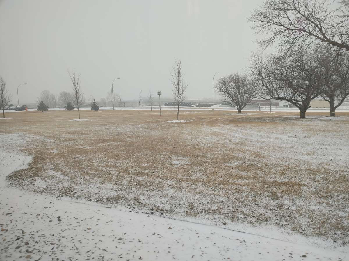
Good start for Brookings early on.
-
3/24-3/27 Midwest/Plains Colorado Low(s)
sholomar replied to Minny_Weather's topic in East of the Rockies
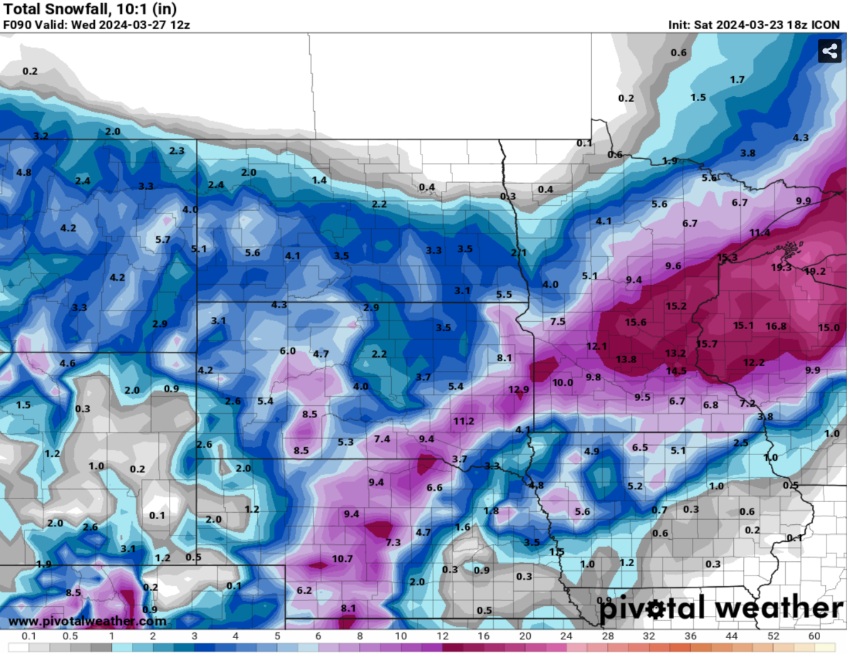
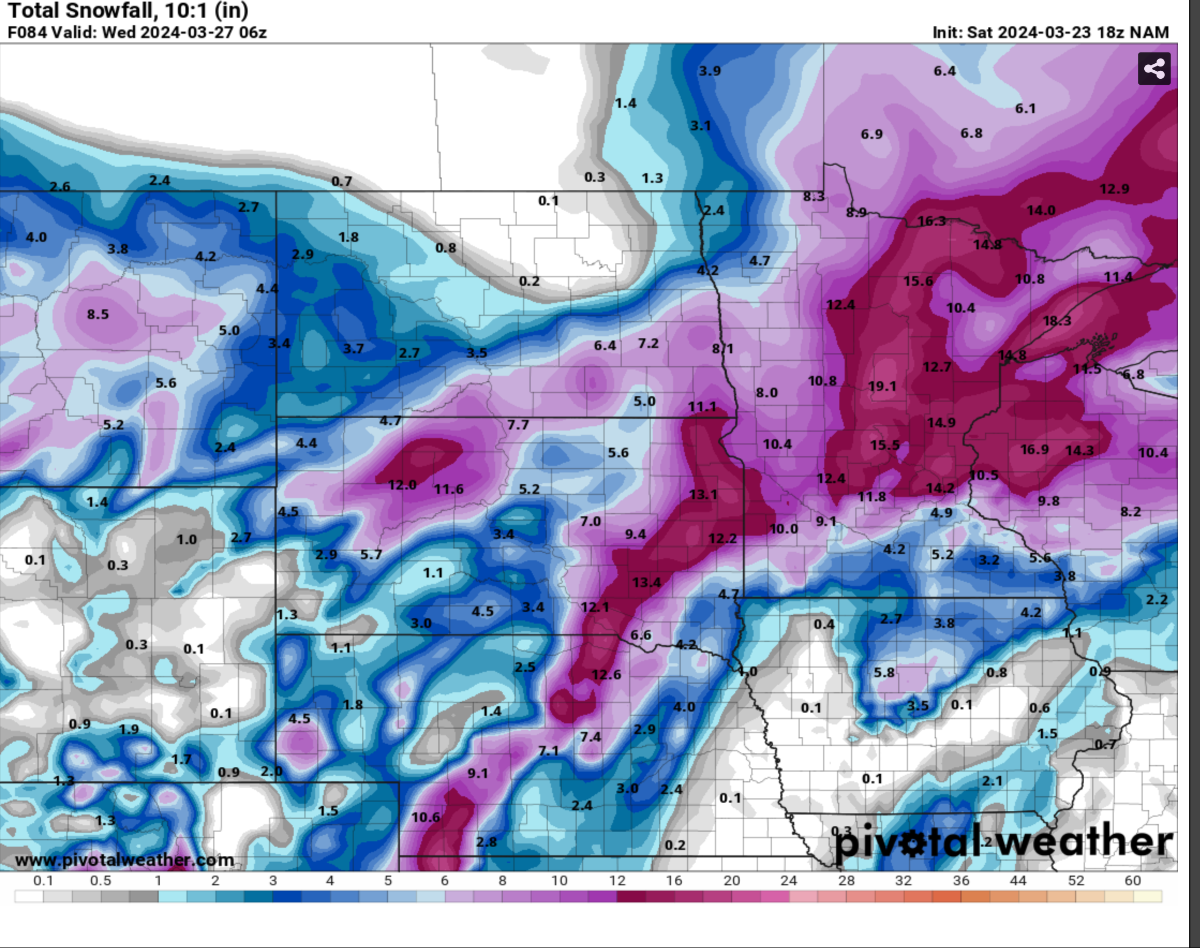
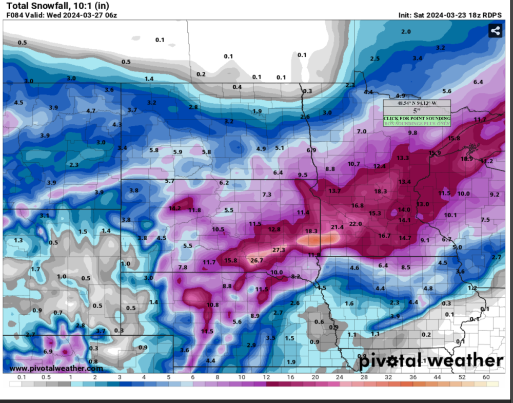
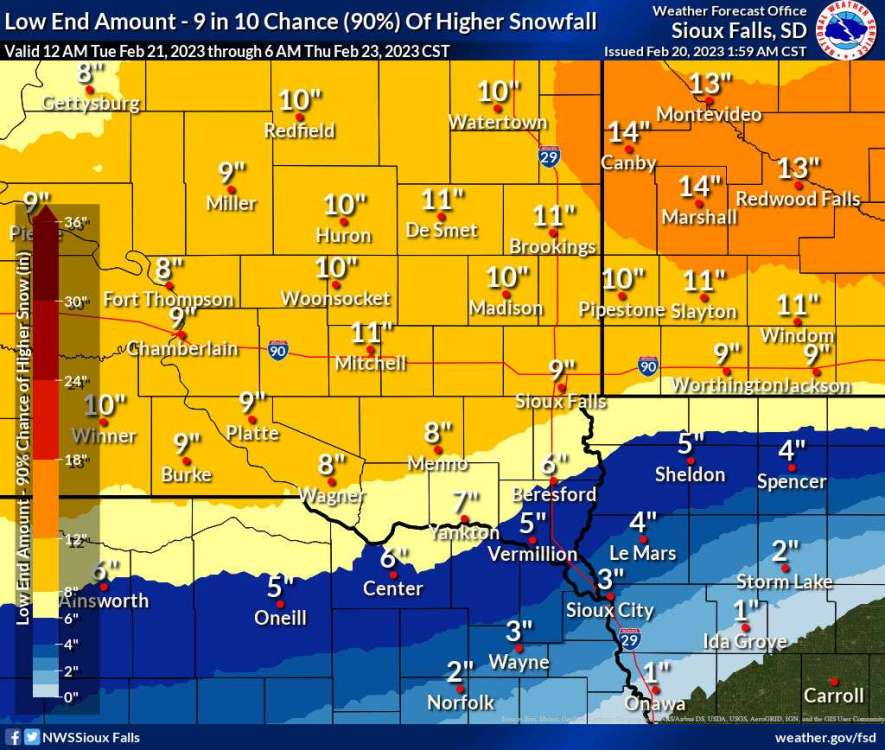
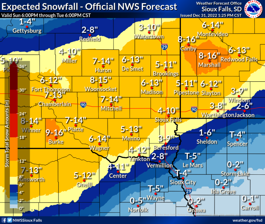
NOAA/NWS upping the sleet/rain numbers while lowering the totals for my area a bit based on some of the model runs... 18Z GFS data is coming in right now I see. 18Z GFS looking good for Brookings... not much change from past runs. Unfortunately Sioux Falls is still solidly in the mixed precip area. My mother lives in Lake county, which is in the bullseye on this model, on an acreage. She'll be stuck at home a day or two if this one pans out. RDPS looks better for Sioux Falls with south shift on 18Z, ICON has us in the bullseye but has reduced totals for everywhere compared to a day or two ago, and NAM has the storm taking a more north track with the bullseye over Watertown but still much better than it's 12Z run which quite frankly sucked and likely contributed to NWS's recent estimate lowering.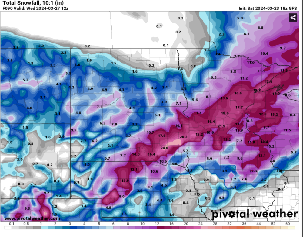


-
3/24-3/27 Midwest/Plains Colorado Low(s)
sholomar replied to Minny_Weather's topic in East of the Rockies
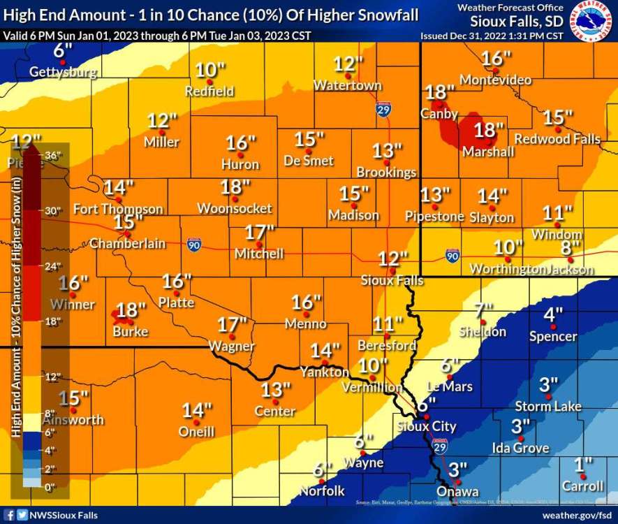
NOAA prediction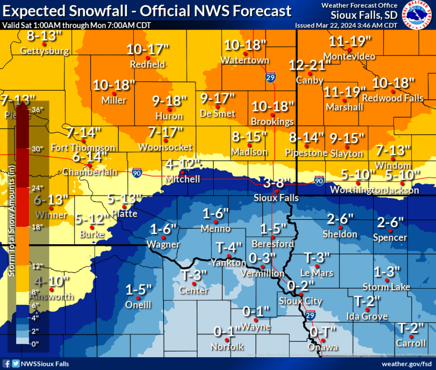
-
3/24-3/27 Midwest/Plains Colorado Low(s)
sholomar replied to Minny_Weather's topic in East of the Rockies
"Be glad if it's less" says the normies. I hope we get 24 inches. -
3/24-3/27 Midwest/Plains Colorado Low(s)
sholomar replied to Minny_Weather's topic in East of the Rockies
KELOLAND being more optimistic regarding getting both waves in the last hour... a "disruptive" storm.. more for Brookings to Sisseton and east into Central MN. More moisture in general is good for this area regardless how it falls.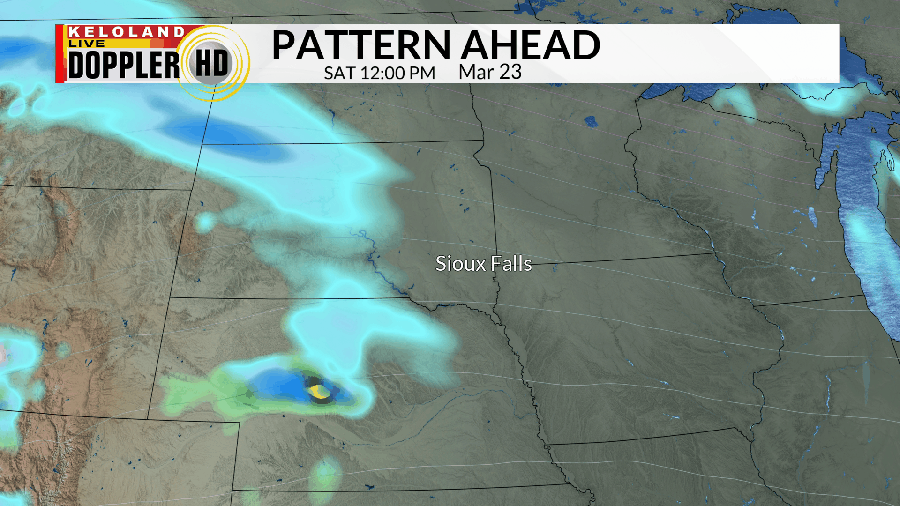
-
3/24-3/27 Midwest/Plains Colorado Low(s)
sholomar replied to Minny_Weather's topic in East of the Rockies
KELO is always better than your average TV station with their weather modelling. They tend to be more conservative with their estimates for snowfall and tend to be more correct. Here's their say thus far: https://www.keloland.com/weather/forecast/spring-like-weather-coming-to-an-end-hello-winter-this-weekend/ -
January 11-13 Major Winter Storm/Blizzard
sholomar replied to Hoosier's topic in East of the Rockies
Father is in Grafton, WI... just far enough west from the lake to be getting snow... often it's the simple drive 2 miles east to costco and you get the transition. Looking at these live cams you can see that West Bend and Waukesha are getting hammered while Port Washington and Racine (right along the lake) are not. https://www.tmj4.com/weather/weather-cams https://www.tmj4.com/weather/forecast/todays-forecast/southeast-wisconsin-weather-blizzard-conditions-possible-by-evening -
January 11-13 Major Winter Storm/Blizzard
sholomar replied to Hoosier's topic in East of the Rockies
father lives in Ozaukee County, WI. Looks to get another good storm. However the 5 inches we just got won't melt until March or April anyways, whereas his couple of feet will be totally gone before my 5 inches, LOL. While I was out jogging 5 miles, I got hit by a burst of moderate to heavy snow for about 20 minutes. That was quite enjoyable. -
Our first decent snow for Brookings? As usual KELO is more conservative with their estimates and they tend to be right more often than not.
-
2/21 - 2/24 Powerhouse Upper Midwest/GL's Winter Storm
sholomar replied to Tom's topic in East of the Rockies
This is actually impressing me so far... looks like we'll hit the foot.. Brookings is already a huge mess with the snow we've gotten so far. Off work tomorrow and Thursday just going to relax and enjoy the show. Suddenly they are saying we will get 4 inches overnight tonight instead of the inch they were predicting... that first wave going further south?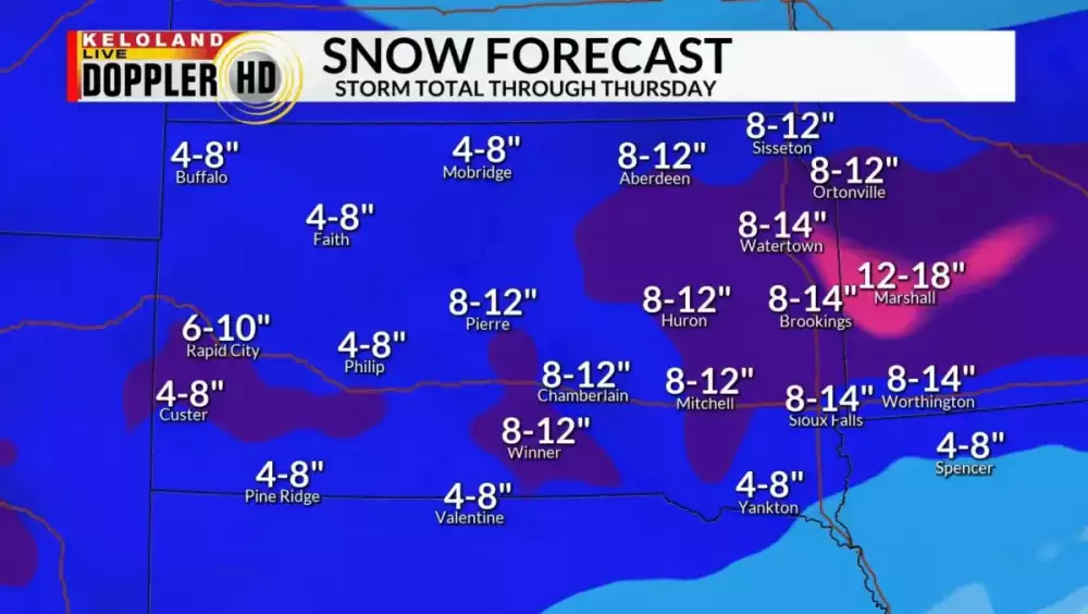
-
2/21 - 2/24 Powerhouse Upper Midwest/GL's Winter Storm
sholomar replied to Tom's topic in East of the Rockies
90% chance of 11 inches with a range of 11-17 inches for me. Maybe my father in Ozaukee county WI might get lucky too!

-
2/21 - 2/24 Powerhouse Upper Midwest/GL's Winter Storm
sholomar replied to Tom's topic in East of the Rockies
New Keloland projections. They tend to be pretty accurate.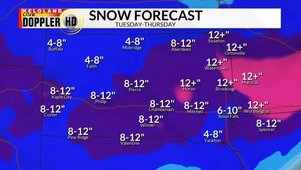
-
2/21 - 2/24 Powerhouse Upper Midwest/GL's Winter Storm
sholomar replied to Tom's topic in East of the Rockies
I'm in Brookings County South Dakota but my father's in Ozaukee County WI. He's been disappointed by the snow this season and wants a big one, so this one will definitely be interesting given how close the snow line it is to that location. -
2/21 - 2/24 Powerhouse Upper Midwest/GL's Winter Storm
sholomar replied to Tom's topic in East of the Rockies
People were actually talking about this one at work on Wednesday already. Was waiting for a thread to pop up about it. They were however totally unaware a snowstorm was going on to the south of us in Nebraska, which caused some of our inputs coming up from Tennessee to get delayed. -
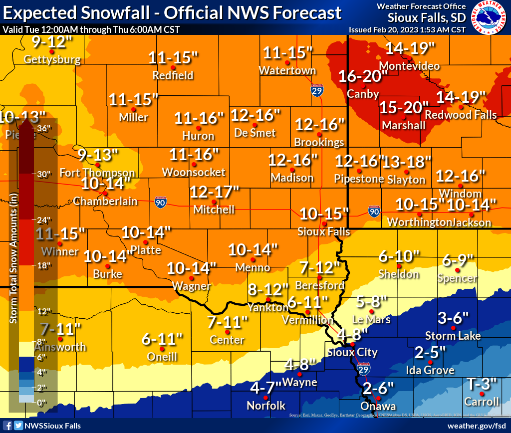
Congrats to Sioux Falls. We haven't even gotten a dusting yet in Brookings. I should know better by now to trust the NWS over KELO as their snowfall predictions are usually much more accurate. They trust the European model and pretty much nobody else. Enough storms being overhyped where they predict double the actual snowfall you'd think I learn my lesson by now. No more following potential storms days ahead of time using models for me. It almost always leads to disappointment. No more trusting the NWS.
-
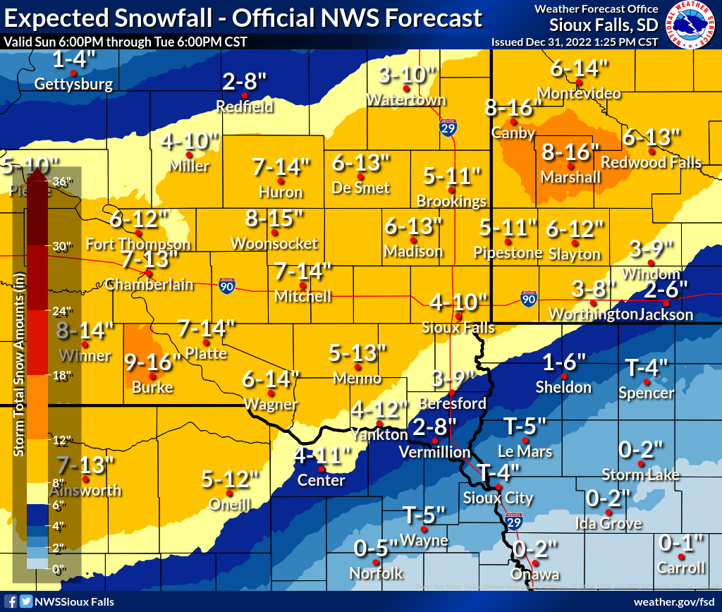
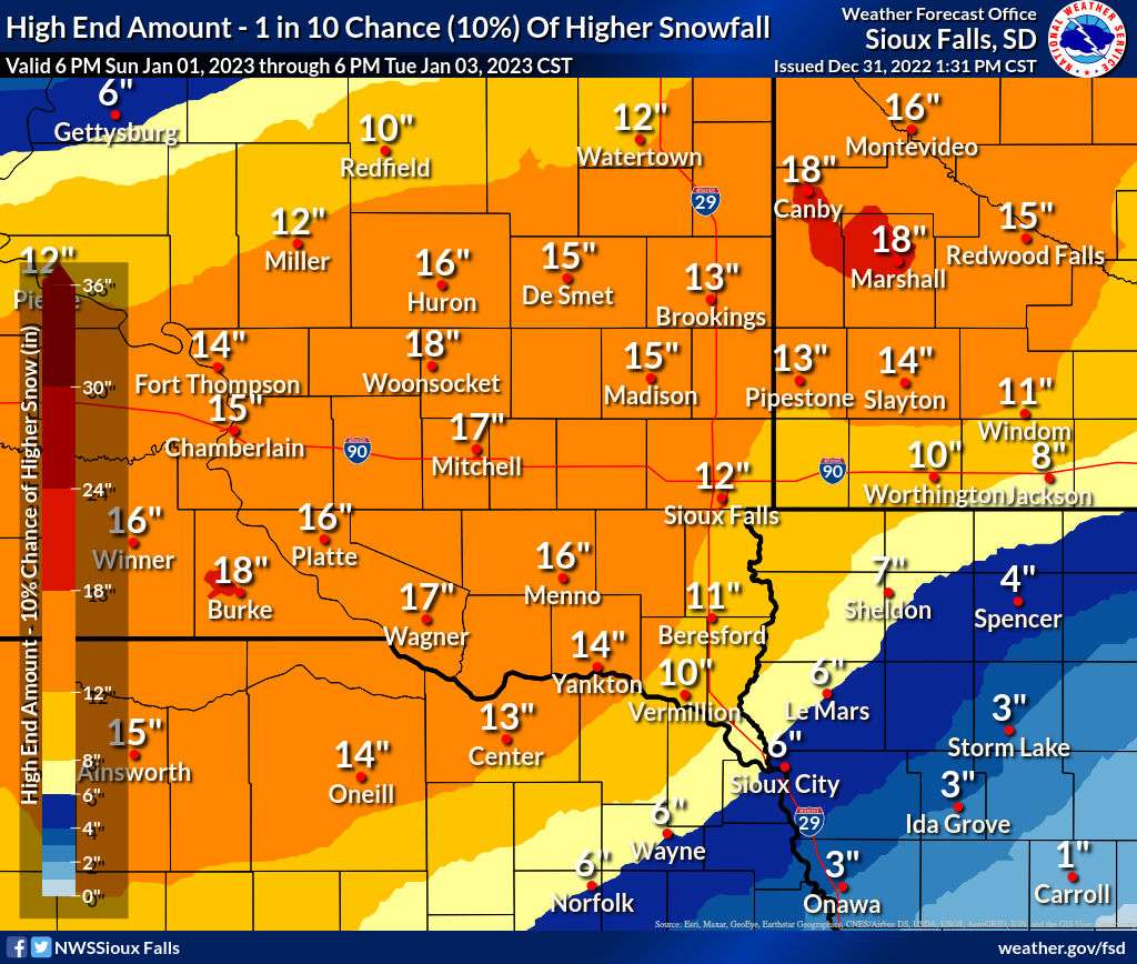
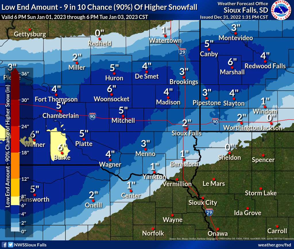
NWS is not backing down... Aberdeen office just issued winter storm warnings. They seem to think Watertown is getting more snow than the latest models suggest. Local point forecast says we are getting a foot now which is up 4 inches from this morning. Still looking good. Ice storm warning just issued for Sioux City a minute ago. Looking good for both Sioux Falls and Brookings. I will stay optimistic. The "bullseye" area hopefully hits between these two towns to share the fun. My mother is located on an acreage east of Madison in Lake County SD ... if they end up getting a foot or more she'll be stuck at home a couple of days. Her forecast... https://forecast.weather.gov/MapClick.php?x=195&y=75&site=fsd&zmx=&zmy=&map_x=195&map_y=75
-
If Brookings gets taken out of the picture I'm done following storms way ahead of time. KELO now has it all going south. https://www.keloland.com/weather/forecast/new-years-day-is-quiet-winter-storm-headlines-for-mon-tue-storm-center-am-update-sunday-january-1/
-
Pretty please with sugar on top... without the dry area that the models like to predict for the Coteau/Brookings.

-
I went from a 55 degree stroll along Lake Michigan in Port Washington WI on Thursday to returning to 6-8 inches of snowcover and 27 degrees in Brookings. Might as well double that with a nice storm. Not going to obsess over the models too much this weekend. Don't want to be set up for disappointment.
-
Pre-Christmas Storm Plains/MW/GL 12/21-12/22
sholomar replied to bud2380's topic in East of the Rockies
And I was going to leave from Brookings SD and drive to Grafton WI Friday Morning. Looks like that might end up being Saturday morning. In any case, I hope we get dumped on. Latest ECMWF FTW. -
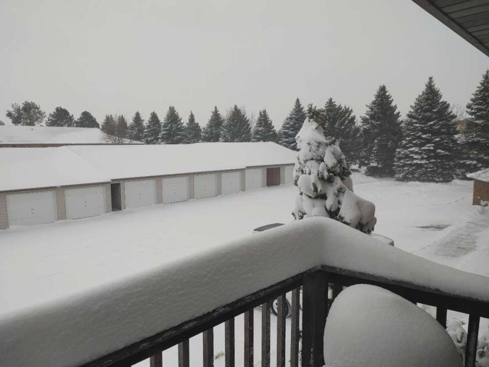
Brookings SD... 5-6 inches from this storm, a couple inches of previous snowcover. Enough to enjoy the Christmas season. All of SD, ND, and MN seem to have snowcover now. Wish I had gotten a foot or two but that was never forecast anyways, plus snow that falls in the coteau des prairies doesn't really like to melt most winters until March, so we get stuck with any snow that falls for quite awhile. The Keloland webcams seem to be working again. "Deadwood 3" provides a nice view. https://www.keloland.com/weather/live-cameras/
-
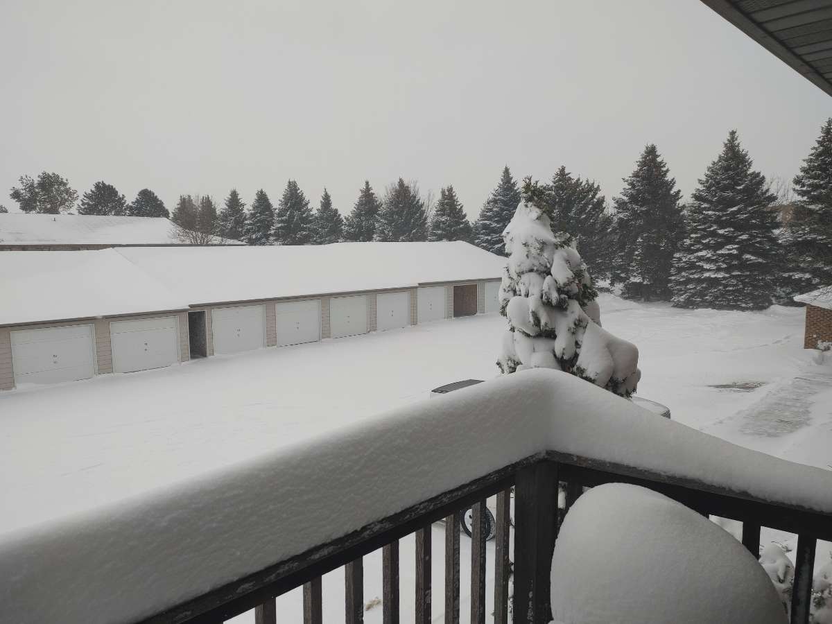
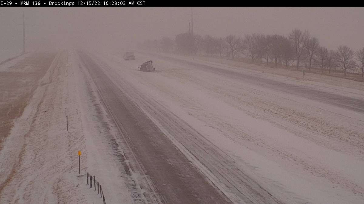
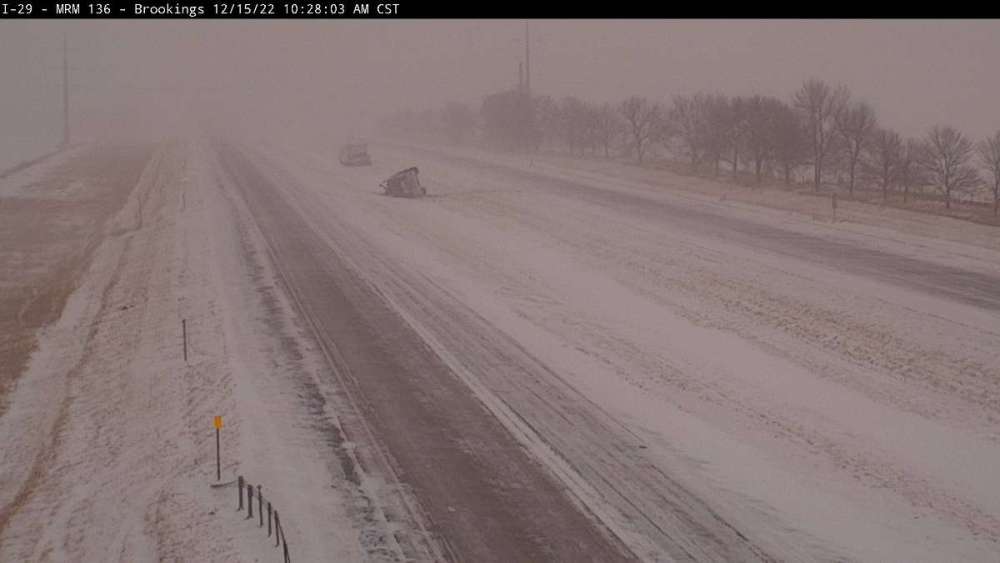
Now we're getting some snow... looks like a couple of fresh inches with maybe 3-4 more inches coming. Looking at the positives had we got dumped on with snow through the whole even I wouldn't have been able to take the nice 5 mile jog around the parks during the break yesterday. That was nice. Will be too cold for cardio for awhile now. I have off so I can relax and enjoy it falling today. DOT webcam outside Brookings caught a couple of median crashes.
-
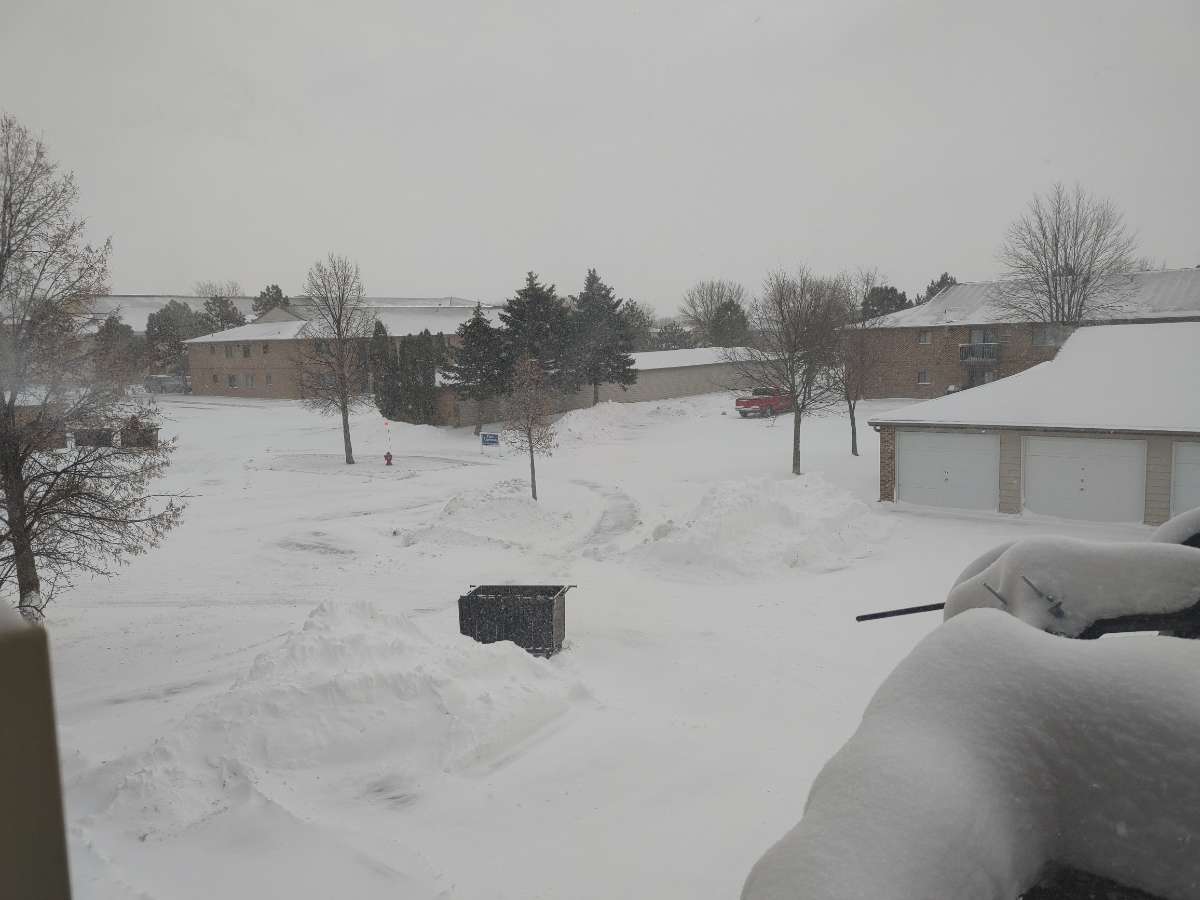
Storm has been as much of a downer as I suspected it would be... but their models were surprisingly accurate. We are finally getting some snow minutes after I made this post. The days of them totally botching the storms when I was younger or even 5-10 years ago has really diminished. I must admit I'm impressed with the ability of models to predict these storms the last few years.