-
Posts
4278 -
Joined
-
Last visited
Everything posted by westMJim
-
The mean meteorological winter temperatures were well above average across west Michigan and that keep the lake effect snow fall down. The 3 month mean at Grand Rapids was 30.7° At Muskegon it was warmer still at 31.4° and to the east at Lansing it was 30.0° all were well above average. For meteorological winter the snow fall was 41.7” at Grand Rapids for the winter season so far it is 48.7” at Muskegon the meteorological winter snow fall was just 39.4” and for the season they are now at 50.3” and to our east at Lansing the meteorological winter snow fall was 36.9” and for the season they are at 42.7” While Muskegon and Grand Rapids are much below average in the snow fall department Lansing is near average.
-
You know here in west Michigan there has been a lot of talk about how little snow that has fallen this winter season. Well yes compared to the averages for our area it has been much less than average but for locations at our latitude this winter has been very much a average year for total snow fall. Grand Rapids officially at the airport is at latitude 42.8825 (I live at 43.0128) and officially recorded 48.5” of snow fall. Well to our west at Madison latitude 43.1406 their 30 year average snow fall is 50.9” at Milwaukee latitude 42.9550 their average snow fall is just 46.9” and to our east at Port Huron at latitude 42.9750 their average snow fall is just 37.1” so yes Grand Rapids is well below average for snow fall this year but is still in line with other locations at our latitude.
-
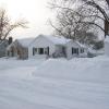
The official snow fall at the airport yesterday was 1.9” while here at my house there was just a trace. And this morning the depth at the airport was reported as 1” while here at my house there is NO snow on the ground just the old snow piles. Now for the official readings for Grand Rapids are for February 15.9” for meteorological winter 41.7” and for the 2019/20 season 47.5”
-
2/24-2/26 Snow (Ring the doorbell so the big dog wakes up!!!)
westMJim replied to Madtown's topic in East of the Rockies
The snow that fell here is now ALL gone. Down to just the old snow piles. Of course there was just a trace that fell here. -

February 2020 (It's cold at the end of the run!)
westMJim replied to Madtown's topic in East of the Rockies
The snow here has lighten up and now is just a few flurries and it has melted on the road, driveway and even the roofs. Also the snow plow went by (more likely than not to drop salt) but the snow was already melted. Here are the stats for February so far at GRR the mean temperateness is 27.9° that is a departure of +1.5° for the month 14.0" (14.8" is average for February) of snow fall has been reported for meteorological winter the total is 39.8" and for the season the total is now at 46.6" the meteorological winter and the total seasons total are both well below average for Grand Rapids and unless there is a massive snow storm in March or April Grand Rapids will end both well below average in the snow fall department. And yes meteorological winter will end up much warmer that average. -

2/24-2/26 Snow (Ring the doorbell so the big dog wakes up!!!)
westMJim replied to Madtown's topic in East of the Rockies
yes it is snowing here NW of Grand Rapids but that is about all you can say. There is a trace of snow on the ground and that is it. With that light snow falling it is now 28 here. -

February 2020 (It's cold at the end of the run!)
westMJim replied to Madtown's topic in East of the Rockies
There is a old weather saying that "ice on a pond that can bare the weight of a duck in November the rest of the winter will be rain and mud" and yes there is way too much reliance on computer modeling and not enough old school meteorology of course now the meteorologists can point a finger at the models and now take as much blame -
With spring now just around the corner one attention now turns towards spring and just what will spring 2020 bring? Well as luck would have it as we head into March and spring there are now indications that the positive NAO that has brought the eastern US a mild winter will now flip to a more negative NAO and guess what? That change could happen around mid March. What will that mean? Beware of the Ides of March. I will say no more.
-

February 2020 (It's cold at the end of the run!)
westMJim replied to Madtown's topic in East of the Rockies
With the sun we had yesterday and mild temperatures took a big bite out of the snow cover here. There now is a lot of bare ground showing. Of course the snow piles are still there and there is still snow on the north side of building and in the woods yet. It is not unusual to have no snow on the ground in late February. In the 30 leap years of records here at Grand Rapids 15 had either no snow on the ground or just a reported trace. At this time it is sunny here with a temperature of 36. -

February 2020 (It's cold at the end of the run!)
westMJim replied to Madtown's topic in East of the Rockies
Lots of sun here today. The low overnight was +8 here at my house with the official low of 12 out at the airport. I live just NW of Grand Rapids and there is a good 3” of snow on the ground here but in the city and into the southside of the city there is a lot less snow on the ground. With the sun the temperature is now up to 24 here. -
Officially yesterday Grand Rapids recorded 1.7” of snow fall that brings February to 13.8” (the 30 year average for a 28 day February is 14.8” so GR needs just one more inch to be average for the month) For meteorological winter GR now has 39.6” and for the season 46.4” As of yesterday at 7 AM GRR reported 2” of snow on the ground. Today I have 2.5” on the ground. Grand Rapids has a chance of making the average snow fall for February, no chance of making average snow fall for meteorological winter. And would need a lot of snow (over 30”) in March and April to reach the average for the season. The mean temperature so far for February at GRR is 27.0 and that is still +1.7 for the month as of this date. February will be the coldest month of the winter and depending on how March plays out could be the coldest of the winter season.
-

February 2020 (It's cold at the end of the run!)
westMJim replied to Madtown's topic in East of the Rockies
Just a short late winter update for Grand Rapids Michigan. Here are some facts for this winter season. The first snow fall of more than a trace was way back on November 6th While November did have below average snow fall there was snow of 1” or more for 5 days that month. November at this time was the only month with below average temperatures. December was mild with most of the snow fall on the 1st and again on the 31st with not much in between. The month ended up +4.0 warmer then average with below average snow fall of 14.3”. Christmas was very warm with a high of 55 and a high of 61 on the 26th January was much warmer than average with a mean of 31.3° and there was just 11.5” of snow fall. January 2020 was the 6th warmest in Grand Rapids recorded history. So far February mean is at 27.2 with a departure of +1.7° The snow fall at this time is at 12.1” this looks it will be the coldest month of the winter of 2019/20 (unless March is much colder than average) So far this winter season there have been 45 days of snow cover of 1” or more. The average for a winter season at Grand Rapids is 70 days with a range of 23 days in the winter of 1982/83 to a high of 124 days in the winter of 1903/04. Last year there were 66 days and in the winter of 2017/18 there were 67. The winter of 2016/17 there were just 42 and in the winter of 2011/12 there were just 34. To sum up this winter season would be mild with much below average snow fall. But since this winter started in early November I would not call it a short one. -
For anyone who is interested the average 1st 50° (we have already have had 2) at Grand Rapids is February 8th the range has been from January 1st 2011 to the latest on April 4th 1912. For 55 the average first one is on February 22nd with the range from January 1st 2011 to the latest on April 8th 1972 and for 60 the average is March 14 with a range of January 4th 1997 to the latest of April 17 1975.
-
With the official 0.4" of snow fall yesterday at GRR (I had a little more at just under one inch) the official total now for Grand Rapids for February is 12.1" since December 1st 37.9" and for the season 44.7"
-

February 2020 (It's cold at the end of the run!)
westMJim replied to Madtown's topic in East of the Rockies
There is only two weeks of meteorological winter left. And while meteorological spring starts on March 1st it can be a long and slow process before we see any real spring like weather. So soon the sap will be running and what little snow and ice we have will be gone and the days will get longer. At this time it is 37 here at my house with some sun. -

February 2020 (It's cold at the end of the run!)
westMJim replied to Madtown's topic in East of the Rockies
Getting light snow fall here at this time. The temperature here is 29 with that light snow falling. -

February 2020 (It's cold at the end of the run!)
westMJim replied to Madtown's topic in East of the Rockies
The overnight low here at my house was +4.6° and it looks like the low at GRR will be +4° at this time it is 15 here at my house. -

February 2020 (It's cold at the end of the run!)
westMJim replied to Madtown's topic in East of the Rockies
The low here at my house was +8.1° but officially at the airport when no one was looking it dropped down to +4 and that has a good chance of being the coldest low for the winter of 2019/20 and if that is the case it will be one of the warmest lowest winter lows here at Grand Rapids A list of winters with warmer lowest that I can find are 1920/21 and 1937/38. -
Officially at Grand Rapids 1.3" yesterday (2/13/20) for the month 11.7" since December 1. 37.5" and for the season 44.3"
-

2/17-2/19 Weather (Somethings brewing, but might just be coffee)
westMJim replied to Madtown's topic in East of the Rockies
GRR this AM is NOT impressed with the system and it looks like mostly rain in west Michigan. -

February 2020 (It's cold at the end of the run!)
westMJim replied to Madtown's topic in East of the Rockies
The sky is cloudy here with clear sky just to my east. Because of that it is warmer here than at the airport at this time it is +9 here and the last report was +7 at GRR. The low at GRR so far has been +6 and that will be the new low for the winter of 2019/20 season. There was a trace of new snow here last night. Officially at GRR yesterdays snow fall was 1.3" that gives Grand Rapids 11.7" for February. Since December 1st the snow fall is 37.5" and for the season it is 44.3" and that is well below average as of this date. Yesterday AM there was 3" on the ground at GRR and this morning here at my house there is 4.6" on the ground. -
Just took a couple of snow fall measurements and the total here at my house is now at just under 2" so will call it 2". At this time some light snow and blowing snow with a temperature here of 21
-
Here is where several Michigan locations are for total seasonal snow fall this winter. Grand Rapids 43.0” Muskegon 44.0” Lansing 33.2” Detroit 29.0” Flint 39.3” Saginaw 27.3” Alpena 51.0” Sault 86.3” Gaylord 92.7” Petoskey 84.2” Traverse City 65.7” Marquette 144.4” At this time it is 21 here with light snow falling.
-

February 2020 (It's cold at the end of the run!)
westMJim replied to Madtown's topic in East of the Rockies
With hazy skies the temperature here is now up to 35 at my house and the latest official reading is 28 at GRR. The most official snow depth at Grand Rapids this winter has been 6" The record lowest maximum snow cover for a winter at Grand Rapids is 4" in the winters of 1943/44 and 1905/06. There have been 4 years with 5" and 10 more years with 6". At this time while the snow has been on the below average side it looks like it will be how warm this winter has been that will make the record books. -

February 2020 (It's cold at the end of the run!)
westMJim replied to Madtown's topic in East of the Rockies
For Grand Rapids the average number of days with a maximum of 32 or less is 54 the. So far this year GR is at 19 days the record low number is 18 set in the winter of 2011/12. Other years with a low number that I can find are the winters of 1931/32 and 2011/12 with 27. I know you were not interested in this but hey you brought up a good point.


