CentralNebWeather
-
Posts
7133 -
Joined
-
Last visited
-
Days Won
34
Everything posted by CentralNebWeather
-

January 21-23 Wintry Mix Transition Event
CentralNebWeather replied to Black Hole's topic in East of the Rockies
Just saw a forecast of snow and potentially ice Monday night to Tuesday morning with .05-.15” of ice. This will need to be monitored closely. Sure can’t say this has been a boring winter around here since the Christmas blizzard onwards. -
January 17-19 Plains-Midwest Snowfall
CentralNebWeather replied to Hoosier's topic in East of the Rockies
Yep. That’s is what came through and ended up cancelling many events. We were in the last hour of school so no early dismissal. -
January 17-19 Plains-Midwest Snowfall
CentralNebWeather replied to Hoosier's topic in East of the Rockies
After the latest snow. IMG_1894.mov -
January 17-19 Plains-Midwest Snowfall
CentralNebWeather replied to Hoosier's topic in East of the Rockies
Heavy snow band came through with blizzard conditions for awhile. Snowing and blowing again. More impact than was anticipated around here. MS Basketball games postponed. Lots of games starting to be called off as snow is blowing across the roads. Almost 0 visibility on the north side of town as I drove home from school. I hope after the warm spell, this all cycles through in February and March. Typically our stormiest and snowy months. -
January 2024 Observations and Discussion
CentralNebWeather replied to Minny_Weather's topic in East of the Rockies
GFS much farther west.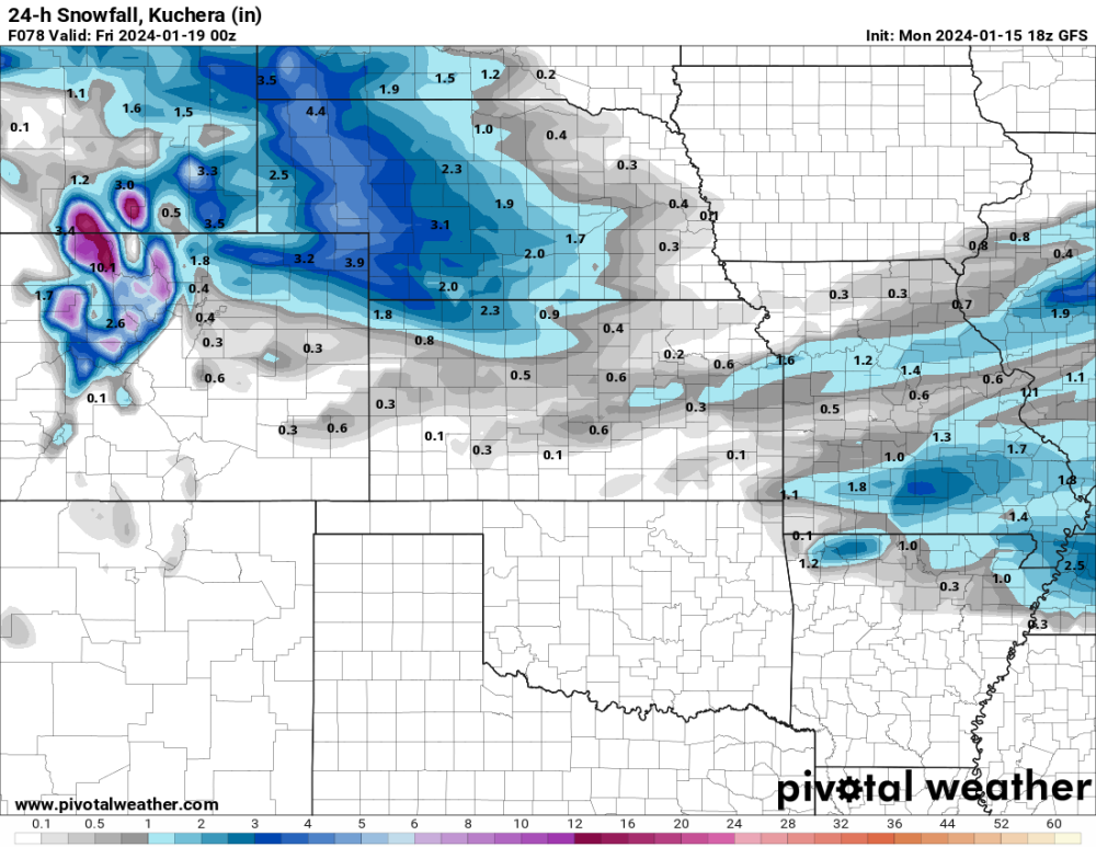
-
January 14-16 Major Winter Storm and Arctic Blast
CentralNebWeather replied to Black Hole's topic in East of the Rockies
Almost 2” more today. Keep it coming. Neighborhood this afternoon adding to the snow depth.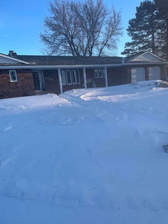

-
January 14-16 Major Winter Storm and Arctic Blast
CentralNebWeather replied to Black Hole's topic in East of the Rockies
Snowing again since around 5:30 am. Forecast says 1-3”. Blowing around with the cold temp, dry snow and wind gusts to 20 mph. Visibility down to 0.75 miles. I would say 1” so far -
January 14-16 Major Winter Storm and Arctic Blast
CentralNebWeather replied to Black Hole's topic in East of the Rockies
Still dropping. Was -12 just 3 hours ago.
-
January 2024 Observations and Discussion
CentralNebWeather replied to Minny_Weather's topic in East of the Rockies
Just got done snowblowing again. -38 wind chill. We live on the northeast side of town. You can see blowing snow clouds in the country. Our typical east west roads in this part of town are virtually impassable without 4x4. So of course I went out through them. Very fun. -
January 14-16 Major Winter Storm and Arctic Blast
CentralNebWeather replied to Black Hole's topic in East of the Rockies
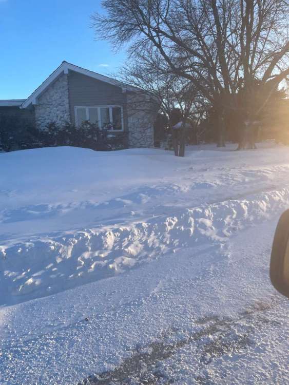
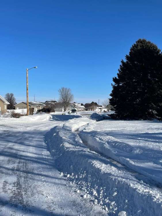
Just went outside to start our cars that have to be out in this. It is hard to describe this type of cold. The wind and snow overnight has really increased the drifting. I cleared our sidewalk yesterday to the mailbox This morning there is a 2-3’ drift across there -
January 14-16 Major Winter Storm and Arctic Blast
CentralNebWeather replied to Black Hole's topic in East of the Rockies
Temp has dropped since 6 am. My gosh.
-
January 14-16 Major Winter Storm and Arctic Blast
CentralNebWeather replied to Black Hole's topic in East of the Rockies
Looks like we had another 1/2”-1” overnight of very dry wind blown snow.
-
January 2024 Observations and Discussion
CentralNebWeather replied to Minny_Weather's topic in East of the Rockies
0z Canadian turning very snowy. Ok then.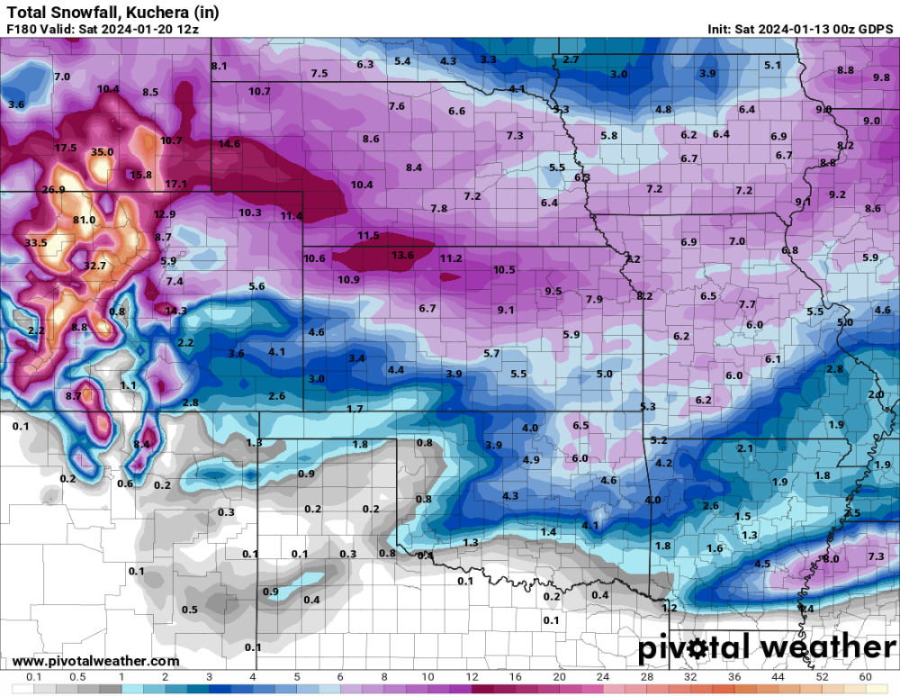
-
January 14-16 Major Winter Storm and Arctic Blast
CentralNebWeather replied to Black Hole's topic in East of the Rockies
10 pm.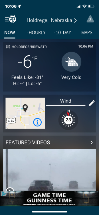
-
January 11-13 Major Winter Storm/Blizzard
CentralNebWeather replied to Hoosier's topic in East of the Rockies
Already blizzard warnings very close to me. We’ll see if I’m added overnight or not. -
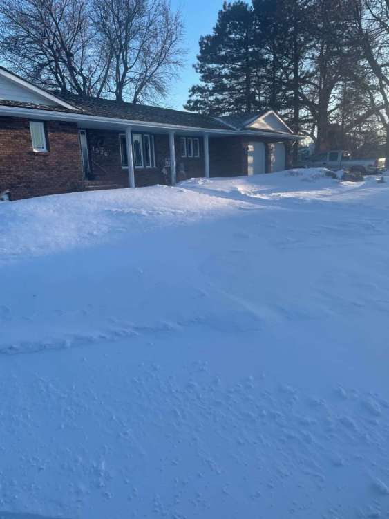
January 11-13 Major Winter Storm/Blizzard
CentralNebWeather replied to Hoosier's topic in East of the Rockies
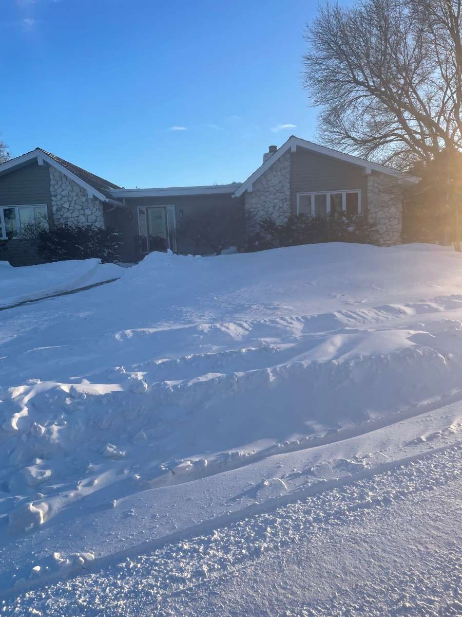
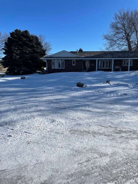
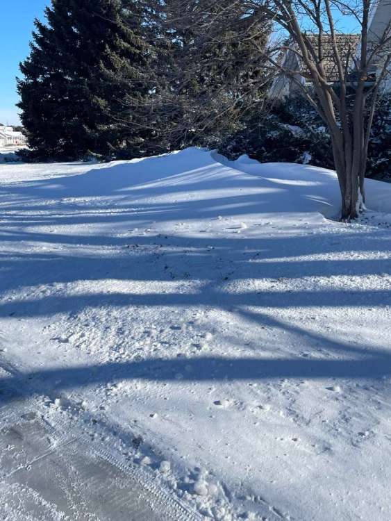
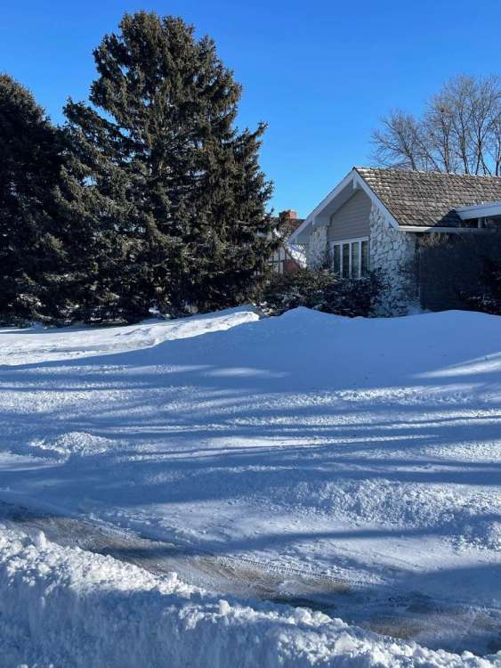
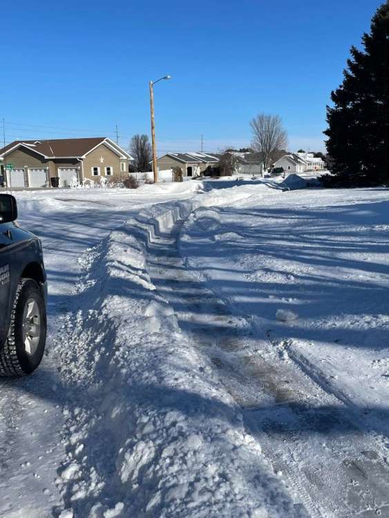
We received 5” last night into early this morning. Not like others got, but adds to our drifts and piles. Another snow late tonight through tomorrow. Pictures from this afternoon.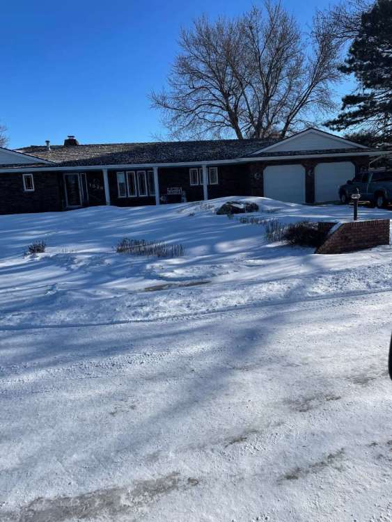
-
January 11-13 Major Winter Storm/Blizzard
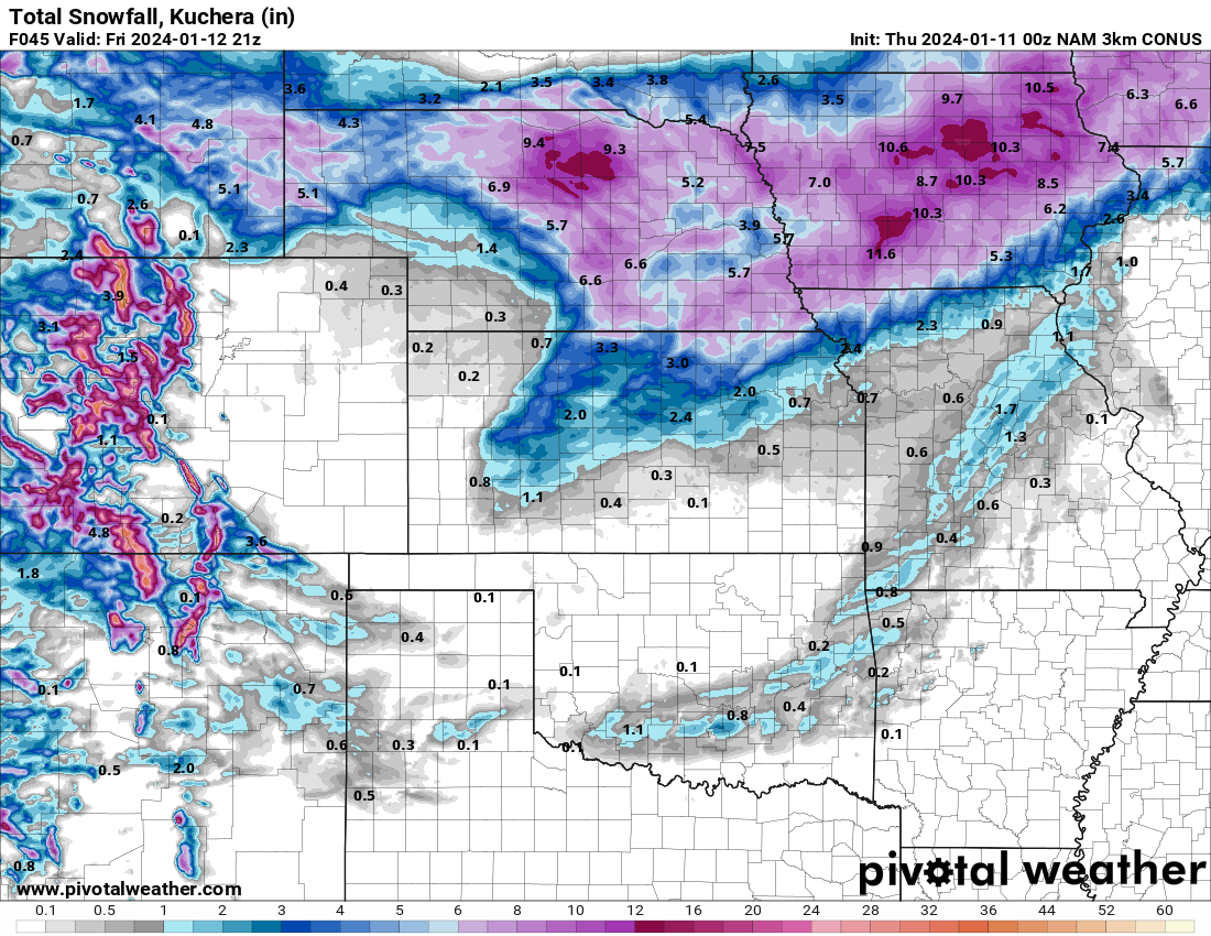
CentralNebWeather replied to Hoosier's topic in East of the Rockies
NSSL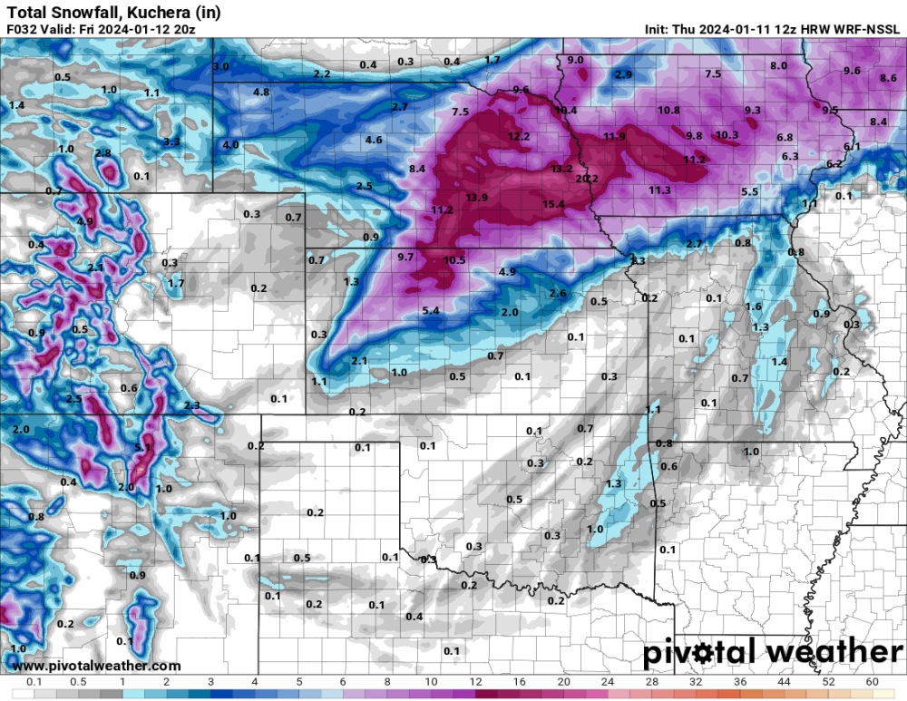
-
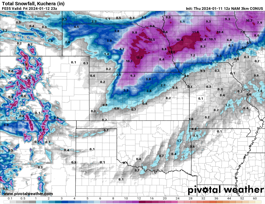
January 11-13 Major Winter Storm/Blizzard
CentralNebWeather replied to Hoosier's topic in East of the Rockies
3KM
-
January 11-13 Major Winter Storm/Blizzard
CentralNebWeather replied to Hoosier's topic in East of the Rockies
Last minute surprise? NAM putting a good band of snow over my area. I’ll be watching the radar all day. Good luck everyone.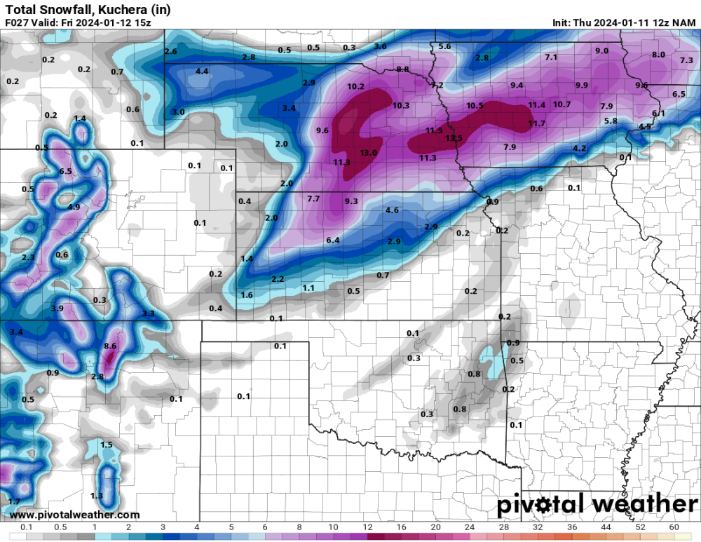
-
January 11-13 Major Winter Storm/Blizzard
CentralNebWeather replied to Hoosier's topic in East of the Rockies
I’d sure take this. -
January 11-13 Major Winter Storm/Blizzard
CentralNebWeather replied to Hoosier's topic in East of the Rockies
3KM
-
January 11-13 Major Winter Storm/Blizzard
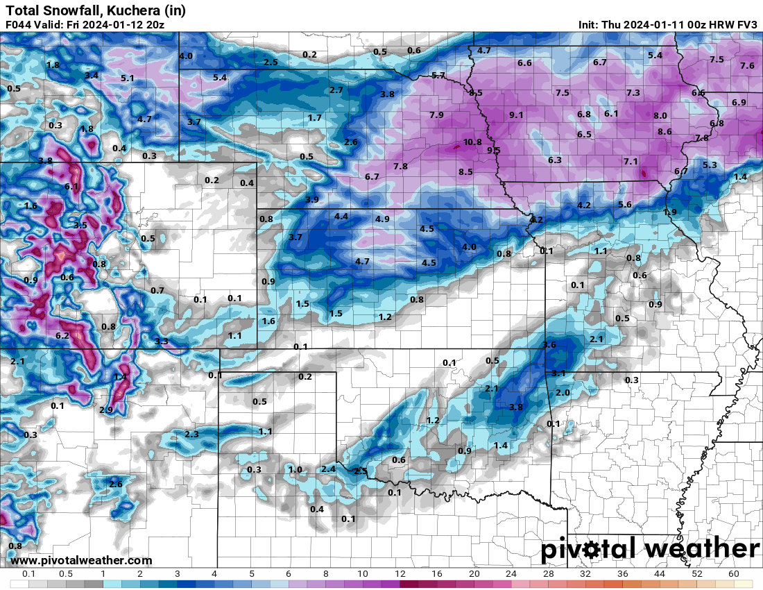
CentralNebWeather replied to Hoosier's topic in East of the Rockies
FV3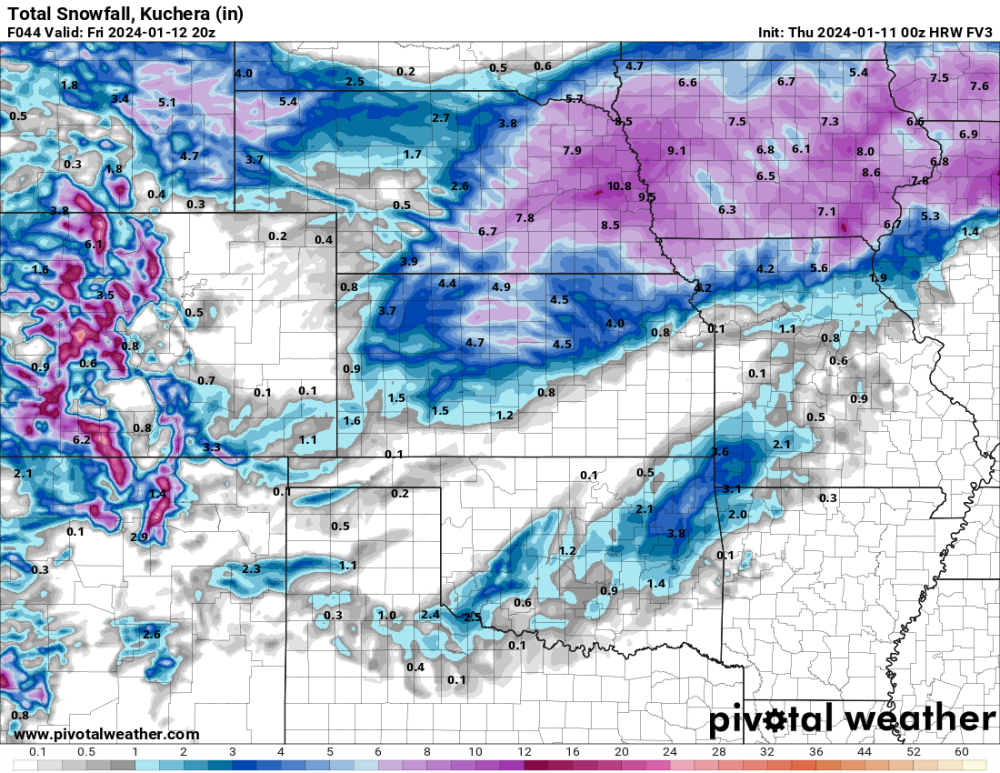
-
January 14-16 Major Winter Storm and Arctic Blast
CentralNebWeather replied to Black Hole's topic in East of the Rockies
That is brutal for your area. Here is what we’re going to deal with. Will rival February of 2021. Lowest windchill for me was -42.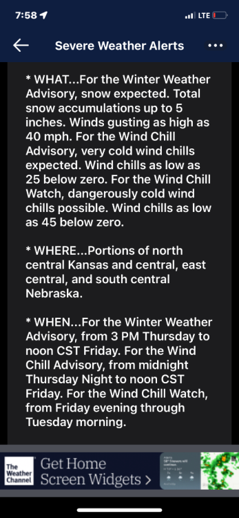
-
January 11-13 Major Winter Storm/Blizzard
CentralNebWeather replied to Hoosier's topic in East of the Rockies
It is odd. Hastings with a very poor discussion with any details. Really never talked about various models. Now the ICON and GFS have increased amounts again. 18z Canadian looks very juiced on the meteocentre site. -
January 11-13 Major Winter Storm/Blizzard
CentralNebWeather replied to Hoosier's topic in East of the Rockies
I don’t think Hastings has much of an idea either. The earlier models trended down. Now they seem to be trending back up. It’s not like this system is next week. It is supposed to start here after lunch tomorrow. Model mayhem around here imo.