gabel23
-
Posts
2304 -
Joined
-
Last visited
-
Days Won
5
Everything posted by gabel23
-
Been a crazy year @Tom. Rain totals this month is sitting at just over 7" with another 2-3" in the forecast for tomorrow into tomorrow night. Last night we had a crazy amount of CG and the rain came down in buckets. Garden is out of conrol! Wife put up 14 quarts of chili and spaghetti base today and I still have 6 beer flats of tomatoes sitting in the wind! We also canned our Colorado peaches tonight so it has been a crazy sunday. My total precipitation since January (34.05") is well over what I average in a given year!
-
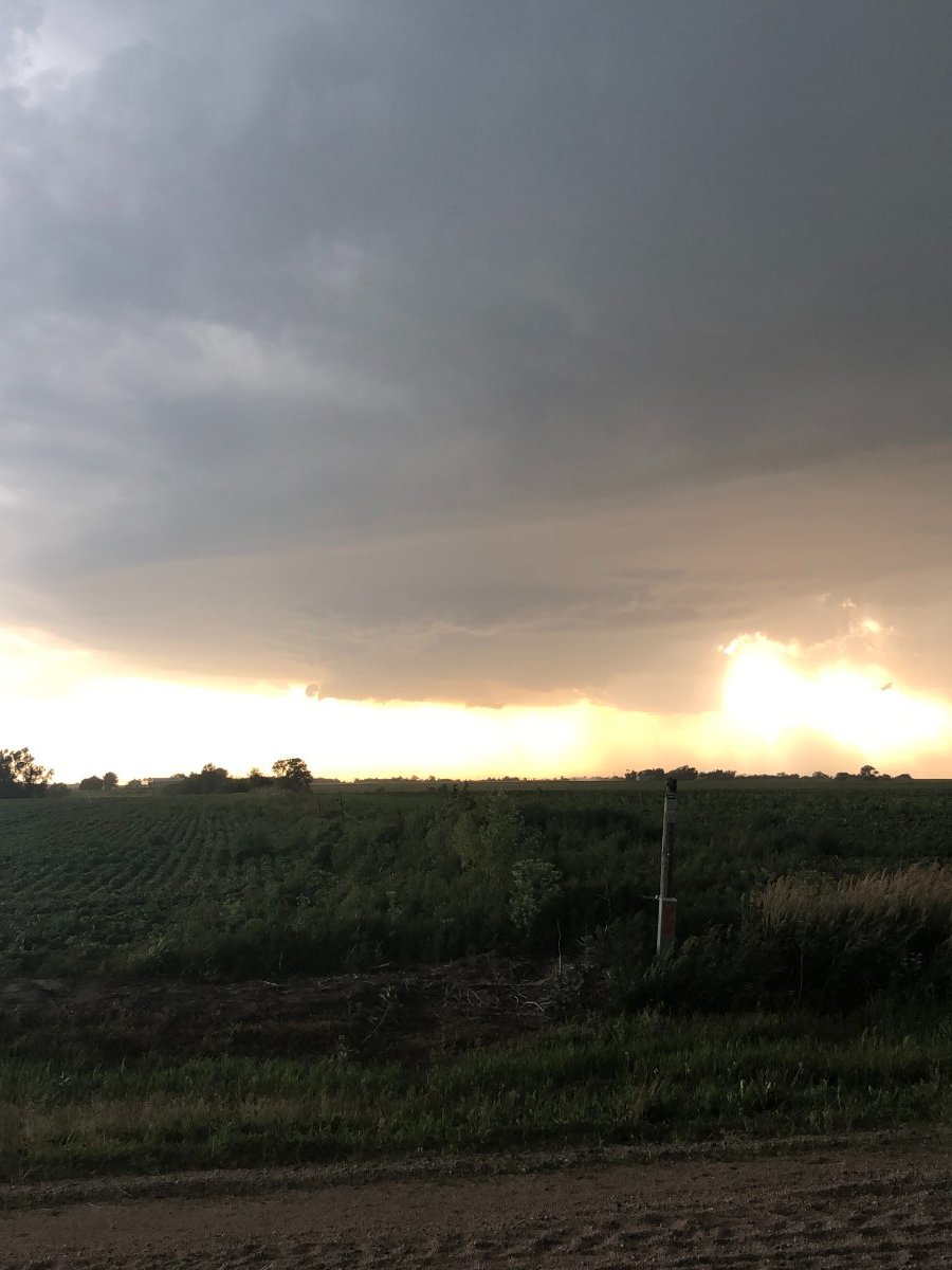
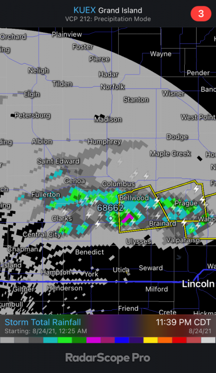
Amazing how well the HPC and their prediction for QPF played out. I wish I would have snapped that picture of their forecast earlier today. It showed a stripe of 1 to 2 inches of rain right along the Platte River. I’m approaching 2”. It didn’t start off looking good; this was what my radar was showing an hour prior to the storms.
-
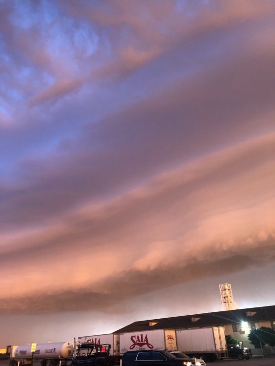
Not often we see tornado warnings at night around here. The leading edge of these storms must be spinning up some crazy air out ahead of the line. The way it looks things will pass off to my north; I could use the rain but it looks like I will be hit by the wind instead. Tornado Warning NEC119-167-240645- /O.NEW.KOAX.TO.W.0003.210624T0611Z-210624T0645Z/ BULLETIN - EAS ACTIVATION REQUESTED Tornado Warning National Weather Service Omaha/Valley Nebraska 111 AM CDT Thu Jun 24 2021 The National Weather Service in Omaha has issued a * Tornado Warning for... Southeastern Madison County in northeastern Nebraska... Southwestern Stanton County in northeastern Nebraska... * Until 145 AM CDT. * At 111 AM CDT, a severe thunderstorm capable of producing a tornado was located near Madison, or 13 miles south of Norfolk, moving east at 50 mph. HAZARD...Tornado. SOURCE...Radar indicated rotation. IMPACT...Flying debris will be dangerous to those caught without shelter. Mobile homes will be damaged or destroyed. Damage to roofs, windows, and vehicles will occur. Tree damage is likely. * This dangerous storm will be near... Stanton around 130 AM CDT.
-
Low level jet just pumping out in front of this line.

-
This would be horrible for our area, this would expand crop damage or make things worst around here. Until 145 AM CDT. * At 1257 AM CDT, a severe thunderstorm was located near Norfolk, moving east at 35 mph. This is a very dangerous storm. HAZARD...80 mph wind gusts and penny size hail. SOURCE...Law enforcement.
-
The crazy thing (and hopefully good thing) it's only a moderate risk on the dial. I would think a 90 mph likely would mean a high risk for wind on the watch detail. Regardless the supercell in O'neill is combining with the main line and will run into a lot of instability....and a low level jet.

-
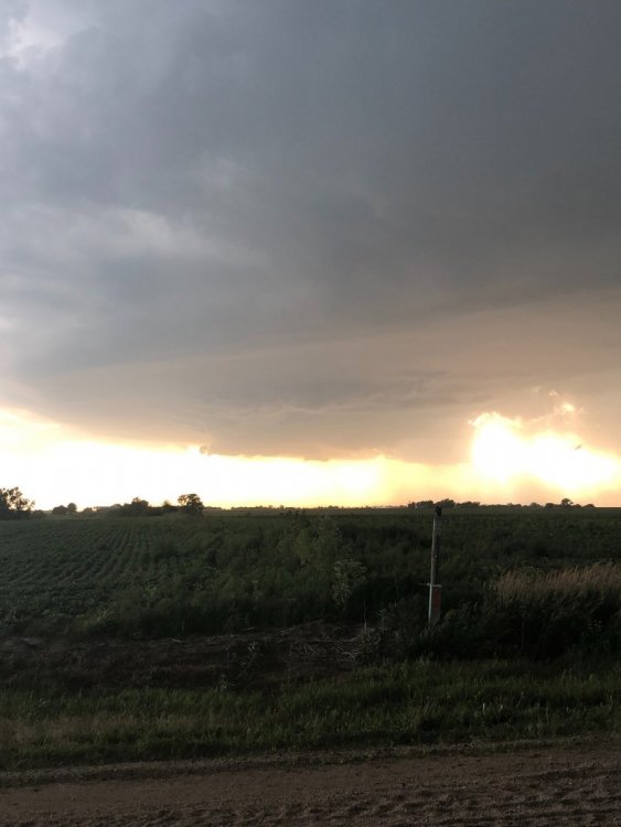
Well bad news around my county area. Last night the first of what was two supercells passed through my county. Multiple fields got shreaded by hail last night. Now it looks like a pretty good bet of a possible wind damaging MCS rolling through tonight. We need the rain but too bad about the crops. I was able to chase both supercells that passed through my county and the lightning was crazy! IMG_1330.MOV
-
It’s insane how the line of storms was moving south east and then they shifted off to the northeast once it hit the platte around Kearney.
-
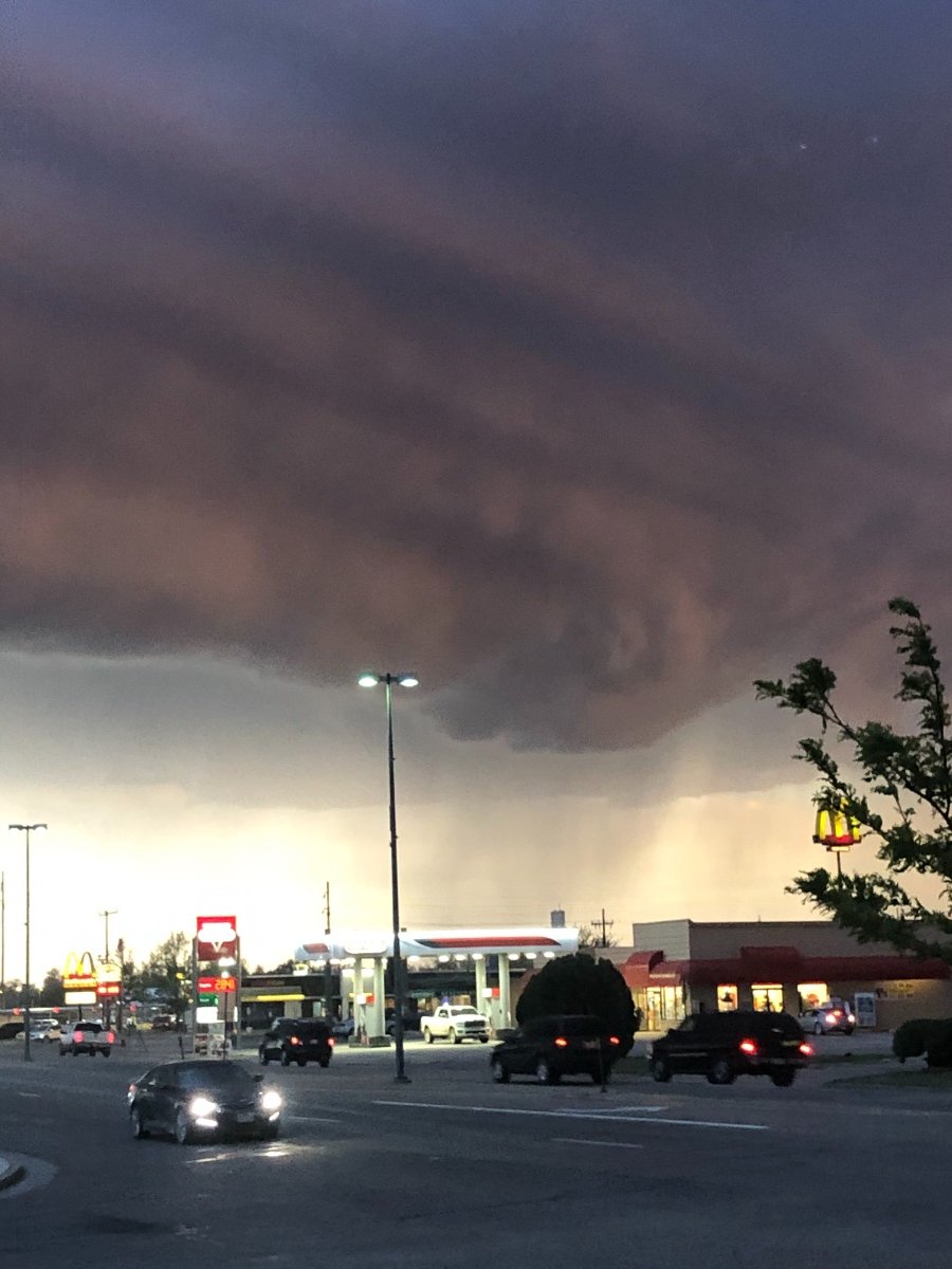
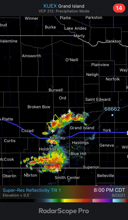
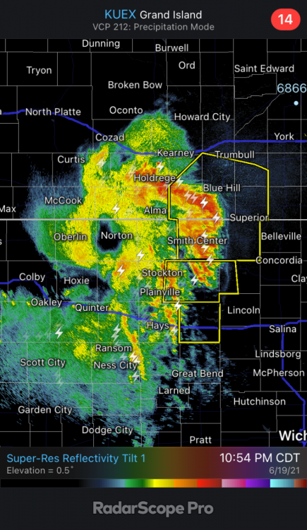
Eye of the hurricane right over Norton, Kansas. 80 mph winds following the platte river. My garden definitely doesn’t want that…butI will gladly take the rain! Until 1130 PM CDT. * At 1044 PM CDT, severe thunderstorms were located along a line extending from near Wilcox to near Campbell to 6 miles northeast of Inavale to 6 miles south of Red Cloud to 9 miles west of Ionia, moving northeast at 55 mph. These are very dangerous storms. HAZARD...80 mph wind gusts. SOURCE...Law enforcement. Law enforcement reported widespread damage across Phillips County. Additionsly at 10:35pm 83 MPH was reported at Smith Center, Kansas Airport. IMPACT...Flying debris will be dangerous to those caught without shelter. Mobile homes will be heavily damaged. Expect considerable damage to roofs, windows, and vehicles. Extensive tree damage and power outages are likely.
-
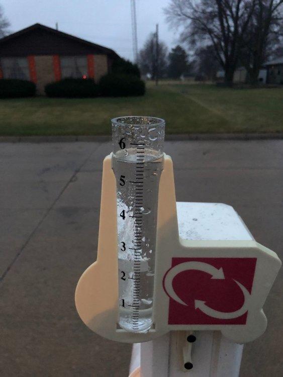
Lucked out here that’s for sure. Ended up with 1.3” of rain and was a welcome relief! I have a mowing business and I was outside for nine hours yesterday, then had my daughters eight and under softball game that night. I’m about sick of this heat and yards are in stress. This rain will help them bounce back for a bit.
-
Video. IMG_1192.MOV
-
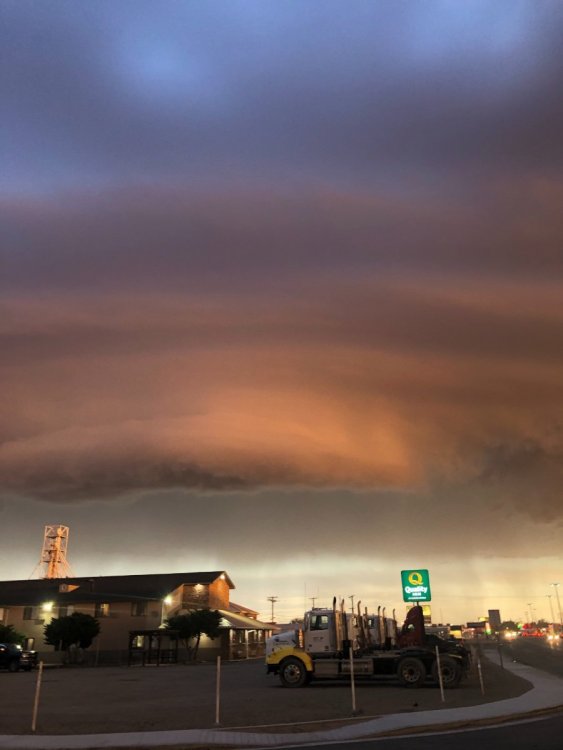
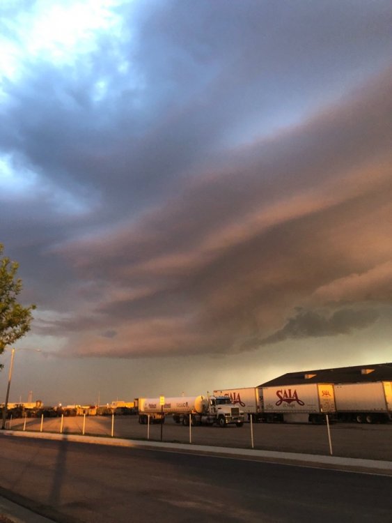
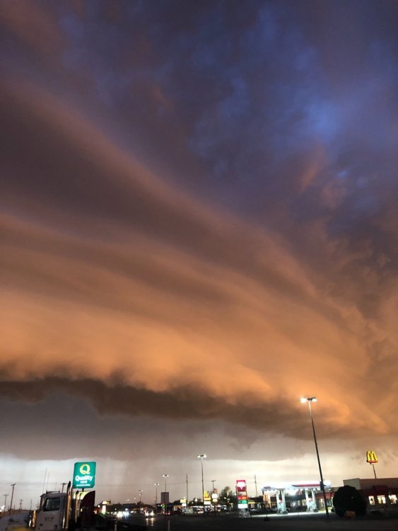
I’m in Lamar Colorado for my nephews graduation. Got to witness a gorgeous supercell thunderstorm last night! First supercell of this year, and it came right to me here in Lamar! Was tornado warned for a while.

-
Calling for all input!! What the hell is up with all of these land spout tornadoes?! We had a couple in my county the other day too. I’m thinking it’s a sign of something big coming soon.....
-
@Tom Thanks for sharing that’s amazing! I love teaching my geology unit; it’s amazing to think what the climate was like in these different regions millions of years ago. Then you throw in the Native American history and you have an amazing collection of history!
-
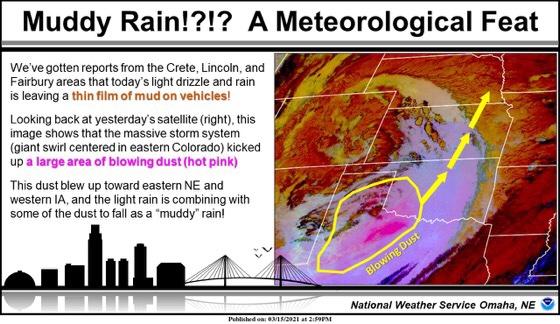
I had 5.5” of rain this morning and picked up another .1” of red mud rain today for a storm total of 5.6”. This storm was able to suck up dust from New Mexico and Texas and rained down on us!
-
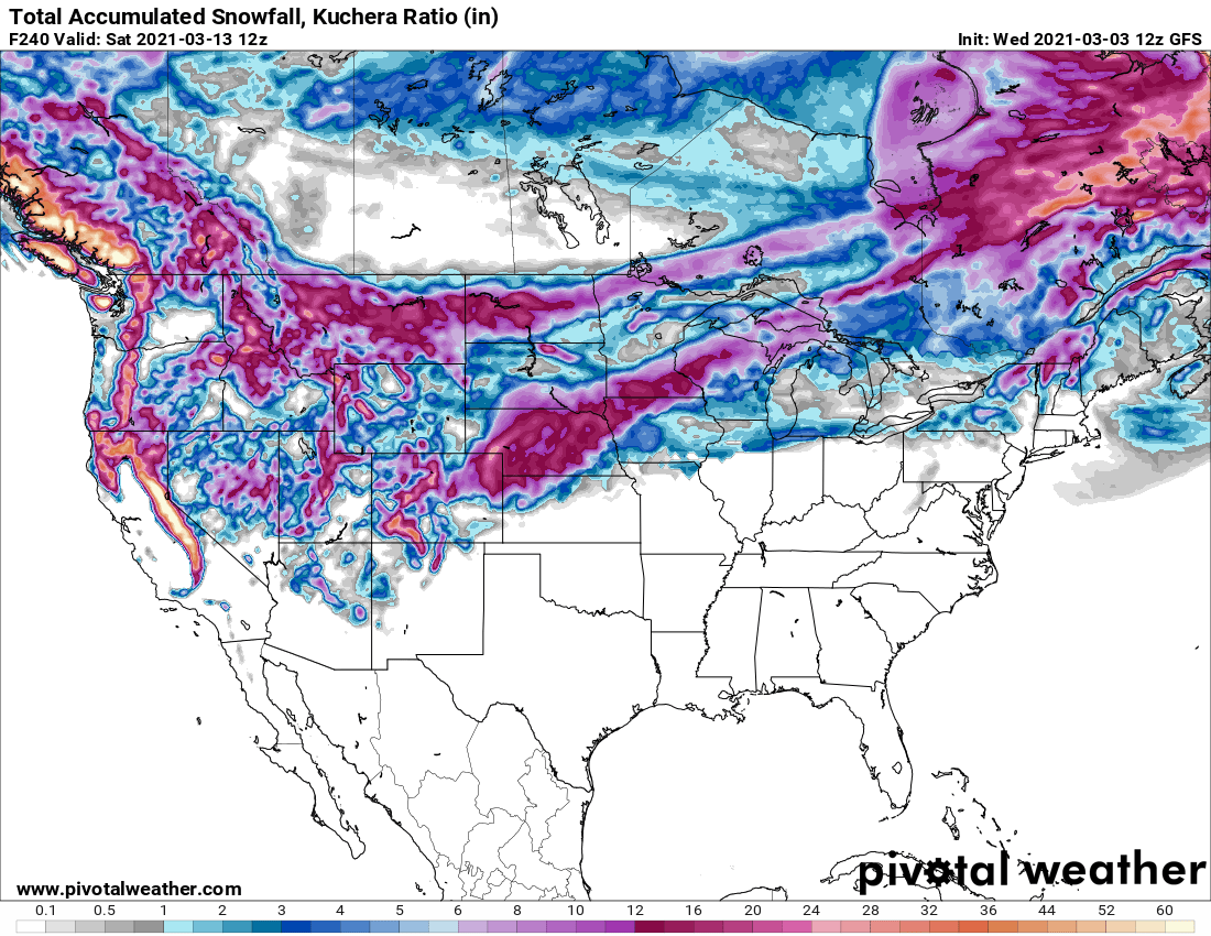
The one thing I have noticed in terms of the past couple runs of models; it seems the deformation zone is taken on a more west to east based set up. With the surge of moisture coming up to the north it’s going to be interesting to see if that’s a trend. There is gonna be a lot of snow dumping on the front range of the Rockies. I would think dynamic cooling along with the fact that it is a cut off low will make this an interesting set up.
-
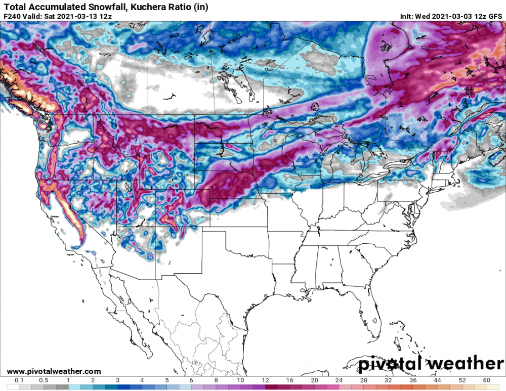
Holy blizzard by the 12z GFS. Winter might make a come back in 7-10 days. Long ways out but something is brewing in the long range; it fits the LRC also as Gary Lezak talked about it in his blog this morning.
-
I find it funny that the above precip goes right through the area that saw pretty much no snow this year! Specifically the western part of the dakotas.
-
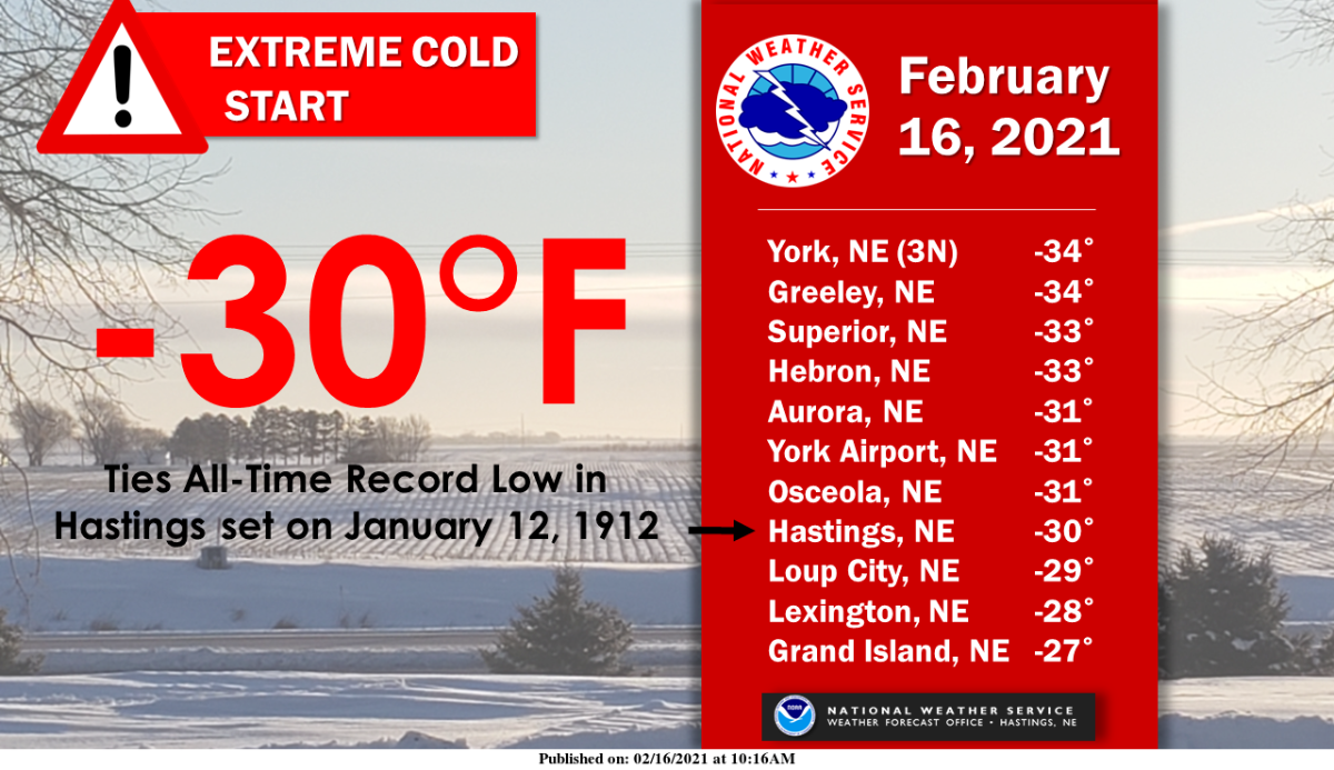
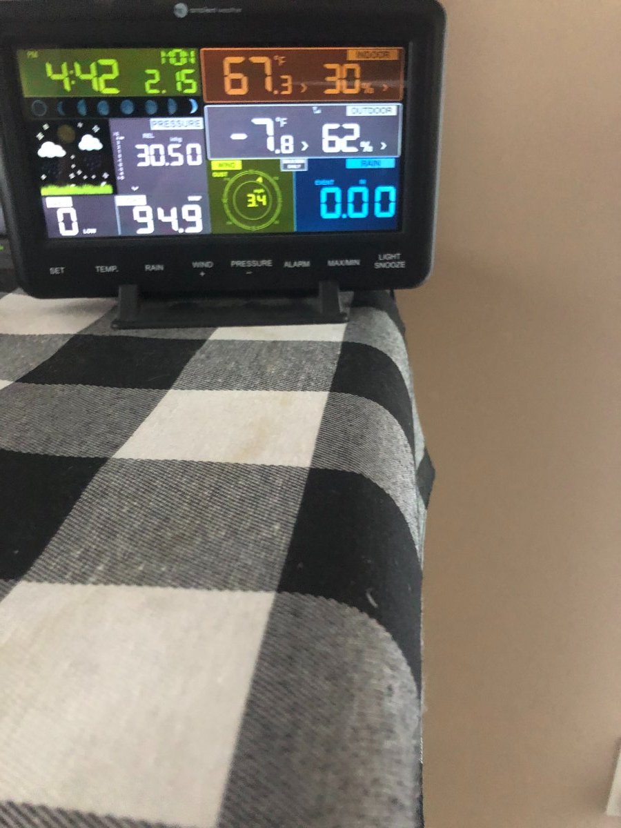
Lincoln got down to -31 this morning, the second coldest ever recorded there! -30 degrees was common in South Central Nebraska. My weather station had -25 for the min this morning.

- 327 replies
-
- 9
-

-
- 2/6-2/9
- polar vortex
- (and 1 more)
-
Wow flip the scrip because of one month?! That is amazing. We had a stretch in January where we had consecutive days of 50+.
- 327 replies
-
- 3
-
-
- 2/6-2/9
- polar vortex
- (and 1 more)
-
Temps are hitting rock bottom! Holy smokes it's cold out there!

- 327 replies
-
- 4
-
-
- 2/6-2/9
- polar vortex
- (and 1 more)
-
-15.2 here and continuing to drop at a high rate. I would think-25 would be a good bet. Would be the coldest I have ever experienced.
- 327 replies
-
- 4
-
-
- 2/6-2/9
- polar vortex
- (and 1 more)
-
Thanks for the info! I actually found the online info also but this should work!!
-
2902 b actually! Looks like yours is one better than mine!!
-
Correct, had it for a while but never got around to get it up online. Now of course I can't find the directions......