BLI snowman
-
Posts
16285 -
Joined
-
Last visited
-
Days Won
38
Everything posted by BLI snowman
-

January Weather In The PNW 2024 (Part III) - The Warming Shot
BLI snowman replied to iFred's topic in West of the Rockies
Regional duds are a product of a bygone climate era. -
January Weather In The PNW 2024 (Part III) - The Warming Shot
BLI snowman replied to iFred's topic in West of the Rockies
Yeah, now that's a head scratcher in terms of analogs. ZR to rain to ZR. It's not unheard of to see a little resurgence through the gorge after a low evacuates (1/19/2012) but I can't think of any examples where surface advection was strong enough to get PDX back below 32 and into ZR without more appreciable upper level reinforcement. -
January Weather In The PNW 2024 (Part III) - The Warming Shot
BLI snowman replied to iFred's topic in West of the Rockies
Early February it is. -
January Weather In The PNW 2024 (Part III) - The Warming Shot
BLI snowman replied to iFred's topic in West of the Rockies
Nope, and unfortunately Everett is a really tricky spot for long term snowfall history. The existing co-op station there in town dates back to the late 1800s but has a really spotty and inaccurate record when it comes to snow. In fact, a lot of the PSCZ microclimate isn't well reflected by any official station's records around there. Though there is a long term station in Monroe that's at least a little better than Everett. -
January Weather In The PNW 2024 (Part III) - The Warming Shot
BLI snowman replied to iFred's topic in West of the Rockies
My 2nd favorite Portland viral snow video after this legendary gem. Hoping for some 10th anniversary magic!- 6999 replies
-
- 14
-

-

-

-
January Weather In The PNW 2024 (Part III) - The Warming Shot
BLI snowman replied to iFred's topic in West of the Rockies
Kind of similar performance to late January/early February 1996 as well, although the deeper snowcover on the eastside helped beef up the temps with that airmass. Spokane had over a foot on the ground and hit -24 on the 2nd after the upper level support had already peaked. But this one wound up being way colder than 1996 or 2004 for Fraser River outflow, and I definitely think a bit more impressive through the gorge as well in terms of the intensity of the CAA. 1996's advantage was that aforementioned cold pool which got insanely deep in early February as that transitioned to more of a strictly gap based outflow event. 1968 is still on another level from this, but a similar evolution for sure with the PV briefly jumping the continental divide. Very rare stuff and the numbers especially in the northern Rockies attest to that. -
January Weather In The PNW 2024 (Part III) - The Warming Shot
BLI snowman replied to iFred's topic in West of the Rockies
Looks like EUG officially measured 0.7" of snow on Saturday. Of course this was actually sleet, but at least nice to see them recording snowfall there. They are the only airport in Western OR and Western WA besides SEA, PDX, and MFR that still does. -
January Weather In The PNW 2024 (Part III) - The Warming Shot
BLI snowman replied to iFred's topic in West of the Rockies
Down to 10 degrees, a new low for the event.- 6999 replies
-
- 14
-
-
January Weather In The PNW 2024 (Part III) - The Warming Shot
BLI snowman replied to iFred's topic in West of the Rockies
Just a little more with around 4" of almost all snow here. Not the huge storm we had the potential for but objectively still a great event. And a little heavier just up the road, with 5-6" in the town of Ridgefield and up towards La Center where the deformation band lasted a little longer. -
January Weather In The PNW 2024 (Part III) - The Warming Shot
BLI snowman replied to iFred's topic in West of the Rockies
17 here already. Tomorrow has nice bonus cold potential with the early morning temps and then clouds capping heating early. Good stat-padding on what has already been a historic event.- 6999 replies
-
- 10
-
-
January Weather In The PNW 2024 (Part III) - The Warming Shot
BLI snowman replied to iFred's topic in West of the Rockies
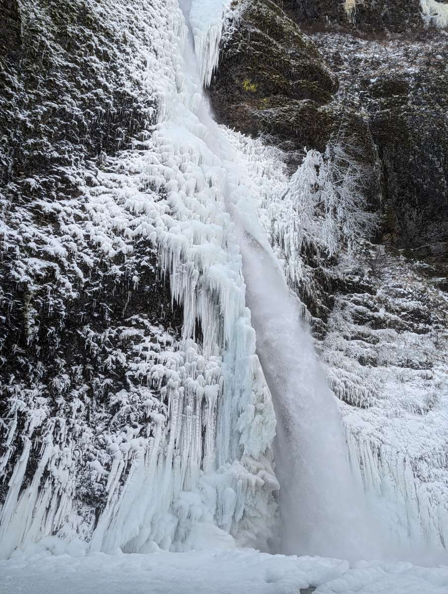
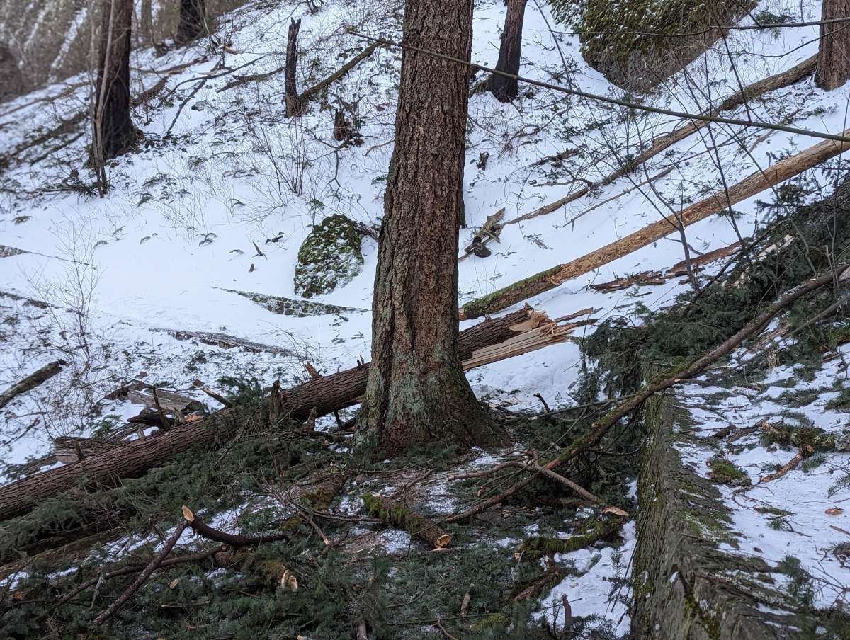
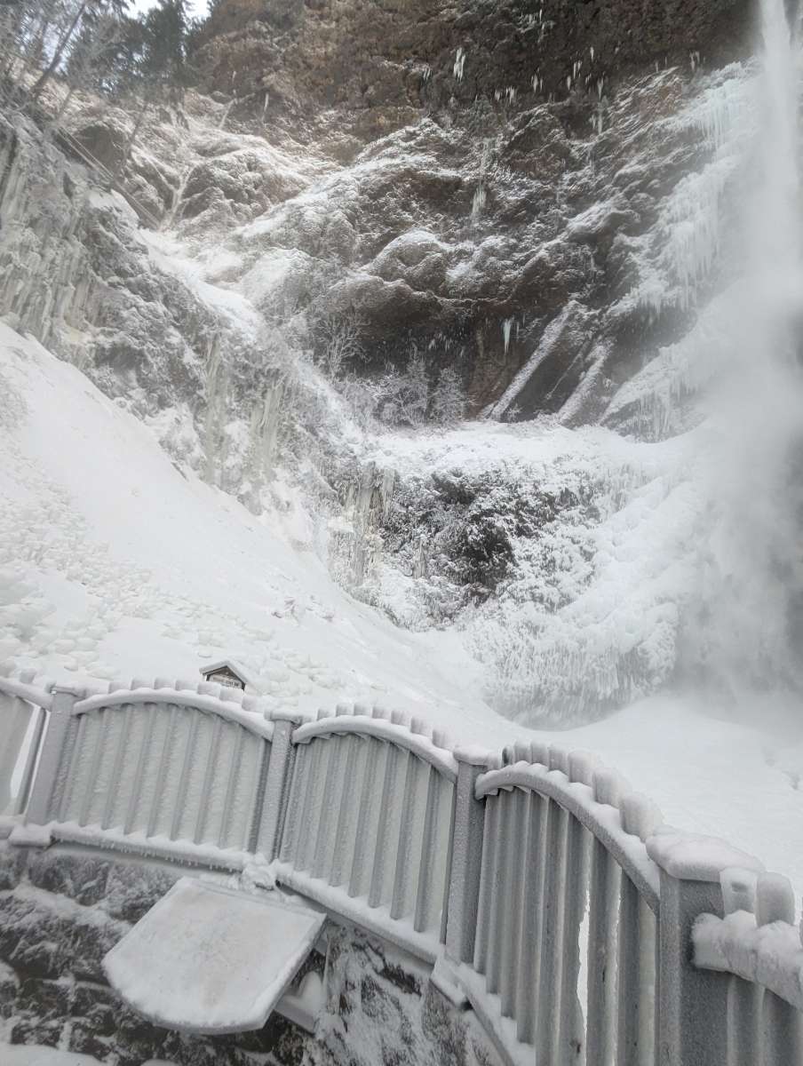
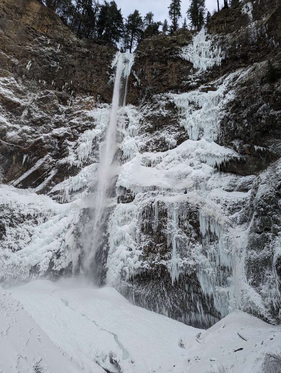
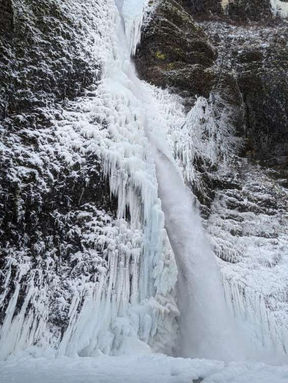
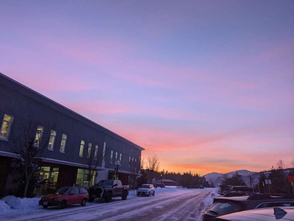
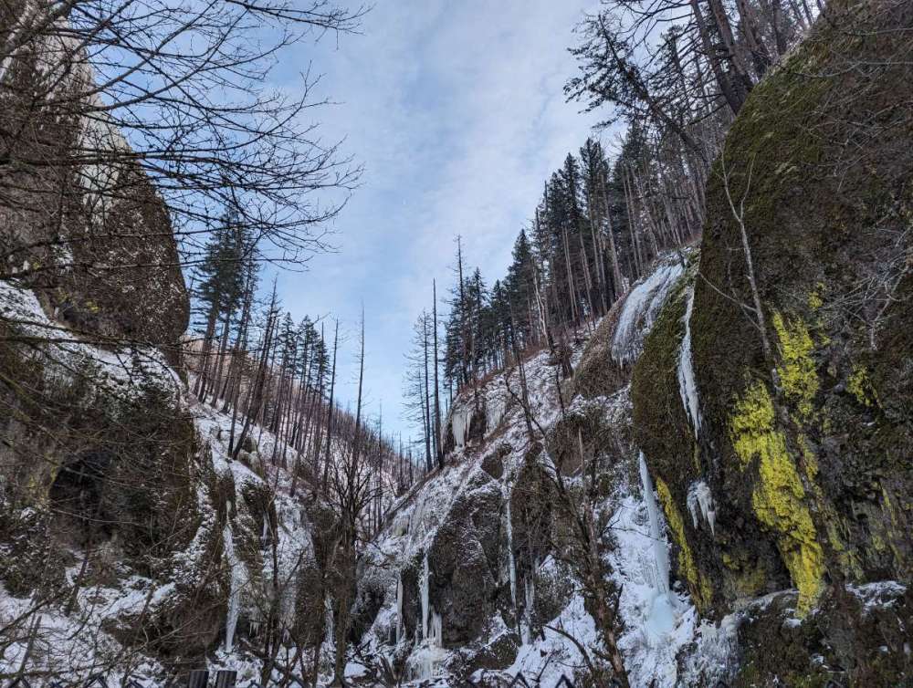
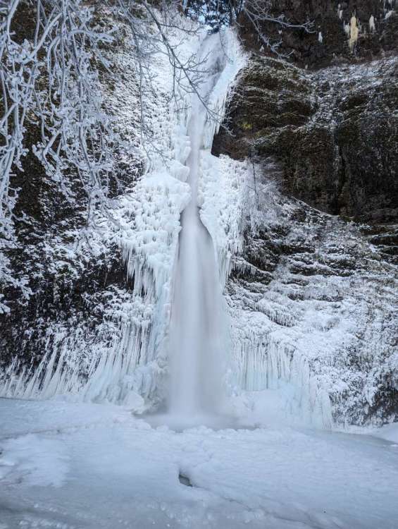
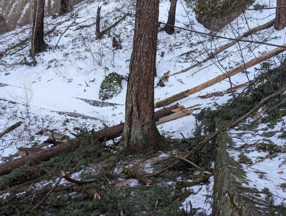
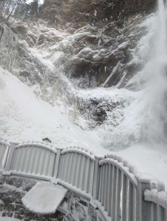
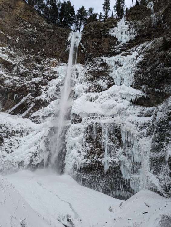
Gorge run today. Started out at the Vista House where 60-70mph winds nearly claimed my hat. Coldest windchill I've ever personally experienced, guesstimating it was around -10. Went down to the waterfall corridor and not surprisingly it got progressively more frozen the further east you went. Horsetail was completely frozen over at the basin. Also came across some snapped trees along the trail in the area near Wahkeena Falls. Wrapped up in Hood River for dinner with the kickass sunset and temps around 12.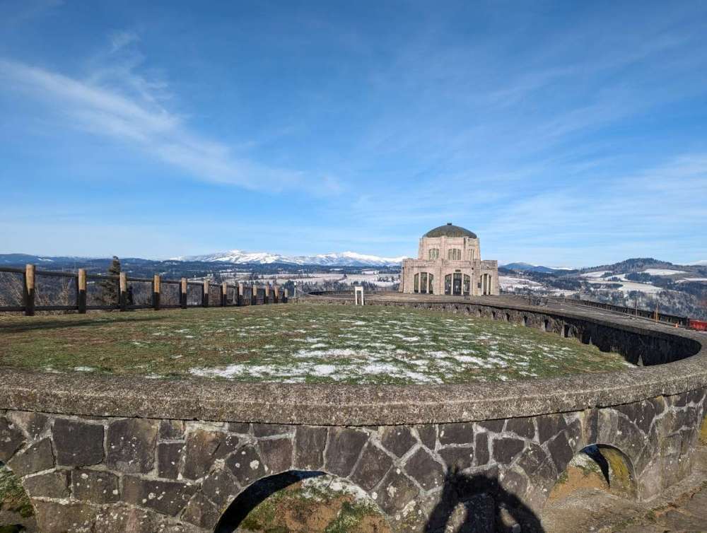
- 6999 replies
-
- 42
-
-

-
January Weather In The PNW 2024 (Part III) - The Warming Shot
BLI snowman replied to iFred's topic in West of the Rockies
It happens to the best of us, my good man. -
January Weather In The PNW 2024 (Part III) - The Warming Shot
BLI snowman replied to iFred's topic in West of the Rockies
Almost certainly just Airbnb/VRBO fodder for some rich investor. And we wonder why there's a housing supply crunch.... -
January Weather In The PNW 2024 (Part III) - The Warming Shot
BLI snowman replied to iFred's topic in West of the Rockies
I think Andrew meant to say highs. Consecutive lows below 25 has happened many, many times. -
January Weather In The PNW 2024 (Part III) - The Warming Shot
BLI snowman replied to iFred's topic in West of the Rockies
Nyberg's record could be in jeopardy. -
January Weather In The PNW 2024 (Part III) - The Warming Shot
BLI snowman replied to iFred's topic in West of the Rockies
https://www.zillow.com/homedetails/714-Cascade-Ave-UNIT-8-Hood-River-OR-97031/92985168_zpid/?utm_campaign=androidappmessage&utm_medium=referral&utm_source=txtshare Almost half a million for a 700 square foot condo. With a $200 monthly HOA. It could be yours. -
January Weather In The PNW 2024 (Part III) - The Warming Shot
BLI snowman replied to iFred's topic in West of the Rockies
Yeah, the cold air is deep enough east of Cascade Locks to start out as snow, and gets deeper each further mile east you go. Looking good for 8"+ in Hood River. -
January Weather In The PNW 2024 (Part III) - The Warming Shot
BLI snowman replied to iFred's topic in West of the Rockies
In 2024 the rules are going out the window. -
January Weather In The PNW 2024 (Part III) - The Warming Shot
BLI snowman replied to iFred's topic in West of the Rockies
Cleared out and plummeted. Hit 13 here for my lowest of the event.- 6999 replies
-
- 10
-
-

-
January Weather In The PNW 2024 (Part III) - The Warming Shot
BLI snowman replied to iFred's topic in West of the Rockies
https://www.wweek.com/outdoors/2024/01/14/top-of-mount-tabor-destroyed-by-downed-fir-trees/ Some really significant damage from the east winds in SE Portland. -
January Weather In The PNW 2024 (Part III) - The Warming Shot
BLI snowman replied to iFred's topic in West of the Rockies
Euro seems the most aggressive with getting that guy onshore right now, which obviously would increase mixing on Wednesday. But the the trend seems clear right now that that thing is limping along and gasping for air as more of an open wave, so I expect some further cutbacks here. -
January Weather In The PNW 2024 (Part III) - The Warming Shot
BLI snowman replied to iFred's topic in West of the Rockies
6" total here, putting me solidly in the purple. -
January Weather In The PNW 2024 (Part III) - The Warming Shot
BLI snowman replied to iFred's topic in West of the Rockies
It's going to be a very so low inch up as the mixing looks very minimal. Some real similarities to January 7-8, 2004. -
January Weather In The PNW 2024 (Part III) - The Warming Shot
BLI snowman replied to iFred's topic in West of the Rockies
Think it might try to clear out some tonight. Fog and sh*t. -
January 2024 Weather in the PNW (Part II)
BLI snowman replied to Meatyorologist's topic in West of the Rockies
About 4" even here. Great storm, though it was a little heavier just to my north. I actually moved back to Clark County in 2015. So my name is kind of an ancient artifact at this point but I've just been too lazy to change it.