Seems on point KC office says dusting to 1 inch in the metro. We shall see but I will guess they will have change that forecast. But baby steps for them, today they figured out it's going to get cold next week.
AREA FORECAST DISCUSSION
National Weather Service Kansas City/Pleasant Hill MO
316 PM CST Thu Feb 4 2021
.Discussion...
Issued at 316 PM CST THU FEB 4 2021
Key Messages...
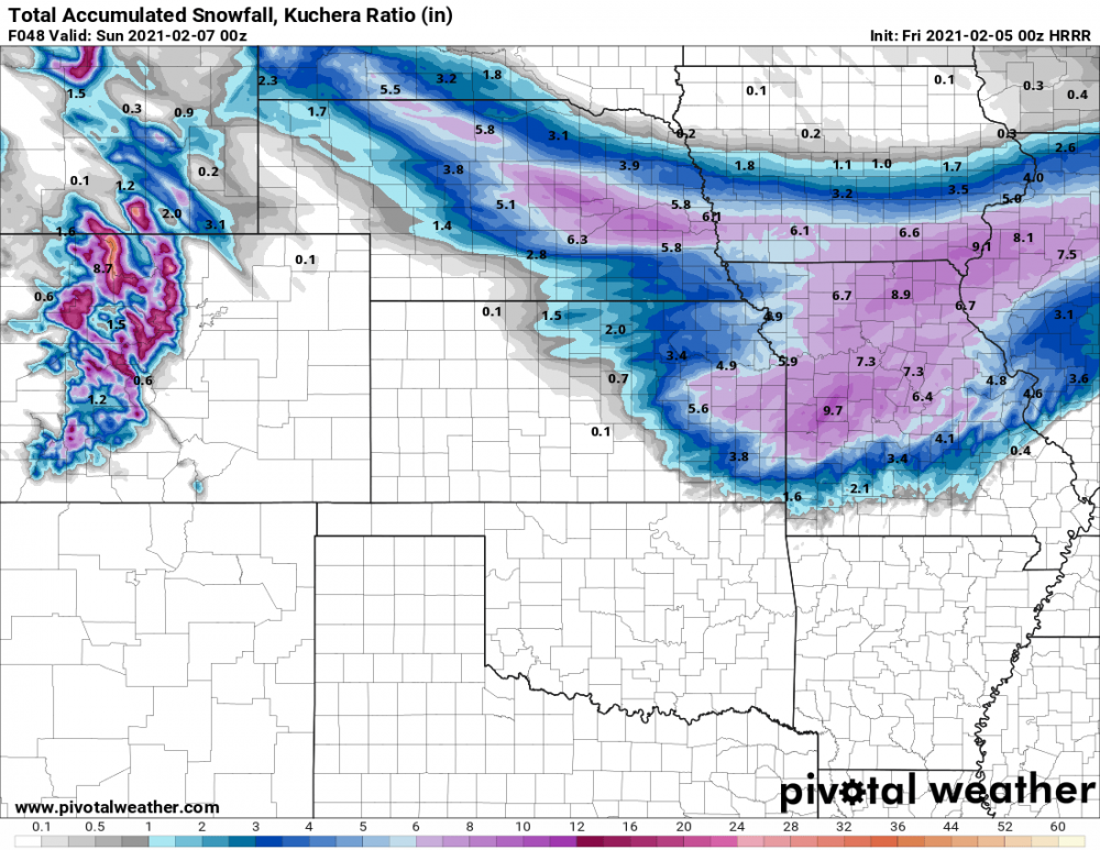
1. Light snow is expected on Saturday, Amounts will range from one
to two inches across the northern half of Missouri. Snow will begin
in the morning and taper off West to East through the afternoon and
evening. Expect a dusting to an inch across the KC Metro.
2. A brief burst of snow may sweep across northern Missouri on
Sunday, with a dusting to a half inch possible, but better chances
will exist early Monday through the day. As of now, upwards of one
to two inches is possible Monday across the northern half of
Missouri, including the KC Metro. Up to three inches is possible in
north central Missouri.
3. Dangerously cold conditions are still expected to develop over
the weekend and continue through all of next week. Highs are not
expected to climb above freezing for most places across central and
northern Missouri, with cold really taking hold on Sunday and
persisting through next Friday. Morning lows will dip into the
single digits Tuesday morning through the end of the week, with lows
in northern missouri below zero.
Detailed Discussion...
Quite a bit to discuss this afternoon. The narrow swath of moderate
to dense snow has weakened, but continues to push into eastern
Missouri through 2 PM CDT. Behind this activity, breezy and much
colder conditions have settled in, with temperatures holding steady
in the lower 30s to upper 20s in northern Missouri. Overnight, the
500mb trough will continue to dig, pivoting northeastward towards
the Great Lakes through early Friday. Short range guidance continues
to suggest a weak short wave traversing across western Missouri
around midnight. Forecast soundings suggest a near saturated
dendritic growth zone. Any dendrites that develop will struggle
through drier boundary layer conditions, but if development persists
and enough support is present, as the HRRR and NAMnest suggest, I
cannot rule out some flurries across the KC Metro for a few hours
tonight. Morning lows, Friday, will dip into the mid 20s, for areas
that saw upwards of 2 inches of snow today in northern MO, temps
will dip into the teens. Afternoon highs will climb into the 40s
south of the Missouri River with temps dropping off quickly to the
north, with locations in northern MO not reaching above freezing.
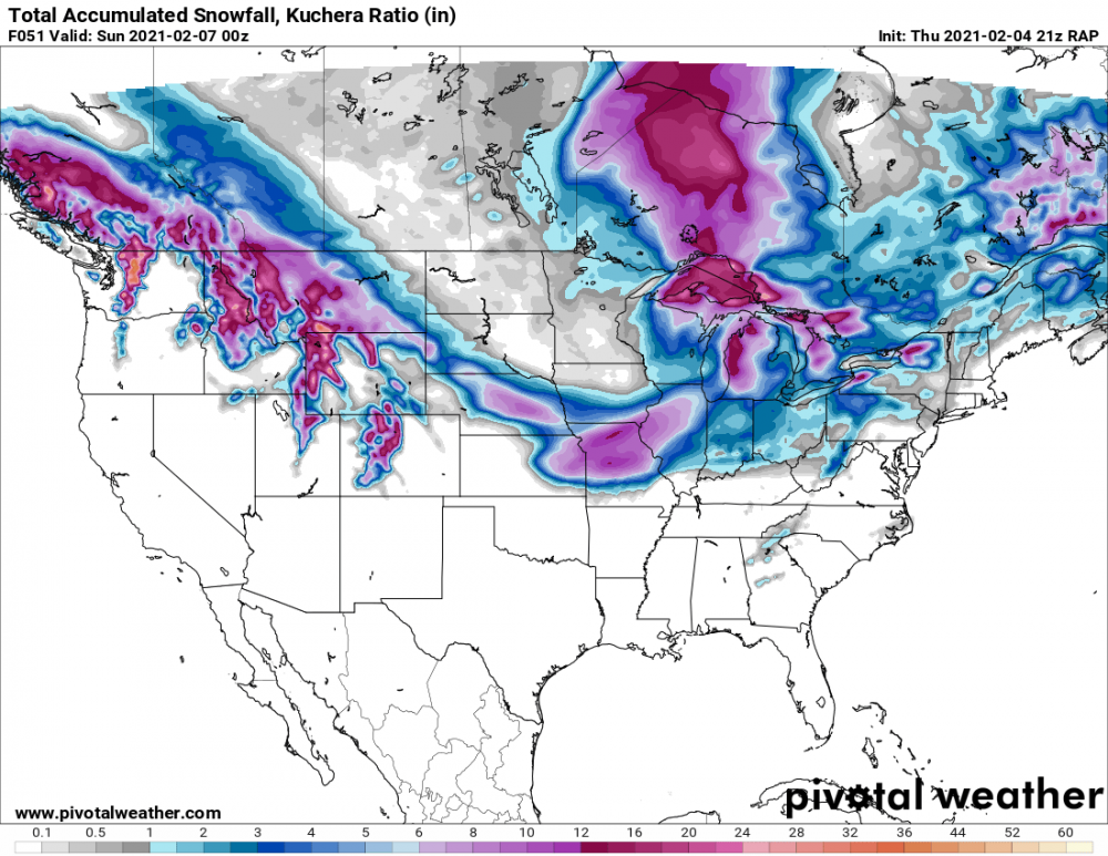
The weekend forecast remains, for lack of a better phrase, a mess.
With a large scale troughing centered over Hudson Bay, the Plains
and Midwest are left open to subsequent short waves dropping from
the northwest. On Saturday, a stout short wave digging southeast
will bring ample moisture and support for a quick hit of modest
snowfall and rain. Expect light to moderate snowfall to develop into
northwest and northeastern Kansas through the Morning. Precipitation
will continue to spread eastward with time, with afternoon temps
in the mid 30s along the Ozark Plateau resulting in rain and or a
rain snow mix across the Lakes region, for a few hours. Expect one
to two inches of snow across northern Missouri, with a dusting to
an inch along the Missouri River Valley and KC Metro.
Sunday, a shallower short wave will bring a quick burst of light
snow across northern Missouri. This will proceed a more prominent
short wave that will cross the area on Monday. Early projections
are for one to two inches along the Missouri River valley to two
to three inches in north central Missouri.
The big impact this coming week is the cold. It cannot be stressed
enough the impact of multiple below freezing temperature days. As
discussed in the key messages above, the region is looking at
multiple days in a row next week of single digit low temperatures,
along with negative single digits across northern Missouri. Over the
next seven days, there`s no break in bitter cold temperatures on the
horizon.