ShawniganLake
-
Posts
15471 -
Joined
-
Last visited
-
Days Won
25
Everything posted by ShawniganLake
-
Kelowna looks to threaten their record dry streak. Their current record is from 2003, the year of the Okanagan firestorm. If it wasn't for 0.02" on June 28th, that record would be in the bag.
-
The area burned in BC is up to 1.15 million acres. So there is lots more smoke where this came from.
-
93F here today. Can barely see the hills across the lake for all the smoke.
-
Visibility is Whistler is being reported as less than 1 mi in smoke.
-
Up to 88F here. Further inland, lake Cowichan is showing 92F. Seems like the smoke is mixing down to the surface. The sun feels stronger, but you can clearly see and smell the smoke at the surface.
-
looks like the Fraser valley is in the 2.5 to 3mi range as well. You can definitely smell it here today.
-
The 6z GFS was just a touch on the warm side thru mid month. Pretty hard to believe that could even be close to being right.
-
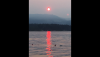
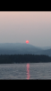
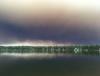
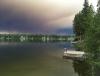
Smoky sunset at the Old Mill Park at Shawnigan Lake
-
89F with the smoke now thick enough to allow you to look directly at the sun.
-
That smoke looks pretty thick here. Only 76F and tracking a touch cooler than yesterday at this time.
-
I'm on the ferry back home to the island and you can see the cloud of interior smoke now moving into the lower mainland.
-
That's ridiculous.
-
Smoke forecasts do bring the smoke to the west side as we move towards mid week. Latest estimates for area burned in BC is 1,050,000 acres
-
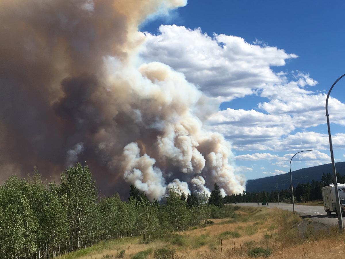
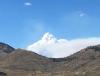
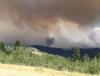
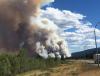
Took a couple of photos today looking north from Cache Creek towards the Elephant Hill fire near Clinton BC. Several big pyrocumulus smoke columns went up this afternoon from the 190 000 acre fire.
-
Many places only saw Trace amounts of rain in June. Strong westerly flow and heavy rain on the coast, usually translates to dry westerly downsloping winds in the interior. It's crazy to think that this fire started as a grass fire in the desert near Ashcroft on July 6th. Our place is about 1.5hr drive from there.
-
I just drove that road. We were evacuated to the community center in 100 mile house. I guess we will probably head home later this morning
-
Central BC has been dry for most of the year. But on the whole, a rainless June in the interior is a bad thing. That's normally the wettest month of the year for many areas east of the coastal ranges. The month of June at Watch Lake usually frequent afternoon downpours during ULL season. This year there was nothing.
-
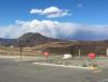
This picture was taken yesterday overlooking the valley that the town of Clinton is located. Thick black smoke over our cabin at Watch Lake yesterday evening
-
Most area burned in BC in the past 56 years and it's still July. 50 000 people evacuated. 41 homes burned so far. Maybe not catastrophic yet but it's been pretty serious. With the forecast heat wave things could get worse.
-
We just got evacuated.
-
Ash falling here in the Cariboo this evening. I can't post pictures, unfortunately, the network up here is pretty poor.
-
I Drove thru Clinton BC this afternoon, less than 1 hr later it was evacuated from an approaching forest fire.
-
We had a deck of high clouds move over on the hottest day of July 2009. Happened during mid afternoon too and capped the temps around 2pm.
-
Shawnigan lake hasn't set a monthly record high during JJA since July 1941. Seems hard to believe.
-
Well it is in that late July/ early August window. Wouldn't mind seeing some rain up in the interior. We are supposed to head to the cabin tomorrow. My mom arrived there yesterday, just as they were put on Alert. That area has to be ready to leave with 1 hr notice.