Frontal Snowsquall
-
Posts
7890 -
Joined
-
Last visited
-
Days Won
1
Everything posted by Frontal Snowsquall
-

August 2018 Weather in the Pacific Northwest
Frontal Snowsquall replied to Geos's topic in West of the Rockies
Yuck -
August 2018 Weather in the Pacific Northwest
Frontal Snowsquall replied to Geos's topic in West of the Rockies
It's not fluky when you go 44 straight days with highs at or above 80 and your next best streak was 29 close to 70 years ago. Albany posted a +4.7 departure for July. Parts of the Northeast have also been in a drought. http://droughtmonitor.unl.edu/data/png/20180807/20180807_Northeast_text.png -
August 2018 Weather in the Pacific Northwest
Frontal Snowsquall replied to Geos's topic in West of the Rockies
It felt cooler than what it actually was because we've been roasting all summer long. In reality it's been around average. PDX had a +1 departure yesterday and today it looks like it will finish at 0. -
August 2018 Weather in the Pacific Northwest
Frontal Snowsquall replied to Geos's topic in West of the Rockies
You will always have analogs contradicting each other for any given year. You will never have a perfect match. 1933-34 was a warm winter but I don't know much else about it. Was it warm all throughout or did we have some near misses with Arctic outbreaks? Those are the things I would want to know. Also there is another analog pointing to 1949 that is of longer duration. Albany, NY set a new record with consecutive 80+ degree highs this year. I believe it ended yesterday at 44 days. The previous best was 29 days and low and behold it was in 1949. Records date back to 1874 in Albany. -
August 2018 Weather in the Pacific Northwest
Frontal Snowsquall replied to Geos's topic in West of the Rockies
I have huge expectations for this coming Winter. We haven't had a regionally snowy winter in a while but I believe this will finally be the year everybody will be happy. -
August 2018 Weather in the Pacific Northwest
Frontal Snowsquall replied to Geos's topic in West of the Rockies
Analogs can be used a number of different ways. It's rare to have the perfect analog, you just have to try your best. Something can definitely be said for Regina setting an all time record high in August at 41.3C, breaking the old high of 40.6C way back in 1949. Other than those 2 years the next closest is 39.4C. Coincidence or not, it's there. -
August 2018 Weather in the Pacific Northwest
Frontal Snowsquall replied to Geos's topic in West of the Rockies
I believe so. That doesn't necessarily disqualify it as an analog however. There's more to it than just ENSO type. The winter of 68-69 for example was a moderate El Nino and we all got pounded. -
August 2018 Weather in the Pacific Northwest
Frontal Snowsquall replied to Geos's topic in West of the Rockies
FWIW, Regina, Saskatchewan, CA set an all time record high for August today with a temperature of 41.3C(106F). The last time they got this hot in August was back on August 6, 1949 when they reached 40.6C(105F). Now we will know what happened in the winter of 1949-50 here in the PNW. Pretty good analog right here. -
August 2018 Weather in the Pacific Northwest
Frontal Snowsquall replied to Geos's topic in West of the Rockies
The analog(s) I'm using point to a troughy September. We really need to get a regional rain event within the next ~4-6 weeks or so. If we continue to torch through all of September then it might have bad ramifications down the line. -
August 2018 Weather in the Pacific Northwest
Frontal Snowsquall replied to Geos's topic in West of the Rockies
Not again. Was hoping this coming week we could have some smoke free air. -
August 2018 Weather in the Pacific Northwest
Frontal Snowsquall replied to Geos's topic in West of the Rockies
Normally I would be ecstatic about this but I'm ready for Autumn now. I've already had my heat fix for this summer. If we do continue to torch then hopefully it won't be too smokey. -
August 2018 Weather in the Pacific Northwest
Frontal Snowsquall replied to Geos's topic in West of the Rockies
Makes you appreciate tropical cyclones even more. Growing up they always fascinated me and is what got me hooked onto weather. My first ever forum username was Swift. To this day I still think I'd prefer a strong windstorm to a snowstorm. -
August 2018 Weather in the Pacific Northwest
Frontal Snowsquall replied to Geos's topic in West of the Rockies
Yeah, I read before they remove pollution from the air and bring needed rain to some parts of the world. Mother nature always has a purpose for everything in the grand scheme of things. -
August 2018 Weather in the Pacific Northwest
Frontal Snowsquall replied to Geos's topic in West of the Rockies
I haven't been able to enjoy this heatwave due to all the smoke. I'm happy it will be gone for the time being. -
August 2018 Weather in the Pacific Northwest
Frontal Snowsquall replied to Geos's topic in West of the Rockies
Yeah, I already know that. I believe I pointed it out when I talked about the typhoon rule on here before. I know it's not 100% accurate but it has a good track record IMHO. The rule is just a quick way for people to see quickly into the future of the possible downstream effect the typhoon could cause without getting into all the technical stuff. -
August 2018 Weather in the Pacific Northwest
Frontal Snowsquall replied to Geos's topic in West of the Rockies
Usually we prefer not to see any typhoons at all. They do more harm than good for us here. -
August 2018 Weather in the Pacific Northwest
Frontal Snowsquall replied to Geos's topic in West of the Rockies
FWIW, Hurricane/Typhoon Hector recurves out to sea per the 12z EURO and it gets caught up in the jet stream. In turn that's going to pump up a huge Western ridge over us and will drop a trough out east. Pretty good illustration of the Typhoon/Bering Sea rule. In the winter time we will need these typhoons to head into mainland Asia instead of recurving out to sea. -
August 2018 Weather in the Pacific Northwest
Frontal Snowsquall replied to Geos's topic in West of the Rockies
This can't come any sooner. -
August 2018 Weather in the Pacific Northwest
Frontal Snowsquall replied to Geos's topic in West of the Rockies
Too smokey out here. I'd rather have 80s and clean air than what's going on right now. I'm looking forward to the rain. -
Summer forecast contest, year three.
Frontal Snowsquall replied to Phil's topic in West of the Rockies
We've only gotten 1.22" of rain since May 1st. Which is 2.68% of what you have received. Pretty extreme difference right there. -
August 2018 Weather in the Pacific Northwest
Frontal Snowsquall replied to Geos's topic in West of the Rockies
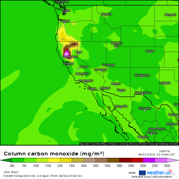
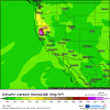
I don't know how accurate this map is but this is the 12z EURO column carbon monoxide map. It's basically showing the carbon monoxide released into the atmosphere during forest fires and/or large brush fires. It's showing the highest levels of carbon monoxide coming up from the south Thursday overnight into Friday. The good news is a push of cooler air comes in time for the weekend to remove all the smoke at the moment.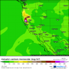
-
August 2018 Weather in the Pacific Northwest
Frontal Snowsquall replied to Geos's topic in West of the Rockies
-
Summer forecast contest, year three.
Frontal Snowsquall replied to Phil's topic in West of the Rockies
You're welcome. If Phil or anybody else wants to check these numbers feel free. Did it quickly and had to correct some numbers. -
Summer forecast contest, year three.
Frontal Snowsquall replied to Phil's topic in West of the Rockies
Here are the unofficial standings after the first 2 months. I calculated everybody's error for the 6 locations and added them up. The 1st number is for June and the 2nd is for July incase everybody wanted to know how well they did each month. I added them together to get the current standings. The smaller your number the better you did. Everybody did better in June than in July. Still one month to go so still anybodys ballgame. 1)Frontal Snowsquall -6.0 + -7.7 = -13.7 2)TT-SEA -6.4 + -11.1 = -17.5 3)Phil -8.5 + -10.05= -18.55 4)Jesse -5.0 + -13.8 = -18.8 5)ShawiganLake -8.3 + -10.8 = -19.1 6)Scott -7.2 + -12.4 = -19.6 7)BLI snowman -10.5+ -11.3 = -21.8 8)Front Ranger -7.0 + -18.1 = -25.1 9)Mr Marine Layer -11.5+ -17.8 = -29.3 10)Deweydog -10.8+ -20.1 = -30.9 -
August 2018 Weather in the Pacific Northwest
Frontal Snowsquall replied to Geos's topic in West of the Rockies
NWS Portland just put out an Excessive Heat Warning. URGENT - WEATHER MESSAGE National Weather Service Portland OR 147 PM PDT Mon Aug 6 2018 ...HOTTEST TEMPERATURES OF THE SEASON EXPECTED WEDNESDAY AND THURSDAY... . Strong high pressure will result in the hottest three days of the season Tuesday through Thursday. ...EXCESSIVE HEAT WARNING IN EFFECT FROM 2 PM TUESDAY TO 11 PM PDT THURSDAY... The National Weather Service in Portland has issued an Excessive Heat Warning, which is in effect from 2 PM Tuesday to 11 PM PDT Thursday. * MAXIMUM TEMPERATURES...Daytime high temperatures of 98 to 103. Temperatures will peak near 100 degrees on Tuesday, then above 100 for Wednesday and Thursday. Timing of peak heating will be between 3 and 6 PM. It will be warmest in urban areas. * MINIMUM TEMPERATURES...Overnight lows of 60 to 67, but the nighttime cooling will be slow. Temperatures will be around 80 at 10 pm, around 75 at midnight, and cool below 70 around 2 AM. The coolest temperatures will occur around 5 AM. It will be warmest in urban areas. * HEAT INDEX VALUES...Dewpoint temperatures in the low 60s will result in temperatures feeling slightly warmer than they are on Wednesday and Thursday. The Heat Index will be 102 to 104. * IMPACTS...The heat and humidity may cause heat stress especially with the limited relief at night. Heat stress is also possible for livestock and outdoor pets.