


FarmerRick
-
Posts
293 -
Joined
-
Last visited
Everything posted by FarmerRick
-
will measure in Valley when I get home in about an hour. I hope.... LOL
-
It's churning.... https://weather.cod.edu/satrad/?parms=subregional-Cen_Plains-10-24-1-100-1&checked=map&colorbar=undefined
-
Still just light snow in Omaha.
-
No "Lincoln screwjob" with this storm... LOL!!
-
I haven't used NWS radar in years... COD or Wunderground are my favs.
-
they bumped us up to 2-5" as well..
-

January 2021 Observations and Discussion
FarmerRick replied to Grizzcoat's topic in East of the Rockies
Georgia deserves a 5 day ice storm -
Good snow.
-
Snow almost done in Omaha https://weather.cod.edu/satrad/nexrad/?parms=OAX-N0Q-0-24-100
-
1250 PM SNOW 2 NNW NEBRASKA CITY 40.70N 95.87W 12/29/2020 M7.5 INCH OTOE NE EMERGENCY MNGR SNOW CONTINUES TO FALL. 1200 PM SNOW 7 ENE OMAHA 41.30N 95.90W 12/29/2020 M5.1 INCH DOUGLAS NE OFFICIAL NWS OBS OFFICIAL OMAHA EPPLEY CLIMATE OBSERVATION THROUGH NOON. SNOW CONTINUES. 5.1 TOTAL SNOW SO FAR WITH 4.7 IN THE PAST 6 HOURS. SNOW WATER EQUIVALENT OF 0.35 FOR AN AVERAGE SNOW LIQUID RATIO OF 15 TO 1. 1200 PM SNOW COUNCIL BLUFFS 41.25N 95.86W 12/29/2020 M5.0 INCH POTTAWATTAMIE IA EMERGENCY MNGR 1200 PM SNOW SEWARD 40.92N 97.09W 12/29/2020 M5.0 INCH SEWARD NE EMERGENCY MNGR 1155 AM SNOW RED OAK 41.01N 95.23W 12/29/2020 M6.5 INCH MONTGOMERY IA EMERGENCY MNGR SNOW CONTINUES WITH SOME SLEET MIXING IN.
-
I had an old 440 TNT also in High School. Hated that D**n Tillotson carburetor!! as for weather.... PRELIMINARY LOCAL STORM REPORT NATIONAL WEATHER SERVICE OMAHA/VALLEY NE 1249 PM CST TUE DEC 29 2020 ..TIME... ...EVENT... ...CITY LOCATION... ...LAT.LON... ..DATE... ....MAG.... ..COUNTY LOCATION..ST.. ...SOURCE.... ..REMARKS.. 1200 PM SNOW 1 WNW VALLEY 41.32N 96.37W 12/29/2020 M5.8 INCH DOUGLAS NE OFFICIAL NWS OBS OFFICIAL NWS VALLEY CLIMATE OBSERVATION. SNOW CONTINUES. 5.8 TOTAL SNOW SO FAR WITH 3.5 IN THE PAST 6 HOURS. MEASURED LIQUID OF 0.38 FOR AN AVERAGE SNOW LIQUID RATIO OF 15 TO 1 THROUGH NOON.
-
Wishing I still had my old Polaris 500 SKS(700 hood, wish it had the 700 engine)... This is perfect snow for snowmobiling!!
-
Graupel in SW Omaha, heavy snow in NW Omaha.
-
because I'm watching the satellite and radar returns.
-
I think this will taper off much sooner than expected in Omaha.
-
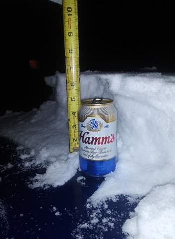
Nearly 3" already IMBY
-
-
DECEMBER 23-26 Potential storm for SW Great Lakes
FarmerRick replied to kush61's topic in East of the Rockies
Just light snow in Omaha so far. Blowing D**n hard though. -
Nam is pretty juicy just NW of Omaha...
-
if the GFS was showing 12" of snow, everyone would be saying it was the one to go with....
-
OAX just dropped me from 4-6 to 1-2 same old story...
-
Models suck. ALL THE TIME. Not sure why I even look at them anymore. Will Omaha get 10" of snow? Or will Omaha get less than an inch?
-
OAX discussion The longer range models change the rain to snow over quicker with accumulating snow becoming more probable. The GEFS plumes continue to show a range of accumulations of 2 to 8 inches with the higher accumulations in bands. Strong north winds gusting to 50 mph becomes problematic with the rain changing to snow. Those with travel plans should pay attention to the forecast for Easter Sunday related to this developing storm and the potential for winter related headlines/impacts to travel and power. Highs Sunday were lowered to the 30s and 40s
-
https://www.wowt.com/content/news/Former-local-meteorologist-facing-charges-of-threatening-county-health-director-569288101.html Ron "Gerrard" worked at KPTM and KETV as ameterologist years ago. No more social distancing for him.... Oh, and it's a sunny beautiful 70* in Omaha today.
-
Whoa!!!


