TT-SEA
-
Posts
87083 -
Joined
-
Last visited
-
Days Won
566
Everything posted by TT-SEA
-
Are you talking about the 8 weeks of July and August? Because it almost always rains in June and September with only a few exceptions. SEA averages .60 in July and .97 in August. So in order to have a rainfall every 2 weeks it would need just 2 events each month. July and August in recent years has been an anomaly.
-
Mentioned that earlier. Really sucks.
-
Way too early for hot summer weather consistently. Something in between the last two years would be nice for May. Both of those were too extreme.
-
Jon Stewart skewers the media for its coverage of Trump trial...
-
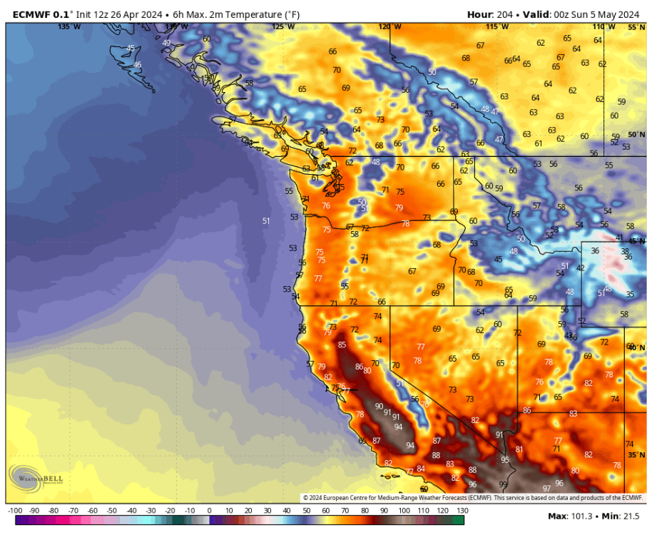
La Nina is rapidly emerging on the SSTA map.

-
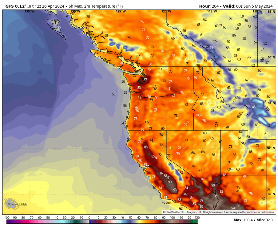
12Z GEFS was decent.

-
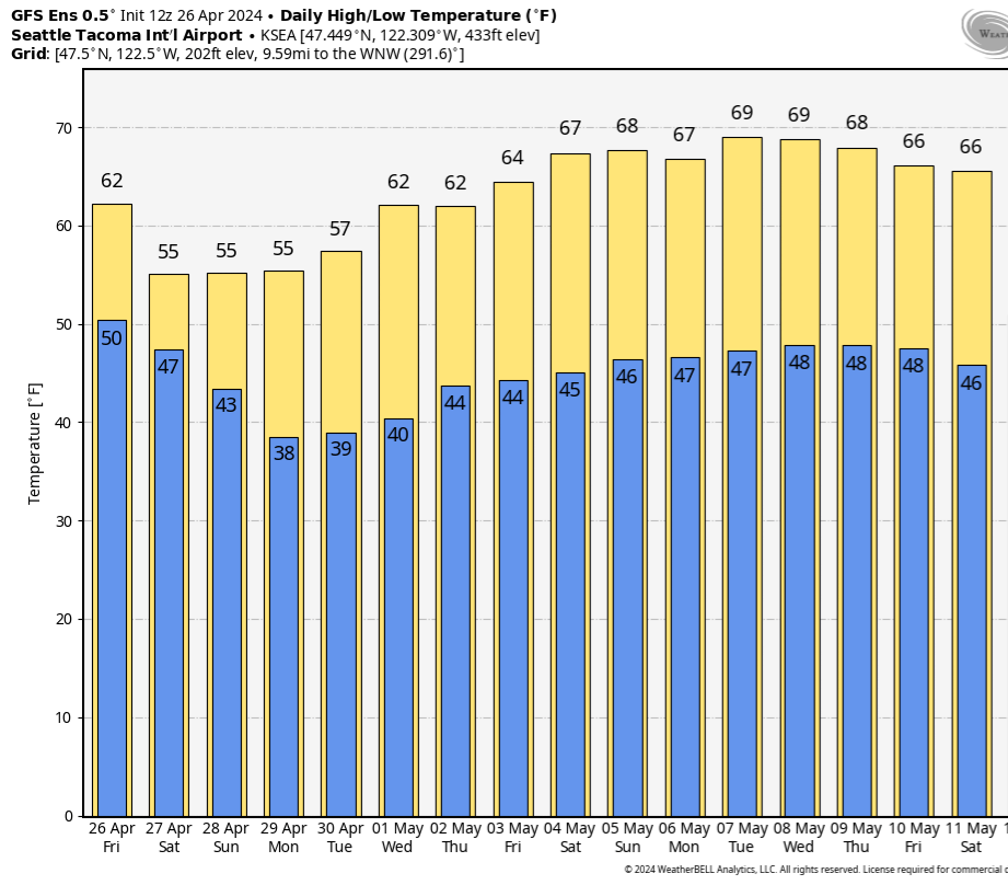
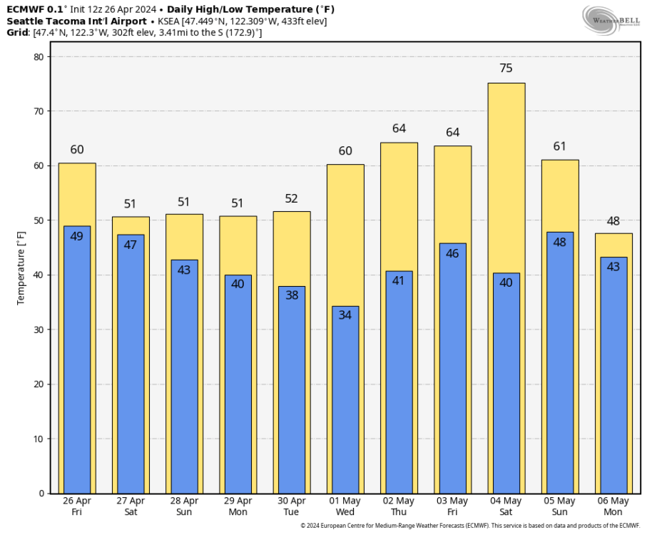
OK. 15 hours of daylight and SEA will struggle to get out of the 40s. That is some notable troughing.
-
I have access to the internet Jared. On the plane when my son asked about the weekend I told him Friday afternoon would be the best period. Playing out as expected.
-
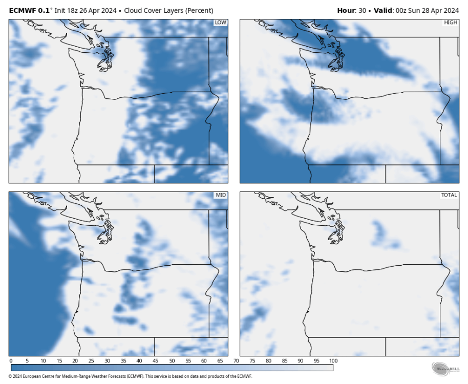
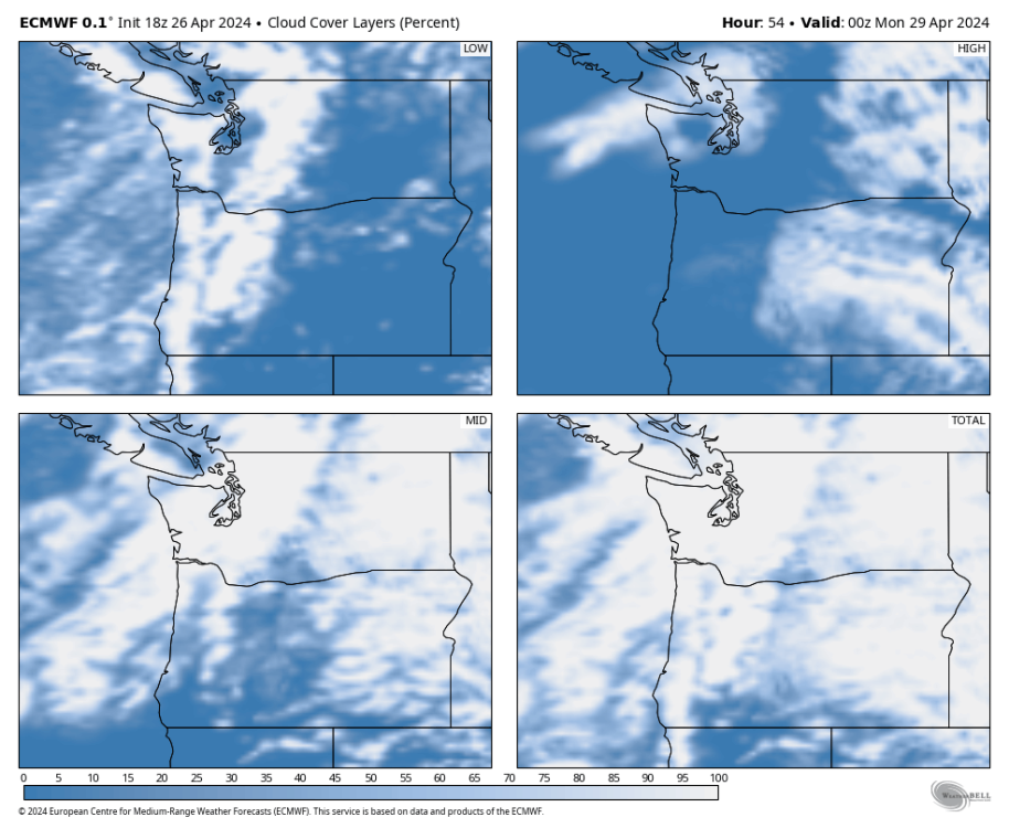
Solid mid level clouds both days over the weekend. Lower left box in each square.
-
ECMWF showed decent sun breaks for the Seattle area for today for many runs. The high temps over the weekend and into early next week indicate sun breaks won't be nearly as prevalent. Pretty hard for SEA to only get to 51 with sun breaks like today.
-

-
This is an insane video... the guy was praying.
-
Yes... today looks decent but the next 4 days will be quite different per the ECMWF. It was great to get the soaking rain yesterday.
-
I enjoy some spring troughing... just looking for an alternating pattern and not all mega troughing.
-
As expected... the 18Z GFS is back to mega troughing.
-
I was just going to mention that its looks quite nice in Seattle.

-
ECMWF shows SEA barely making it to 50 for the next 4 days. Way below normal.
-
Only people who want troughing all the time and have severe climate anxiety. I am just someone looking for those spectacular PNW spring days. I think May has a decent to be ghastly in true post-Nino fashion as Justin has pointed out.
-
Yes Jared. But at least its not some monster trough parked over the PNW for weeks. My expectations were set back to very low based on some of the posts here about May. Any nice days are even more of a blessing now than usual.
-
12Z ECMWF is much more realistic that day... but of course its still over a week away and it will probably be pouring rain in reality.
-
Some GFS goofiness on the 12Z run. At least the trend is favorable and moving away from solid troughing for the next 2 weeks straight.
-

West Coast Sports Talk and Other Banter
TT-SEA replied to Anti Marine Layer's topic in West of the Rockies
I said that to my son last night and listed some first 'pick of the draft' QB busts like JaMarcus Russell in 2007. Who?? -
Nice!
-
Of course... and amplified ridging won't be happening. But even back to climo would be nice!