

Perturbed Member
-
Posts
5085 -
Joined
-
Last visited
-
Days Won
2
Everything posted by Perturbed Member
-

January 2024 Weather in the PNW (Part I)
Perturbed Member replied to Sunriver Snow Zone's topic in West of the Rockies
Thursday night -15c 850mb SEA and -12c PDX Pretty similar to the UKMET as far as 850s in western OR and WA in that time frame. The results turn out fine but the mechanism to force this cold air down looks so marginal with that ridge barely hanging on. Seems like we will be in for many more tense nailbiter model runs. -
January 2024 Weather in the PNW (Part I)
Perturbed Member replied to Sunriver Snow Zone's topic in West of the Rockies
FWIW the 00z UKMET is a massive improvement over the crap 12z run from earlier today 12z 00z Final frame of tonight's run Thursday evening it has -13c 850s into SEA and -11c over PDX -
January 2024 Weather in the PNW (Part I)
Perturbed Member replied to Sunriver Snow Zone's topic in West of the Rockies
Just one time I want the truly arctic stuff to actually make it this far south and not get watered down as we approach the event. I just want to see what this climate is still capable of. I think we still have a shot since the Euro is onboard but this could still either be a total non-event or end up being a very sharp north-south gradient with cold air never really making it down here and western WA getting snow. I can't say I feel too great about it. I suspect tonight's 00z GFS is wonky though. This low bombing to 972mb like this just seems completely out of the blue and doesn't look right. -
January 2024 Weather in the PNW (Part I)
Perturbed Member replied to Sunriver Snow Zone's topic in West of the Rockies
It's over. -
January 2024 Weather in the PNW (Part I)
Perturbed Member replied to Sunriver Snow Zone's topic in West of the Rockies
Just got off the conference call. This is going to be a BLI to OLM event. Not too late for OR folks to hop on Zillow and try to close on some property up north before it starts. -
January 2024 Weather in the PNW (Part I)
Perturbed Member replied to Sunriver Snow Zone's topic in West of the Rockies
Yep, they run a proprietary model internally. At least that was true as of a few years ago, not sure if they are doing something different now. -
January 2024 Weather in the PNW (Part I)
Perturbed Member replied to Sunriver Snow Zone's topic in West of the Rockies
Weather.com Portland forecast We don't need the Phil when we have the IBM model on our side.
-
January 2024 Weather in the PNW (Part I)
Perturbed Member replied to Sunriver Snow Zone's topic in West of the Rockies
Feeling a bit more convinced that the ridge isn't going to pack up and fly off north like it did on the 00z GEM. The critical events needed to get this into motion are well within 7 days now and the Euro is looking pretty steady. Nice to see. Hopefully the GFS is done waffling around but that is probably wishful thinking. -
January 2024 Weather in the PNW (Part I)
Perturbed Member replied to Sunriver Snow Zone's topic in West of the Rockies
I would pay actual money to have a truly regional heavy snowstorm like this that hits all up and down OR and WA at the same time. Lock in the 00z GFS, no more changes allowed. -
January 2024 Weather in the PNW (Part I)
Perturbed Member replied to Sunriver Snow Zone's topic in West of the Rockies
Annoying to lose the GEM after it has been so consistent in showing favorable outcomes. It is just 1 run though. As long as the Euro is still onboard and the ensembles are decent, should still be ok. Couple of these pullbacks pretty much always happen. -
January 2024 Weather in the PNW (Part I)
Perturbed Member replied to Sunriver Snow Zone's topic in West of the Rockies
Yeah that'll work -
January 2024 Weather in the PNW (Part I)
Perturbed Member replied to Sunriver Snow Zone's topic in West of the Rockies
Although historically true, the last major snowstorm in PDX was Feb 2023 where parts of the eastern metro got over a foot. PDX NWS was still talking about "less than 1 inch" accumulations the night before because their NBM model never got on board even at point blank range. -
January 2024 Weather in the PNW (Part I)
Perturbed Member replied to Sunriver Snow Zone's topic in West of the Rockies
I'm pretty excited with the timing of this being in mid-January. Should allow us to maximize the potential of our winter climate. Will hopefully be a nice change from those late Feb - March events that have been more common in recent years. -
January 2024 Weather in the PNW (Part I)
Perturbed Member replied to Sunriver Snow Zone's topic in West of the Rockies
December 25-26 2021 I got 2-3 inches. It wasn't widespread though. In Hillsboro that morning there was hardly a dusting on grass but as you went west to North Plains, Banks, Forest Grove, etc. there were a few inches and good accumulation in the Coast Range of course. Don't remember how other parts of the metro did. -
January 2024 Weather in the PNW (Part I)
Perturbed Member replied to Sunriver Snow Zone's topic in West of the Rockies
The best frame -
December 2023 Weather in the PNW
Perturbed Member replied to TigerWoodsLibido's topic in West of the Rockies
Yeah, I think I got ~7 inches that event. It looked a bit worrying for us westside people until that heavy band came in late at night. We certainly didn't get as high totals as areas east but you really can't complain about 6+ inches of snow with temps in the 20s and angry east wind. That setup was pretty dynamic and exciting. -
December 2023 Weather in the PNW
Perturbed Member replied to TigerWoodsLibido's topic in West of the Rockies
These temps are just wrong and pretty sad for the time of year. Already missing our fake cold from last week and looking at all the Christmas lights with the heavy frost everywhere. -
September 2023 Weather in the PNW
Perturbed Member replied to TigerWoodsLibido's topic in West of the Rockies
Really impressive how persistent this has been. Still seeing flashes and hearing some thunder too. -
September 2023 Weather in the PNW
Perturbed Member replied to TigerWoodsLibido's topic in West of the Rockies
One of the nicest light shows I've seen here in a very long time. Such frequent lightning. -
PNW March 2023 Weather Discussion (2012 Redux)
Perturbed Member replied to Requiem's topic in West of the Rockies
Woke up randomly around 3 AM and noticed it looked unusually bright and peeked outside. Everything was covered in snow including the roads and it was coming down at a good rate still. Had snow the previous morning too but not on the roads. I hadn't been tracking the models or even reading the forum much at all, was actually really nice to experience accumulating snow like that without any model riding, knowledge of how much would fall or how long it would last. Just watched it for a while and enjoyed it for what it was. Overall it has been a pretty darn nice season with snow visiting the low elevations often. -
PNW March 2023 Weather Discussion (2012 Redux)
Perturbed Member replied to Requiem's topic in West of the Rockies
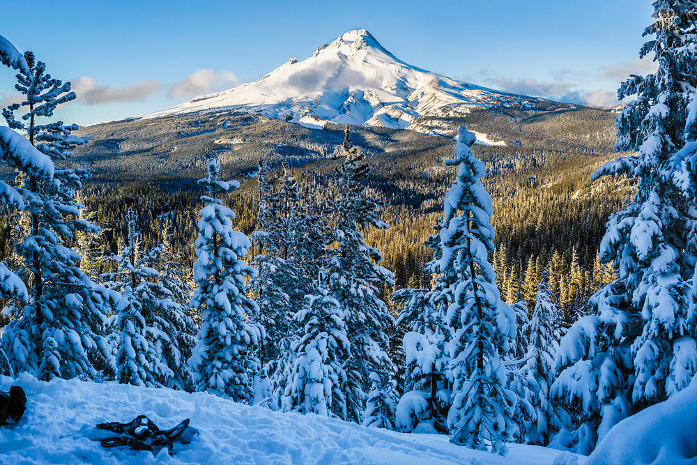
Sticking to below 600ft in the coast range.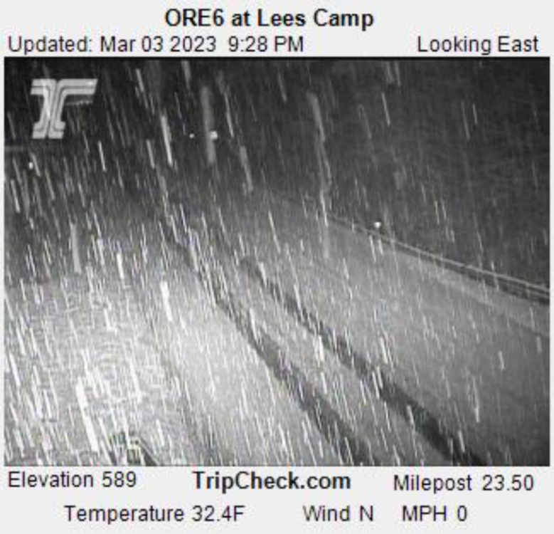
-
PNW March 2023 Weather Discussion (2012 Redux)
Perturbed Member replied to Requiem's topic in West of the Rockies
Special Weather Statement National Weather Service Portland OR 107 PM PST Thu Mar 2 2023 ...CHANCES FOR LOWLAND SNOW REMAIN IN THE FORECAST FRIDAY NIGHT THROUGH SATURDAY MORNING... There is an increasing threat of snow Friday night and Saturday morning across the interior lowlands of southwest Washington and northwest Oregon, including the Portland metro and the I-5 corridor from Eugene, Oregon to Castle Rock, Washington. This is due to an incoming low pressure system that is set to dive southward out of the Gulf of Alaska and move towards the Pacific Northwest Friday night. The main forecast challenge is determining exactly where this low will track and how heavy precipitation will be, as the exact track and precipitation intensity will determine what locations do or do not see accumulating snow. Forecast uncertainty is currently high as model guidance continues to show differing tracks of the surface low and varying degrees of precipitation intensity. While forecast snow amounts are currently less than one inch across the interior lowlands, there is a small but nonzero chance for snow amounts in excess of two to four inches by late Saturday morning (<5% chance as of 1 PM PST Thursday, March 2nd). If snow amounts in excess of four inches do end up occurring for some locations, then at least some tree damage would be expected given the heavy and wet nature of the snow. Anyone with travel plans Friday night or Saturday should pay close attention to the forecast over the next 24 hours to monitor for potential changes as the track of the surface low becomes more clear. -
PNW March 2023 Weather Discussion (2012 Redux)
Perturbed Member replied to Requiem's topic in West of the Rockies
A lot of 35F conversational snow for Washington county on most models Saturday AM. I will happily take it if it happens. Few hours of non-sticking snow in March ain't bad. -
Been snowing almost all day here since 830 AM. Just a bit too warm to stick but it is quite impressive. I drove up the hills and it is a different world above about 600ft or so. I also drove west into the coast range and even at 250ft it is pretty snowy for the most part. I turned around at about 1000 ft in the Coast Range where there is a ton of snow. Must be 15+ inches. If all of this happened overnight, I think we would have seen several inches even at the lowest elevation. Regardless, a very impressively cold day for late in the season.


