Hawkeye
-
Posts
7154 -
Joined
-
Last visited
-
Days Won
17
Everything posted by Hawkeye
-
It's nice to see models beginning to tease a snow system next weekend into early the following week.
-
We made it to 56º a couple days ago, but yesterday and today thick, low stratus killed our temp. We were stuck in the mid 30s yesterday and the temp has gone nowhere again today... both days well before the forecast.
-
Up to a few days ago models were retrograding a big northeast US upper low and pulling in some colder air from that direction, but they've dropped that idea. Now the latest model runs are trending from mild to blow torch. The Euro has us getting into the 50s several times over the next ten days.
-

January 2024 Observations and Discussion
Hawkeye replied to Minny_Weather's topic in East of the Rockies
We are down to about 2 inches of snow on the ground... with much deeper piles, of course. The next week should take care of it. -
January 2024 Observations and Discussion
Hawkeye replied to Minny_Weather's topic in East of the Rockies
That is a LOT of precip. We've had a top-ten wet January, but it's not even half of what you've received. -
January 2024 Observations and Discussion
Hawkeye replied to Minny_Weather's topic in East of the Rockies
That is a pretty ugly, horribly blocked-up pattern the op Euro is showing in early February. A massive ridge over the northern US and southern Canada will never allow any precip to get up here. -
January 2024 Observations and Discussion
Hawkeye replied to Minny_Weather's topic in East of the Rockies
0.57" of rain here from this latest system. My January total is 3.25", which is apparently the wettest January in several decades. A few inches doesn't sound like much, but January tends to be cold and dry here so it's difficult to get a lot of precip. Our snow is vanishing pretty quickly. I'm guessing 2/3 of our snow is gone. A few bare spots are showing. The grass is as green as it will ever be in late January, thanks to all the snow insulating the unfrozen ground during the cold outbreak. -
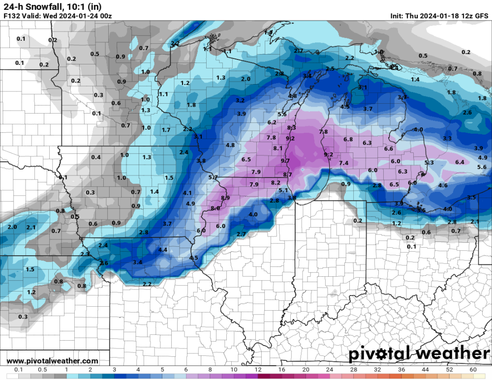
January 21-23 Wintry Mix Transition Event
Hawkeye replied to Black Hole's topic in East of the Rockies
This was a big ol' dud. For days models suggested some decent snow this morning, but it just didn't happen. It appears there is some snow from near Dubuque to southern Wisconsin where the precip is heavier. -
January 21-23 Wintry Mix Transition Event
Hawkeye replied to Black Hole's topic in East of the Rockies
The snow did not last long. Instead of expanding throughout the precip shield like models predicted, radar shows it shrinking as the temp gradually warms. -
January 21-23 Wintry Mix Transition Event
Hawkeye replied to Black Hole's topic in East of the Rockies
We have finally switched to snow after getting a glaze of ice this morning. Models are not too bullish on accumulation... maybe an inch. -
January 2024 Observations and Discussion
Hawkeye replied to Minny_Weather's topic in East of the Rockies
The latest GFS and Euro both show a stretch of 50s, or even 60s, across the region in early February. -
January 2024 Observations and Discussion
Hawkeye replied to Minny_Weather's topic in East of the Rockies
Models have most or all of our snow melting by Groundhog Day. -
January 21-23 Wintry Mix Transition Event
Hawkeye replied to Black Hole's topic in East of the Rockies
The Euro had been pretty weak, but it is trending toward a few inches of slop.
-
I finished with 1.8", a bit disappointing. We were toward the north edge of the snow, where the flake quality was poor, so the ratio was only 11 to 1 despite the very cold atmosphere. The best snow definitely shifted south.
-
It appears Des Moines got bulls-eyed yet again. There is a report of 4.5" near the city.
-
Radar shows most of the snow sagging into southern Iowa. The latest HRRR/RAP have dropped Cedar Rapids down to only 1-2".
-
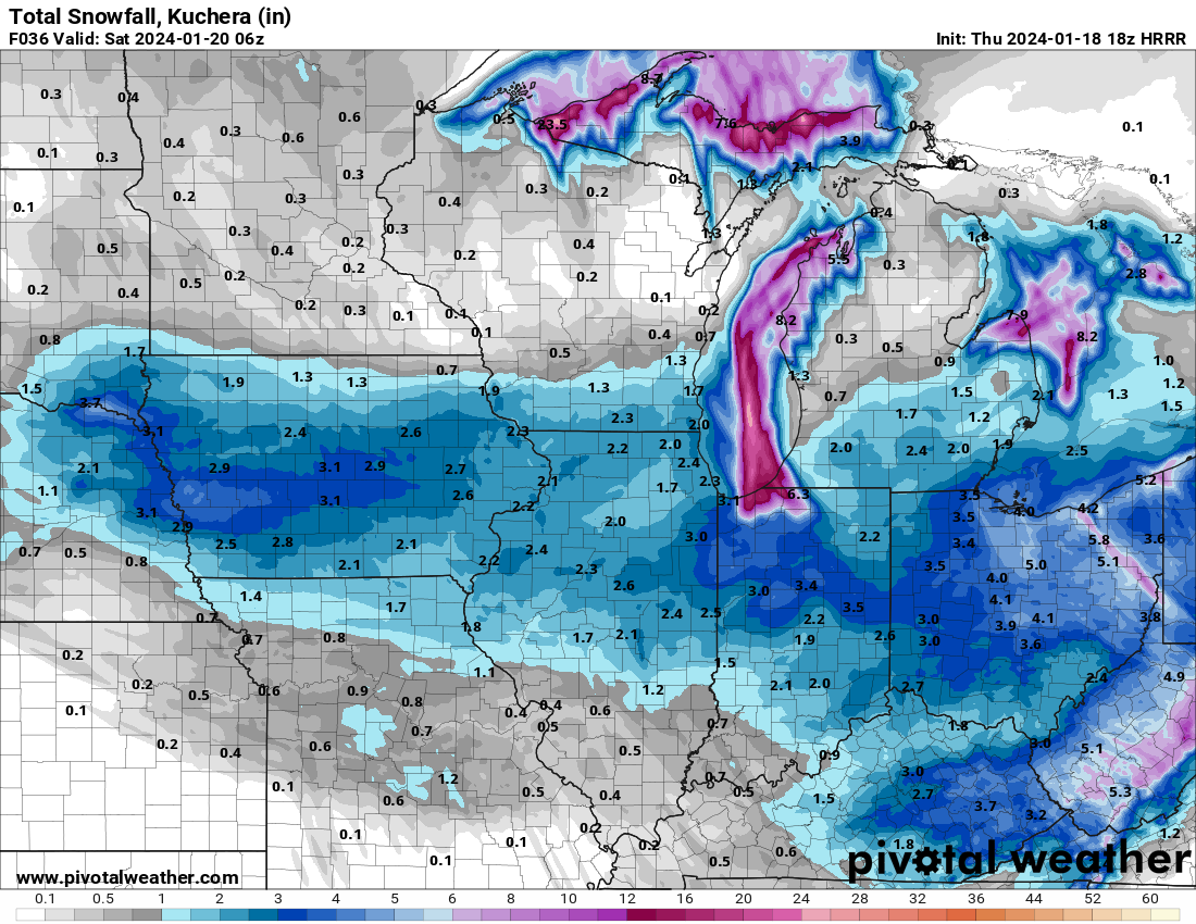
18z HRRR

-
January 21-23 Wintry Mix Transition Event
Hawkeye replied to Black Hole's topic in East of the Rockies
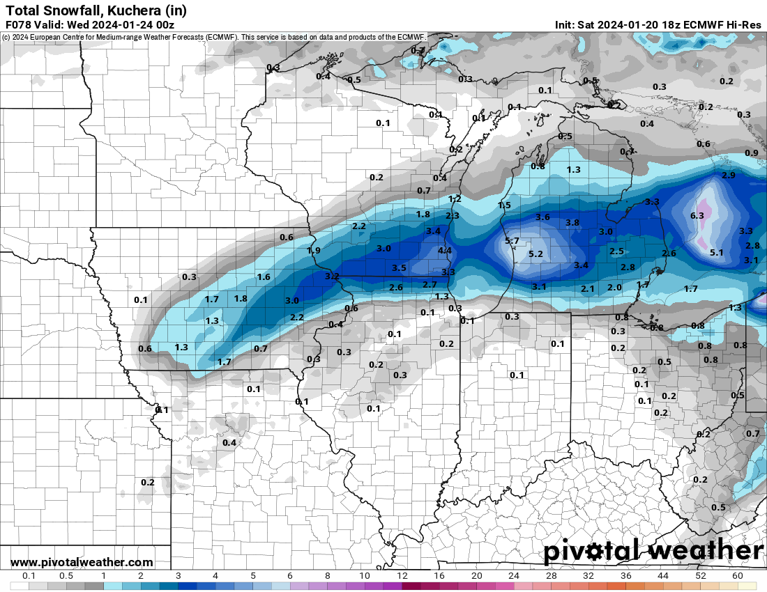
12z Euro has snow, but it's weakish.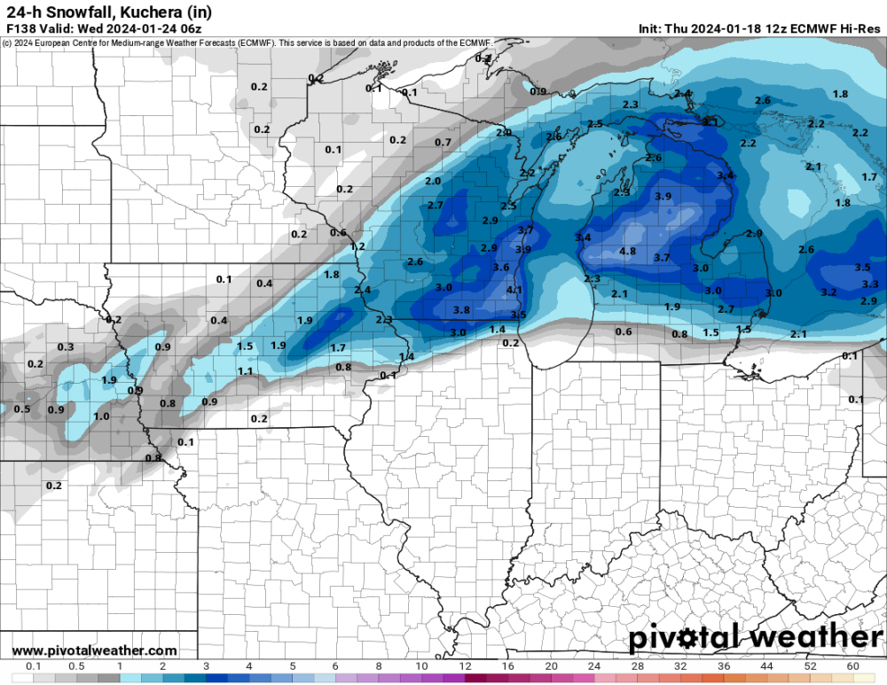
-
January 21-23 Wintry Mix Transition Event
Hawkeye replied to Black Hole's topic in East of the Rockies
For days, models showed all rain here. Recent runs have certainly trended colder and snowier.
-
Several models have sagged south this morning... tracking the snow band through southeast Iowa.
-
00z Euro has juiced up a bit more through Iowa.
-
Other spotter/Cocorahs reports from Cedar Rapids are in the 6-8" range, but I'm just going to record 5". My snow board only has 2.5" on it this morning, but the liquid is 0.43. Extrapolated to 5", that's 0.80" and a 6 to 1 ratio. This always happens when the snow is dry and the wind is strong. The dry snow should have a relatively high ratio, but it's ends up being 5 or 6 to 1 for me.
-
More good snow is blowing up across the Quad Cities area. They may end up with 15+".
-
Another three hours of snow produced only about 0.1" on my snow board, so my measurement is worthless. I'll probably just record 5" or whatever the local average is.
-
Snow is vanishing from radar around Cedar Rapids, but somehow it's still going strong in the Des Moines area. Is it just me or does Des Moines hit the jackpot almost every storm?