

Brian_in_Leavenworth
-
Posts
3545 -
Joined
-
Last visited
-
Days Won
7
Everything posted by Brian_in_Leavenworth
-
 Novody in the mainstream media wll check on this or hold them accountable.
 -
The Spokane one is very detailed, I like the different scenarios they put out there, and the confidence level. I know most of you don't live in the area covered by the Spokane NWS, but it is still a good read (and a long one too): "The weather will trend very active starting Thursday night and continue into Friday. The Polar Low sprawled across a majority of Canada will dig into what's left of the ridge and swing into the Inland NW. This will usher an arctic front into the region, supply a means of strong lift, and bring the potential for a very windy period. There are still considerable differences amongst the models regarding the trajectory of the midlevel wave and we generally preferred a SREF/GFS solution with signs that the ECMWF is trending this direction. Unlike most arctic fronts that typically pass through with generally dry, windy conditions a moist air mass will be in place. Lift along the front coupled with modest Q-vector convergence should lead to increasing precipitation chances for much of Thursday night and Friday. Precipitation type should transition from rain to snow for most locations and the potential for a few inches of snow will be there...but carry low confidence and will depend if the upper- level wave stalls or continues to press south which would shut off precipitation quickly...or as snow levels fall back to valley floors. Hopefully, models match up a bit better tomorrow and we can achieve more confidence with potential snowfall amounts. The forecast is leaning toward a snowier solution but spread at locations like Spokane range from o.2 to 5.0" per SREF plume diagrams. A bigger concern will be the potential for strong, damaging northeast winds. GFS forecast pressure gradients between Kalispell and Portland to tighten between 25-30mb Friday night. The Purcell Trench, West Plains, and Columbia Basin will get the brunt of the winds which could increase between 15-30 mph with gusts in excess of 40 mph. Ridgetops across the ID Panhandle could be facing gusts in excess of 50 mph. /sb Saturday through Tuesday...A wintry weather pattern is expected in the extended period with arctic air returning to the Inland Northwest. A high amplitude upper ridge along 140W is expected to allow an arctic air mass over north Central Canada to plunge southwest into the Inland Northwest. This arctic air mass should result in mainly dry weather although uncertainty exists as described below. *Temperatures: Well below average Confidence: Above average The GFS and ECMWF are in good agreement that 850mb temperatures Saturday and Sunday will plummet into the -15 to -23C range with the coldest values over the Idaho Panhandle. Confidence in precise values however is low due to uncertainty with cloud cover. Temperatures should begin to gradually moderate Monday and Tuesday. *Wind: Breezy to windy conditions for much of the Inland NW Saturday creating very cold wind chill values Confidence: Above average GFS and ECMWF show at 1040-1048mb arctic air over southern Alberta and a 1000mb surface trough along the Oregon coast. This will create a strong pressure gradient along with strong cold air advection. The Purcell Trench will likely see sustained winds 20-30 mph with higher gusts which includes Sandpoint and Coeur D'Alene. This combined with the cold temperatures will create wind chill values as low at -10 to -20F. Elsewhere breezy winds across the Spokane area and Columbia Basin will result in very cold conditions as well. *Precipitation: Most likely a drier pattern should develop Saturday or Saturday night. Confidence: Below average Models are having a difficult time with the precise pattern with the arctic air intrusion. Several GFS Ensemble members carve a trough more aggressive over southwest British Columbia with increased frontogenesis over the weekend resulting in areas of snow over the Inland Northwest. The UKMET extension and the 18z NAM out through Friday night is more in support of this scenario. The operational GFS shows this scenario for Saturday before the very cold/dry arctic air mass takes over with drier conditions Saturday night through Monday. The GEM shows similarities to the GFS although is fairly dry. The ECMWF maintains a deep northerly flow with the Inland Northwest free of precip Saturday through Monday night. Given that most of the operational models show a drier pattern forecast favors this. However With the GFS Ensemble POPs at 40-60% each 12 hour period precipitation chances have been trended upward to 20-30% just in case some of the more unsettled solutions pan out. JW"
-
My brother-in-law from Toronto honymooned in Cuba in 2005, and said it was nice, but they were bad at customer service. Like they had little experience in tourism. For example, a hurricane was heading toward Cuba and they were told nothing. They lost power for a few days and did not know why, and the place they stayed at had no emergency supplies. I knew more than they did. Perhaps now they are better at it.
-
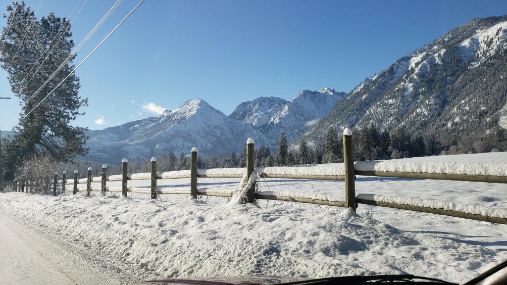
No crying here in Leavenworth. It has been snowing almost non stop since Saturday evening, though it did stop for awhile overnight. The weekend snow did not add up to too much, but we have had 5 unexpected inches today. I have 17-20" on the ground here. It has snowed a lot more than that, but rain, warm temps, and compression have kept the totals on the ground from adding up as much. The snow that is there is very solid, very compact except for the top 6 inches or so. And they keep the roads plowed around here. The only hard part of driving is the driveway and the pile at the end of the driveway due to the snow plow. Jim, you would like it here. And a beautiful place to have the snow. We may get sunshine here, and with a fresh coating of snow everywhere and the hlls and mountains covered, is will be gorgeous.
-
To be fair, the Euro last week about this time was showing a torch, IIRC. Yes, the GFS overdid the cold, as usual, but it ended up being closer to the truth than the Euro, or at least it caught onto this pattern a lot sooner.
-
Yes Here is the full quote, a good summary of the models. "Saturday and Sunday: Little has been resolved in the forecast for next weekend. Split flow patterns can give us fits. Considerable model uncertainty continues. Of the 12z models: * The GFS is the most aggressive plowing an arctic front into eastern and central Washington on Saturday which would produce a good chance of rain and snow Saturday followed by bitterly cold temperatures and blustery northeast winds into Sunday. * The ECMWF keeps the lion's share of the arctic air mass east of the Continental Divide through the weekend. The best chance for rain and snow would occur Sunday into Monday. * The Canadian model phases the northern and southern branch Saturday night into Sunday. The collision of arctic air with Pacific moisture produces a nasty winter storm with widespread snow accumulations and gusty winds. Needless to say, forecast confidence is much below average for the upcoming weekend. Our current forecast probably favors the ECMWF, but is a middle of the road blend of scenarios. Temperatures could easily be 10-15 degrees warmer or cooler than our forecast, so stay tuned. It could be a few more days before we can improve our forecast confidence with this kind of pattern. /GKoch
-
I hope it is. This is what the Spokane NWS AFD said about the 12Z GEM (keep in mind they are talking about Eastern Washington and Northern Idaho) "The Canadian model phases the northern and southern branch Saturday night into Sunday. The collision of arctic air with Pacific moisture produces a nasty winter storm with widespread snow accumulations and gusty winds."
-
(in response go Jim's comment about Leavenworth) I know you would enjoy it too. More sunny days as well, with great views. Peshastin is 5-6 miles east of here, that much closer to Wenatchee. It makes Leavenworth look like a metropolis, and the views are not quite as nice. I am guessing they get a bit less snow than we do, but certainly more than Cashmere and Wenatchee. But probably cheaper to live there though. Places like Plain and Lake Wenatchee get even more snow than we do, since they are a bit west and have higher precip totals, and they can be just a bit cooler, so marginal snow here is all snow there. Those places are probably 20 minutes from Leavenworth. You can get better real estate deals if you go out of town just a little bit. If you are serious, PM me and I can give you the names of a couple of good real estate agents who really know the area.
-
Actually we are much closer to Wenatchee then you think. We are 25 minutes from Wenatchee, max. A very easy drive on highway 2 straight into downtown. Yeah, it is hot in the summers. It does help that it is dry, but it is still hot. Air conditioning is a must here, and most houses have them. We have had a lot of snow since January 29th. I have not kept track of totals, but we have had probably 7-8 snows of 2-6'. And some rain in the daytime, which has kept the snow totals still on the ground a bit lower then it otherwise could be. Still plenty of snow though.
-
This is from a blog post by Scott Sistek: Heavy Snow Warning: -- For the mountains above 2,000 feet, this is 12" of snow or more in 12 hours, or 18"+ in 24 hours. For the lowlands, it's 4" or more in 12 hours or 6" or more in 18 hours. Winter Storm Warning: -- Conditions for Heavy Snow Warning plus added element of wind or other hazard. Winter Storm Watch: -- Warning-like conditions possible with the next 12-48 hours. Snow Advisory: -- For the mountains, it's 6-11" in 12 hours or 11-17" in 24 hours. For the lowlands, it's 1-3" in 12 hours or 3-5 inches in 24 hours. (Sometimes this also comes out as a "Winter Weather Advisory" -- that might mean it could be sleet or freezing rain too) http://www.komonews.com/weather/blogs/scott/182049301.html
-
FWIW, there is a new feature on the GFS showing dominant precipitation type. I have no idea if it is accurate, especially for the northwest, but they just implemented this recently http://mag.ncep.noaa.gov/model-guidance-model-parameter.php?group=Model Guidance&model=gfs&area=namer&cycle=20140221%2000%20UTC¶m=200_wnd_ht%2C500_vort_ht%2C1000_500_thick%2C850_temp_ht&fourpan=yes&imageSize=&ps=modelGuidance&model=gfs&area=namer&cycle=20140221%2000%20UTC¶m=dom_precip_type&fourpan=no&imageSize=M&ps=model EDIT: not sure if the link works right, but I copied and pasted it from the NCEP site. Just pick "Dominant precipitation type" from the parameters instead of 850 temps, or whatever
-
Regarding the low temps, keep in mind the wind will prevent the temps from reaching their potential.
-
Mt Baker has between 74 and 87 inches, and Stevens Pass has between 51 and 75 inches. Not a lot for this time of year, but enough for good skiing.
-
We have no snow on the ground in Leavenworth, so that is a record low, or at least tied. Very unusual, but not unprecedented. Old timers tell me we have had a few snowless winters in the past. At least one or two of the winters never even had any snowfall. It would suck to then get a big El Nino next year and have another low snow winter, though Leavenworth does get snow in a nino, just not as much as usual.
-
I'm surprised that they didn't email everyone on the old board to tell them about the new one.