Clinton
-
Posts
6477 -
Joined
-
Last visited
-
Days Won
28
Everything posted by Clinton
-
EPS is starting to get some ensembles on board. Canadian ensembles further north
-
12z Run of the Euro and the Control showing a nice panhandle hook in about a week. I would like to see some more colder ensembles. GFS looks like it's trying to join in.
-
Light rain had been falling most of the night. I've received about a.40 inch of rain. Looks like we'll have a storm to track on or just after super bowl Sunday.
-
Good write up from Bastardi I want to share. Seven reasons for huge Feb 10-March 20 for US. No Retreat No Surrender 1) SOI crash for feb. 2 stratwarm in Jan 3 MJO move 4 teleconnections all flipping 6 europe turning very cold again Cahirs Connection arises 70 north 70 east Analogs to who's who of winter end games
-
And the cold is starting to show itself on the control.
-

January 2024 Observations and Discussion
Clinton replied to Minny_Weather's topic in East of the Rockies
January stats for KC. NWSKansasCity Follow Here is your KC Jan 2024 Climate Stats... The avg temp for the month at KC was 24.8° which was 4.2° below normal and 25th coldest on record (136-years). Precip was 2.08" which was 0.92" abv normal and 26th wettest. Snow came in at 8.7" which was 3.8" abv normal and 25th snowiest. -
January 2024 Observations and Discussion
Clinton replied to Minny_Weather's topic in East of the Rockies
Bonfire weather to close out January.
-
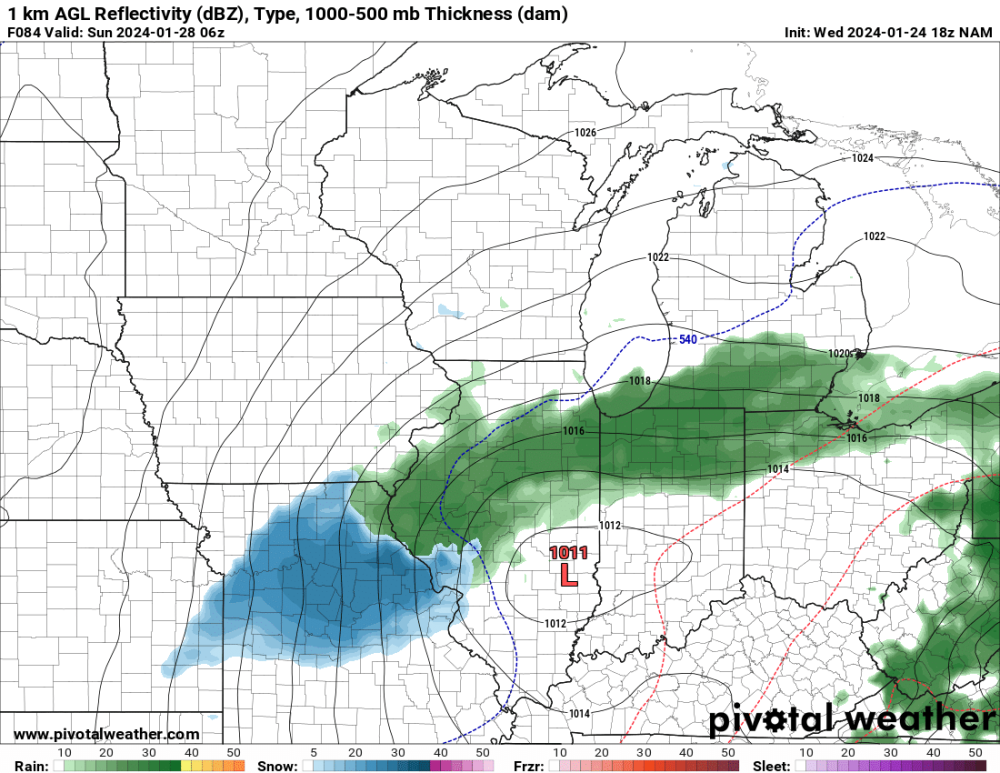
12z GFS brings the snow and the artic back! Snow in KC for superbowl Sunday.
-
January 2024 Observations and Discussion
Clinton replied to Minny_Weather's topic in East of the Rockies
Yesterday was nice day to get outside and soak in some vitamin D. Mby hit 57 it will be a little cooler today. @NWSKansasCity Follow Yesterday Kansas City reached 61 degrees. That broke a stretch of 51 days without reaching 60. It was the longest stretch of days not reaching 60 degrees since 2010 -
January 2024 Observations and Discussion
Clinton replied to Minny_Weather's topic in East of the Rockies
Congrats to the Chiefs once again! It was great to see the sun yesterday for the first time in over a week more of it coming today. -
January 2024 Observations and Discussion
Clinton replied to Minny_Weather's topic in East of the Rockies
0z Euro and Euro control both bringing some cold air into the pattern around Feb 4th and they have a marginal event across the middle of the country. The Euro showing a bowling ball type storm. -
January 2024 Observations and Discussion
Clinton replied to Minny_Weather's topic in East of the Rockies
Models are still all over the place but the Euro last night is getting cold. 7 day temp anomaly 15th-22nd 22nd - 29th 29th - 7th Deep freeze snow -
January 2024 Observations and Discussion
Clinton replied to Minny_Weather's topic in East of the Rockies
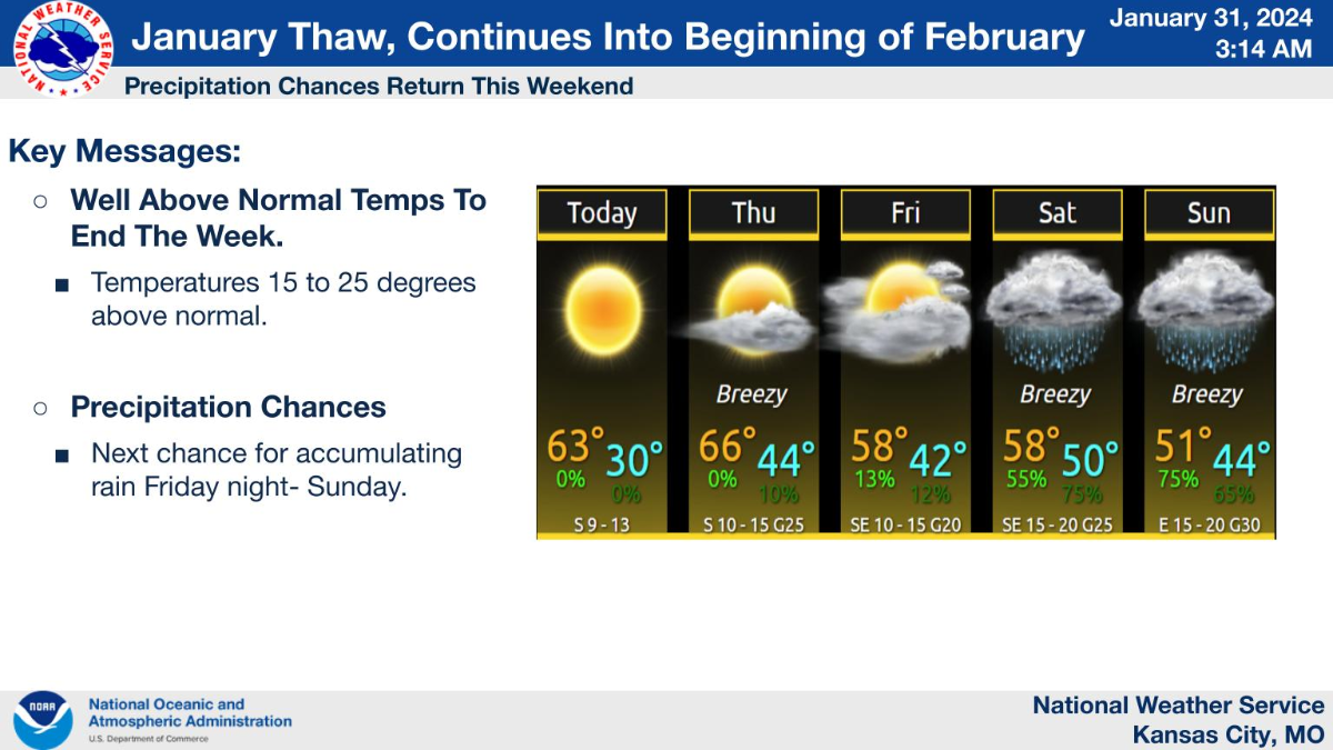
I hope everyone enjoys this thaw because come Feb 10th we are headed back to the deep freeze and it may last for some time. Yesterday I showed the Euro Weeklies here is the GEFS Ext. This resembles February of 2021. The AO: PV could get displaced NAO stormy look for the Midwest and east EPO showing a ridge over Alaska is likely WPO PNA is strong positive but not so extreme that it will cut off moisture. -
January 2024 Observations and Discussion
Clinton replied to Minny_Weather's topic in East of the Rockies
Rainy day here with about a half to 1 inch expected. It would really be something if the drought was busted before Spring arrives. Keep it coming! -
The weeklies came in with a cold and snowy look for February starting in week 2. Here we go, blocking from Alaska to Greenland seeding the cold for the jet that's cutting underneath.
-
January 2024 Observations and Discussion
Clinton replied to Minny_Weather's topic in East of the Rockies
Models a little colder with the storm Saturday, maybe a little snow. It would be some big wet flakes and it won't stay long but I'll take it.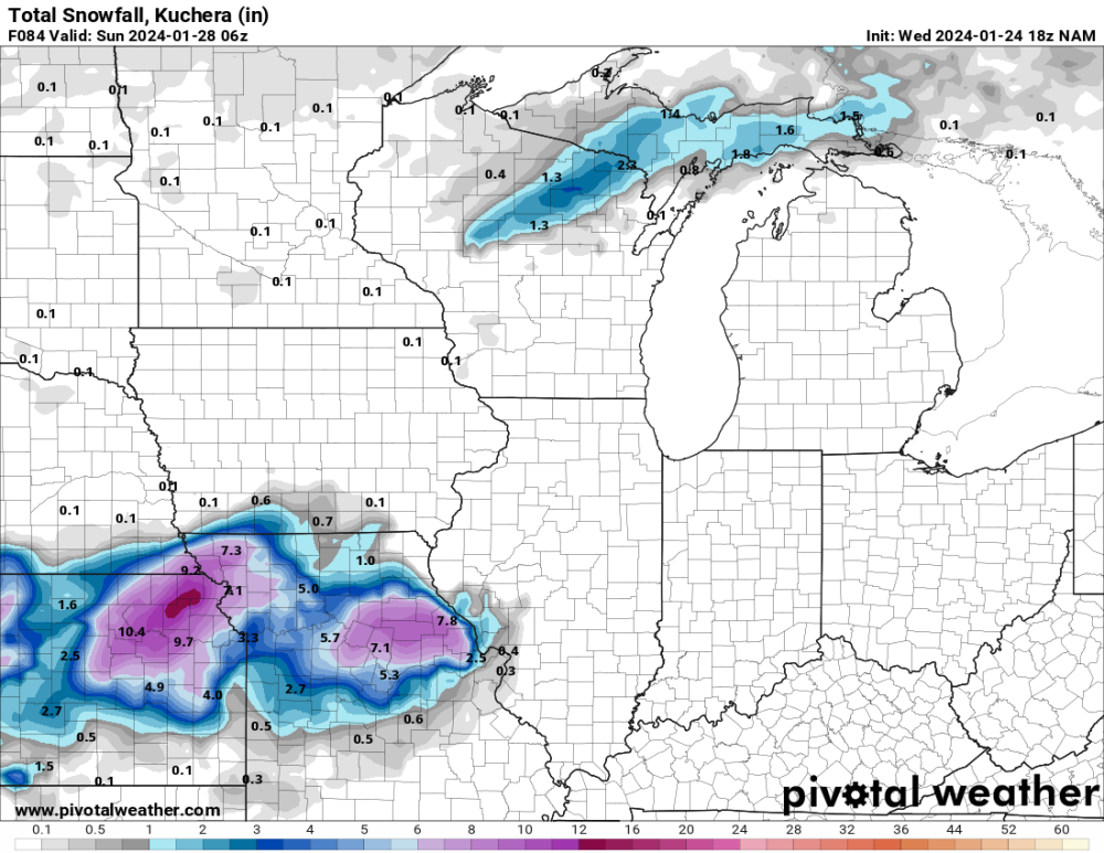
-
January 2024 Observations and Discussion
Clinton replied to Minny_Weather's topic in East of the Rockies
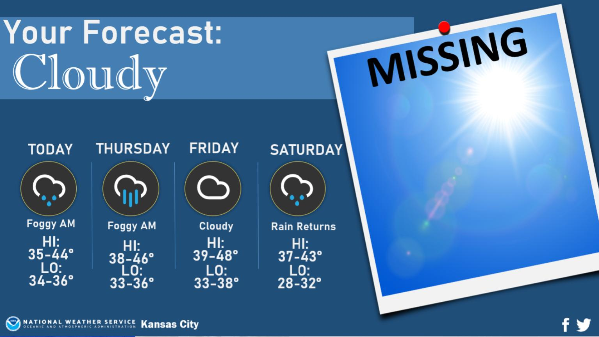
Cloudy and damp for the rest of the week. I could push 60 though next week before the cold returns.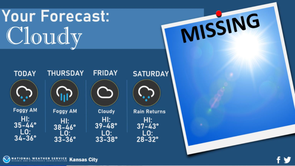
-
January 2024 Observations and Discussion
Clinton replied to Minny_Weather's topic in East of the Rockies
Thick fog with a temp of 33. At least no ice today! -
January 21-23 Wintry Mix Transition Event
Clinton replied to Black Hole's topic in East of the Rockies
Roads are a mess here. County and state patrol telling people to stay off the roads. -
January 2024 Observations and Discussion
Clinton replied to Minny_Weather's topic in East of the Rockies
This was a memorable stretch of weather. I'm good with a little warm up. NWS Kansas City @NWSKansasCity It's cold and it's been cold! The past week from 1/13 to 1/19 was the coldest week on record for that period. And, it wasn't even all that close. NWS Kansas City @NWSKansasCity This morning's low temperature of -7° F at @Fly_KansasCity ties 1984 for second coldest January 20th. The record for today is -14° F set in 1985. -
Likely imo.
-
Teleconnections on the Euro weeklies are trending toward another artic outbreak come the middle of February. Bastardi has been forecasting this for awhile and thinks it has some legs to last into March. Lots of things coming together at the same time, a return to a negative AO, NAO, and EPO, a SSW event and the LRC which is predicting a cold and snowy end of February for the nations mid section. Looks like things will get going around the 11th and by the 15th cold air may really pour into the pattern.
-
January 21-23 Wintry Mix Transition Event
Clinton replied to Black Hole's topic in East of the Rockies
6z GFS -
January 21-23 Wintry Mix Transition Event
Clinton replied to Black Hole's topic in East of the Rockies
Icy conditions expected tomorrow morning and maybe into the afternoon. I'm concerned about road conditions tomorrow morning given how cold the surface temps are. WWA in effect for this and a rather significant ice storm looks possible across the Ozarks. ...WINTER WEATHER ADVISORY REMAINS IN EFFECT FROM 9 PM THIS EVENING TO NOON CST MONDAY... * WHAT...Mixed precipitation expected. Ice accumulations of up to one tenth of an inch. * WHERE...Portions of east central Kansas and central and west central Missouri. * WHEN...From 9 PM this evening to noon CST Monday. * IMPACTS...Plan on slippery road conditions. The hazardous conditions could impact the morning commute. -
Congrats looks like you did well.