


mlgamer
-
Posts
802 -
Joined
-
Last visited
Everything posted by mlgamer
-
April 10th - 15th Extremely dynamic storm system
mlgamer replied to Iceresistance's topic in East of the Rockies
Picked up .48" of rain overnight. My current temp is 41.5. Highs the next week are forecast to be in the mid 50s to around 60 so back to cool weather again... -
April 10th - 15th Extremely dynamic storm system
mlgamer replied to Iceresistance's topic in East of the Rockies
For MBY it seems a pre-midnight squall line is the most likely scenario, hopefully without any embedded tornadoes and perhaps beginning to weaken as it gets to my area. Any discrete storms that form earlier and sustain their strength could be a real problem. -
April 10th - 15th Extremely dynamic storm system
mlgamer replied to Iceresistance's topic in East of the Rockies
Sitting on the western edge of the D4 (Tue) severe enhanced area. Precip probabilities are 20% Tuesday and 40% Tuesday night in MBY so nothing certain here. Just keeping an eye on things for now. -
I'll admit it...I'm jealous.
-
The problem with daylight savings time is we get our weather data an hour later local time which would be a pain in winter. That said, I would prefer standard time but either way works just as long we stop this near meaningless clock changing twice a year.
-
Officially Topeka had 4.5" (but in my area 5-6" was common, I had about 5.75"). 4.4" fell on Mar 10. That broke a record for the date. The previous record was 2.7" in 1943.
-
They have a snow squall warning in ND/MN. I'm mobile so I can't post the details easily...
-
I'll borrow @OmahaSnowFan's turbo snowblower and see if we can get you into double digits!
-
I have a solid 5.5" in MBY and still snowing. Looks like I'll miss out on the 2nd wave tonight.
-
Winter seems to have saved the best for last over here anyway. Yeah, I expect severe weather season to be more active here than in recent years. We'll see...
-
Actually, I was all ready moving on to Spring before this came along...lol.
-
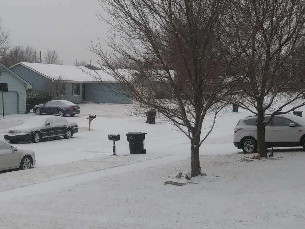
I have nearly 3" in MBY with moderate to heavy snow falling. A NWS employee near me reported 3.3" just before 8 AM CST. The radar looks good for the moment and this could be my biggest snow of the season. A storm total of 3.4" would push Topeka over 20" for the season for only 2 of the last 8 winters!
-
Looks like we all have new neighbors!

-
SPC just issued this heavy snow MSD... https://www.spc.noaa.gov/products/md/md0232.html SUMMARY...Heavy snow may develop over the next few hours in proximity to a sagging arctic front across the central Plains. Snow rates of 1+ inch per hour will be possible, potentially impacting travel. DISCUSSION...As of 2140z, regional radar imagery showed a band of snow showers developing across portions of the central Plains. Driven by increasing forcing for ascent ahead of a positive-tilt shortwave trough over the Great Basin and central Rockies, precipitation coverage/intensity is forecast to increase over the next few hours. Aloft, strong warm advection is forecast to increase late this afternoon and overnight as the low-level jet increase across the Plains in response to the approaching trough. This along with strengthening frontogenesis and some symmetric instability release will likely support a narrow band, or bands, of moderate to heavy snow through parts of eastern CO and the NE/KS border region. Hi-res ensemble guidance agrees and suggests fairly high probabilities of 1 to 2 inch per hour snow rates developing within some of these convectively augmented bands this evening and overnight. While most model guidance suggests the greatest potential for heavy snow will occur after 02z, current radar trends suggests some moderate to heavy snow may develop slightly earlier closer to 23-00z. Heavy snow will likely result in quick accumulations and travel problems, especially under the stronger bands later tonight.

-
Old Man Winter this year is like the bad relative that shows up late for the family gathering and then won't leave...lol. Oh well, maybe some last minute stat padding...
-
Mother Nature says she was having some supply chain issues but is now going to make the deliveries for your area! Hopefully no last minute snags. Good luck!
-
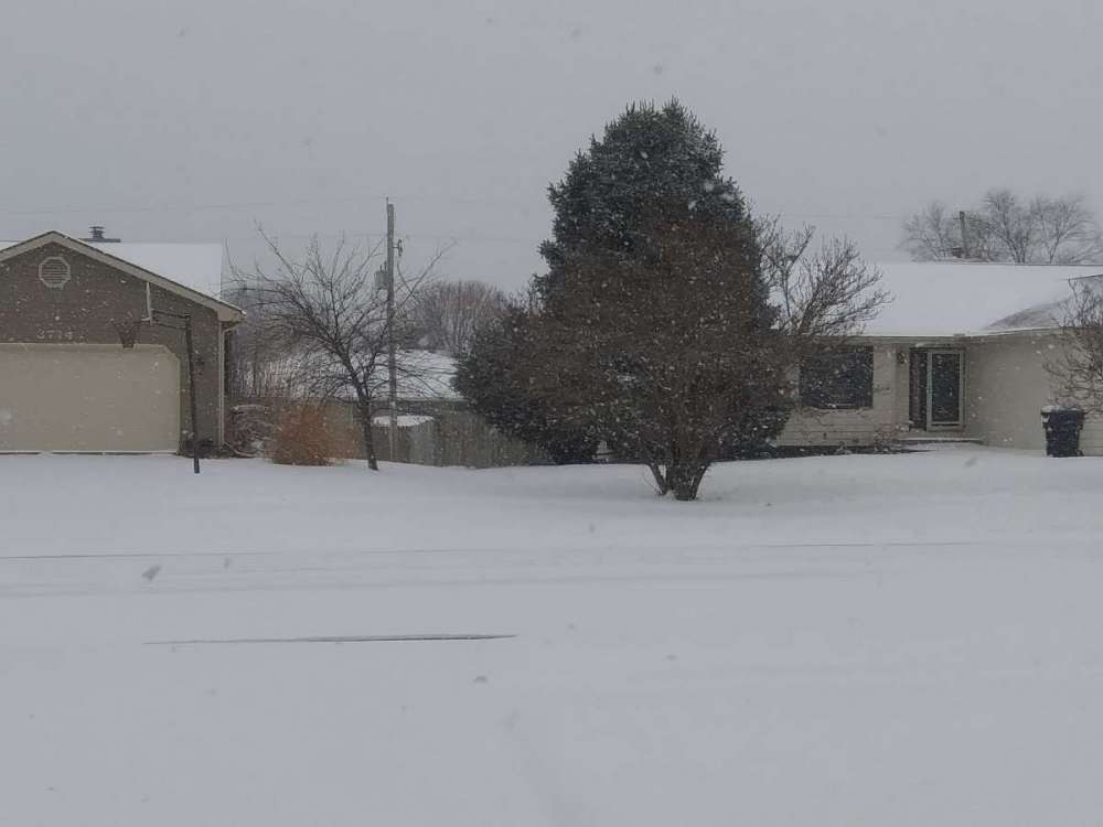
The first six days of March had a +9.8 temp anomaly, but we have a fresh blanket of snow on this crisp March 7 morning. A solid 1.5" on the deck with maybe a bit more in the grassy areas. Very nice morning.
-
Had a sleet/snow mix much of the late afternoon while temps were 34-38. Now mostly moderate rain with a temp of 32.5. Weather is weird.
-
Bright sunshine, very light to no breeze and 83 here. Feels like an early summer day. Can't complain at all [sips glass of ice tea].
-
We have a gentle snow falling this morning that has whitened everything back up to a 1/2" or so. Funny, we have had winter storms warnings end up like this and we don't even have an advisory here this morning...lol
-
Autumn & Winter 2021-22 Observations and Discussion
mlgamer replied to Tom's topic in East of the Rockies
Along this same line, in my limited dataset for Topeka, December was always ahead of January until this year (+0.9" now). Last four winters: Dec: 4.8", Jan: 23.4". Our December snows have seemingly shifted into January. -
Autumn & Winter 2021-22 Observations and Discussion
mlgamer replied to Tom's topic in East of the Rockies
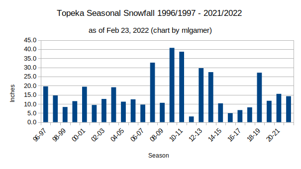
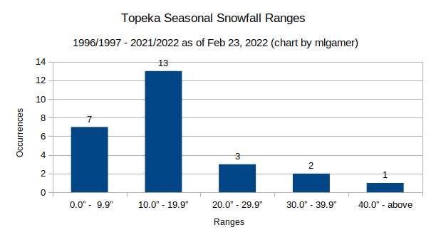
For those interested in this kind of thing, I took a look at the last 26 Topeka winters (counting 2021/2022) and came up with this. In a nutshell, slow starts, backloaded winters and less than 20" of snow in 20/26 past winters. Not a snow lover's paradise for sure.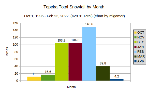
-
February 2022 Observations and Discussions
mlgamer replied to Grizzcoat's topic in East of the Rockies
Enjoying the last few minutes of spring with a temp of 71.1F in MBY. Not expected to get above freezing again until Saturday. I'm not expecting any major precip during this time even with the upcoming Thursday system. ETA: looking at radar, the arctic front is about 10 miles NW of me and heading this way! -
Topeka NWS official measurement is 4.5" and a NWS employee reported 2.3" not too far from me. Some of that 6-10" is only 25 miles to the east of me. So it can be hit and miss for sure.
-
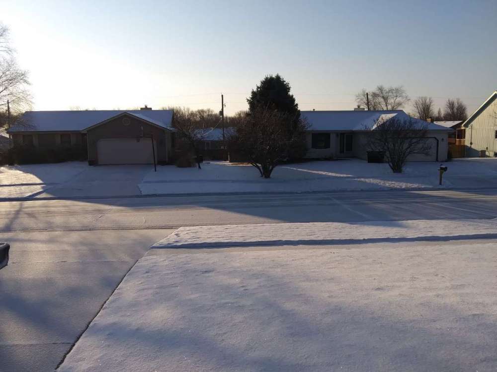
Hard to measure but it looks like I finished somewhere around 4". Missed out on the bigger totals, but happy with what I got.


