
Leaderboard


Popular Content
Showing content with the highest reputation on 10/04/15 in all areas
-
I had 1.30" before it got dark and has since rained a bit. We'll see in the morning what it adds up to. Currently 43F after a high of 46F early this morning.1 point
-
Congrats man! Post a link when you find it. I may be following in your path soon. Still haven't decided between meteorology, geology or ecology as my primary area of study, BUT I am currently getting the calculus sequence out of the way, which opens a lot of doors for the sciences in general.1 point
-
So my paper that I wrote earlier this year on the fog climatology, distribution, and frequency for Northern Utah was officially accepted by the American Geophysical Union last week. I am not sure when it will be printed but its fun to officially have a paper under my name.1 point
-
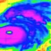
The first few datasets available for ONI calculations have started to trickle in for JAS, and the numbers are impressive, even in ERSSTv4 & ERSSTv3b, which have been low outliers, horrendously underestimated the intensity of this NINO thus far ,& are closer to the un-interpolated/unadjusted IOCADSv2.5 dataset, which isn't surprising given their (piss-poor) methodologies for handling satellite data input. NCEP R1 is likely a bit closer to reality & what will likely be reported in short order by OISSTv2, Kaplan Extended SSTv2, & COBE SST (as well as HADISST next month) with values approaching +1.9C. Thus, based on NCEP R1 & how well it has correlated to these aforementioned datasets, it appears likely that we'll reach +2.0C in ASO. This threshold has been surpassed only twice this early in the evolution of an El Nino event since the mid 19th century, of course during the 2 strongest events in the entire observational record... (1877-78 & 1997-98). The BOM SOI index was 5th lowest on record in September, only beaten out by 1982, 1940, 1902, & 1896, all of which were embedded within strong El Ninos. The MEI should be updated by tomorrow (Oct 5). http://www.bom.gov.au/climate/current/soihtm1.shtml ERSSTv4 ONI (1990-Present). The latest value (+1.46) was the 6th highest on record in JAS in this dataset, superseded by 1987, 1905, 1902, 1997, & 1877. Again in reality, this estimate is likely far too conservative & using the entire record, this El Nino should be ranked comfortably in 2nd behind 1877. Kaplan's Extended SST v2 (LDEO) data will confirm this in several days... http://weatheradvance.com/home/weather/weatheradvance.com/wp-content/uploads/2015/10/ERSSTv4-ONI-1990-JAS-2015-893x1024.png ERSSTv3b ONI (1990-Present) http://weatheradvance.com/home/weather/weatheradvance.com/wp-content/uploads/2015/10/ERSSTv3b-ONI-1990-JAS-2015-888x1024.png NCEP R1 ONI (1990-Present) http://weatheradvance.com/home/weather/weatheradvance.com/wp-content/uploads/2015/10/NCEP-R1-ONI-1990-JAS-2015-890x1024.png1 point
-
I'm new here -- in northern New Mexico as well as in this forum. And I am not a weather geek, although in my maritime-related career I paid a lot of attention to (1) fog, and (2) storms. (There was a LOT of fog, but not many storms, in the San Francisco Bay area, where I worked.) I am a retiree, and a refugee from what I call the namby-pamby, sissy weather of coastal California. Spent most of my life there, where it's always nice and mild, and I always wanted to live somewhere where the weather has character -- some muscle, some teeth. So -- at least for now, we're in the southern Rockies, and I love it. I've seen more lightning in the last 10 months than I had seen all my life before. I love it. (Have I mentioned that I don't like weather that is so *nice* and *pretty* all the time? Yuck.) Today we seem to have turned a corner. My experience here is very short, so I am not a good judge of this. Still, every thunder storm up to now has brought a blast of cold air -- you all know about that; but this is the first one to bring a real chill which has stuck around for the rest of the day and into the evening. I like it. It's real weather.1 point

This leaderboard is set to Vancouver/GMT-07:00