DSM WeatherNut
-
Posts
95 -
Joined
-
Last visited
Everything posted by DSM WeatherNut
-
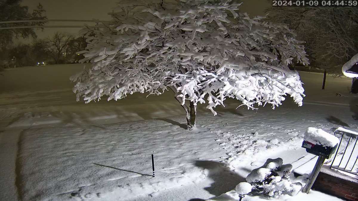
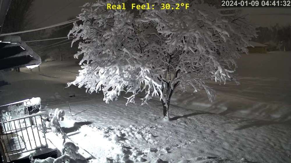
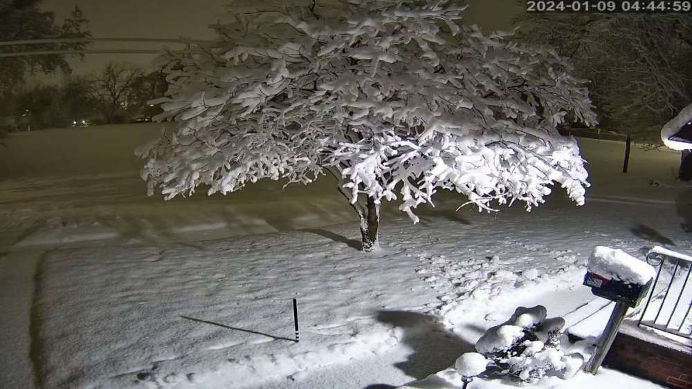
Dumping down snow here in Des Moines right now.
-
 Be a foot of snow if it was a tad cooler.
 -
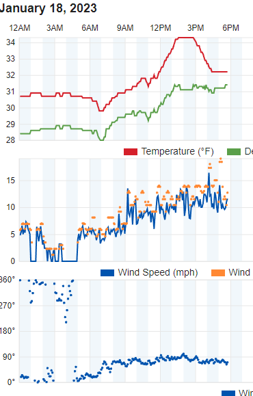
33.1 now and still coming down.
-
I have to agree and its still coming down hard.
-
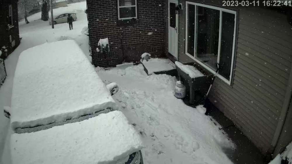
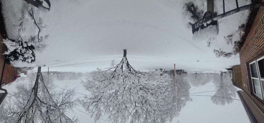
DMX totally missed the forecast on this one. Not even an advisory. Im by Windsor Heights, IA basically Des moines and have a solid 5 inches of VERY heavy snow. Thats in 3 hours. Probably one of the heaviest snowfalls I've seen and I've seen a lot. Vehicles not getting around very well and many accident reports. Its also been over 32 the entire time. Be crazy if it was a degree cooler. PS. Even if I rotate the picture on my end it still displays upside down. Makes no sense.
-
2/14 - 2/17 Cutter and Panhandle Hook
DSM WeatherNut replied to Clinton's topic in East of the Rockies
Decent shift on that model -
2/14 - 2/17 Cutter and Panhandle Hook
DSM WeatherNut replied to Clinton's topic in East of the Rockies
Looks closest to radar trends so far. -
2/14 - 2/17 Cutter and Panhandle Hook
DSM WeatherNut replied to Clinton's topic in East of the Rockies
This seems normal. I see it going back nw after these runs. Wishcasting maybe. -
2/14 - 2/17 Cutter and Panhandle Hook
DSM WeatherNut replied to Clinton's topic in East of the Rockies
Lot of consistency now. -
2/14 - 2/17 Cutter and Panhandle Hook
DSM WeatherNut replied to Clinton's topic in East of the Rockies
No confidence in add more counties to the North of Warren like Polk or Dallas yet. -
2/14 - 2/17 Cutter and Panhandle Hook
DSM WeatherNut replied to Clinton's topic in East of the Rockies
NWS DMX releasing their predictions. -
2/14 - 2/17 Cutter and Panhandle Hook
DSM WeatherNut replied to Clinton's topic in East of the Rockies
KCCI Des Moines throwing out their prediction. -
2/14 - 2/17 Cutter and Panhandle Hook
DSM WeatherNut replied to Clinton's topic in East of the Rockies
Strange WSW put out by DMX. Greater expansion to come? -
Its trying to cool down aloft. Probably false hopes.
-
1/28 - 1/29 Weekend Snowstorm - Plains/MW/GL
DSM WeatherNut replied to bud2380's topic in East of the Rockies
Radar/Nowcasting seems to be more south as well. Guess we will see.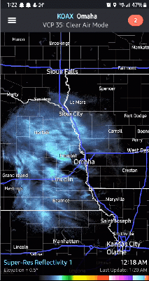
-
I take that back. I didn't refresh my weather station page. Either way we are close.
-
I've been sitting at 34 to 34.5 here in Des Moines all day with a mix that ends up to wet everything. With the last 15 minutes we have drop to 32.2 with a slight wind change out of the north so should be snowing anytime.
-
Isn't this what makes part of the fun of being part of this forum? Always that possibility of epic snow storms, awesome sledding or building a fort in 40" of snow. Good times because we all probably like analyzing data in here whether we know little or a lot.
-
Starting to change over here in Des Moines at 31.6
-
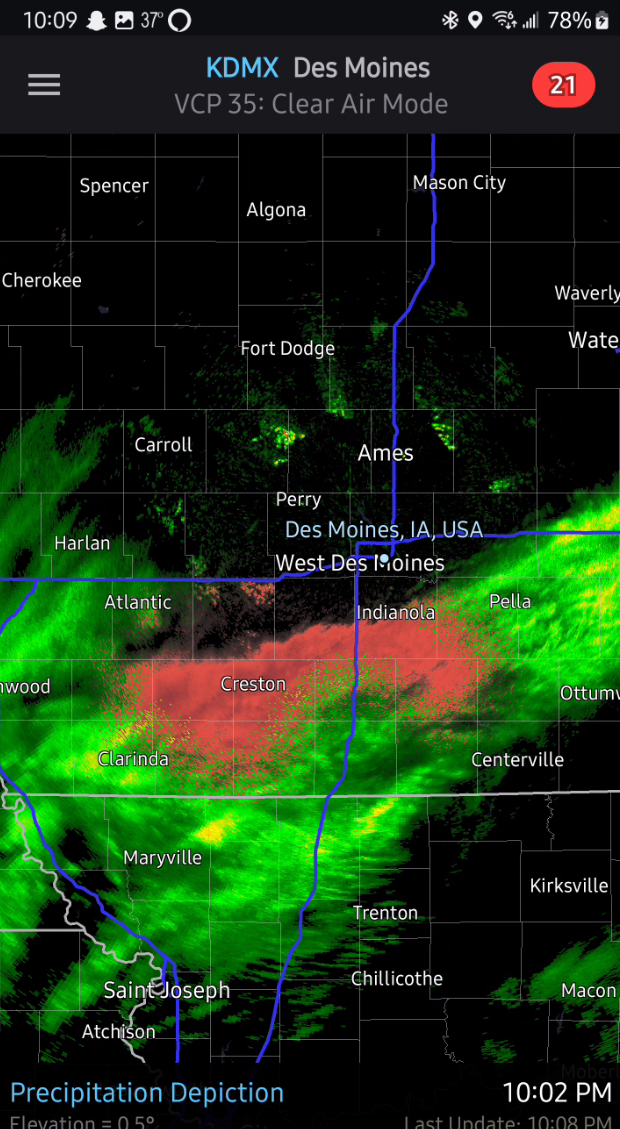
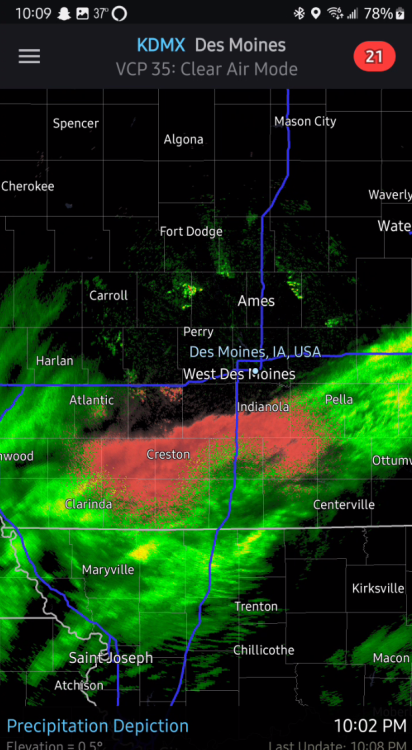
DMX still thinking there is a chance over Central Iowa. Winds become more northerly by this evening as the low swings northeast across MO into IL. This will bring cooler air back into the area and eventually lead to a transition over to snow. Models have honed in on a dominant mid-level deformation axis developing over central Iowa, mainly along and east of I-35. This will be the favored zone for accumulating snowfall Saturday night possibly lingering into Sunday morning. For the most part snow amounts are generally in the 2-4" range, but some hi-res models suggest isolated pockets of 4-6" cannot be ruled out.
-
Graupel/sleeting here in Des Moines. Strange.
-
1/23 - 1/26 Two Wave Major Winter Storm
DSM WeatherNut replied to Tom's topic in East of the Rockies
Large expansion of warnings to the North were just posted. -
1/23 - 1/26 Two Wave Major Winter Storm
DSM WeatherNut replied to Tom's topic in East of the Rockies
no massive thunderstorms to cut off the moisture. timing is great. -
1/23 - 1/26 Two Wave Major Winter Storm
DSM WeatherNut replied to Tom's topic in East of the Rockies
Just as I was going to post a radar image of all that moisture flowing up..... its about to hit that cold air and blow up. -
1/23 - 1/26 Two Wave Major Winter Storm
DSM WeatherNut replied to Tom's topic in East of the Rockies
Go away now.... lol