
OttumwaSnomow
-
Posts
575 -
Joined
-
Last visited
Everything posted by OttumwaSnomow
-
Today was one of dampest days in this string of threats of rain daily. .26 my home. But .95 surprisingly at our shop east of Ottumwa. NWS had us a 20% for today yesterday evening forecast. Zero sun and still showering, Tropical. But high temp 73, not the 80s anticipated couple days back.
-
Very nice info! Ive only lived in Iowa since 2008. But the summer of 2010 was crazy wet. A friend ne of Ottumwa had over 60" for the yr and lake rathbun was absurdly over 70" 2008 was bad but seems most the river flooding originated further north? Its interesting to see 1993 started with low severe numbers. Ive barely heard any thunder here this yr. But plenty wet!!
-
Made 80f today and 72 dewpoint, sticky.. only 4/100 today. But some measurable rain now 5 straight days. About 1.6 since Saturday. Lawns soft and damp. But not much standing water as can be the case at times in may here
-
Sparky, where are you in Southeast Iowa? My home is 6 miles wsw of Ottumwa just south of hwy 34. I also own a farm, shop and home just east of Ottumwa city not far from hospital. I track the albia, Ottumwa, Batavia eldon weather very closely via friend and farms I hunt on and our 130 customers throughout this area. Ive studied se iowa climate in depth.
-
Im sitting at .70 past 24 hrs. And 3.1 for May so far. Its been a good spring for business! Odd thing has been lack of true warmth. 4 days over 80, but outside of those days very few in the 70s, just 3 or 4. Most 40s to 60s. Have barely been able to open windows. No ac at all yet. Still turning furnace on to take chill off. Many seed will barely germinate at all.. but cool weather things like potatoes, onions, radishes and perennial native plants look great!
-
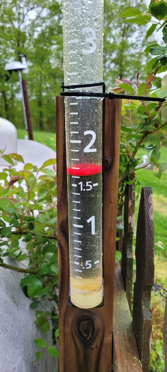
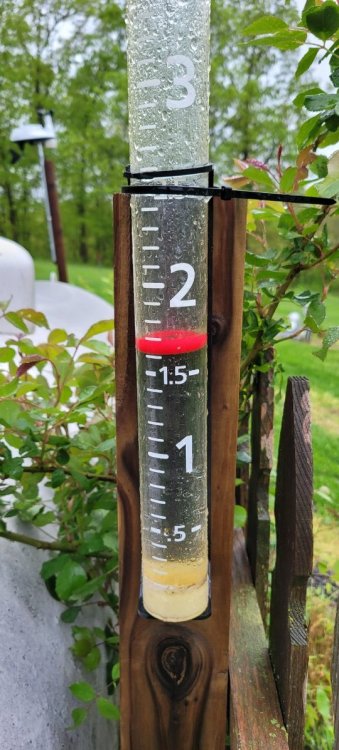
Very nice 1.6" rain here in the Ottumwa Iowa area. Widespread 1 to 2 inches across the entire area. Models were exceptional. Started late but was quite the event with brutal east wind. Many have roof leaks owing to the wind. We have 5 gauges on 2 properties. Each was different with the wind I suspect
-
Got down to 37 my home overnight! But on way to my shop saw few small pockets of frost!
-
Its been a tale of 2 worlds. Here near Ottumwa I ended up with 3.2" since Aug 2018 I can only remember 3 months substantially below avg precip. After so many years driving to Desmoines and other place only to leave the dry dust for the green!
-
Well im quite shocked after models back off completely on good rain here. Several counties with half to 1.5 here. I have 1.0 my home.
-
It was 32 yesterday morning. Today it reached 88! Dewpoint all the way to 66. After so many days with highs in the 40s and 50s. A few 70s would of been nice
-
Im sitting at 1.97 inches for April. Its likely that April finishes below normal precip. This will make April 2021 only my 4th month significantly below avg precip since Aug 2018. Thats been a pretty good run! And throughout this period no real flooding.
-
Short range models were a total bust in my area. Barley a flake. Fruit is in a serious threat next 2 nights. Thurs am could be low 20s?
-
I had 1.30 inches on Saturday. And almost 2 inches total wed through sat. Its actually needed this wind can rapidly dry and crust the surface.
-
We had 62/100 yesterday & today. Ended the windy dry spell. Solid mowing mon to wed, more fri. Hope to catch the next low to keep bumping april precip toward 3 inches by months end.
-
Got a quick 57/100 here this eve, was much needed. Since feb 4th not a super amount of precip here. 2.6 in march and todays. Snow and ice melt kept it damp. But long periods of no rain and wind its fairly dry for mid April
-
Yes youre right! Went and looked our paper work. It was 2012! My memory failed me! I try to to forget 2012 it was worse summer of my life! Yes we started the business in 2008
-
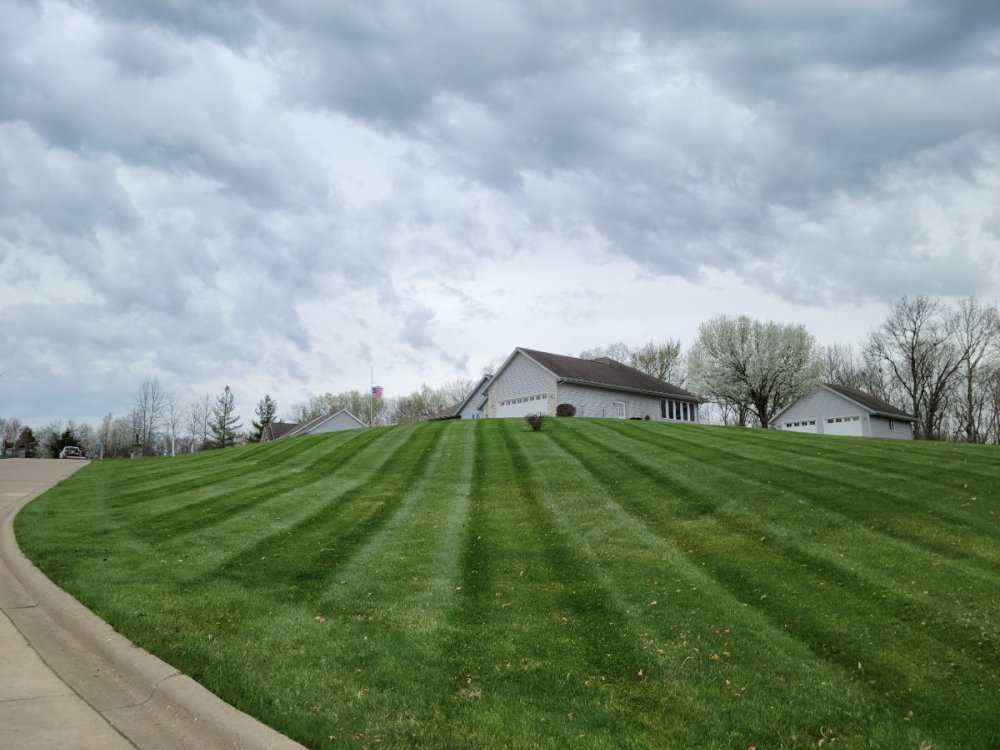
Nice! I have kept in depth records of lawn care in this area. We currently maintain over 125 properties. Our avg first mow is april 9th. We started yesterday, more tomorrow. 2013 was our earliest start on March 30th. 2018 was our latest April 29th!! 2018 was a bitter cold and dry April. This year was our 3rd earliest since 2008. Last April was our best gross revenue April ever and we plowed 8 inches of snow in mid April 2020. I suspect 2021 will up that!
-
Whats your Dec, Jan, Feb melted precip totals? At one point we melted ice and snow. And we also had way higher precip totals than the official Ottumwa numbers. I really dont believe the monthly and yearly precip amounts can be trusted from what ive seen in my part of rural Iowa.
-
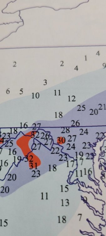
Im color blind so its tough to decipher. I have 2 properties, one 6 miles wsw of Ottumwa and another on the NE edge of city limits. Both have hovered around 20 inches much of Feb. Both are not open areas and have had little drifting.
-

February 2021 Observations and Discussion
OttumwaSnomow replied to Hawkeye's topic in East of the Rockies
Exactly same here, 17.5 snow depth yesterday. Layers and several inches of ice at bottom. I maxed out earlier in feb at 21". Over 44 inches for the season. -
Those maps have been incorrect for my property all winter. I do live in a wooded area and slopes slightly north. But since feb 5th have had 17 to 21 inches non stop. Just measured now. 17.5 and about 0.5 snow and sleet today
-
Total bust here. Some very light sleet and freezing rain. Dry slotted and barely any precip. Low must be further north than progged just 36 hours ago?
-
Your All-time favorite winter storms list
OttumwaSnomow replied to jaster220's topic in East of the Rockies
My favorite snowstorm of all time will probably always be the "megaopolis" storm of Feb 11, 1983 in North Central Maryland. I lived on my grandparents dairy farm. The forecast at 6 pm on Feb 10 was for 4 to 7 inches. Snow began about 5 am the next day. Was moderate much of morning. Heavy by noon, becoming the most intense snow of my life to date. From 1 pm to sunset visibility was nill! I still remember repeated rounds of thundersnow. Rates of 4 to 5 inches per hour much of that afternoon. It ended about 7 pm.. a shocking 36" on our farm of about 1100 feet elevation. All in less than 17 hours! 1000s of cars were stranded on interstates. That complete area totally paralyzed. Schools were closed for 5 to 7 days. The 1993 "superstorm" was also quite intense although only 22" of snow due to hours of sleet, the low pressure and intense wind and 10 foot drifts were crazy! I also happen to be in Maryland for the January 24, 2016 storm. In that Baltimore set its all time record of 32" and on My grandparents farm a hour west they easily had over 40". In the midewest the groundhog day 2011 takes the cake. 17" and 8 foot drifts.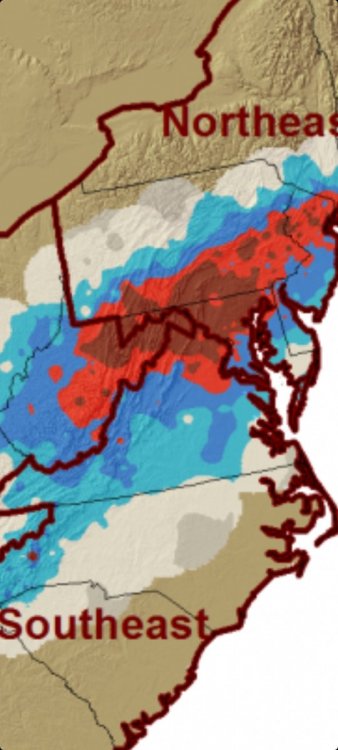
- 93 replies
-
- 6
-

-
- Snowstorms
- Blizzards
- (and 1 more)
-
February 2021 Observations and Discussion
OttumwaSnomow replied to Hawkeye's topic in East of the Rockies
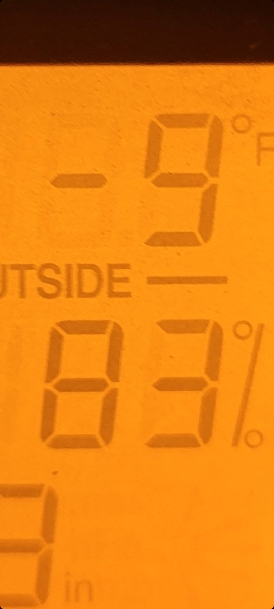
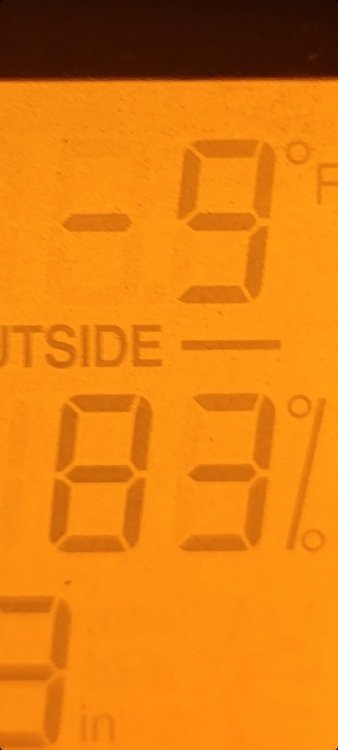
Fridays low was 1F and a high of 32 Todays low was 4F and a high of 37F Quite a temp spread of 33 degrees today. -
Radiational cooling in full force past 2 nights. 2 full weeks now of below zero nights.
- 327 replies
-
- 4
-
-
- 2/6-2/9
- polar vortex
- (and 1 more)