TonyP
-
Posts
118 -
Joined
-
Last visited
Recent Profile Visitors
518 profile views


TonyP's Achievements
")


-
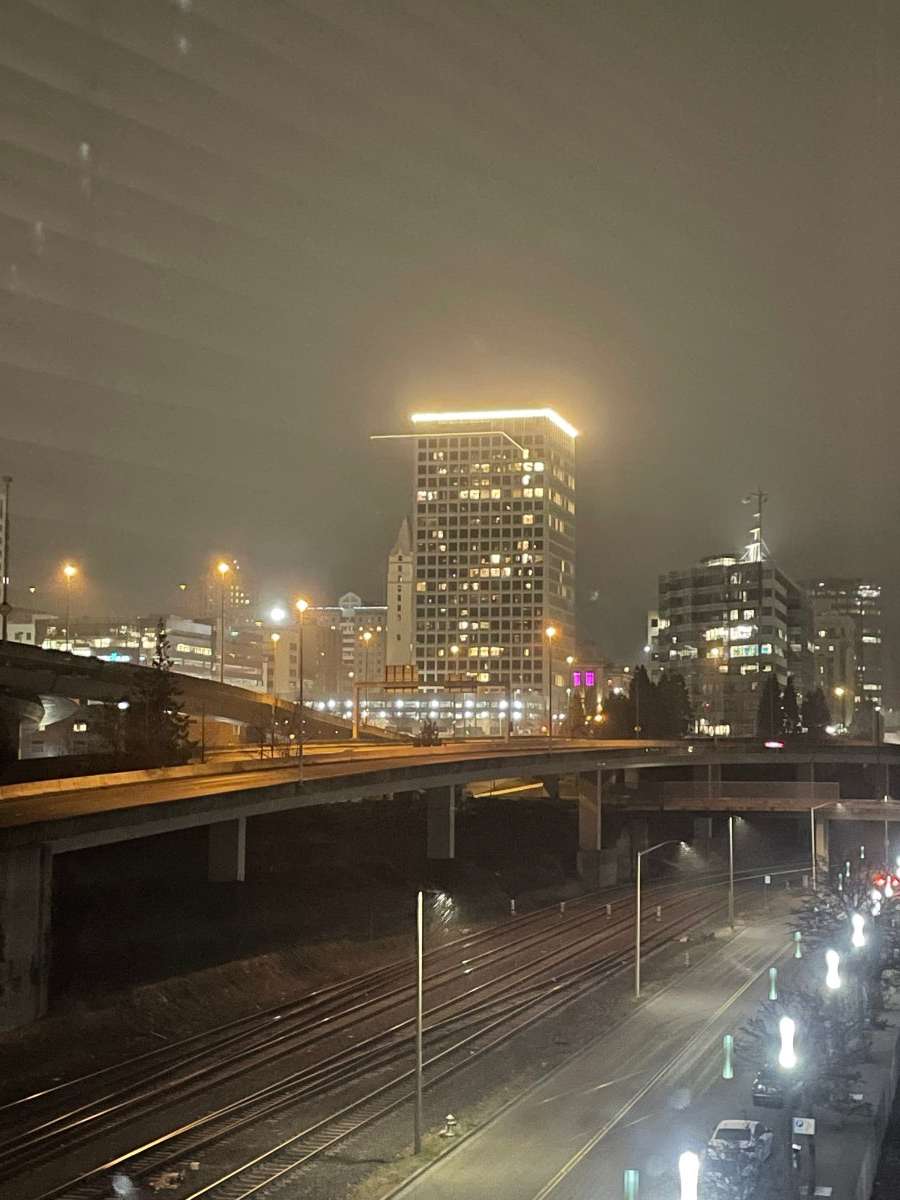
 Cold rain in Tacoma at the moment
 -
It feels much colder in T-town than it was at this time yesterday.
-
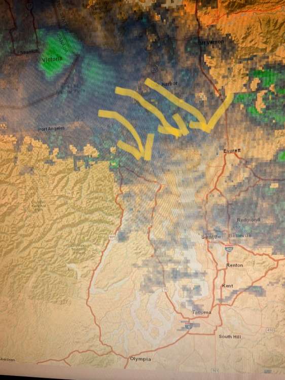
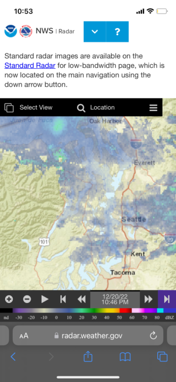
The 00Z RDPS is also picking up on the deformation band Monday morning in the central PS area.
-
What time does the 18z euro run?
-
The margin for error between snow or sloppy rain on this Saturday night Sunday morning system is razor thin. That being said the 18z NAM gives SEA 4 inches and Tacoma 2-3 inches. Not bad if the cards fall the right way.
-
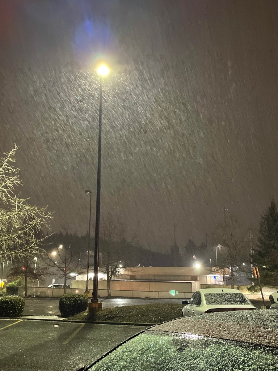
Moderate snow in downtown Tacoma at the moment! Surfaces starting to turn white.

-
That moisture plume around Olympia does seem to be heading north. Hopefully we can see some flakes in the Central Sound!
-
North bend seems promising but there aren’t many places up that way. Would Black Diamond or Maple Valley be better than say, Tacoma?
-
So I’ll be moving soon — what are the best places for snow on the west side of the mountains no more than a ~35 minute drive from Seattle? Rent has to be under 3500 if we have any real estate moguls in this community but I don’t think that will be a limitation.
-
PNW January 2023 Observations and Discussion
TonyP replied to Requiem's topic in West of the Rockies
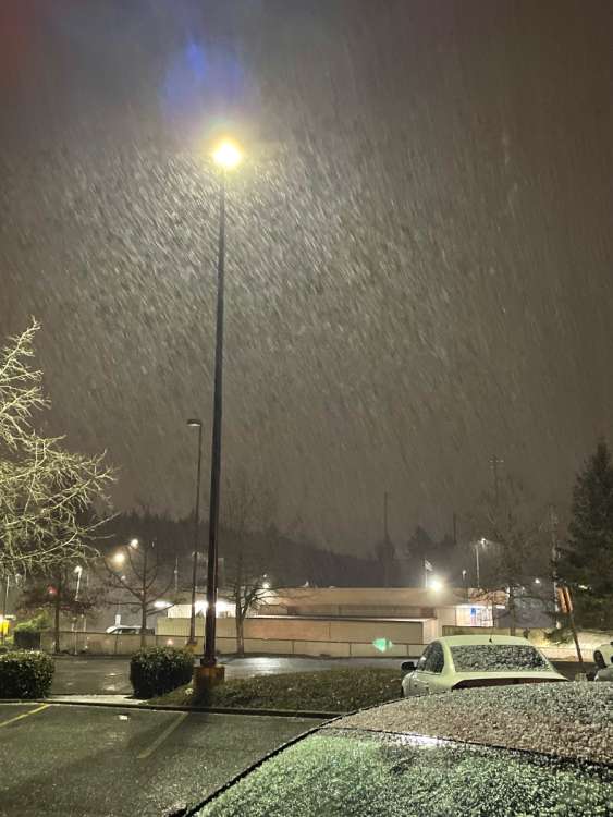
Decent little flurry in downtown Tacoma. It’s even sticking! -
PNW January 2023 Observations and Discussion
TonyP replied to Requiem's topic in West of the Rockies
Really weird precip, not as frozen as typical hail, it’s kind of fluffier??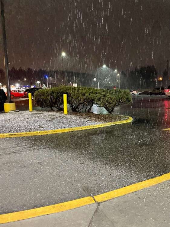
- 9819 replies
-
- 11
-

-

-
Another thing to note, it does look like the current system is backfilling at a decent rate from the north.
-
How well is well?
-
Defffffinitely looks like there is more precip filling in over the Key peninsula
-
The last ~40 minutes of radar do look like the indicate an almost clockwise rotation nearer to the Olympics — but I may also be wish casting.