-
Who's Online 5 Members, 0 Anonymous, 64 Guests (See full list)
-
Activity Stream
-
2567
June 2026 PNW Weather
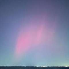
One thing which I've come to accept is, that as long as there exists the bare minumum potential for a singular passing week or so of near climo weather, there will always be some argument fodder for a certain few to claim victory on their front against "doomerism". Then, like always, the ridging will return, our averages will grow warmer, the goalposts will move further along, and history will lick its finger and turn the page. Remember this wisdom Justin: If the climate is warming, then it can be explained by natural variability. If global warming cannot be explained by natural variability, then UHI is bloating its effect. If warming signals are substantial away from urban regions, then you're probably just comparing to a cool time period. Pretend I didn't just return to the natural variability argument, that's not important. What's important right now is that I owned you and won over the internet, epic style. Now I am going to pick apart a post you uploaded three months ago and refute that with a February low in Olympia. Gosh, I'm so witty. Anyways, seeing as I've handily settled this matter yet again, I should probably set the phone down, since I'm already on my way to my sixteen hour shift at the AI mines (doomscrolling in the conference room while hitting my Juul.) I'm tailgaiting a prius right now camping in the left lane with my brights on and Tesla on autopilot. This mandatory Grok feature is feeding me some really funny Tung Tung Sahur reels while speeding a goofy 67 in a school zone. Hilarious! My ex will HAVE to unblock me for at least one of these.. mandatory /s flatty, I just had some fun with the storytelling. i'm sure you text and drive at a reasonable speed -
371
June 2026 Observations and Discussion.
Here in my yard, there was 014” of rainfall yesterday. The overnight low and current temperature here is 62 with a DP of 60. Today looks to have clearing skies with a high in the mid 70’s tonight the skies should be partly cloudy with a low in the mid 50’s. Tomorrow should be mostly cloudy with a high in the upper 70’s tomorrow nigh the low looks to be around 60. The weekend looks summer like with highs on Saturday in the low 80’s and warming to the upper 80’s on Sunday. Lows should be around 60 on Saturday night warming to around 70 Sunday night. Then on Monday a major pattern chance with highs in the mid 90’s and lows in the mid 70’s, after this recent cool spell it will feel very hot. The official H/L yesterday at Grand Rapids was 67/52 there were 5 Heating Degree Days, there was 0.21” of rainfall. The day had rain, light rain and fog. That high of 67 was the 4th coolest high for any June 24th at Grand Rapids. For today the average H/L is 82/61 the record high of 97 was in 1988 the coolest high of 64 was in 1958 the record low of 41 was in 1986 the warmest low of 77 was in 1998 the most rainfall of 2.17” was in 2021. Last year the H/L was 78/67 and there was 0.53” of rainfall. Some weather history for June 25th 1988, Fifty-two cities in the central and eastern U.S. reported record high temperatures for the date. Highs of 100 degrees at Erie, PA, and 104 degrees at Cleveland OH established all- time records for those two locations. Highs of 101 degrees at Flint, MI, 105 degrees at Chicago, IL, and 106 degrees at Fort Wayne, IN, equalled all-time records. Thunderstorms in Idaho produced wind gusts to 100 mph west of Bliss and north of Crouch, injuring 29 persons. (The National Weather Summary) (Storm Data) Here in Michigan, 1969, A tornado begins near Cedar Springs in Kent County and moves east for seven miles, damaging a store and destroying a barn, chicken coop and 14 camper trailers. -
2567
June 2026 PNW Weather
Based on the 00z EPS our low temps will probably be warmer than your high temps. -
2567
-
2567
June 2026 PNW Weather
As long as it flips by winter I’ll acquiesce to suffering through this tropical heat for the next 3+ months.
-