-
Who's Online 6 Members, 1 Anonymous, 48 Guests (See full list)
-
Activity Stream
-
1159
July 2026 PNW Weather
Looks great up there near and below the lake. I hopped into the rabbit hole a bit regarding the climate down there... it looks like a strange hybrid between sagebrush and alpine forest. I think it's called a CsB climate in the Koppen books; cold-summer mediterranean. Very very rare climate type. Cold, snowy winters, but not quite cool or wet enough during the warm season to warrant a full on subarctic/humid continental climate zone, despite a decent spring/summer thunderstorm season equating to 1-2" of precip a month. Big snows and long winters warrant the alpine forest, but by June the snowpack is mostly gone and temps regularly shoot into the 60s/70s, with infrequent, often dry storms. Soil dries out promptly and the sagebrush season takes hold. Good luck finding any non-coniferous deciduous trees up there, even near water sources. Anyways, anyways, I hope neither of us run into smoke! -
1159
July 2026 PNW Weather
Nothing nasty about nature. Some people think snow is nasty. -
1159
July 2026 PNW Weather
I’ve not been but I’m also heading to Joseph and the Wallowas for the first time at the end of July. I was planning on hiking to ice lake, from what I’ve heard it’s a great trail.- 1
-

-
1159
July 2026 PNW Weather
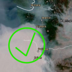
Canada is burning once again and sharing its smoke with the continent. Dangerously bad air quality in the midwest and moving east. For where we live, the region is clean air except some nasty air in southern BC and moderate air in the Lower Mainland. Piece County specifically is having some nasty Canadian wildfire smoke trapping there for a bit bringing air quality to moderate in areas. Otherwise green throughout the region.- 1
-

-
1159
-