Tony
-
Posts
2103 -
Joined
-
Last visited
-
Days Won
8
Recent Profile Visitors
1051 profile views


Tony's Achievements
")


-
This one could turn out to be interesting and some locales could cash in with some pretty good snow. This system seems fairly weak and with the cold air in place it will be hard for warm air to overtake this HP in place.
-
1mb deeper and at same location compared to 12z run so not much change
-
Just a farther north expansion in qpf but not in the low itself
-
Even a subtle shift means tons in a setup like ours.
-
18Z NAM not looking that bad so far
-
Looking better with these 12z runs so far. Was getting a little worried here in the western burbs of Chicago but with the recent SE trends it doesn't look half bad. SE trend is also helping other areas of this Sub.
-
Was actually talking about immediate city/downtown as there was a little improvement there. As far as movement it did trend SE from most of the other models today.
-
Just took a quick glance at it but yes slightly SE of the others.
-
At least the 12z Euro is bringing back some love for the Chicago folks and a few others.
-
Yep, not sure what influence the lake is going to have in the downtown/city area. Wrapping in the lake moisture will make for a tough forecast in this area with lake temps in the 30's I believe.
-
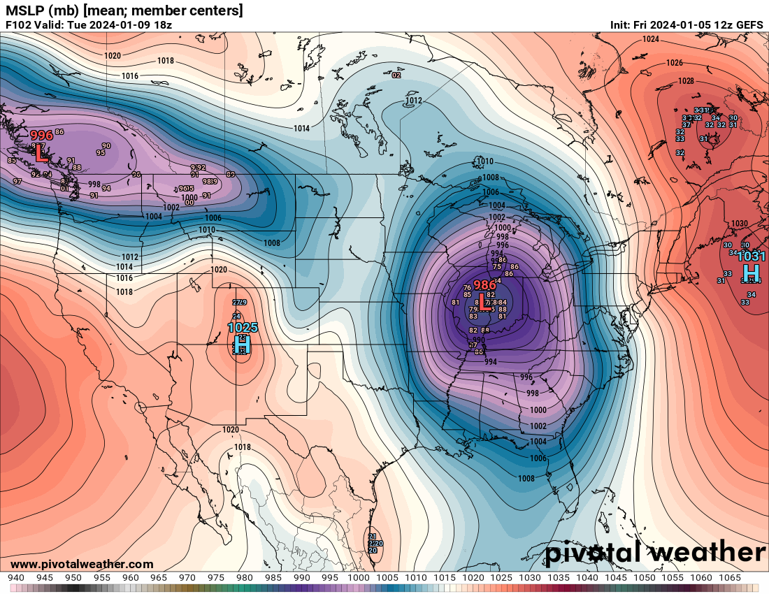
Here is a map of the Ensemble showing a better depiction of the upcoming storm. Still some variance but getting a little better
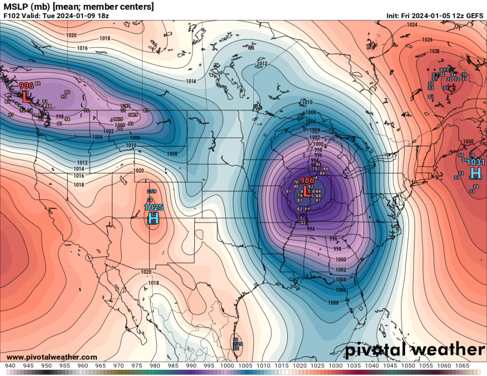
-
Ensembles always a good way to go this far out with this storm.
-
January 2024 Observations and Discussion
Tony replied to Minny_Weather's topic in East of the Rockies
The lake warm waters could also be concerning with the lack of true artic air. Places close to the lake could see more rain than snow I would think in this setup unfortunately. -
This could be the makings of something big, but it is 10 days out.
-
18z NAM looking more juiced and slightly north as well.