-
Who's Online 8 Members, 1 Anonymous, 1608 Guests (See full list)
-
Activity Stream
-
142
August 2026 Observations and Discussions
It looks like @Hoosieris going to get hit again. -
872
August 2026 PNW Weather
Calling bovine excrement on this map from a news story yesterday. In Abbotsford, precip for the year as of July 31 was 93% of average, yet were bordering severe drought? Precip last year wasn’t remarkable. Abnormally dry between Calgary & Edmonton? BS. I was there a month ago. Where the classification is “abnormally dry” it was swampy. It limited bombing around on the ATV when we were there. It’s information such as this along with them being hazy on metrics that fuels institutional distrust. Hard not to come to the conclusion of narrative pushing. -
142
August 2026 Observations and Discussions
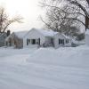
I got missed by big storms again this morning. A band of 2-3" fell just south of the city.- 1
-

-
872
August 2026 PNW Weather
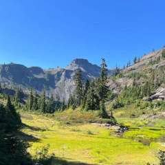
One could call it the end of the boom. From a distance it looks nice. But those are what’s colloquially known as dog crate condos. The condo market has crashed while the rest of the market is soft. I miss the small town I grew up in. -
142
August 2026 Observations and Discussions
Good morning. While it was calm here in NW Grand Rapids yesterday a official Derecho was happening to the SW of here. There were many reports of wind gusts of over 75 MPH. Today looks to be mostly cloudy with a slight chance of a showers, tonight thru Friday look to be partly cloudy and warm. There is a better chance of showers on Saturday into Sunday morning. Early next week looks to be dry and cooler. Highs today thru Saturday look to be in the 80’s and lows in the mid to upper 60’s Monday and Tuesday should see highs in the upper 70’s and lows in the 50’s Detailed Forecast For Grand Rapids Today A slight chance of showers and thunderstorms before 8am, then a slight chance of showers and thunderstorms after 2pm. Patchy fog before 9am. Otherwise, mostly cloudy, with a high near 84. Calm wind becoming west around 6 mph in the afternoon. Chance of precipitation is 20%. Tonight Partly cloudy, with a low around 64. West northwest wind around 6 mph becoming calm in the evening. Thursday Partly sunny, with a high near 83. Light east wind. Thursday Night A 10 percent chance of showers before 7pm. Cloudy, then gradually becoming partly cloudy, with a low around 65. Light and variable wind. Friday Mostly sunny, with a high near 84. East northeast wind 5 to 7 mph. Friday Night A 30 percent chance of showers after 2am. Partly cloudy, with a low around 63. Saturday A 50 percent chance of showers. Mostly cloudy, with a high near 81. Saturday Night Showers likely and possibly a thunderstorm. Mostly cloudy, with a low around 68. Sunday A chance of showers and thunderstorms before 2pm. Mostly cloudy, with a high near 79. Sunday Night Partly cloudy, with a low around 61. Monday Mostly sunny, with a high near 77. Monday Night Mostly clear, with a low around 58. Tuesday Mostly sunny, with a high near 77. Climate report for August 11th at Grand Rapids. The official HL was 80/64 there were 7CDD’s there was a trace of rainfall, the highest wind gust was just 15 MPH out of the E. Weather conditions reported were light rain, fog. For today the average H/L is 81/62 the record high of 85 was in 1988 the coolest high of 63 was in 2004 and 1964 the record low of 45 was in 1945, the warmest low of 75 was in 1995. The most rainfall of 2.61” was in 2016. Last year the H/L was 87/68 and there was 0.49” of rainfall. Some weather history for August 12th 1933, The temperature at Greenland Ranch in Death Valley, CA, hit 127 degrees to establish a U.S. record for the month of August. (The Weather Channel) 2004, Hurricane Charley was the third named storm and the second hurricane of the 2004 Atlantic hurricane season. Charley lasted from August 9 to August 15, and at its peak intensity, it attained 150 mph winds, making it a strong Category 4 hurricane on the Saffir-Simpson Hurricane Scale. It made landfall in southwestern Florida at maximum strength, making it the most powerful hurricane to hit the United States since Hurricane Andrew struck Florida in 1992. My sister lived in Fort Myers at that time here house was mostly ok but there was no power for a week.- 1
-

-