

Dan the Weatherman
-
Posts
1951 -
Joined
-
Last visited
-
Days Won
5
Recent Profile Visitors
1610 profile views


Dan the Weatherman's Achievements
")


-
Also, when you go further to the east of Denver, doesn't the elevation drop somewhat as well, which could also lead to a bit warmer conditions?
-
I wonder if the heat from the tarmac as well as heat from all the jet engines in addition to increased air traffic in general at DEN has made the temperature observations hotter than they would normally be? Or, is it just that the area where DEN is located is just warmer than the old Stapleton location? I know that DEN is located further to the east of Stapleton out on the edge of the suburbs, or at least that was the case when I visited Denver back in 2006.
-
 I think Fullerton has a good chance of reaching 80 or even higher either this coming Friday or Saturday, as we warm up briefly before cooling down early next week.
 -
May 2024 Pacific Northwest Weather
Dan the Weatherman replied to snow_wizard's topic in West of the Rockies
Is it a low cloud stratus / stratocumulus deck that won't clear out day after day, or is it a wet pattern? If that is the case, it sounds a lot like the May Gray / June Gloom marine layer pattern that CA coastal areas often experience this time of year. -
It has been much sunnier here in Orange yesterday and today, as the marine layer has cleared out much earlier. It was also warmer yesterday with a definitely more springlike feel.
-
April 2024 Weather in the PNW
Dan the Weatherman replied to Tyler Mode's topic in West of the Rockies
Looks like a smudge on the camera / smartphone lens. -
2.16" fell here in Orange with this last storm from Friday night to Sunday night, bringing my backyard season to date total to 20.44" (July 1 - June 30) and 17.45" (October 1 - September 30). It appears that I received close to what Anti Marine Layer received. I don't know what happened to Orcutt, but maybe the AR either didn't stick around as long up there or the storm gained strength south of Point Conception. I do know that areas in and around the windward side of the Transverse ranges can really score when the flow is coming out of the SW as it did with this last storm.
-
We also need a cloud icon to represent the marine layer and other cloudy weather. I think that icon would be used to the max in this thread, especially during May Gray / June Gloom season!!
-
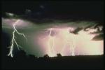
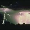
That cell passed just to the west of me in Orange. I heard continuous thunder while that storm was going by, but really didn't see much lightning except for a flicker or two. I don't think I have ever heard that much thunder before without seeing the lightning that goes with it!
-
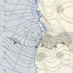
The flow pattern with the moisture coming in from the east and northeast is like that of a monsoon pattern, but the synoptic pattern is different. This is being caused by a cutoff low over AZ circulating moisture counterclockwise into our area, while the monsoon pattern involves moisture and occasional disturbances circulating clockwise around the 4 Corners High.
-
Wow! Was that caused by strong winds uprooting a tree, or was the tree suffering from root rot and easily fell over as a result?
-
0.60" fell here in Orange with this last storm (from yesterday to today) bringing my backyard season to date total to 17.96" (July 1 - June 30) and 14.97" (October 1 - September 30).
-
I hope that it is ultimately decided that we stay on DST year-round, rather than Standard Time.


