-
Who's Online 10 Members, 2 Anonymous, 214 Guests (See full list)
-
Activity Stream
-
57
2026-27 ENSO: Return of El Nino?
Interestingly, the new CANSIPS once again came in with cooler temperature anomalies in the north and warmer in the south in DJF despite having a strong Nino. Honestly makes no sense based on past history of strong Ninos. -
2209
April 2026 Weather In The PNW
God no kidding, I peeked the radarscope archives just now and it's just Battle Ground getting bullied by constant heavy precip for 3 consecutive days, including the late season front riding on the defo's heels. Over three inches in only two days there. Then in early September that year we got some similarly epic cutoffery with a bit more zap to it -
2209
-
2209
-
2209
April 2026 Weather In The PNW
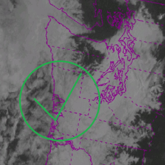
We may be looking at some convection tomorrow afternoon into tomorrow night. First in the evening with scattered pop ups, then another surge overnight as a shortwave moves through from the SSW. Chances for lightning look typically better to the south and east. A concerning situation looks to develop into the early week as the shallow cutoff responsible for our convective threat first grazes by our region to our SW, then swerves eastward into NorCal. That eastward push is going to instigate strong easterly flow throughout the PNW. Surface winds on the westside will still be muddled especially south of Seattle, but any fire starts east of the Cascades caused by the lightning we do see will pour smoke into the higher atmosphere over western WA and OR, then mix downward to the surface amidst descending midlevel easterlies and strong ridging aloft with excellent clearing+mixing.- 1
-

-