-
Who's Online 6 Members, 0 Anonymous, 167 Guests (See full list)
-
Activity Stream
-
278
April 2026 Observations and Discussion
The heavy rain last night stayed to the north of the Grand Rapids area. Here in MBY I only had 0.03” of rainfall yesterday and overnight. It was a kind of odd overnight as the temperature went up to 70 and then back down to the current reading of 59. The rest of the week still looks warm and wet. There will be a cool down early next week. Highs will be in the upper 60’s to mid 70’s before falling down to the upper 40’s to low 50’s lows will be in the upper 50’s before falling to the lower 30’s KEY MESSAGES SEVERE THUNDERSTORMS POSSIBLE LATE TUESDAY INTO EARLY WEDNESDAY FLOOD POTENTIAL REMAINS ELEVATED THROUGH THE WEEK The official H/L yesterday at Grand Rapids was 73/59 there was 0.23” of rainfall the highest wind gust was 39 MPH out of the W. For today the average H/L is 57/37 the record high of 83 was in 2023 the coldest high of 32 was in 1943 the record low of 21 was in 1943 and 1953 the warmest low of 60 was in 1941 and 1938 the most rainfall of 1.07” was in 1987 the most snowfall of 4.1” was in 2019 for the 1st time since November the most snow on the ground was just a trace and that has happened in several years the last time was in 1980. Some weather history for April 14th . 1987 A storm system moving slowly northeastward across the Middle Mississippi Valley produced severe thunderstorms which spawned three tornadoes around Ottumwa IA, and produced up to four inches of rain in southeastern Nebraska, flooding rivers and streams. (The National Weather Summary) (Storm Data)1989, Late afternoon thunderstorms in northern Florida soaked the town of Golden Gate with 4.37 inches of rain in about two hours, resulting in local flooding. (The National Weather Summary) (Storm Data) -
875
April 2026 Weather In The PNW
.26” so far on the day, 1.79” on the month. High of 48. -
875
April 2026 Weather In The PNW
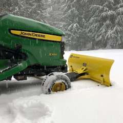
Gearing up for the April 2022 redux. Driveway is already salted.- 2
-

-

-
875
-
520
2026-2027 California and Southwest Weather Thread
It was a cold and sunny day with a high of 65F and windy!
-