-
Who's Online 10 Members, 1 Anonymous, 654 Guests (See full list)
-
Activity Stream
-
2804
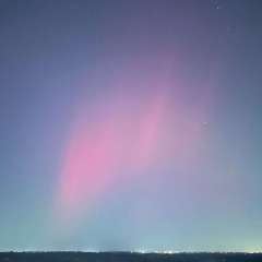
June 2026 PNW Weather
Brother they’ve been verifying since f**king May. We’ve already hit 100°F multiple times this summer and it’s not even July. Believe me I wish it weren’t true. And it’s not just Op runs, NBM is now projecting a new all time high temp record. Good chance the 1930/1918 record is dethroned next week. This is the last thing I’d thought I’d hear myself saying in a super niño onset summer. Obviously I was getting too cocky in Feb/Mar..should have made sure I was in the end zone before spiking the football. -
793
-
2
July 2026 Observations & Discussions
Pretty much all the models are now lowering those high in the sky temps for Chicago as we open up July. While an official Heat Wave looks on tap, I think it is fair to say that 100's are not happening. Storms are now in the forecast and you know how that goes as debris clouds, lake cooling, etc all can be a factor in the high temps for ORD and Chicago. All in all, a summery forecast. LRC for the win...that trended wetter! Out here in the Valley of the Sun, I'm pleased to see that a BN temp regime is in the works from SUN through most of next week! I'm stoked. Low 100's, low DP's are fine by me. -
398
June 2026 Observations and Discussion.
SOME JULY AVERAGES AND RECORDS Wow, time is surely flying by. It just seems like yesterday was the 1st day of the new year and now it is late June and Tuesday with be the 1st of July. At Grand Rapids July in most years is the warmest month of the year. That was not the case in 2009 when both June and August were warmer. In 1947, 1900, 1937 and 1959 August was warmer than July. In the case of 1947 August was much warmer that year July had a mean of just 69.1 but August had a mean of 77.1. The average 30 year mean at Grand Rapids is 72.8 with 3.86” of rain fall. The average H/L is stable at 82.8/61.7 on the 1st and 82.5/62.6 on the 31st. The warmest days on average are between the 9th and the 16th with a average H/L of 83.4/62.7. The 15-year average is warmer with the average mean being 73.5 with the daily average H/L of 82.8/62.0 on the 1st and 83.6/63.2 on the 31st the warmest days are between the 15th to the 22nd with a average a H/L of 84.3/63.6. The 15-year average July rain fall is 3.84”. The warmest means for July are 79.7 in 1921. 79.2 in 2012. 78.7 in 1916. 78.1 in 1901. 77.3 in 1936. Honorable mention goes to 2011 with a mean of 77.0. The coldest means for July are 67.1 in 2009. 67.2 in 1992. 68.1 in 1950. 68.2 in 1996. And 68.4 in 2014. The driest Julys are 0.40” in 1934. 0.46” in 1934. 0.54” in 1898. 0.56” in 1951 and 0.66” in 1930. There has been a total of 13 years when less than 1” of rain fell at Grand Rapids, the last time was in 1976. The wettest Julys are 1992 with 8.83”. 1950 with 8.42”. 1994 with 80.7”. 1912 with 7.47” 1917 with 6.91” honorable mention goes to 2006 with 6.90”. The record hottest day was 108 on July 13, 1936, it was also 106 on July 12th that same year. A high of 104 was recorded in 2012 and 1934 for the hottest days ever recorded at Grand Rapids. On average there are 5 days of 90 or better in July with the most being 18 in 2012 there have been 12 years of 0 days of 90 or better in July the last time was July 2021. On average there are 11 days of 86 or better in July with the most 27 in 2012 and 1921. In 2009 and 2000 there were no days of 86 or better. The record low for July is 41 on July 6th, 1983. Over the years it had gotten down into the 40’s in 75 Julys. The last time that happened was in 2005. Last year the mean at Grand Rapids was 75.0, that was a departure of +2.2,there 6 days of 90° or better the highest for the month was 93 and the lowest for the month was 56, there was 2.62” of rainfall. Here are some top 5 July’s The warmest July’s 79.7 1921 79.1 2012 78.7 1916 78.1 1901 77.3 1936 Coolest 67.1 2009 67.2 1992 68.1 1950 68.2 1996 68.4 2014 Wettest 8.83 1992 8.42 1950 8.07 1994 7.47 1912 6.17 1916 Driest 0.40 1934 0.46 1939 0.54 1898 0.56 1951 0.56 1930 The official H/L yesterday at Grand Rapids was 72/55 there was 1 HDD and no rainfall. For today the average H/L is 82/61 the record high of 97 was in 1933 and 1944, the coolest high of 60 was in 1968 the record low of 45 was in 1902 and 1905 the warmest low of 73 was in several years the last time was in 1944. The most rainfall of 1.30” was in 1921. Last year the H/L was 87/39 and there was 0.03” of rainfall3 Detailed Forecast Today Sunny, with a high near 82. East wind 5 to 8 mph, with gusts as high as 18 mph. Tonight Mostly clear, with a low around 60. East wind 5 to 7 mph. Sunday Mostly sunny, with a high near 87. East southeast wind 5 to 9 mph, with gusts as high as 21 mph. Sunday Night A 40 percent chance of showers and thunderstorms after 2am. Partly cloudy, with a low around 68. East southeast wind 7 to 10 mph, with gusts as high as 22 mph. Monday A 30 percent chance of showers and thunderstorms before 8am. Mostly sunny and hot, with a high near 95. Southeast wind 8 to 13 mph, with gusts as high as 26 mph. Monday Night Mostly clear, with a low around 75. Tuesday Mostly sunny and hot, with a high near 96. Tuesday Night Mostly clear, with a low around 75. Wednesday Sunny and hot, with a high near 95. Wednesday Night Mostly clear, with a low around 74. Thursday Sunny and hot, with a high near 95. Thursday Night A chance of showers. Mostly clear, with a low around 73. Friday A chance of showers. Mostly sunny and hot, with a high near 93.- 1
-

-
2804
June 2026 PNW Weather
Lmao you always post these insane Op runs and they almost never verify
-