
Leaderboard


Popular Content
Showing content with the highest reputation on 04/30/17 in all areas
-
I'm sitting at 3" of rain and probably pretty much done. I don't think the deformation band will have much left when it swings through. Looks like the snow will stay mostly west of me by about 60 miles. Overall, I have to give Hastings NWS some credit, they actually did a really good job with this one.2 points
-
Enjoy it because if Phil's hunch is correct this might be one of only a handful of 80s this year. In 1954 we only saw 10 days of 80+, 27 in 1955 and 1964, 28 in 1948 and 30 in 1953. The 1950s were rough in Portland if you liked warm summers. More recently in 2010 we only managed 37 days. The POR average is 52 days of 80+ a year while the 1981-2010 normal is 56 days. The high was 88 days in 2015...amazing summer that year. The 67 days in 2013, 77 in 2014, 88 in 2015 and 71 in 2016 are unrivaled in terms of consecutive summers with >10% more 80s than normal.2 points
-
The potential for a 55+ low on Thursday is troubling to say the least.2 points
-
They were pretty close both here in the Portland area and then throughout Whatcom County and Lower Mainland B.C. 1992-93 was snowier here but had less impressive cold and snowcover numbers. I would say a lot of western WA from Kelso north to Everett even did slightly better on snow this year than 1992-93.1 point
-
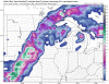
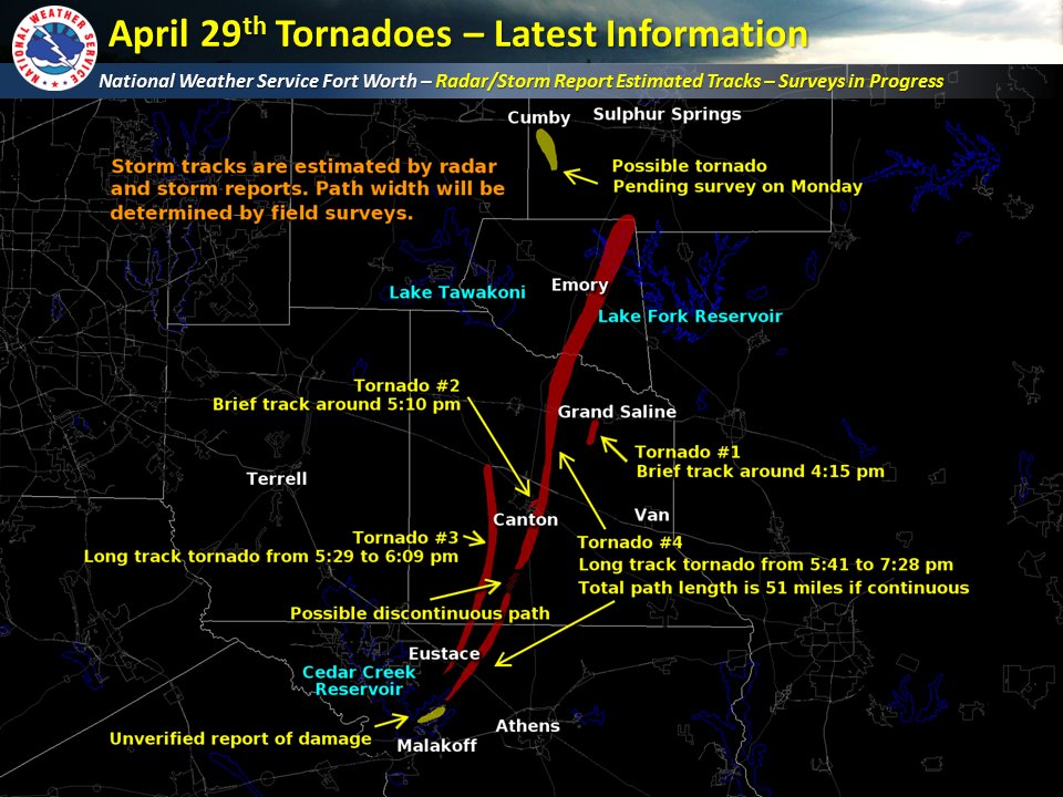
Quite a day if wind in Texas and storms and wind in East Texas. Despite rain forecast none appeared in The DFW area but east it got bad. 4 tornados and 4 deaths.
 1 point
 -
More wild pics out of KS...you can kiss your crops goodbye...1 point
-
has a superceller look to it.last spring or early summer we saw something similar where we had a west to east convergence boundary where west of 95 some supercells formed a longed it.1 point
-
On second thought I'd go warmer mid-week...now looks like 85-88 is possible. Consider the last five runs of the Euro ensembles...highest 850 mb temp for next Wednesday May 3rd: 4/28 12z: 12.9c 4/29 00z: 13.2c 4/29 12z: 15.4c 4/30 00z: 16.4c 4/30 12z: 17.1c Looking at recent climatology for May at SLE (00z 850 temp vs high temp): 23.0c....95 degrees on May 15, 2006 22.0c....99 degrees on May 16, 2008 20.8c....90 degrees on May 27, 2005 19.6c....91 degrees on May 26, 2005 18.8c....87 degrees on May 13, 2012 18.4c....92 degrees on May 17, 2008 18.2c....80 degrees on May 14, 2012 18.2c....87 degrees on May 28, 2009 18.0c....88 degrees on May 15, 2008 17.8c....89 degrees on May 30, 2009 16.8c....88 degrees on May 28, 2007 16.8c....84 degrees on May 15, 2006 16.6c....88 degrees on May 29, 2007 16.2c....85 degrees on May 18, 2008 16.0c....88 degrees on May 29, 2009 15.6c....84 degrees on May 31, 2009 Early May there was a nice warm spell in 2013: 16.4c....83 degrees on the 10th 15.2c....85 degrees on the 11th 15.2c....81 degrees on the 9th 14.4c....87 degrees on the 5th 14.4c....81 degrees on the 6th Seems like mid to perhaps upper 80s is a possibility at 17c with 90 becoming possible around 18-19c.1 point
-
Cool convergence boundary lying E-W across Maryland and Delmarva this afternoon. Thunderstorm near DC tracking along the boundary. Loop here: http://weather.cod.edu/satrad/exper/?parms=cenmidat-02-48-11 point
-
Comes down to timing of everything as usual, but looks likely to be our first shot of the year.1 point
-
Ain't gonna happen. This summer will not be a '93 redux.1 point
-
The Metrodome is gone, but the Twin Cities dome is in full effect. Lol.
 1 point


This leaderboard is set to Vancouver/GMT-07:00