-
Who's Online 21 Members, 0 Anonymous, 37 Guests (See full list)
-
Activity Stream
-
781
January 2026 Obeservations & Discussions
KEY MESSAGES ACCUMULATING SNOW THROUGH TONIGHT PERIODS OF HEAVY LAKE EFFECT SNOW THIS WEEKEND BITTERLY COLD MONDAY AND TUESDAY WITH SNOW SHOWERS Temperatures held steady around 22 overnight and there has been just a trace of snowfall here in my area so far. Now the real question is just how much snow will fall? Todays discussion is calling for a chance of heavy snow for this weekend. It still looks to get very cold for Monday and Tuesday. At 7:50 it is cloudy and 22 here in my yard. Detailed Forecast Today Snow showers, mainly after 8am. High near 34. South wind around 10 mph, with gusts as high as 23 mph. Chance of precipitation is 100%. Total daytime snow accumulation of around 3 inches. Tonight Snow showers likely, mainly between 10pm and 2am. Mostly cloudy, with a low around 23. West southwest wind 6 to 8 mph. Chance of precipitation is 70%. New snow accumulation of around an inch possible. Saturday Snow showers. High near 26. West southwest wind 7 to 11 mph, with gusts as high as 24 mph. Chance of precipitation is 90%. New snow accumulation of around an inch possible. Saturday Night Snow showers. Low around 18. West southwest wind 6 to 8 mph, with gusts as high as 18 mph. Chance of precipitation is 80%. New snow accumulation of around an inch possible. Sunday Snow showers. High near 22. Southwest wind 7 to 13 mph, with gusts as high as 25 mph. Chance of precipitation is 90%. New snow accumulation of around an inch possible. Sunday Night Snow showers. Low around 9. Chance of precipitation is 100%. New snow accumulation of around 3 inches. M.L.King Day Snow showers. High near 12. Chance of precipitation is 90%. Monday Night Snow showers likely. Mostly cloudy, with a low around 5. Tuesday Snow showers likely, mainly before 1pm. Mostly cloudy, with a high near 15. Tuesday Night Snow showers likely, mainly before 1am. Mostly cloudy, with a low around 9. Wednesday Snow showers likely. Mostly cloudy, with a high near 25. Wednesday Night A chance of snow showers. Mostly cloudy, with a low around 13. Thursday A chance of snow showers. Mostly cloudy, with a high near 24. The official H/L yesterday at Grand Rapids was 25/14 there was a trace of snowfall at the airport there is reportedly 1” of snow on the ground (there is just a trace here in my area) the highest wind gust was 37 MPH out of the N. For today the average H/L is 31/18 the record high of 58 was in 1949 the coldest high of 6 was in 1994 the record low of -16 was in 1972 and 1994 the warmest low of 39 was in 1933. The wettest was 0.60” in 1980 the most snowfall of 5.5” was in 1924 the most on the ground was 23” in 1979. Some weather history for January 16th 1964 Fort Worth, TX, received 7.5 inches of snow, and Dallas reported a foot of snow. (David Ludlum) and in 1990 Heavy snow fell across the Prince Williams Sound area and the Susitna Valley of southern Alaska. Valdez was buried under 64.9 inches of snow in less than two days, including a record 47.5 inches in 24 hours. Up to 44 inches of snow was reported in the Susitna Valley. The heavy snow blocked roads, closed schools, and sank half a dozen vessels in the harbor. (Storm Data) -
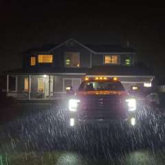
4690
January 2026 PNW thread
That's a sweet truck. I put 300K trouble free miles on a RAM/Cummins. It was a great truck. I hope yours is as good to you as mine was to me. -
781
January 2026 Obeservations & Discussions
It's good to see. We have certainly waited long enough! Non boring weather day today. We could see some snow showers and perhaps a snow squall. n area of subsidence is expected late this morning through early afternoon on the backside of the cold front, with the first mid- level vort maxima exiting toward the southeast. Stronger CAA between 700mb-500mb will help to steepen mid-level lapse rates, meanwhile, warming near the surface from insolation will begin to develop modest instability. Over the past few CAM runs, 0-3km CAPE values are progged to reach 80-100 J/kg just ahead of the cold front, and in another area of stronger Q-vector convergence above 700mb. Moisture will be limited, but model soundings continue to show dendrite development with moisture being located within a favorable DGZ. Couple that with the instability and a few sources of broad scale lift, will be capable of generating snow showers, and some likely to demonstrate convective behavior. A peak at simulated reflectivity from CAM output hints at this, with banded snowfall like features present. With winds around 30-35 kts toward the top of the progged mixed layer, could result in snow shower bursts during the afternoon with visibility dropping below one mile for short periods of time. The background environment does provide some suggestion for snow squall potential. However, the limited moisture may prevent showers from achieving actual snow squall criteria. Mesoanalysis will be important this afternoon to watch for changing conditions. As for snowfall amounts, only a few tenths of an inch are expected. With the gusty winds, getting an accurate measurement anywhere will be very difficult. Further, daytime heating is expected to boost surface temperatures into the upper 30s and lower 40s today, promoting melting that will also limit snow accumulations. It is a bit odd to be talking about snow showers with surface temperatures forecast this warm, but their occurrence is likely given the strong forcing and instability that is expected. In periods absent of snow shower activity, pressure gradient will be quite strong with pressure falls extending southward toward Ozarks region with dCVA heading toward the Interstate 44 corridor, while a surface anticyclone attempts to develop over the High Plains. Wind gusts above 25 MPH may continue into the evening hours. The cold front eventually moves through the area late tonight, with drier air eventually brining an end to snow activity -
781
January 2026 Obeservations & Discussions
Great way to wake up on a Friday lol. Though I was still asleep- 1
-

-
781
January 2026 Obeservations & Discussions
Please let this happen lol. At least something is brewing next week it appears. 6z GEFS 0z EPS may be coming around- 3
-

-

-