
-
Who's Online 12 Members, 1 Anonymous, 110 Guests (See full list)
-
Activity Stream
-
17504
West Coast Sports Talk and Other Banter
Because Gary Payton hasn’t come out of retirement yet. -
526
April 2026 Observations and Discussion
Looks like extensive lingering rain/convection could really throw a wrench in the severe setup tomorrow as far as the magnitude/areal extent of the threat. Definitely still need to keep a close eye on it though because the potential is there if that stuff earlier on gets out of the way more quickly. -
1930
-
526
April 2026 Observations and Discussion
We received between 0.50” to 1.04” across the County with more falling across the north with that higher amount recorded at the Chester Springs DEOS station. We continue with unseasonably chilly weather today with highs remaining around the middle 50’s. Tonight, we could see some patchy frost and even a freeze in some of our typically colder valley locations We moderate to near normal in the mid 60’s both Monday and Tuesday before we turn chillier again and wetter by mid-week. -
526
April 2026 Observations and Discussion
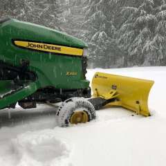
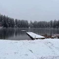
The lake by my house has been limited to slow no wake because of the high water level since the 16th. This spring has been horrible, ended snowboarding early and now I can't go out on the lake because of too much rain.
-

(002).thumb.png.d78828eaea929356c7b2669997f38a8a.png)
