All Activity
- Past hour
-
D**n, that is a chilly afternoon for May!
-
Believe it or not you could have two niños that are almost clones structurally, but entirely different regional outcomes with the slightest tweaks to a few boundary conditions. You can’t know how healthy/coupled a niño is from the weather in your backyard (unless you live in Peru or Australia, maybe). Structurally speaking, the 2023/24 was one of the most majestic of the 21st century, and teleconnected beautifully w/ the extratropics.
-
It was a very strong niño, in some ways more-so than 2015/16 despite the lower ONI. The way it developed was also unique in the post-1976 era (pacific climate shift) in that it began as a niño-costero/EPAC event with the low frequency projection spreading westward from there, which is the opposite of how niños have developed since the late 1970s. Where-as many if not most significant niños during the 1950s-70s developed similarly to the 2023/24 event (1972/73 being the most recent example).
-

May 2024 Pacific Northwest Weather
SilverFallsAndrew replied to snow_wizard's topic in West of the Rockies
Been an interesting start to May. Thursday was supposed to be a dry mild day, but it definitely wasn’t. Just got home, currently 41 with moderate rain. -
It's only bad when the other side does it.
-
No, I know. I was putting it out there for anyone to engage with. Israel just puts crap out there and people eat it up with no fact checking, as the video shows.
-
Hilarious pretense. How many times does it have to be said that being pro-Palestine/anti-genocide does not mean Pro-Hamas? Are some people too stupid to separate the two topics? By the way, I hope it does get really messy over here regarding this topic. For far too long we have been spending hundreds of billions on this garbage. It's about time we wake up and realize what the Zionist movement really is: Racist nationalism. You can really see that when they brutally smear and/or imprison non-Zionist Jews who object. It's awful!
-
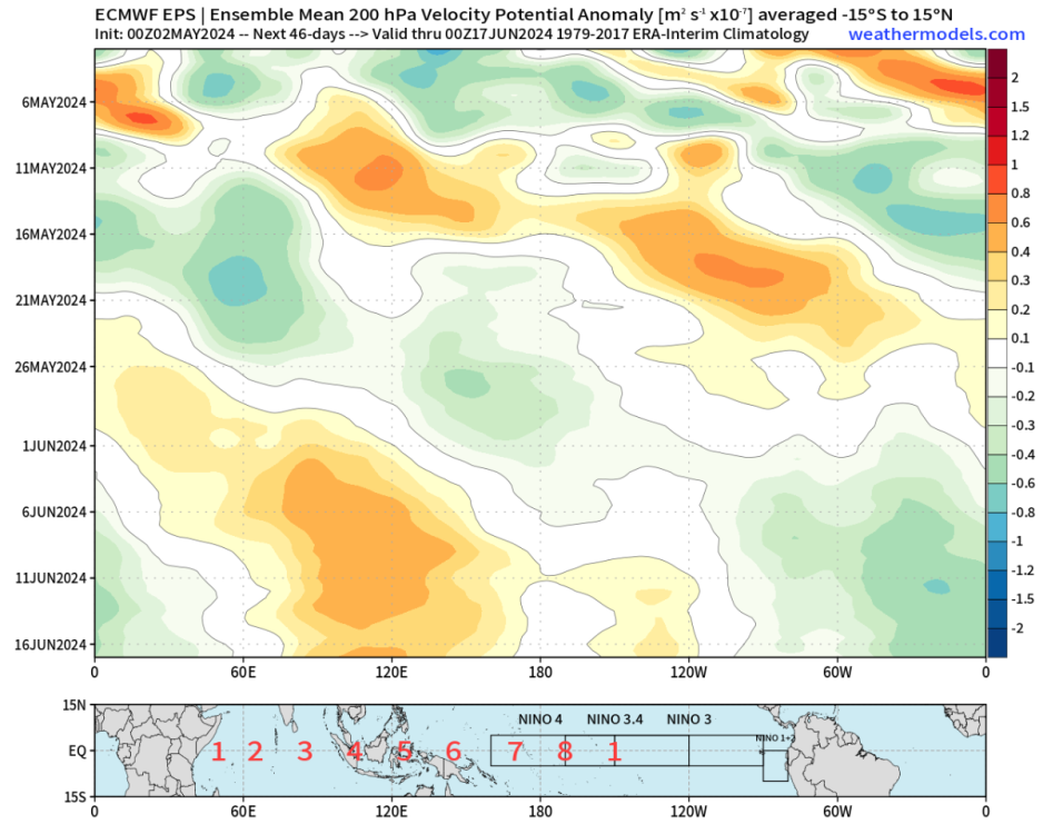
I suspect the bulk of May will be warm/dry up there, but sandwiched between cool/wet patterns at the beginning/end (current troughy pattern and the next one ~ 25th). What happens from the solstice onwards will probably hinge on if/when the niña cell begins to establish. Right now there is no indication of a niña circulation on the EPS weeklies, which run through mid-June. If anything there’s a weak (but insignificant) low frequency signal near the dateline, which is more niño-like. But really this is pure MJO without much of an ENSO component.
-
That was a very tenuous set up only shown the GFS caused by the current system digging a little further south. The ECMWF, EPS, and GEM never even hinted at it which is red flashing sign that the GFS is out to lunch.
-
May 2024 Pacific Northwest Weather
SilverFallsAndrew replied to snow_wizard's topic in West of the Rockies
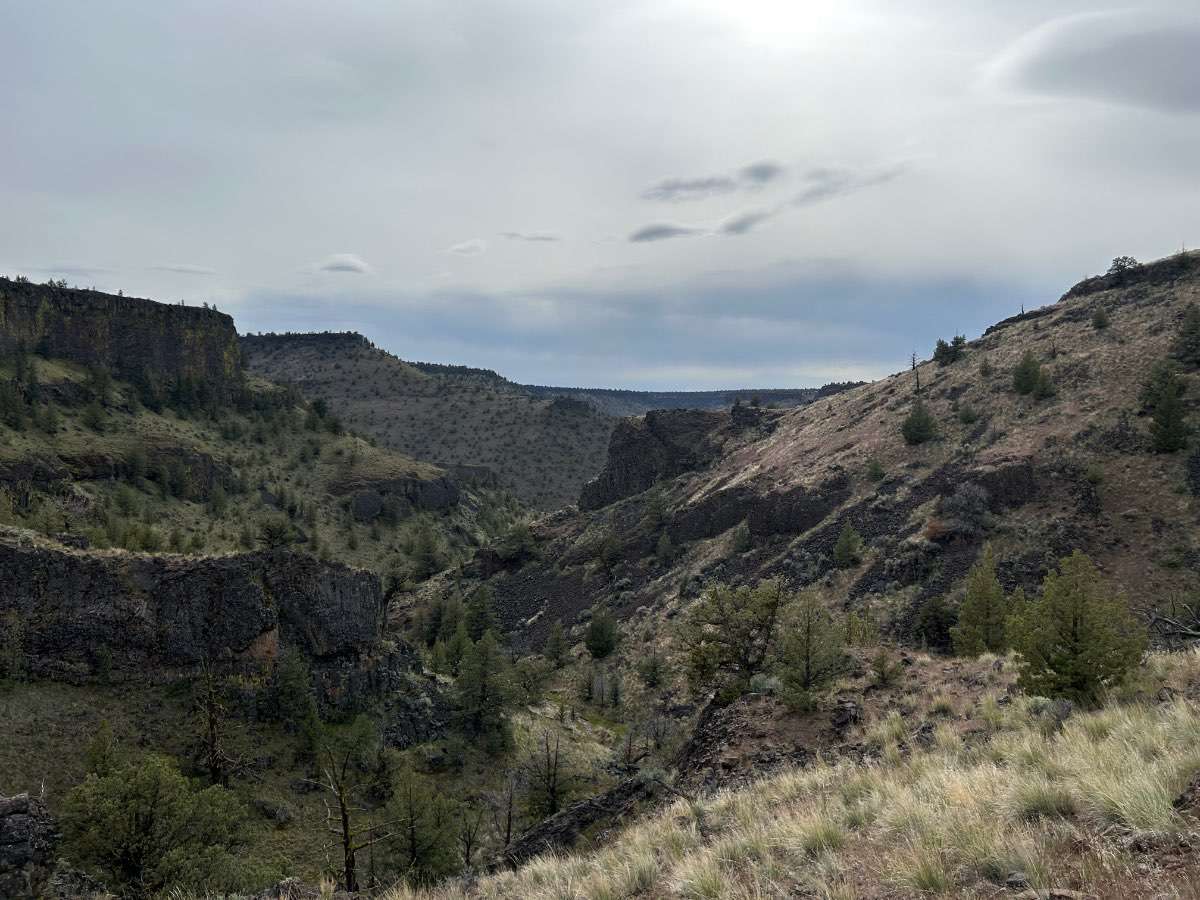
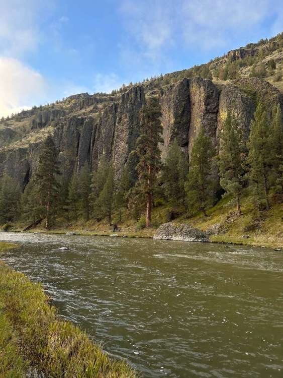
Was snowing, but not sticking going over Santiam Pass this afternoon. Out on the Crooked River the past couple days. Didn’t really rain today until about noon as we were leaving. Caught a few trout, though the river was pretty high. Prineville reservoir is full already.

-
May 2024 Pacific Northwest Weather
SilverFallsAndrew replied to snow_wizard's topic in West of the Rockies
Seems like most of last May was around or above 80. -
No what?
-
May 2024 Pacific Northwest Weather
SilverFallsAndrew replied to snow_wizard's topic in West of the Rockies
Portlands average first 80 is May 6th. About a week ago many in here thought it might happen today. - Today
-
At SEA... every day in May with the exception of 5/3 has a record high of 80+ And 5 days have a record of 90+ and none of those are in the last 15 years.

-

May 2024 Pacific Northwest Weather
High Desert Mat? replied to snow_wizard's topic in West of the Rockies
Fair enough. But what I was thinking about like the normal every day person would see is that El Niños typically are front loaded with dry and drought conditions February onward. Didn’t feel like a typical El Niño to me. -
I think it always been somewhat typical. I just randomly checked Seattle stats from 100+ years ago and many years had some 80-degree temps in May. May of 1895 peaked at 86 in Seattle. Even 2008 had a peak temp of 90 at SEA in May.
-

May 2024 Pacific Northwest Weather
Omegaraptor replied to snow_wizard's topic in West of the Rockies
Yup... December was a +4.5 at PDX, just barely missed warmest on record. Had a ridiculous 67/56 day early in the month too, that 67 is the warmest December temp on record. -
Uhh, no.
-

May 2024 Pacific Northwest Weather
Anti Marine Layer replied to snow_wizard's topic in West of the Rockies
@AlTahoe enjoy the snow -

May 2024 Pacific Northwest Weather
Meatyorologist replied to snow_wizard's topic in West of the Rockies
Models looks pretty steadfast on 80s by Friday. Ensembles might be more muddled, I haven't checked though. -

May 2024 Pacific Northwest Weather
the_convergence_zone replied to snow_wizard's topic in West of the Rockies
Yeah it does look like that on the east side. Looking at the KSEA meteograms suggests it will be close. 80s in May are pretty typical these days it seems… -
Probably be 80s next weekend... at least away from the water. Like out here...
-
May 2024 Pacific Northwest Weather
the_convergence_zone replied to snow_wizard's topic in West of the Rockies
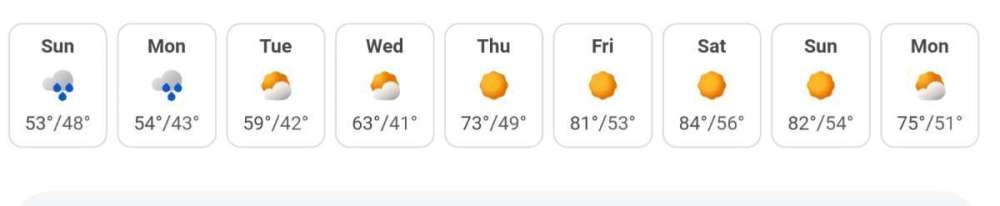
One can hope…so far the outlook for May doesn’t look too bad. I don’t see any 80s on the horizon like last year. -
May 2024 Pacific Northwest Weather
the_convergence_zone replied to snow_wizard's topic in West of the Rockies
If we’re going to get anything decent out of this it will probably be in the next few hours. 0.06 so far, a quarter inch seems like a stretch goal. -
May 2024 Pacific Northwest Weather
Meatyorologist replied to snow_wizard's topic in West of the Rockies
Not to put you on the spot, but from what I can remember, this was actually one of the most prototypical Niños in modern history. @Phil could probably back the strength of the regime up with a whole basket of numbers and acronyms. With the exception of mid January's SSW induced blip and a few expected, but brief, episodes of transient NW flow, our local weather pattern was locked in a +PNA death grip from late November's strong anticyclone and inversion, all the way until January's end-of-month atmospheric river bonanza-torch withered into the opening days of February. A slight +PNA lean still persisted through the end of February before March two thousand and twenty two entered the ring and immediately introduced the first natural system-state troughing regime (no SSW takesies-backsies) in over three months. Even then, the Ides gifted a stout ridge and a fancy pair of record highs, including what still remains to be the warmest weather of the year so far at KSEA...