
Leaderboard


Popular Content
Showing content with the highest reputation on 07/30/17 in all areas
-
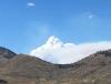
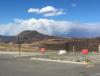
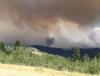
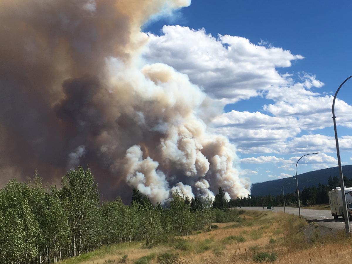
Took a couple of photos today looking north from Cache Creek towards the Elephant Hill fire near Clinton BC. Several big pyrocumulus smoke columns went up this afternoon from the 190 000 acre fire.
 2 points
 -
I've noticed an interesting pattern. You generally take guidance at face value with heatwaves and discount it or go on the warm side with cold snaps. Usually serves you well on the cold calls.2 points
-
Well, if a credible 110 pops up on the valley floor I believe it will be the first on record. Bull Run Headworks hit 110 on 7/13/1935 but that's in the foothills. I believe the 109 at Forest Grove on 7/19/1956 is the valley floor benchmark. I also remember 111 at Mayfield Power Plant in July 2009 but I can't find evidence of that reading anywhere now.1 point
-
Fun times. It was probably the single most important transitional decade in the NH since the 19th century, with the PDO flip and the onset of Arctic warming. Things more or less transitioned from a late 19th century hangover to a more modern regime that we're familiar with.1 point
-
There are a lot of fall-like things that seem to be happening with the weather. I wouldn't mind an early autumn and a cold October/November. Genuinely thinking that may be where we're headed. Seems like an overall new pattern getting started especially with the Pacific starting to wake back up a little as well.1 point
-
Yeah, it was absolutely insane yesterday, and that was a relatively modest 994mb mid-summer cyclone. It was easily the 2nd strongest storm I've ever experienced on the water. I'll bet that a legitimate cold season bomb could produce cat3/cat4 caliber winds through some of those coastal ridges. Some of the more experienced fisherman we ran into around there said they've experienced winds up to 100kts there during the winter, and that yesterday's storm was "mediocre" by comparison. I'm not sure if they were just talking the talk, but when winds started gusting around 60kts yesterday afternoon and the trees barely moved, it became pretty obvious that the Island had seen much worse in the past.1 point
-
Mostly Chinook Salmon and Lingcod, but also grabbed a few Halibut and yellows on the last day. The Coho's were also surprisingly sparse. Apparently they were much more abundant last year, enough that they made it harder to catch the bigger Salmon.1 point
-
I'm hoping the models are underestimating the propensity for a progressive 500mb crash on the other end of this. It'd definitely be disappointing for us to see a transition to more flat ridging. A more active MJO should also theoretically help by midmonth.1 point
-
I might have been too quick to dismiss the July 1901 reading from Tower, MN. I've read up on the July 1901 heat wave since I made the above post, and it looks to have been a legitimate historic heat wave in the Midwest. It's easy to initially dismiss ostentatious-looking warm readings from that era since so many thermos were not properly sheltered and the COOP obs are flooded with bad data. But July 1901 seems to have been legit. Marquette, MI saw its all-time record high of 108F in the same heat wave that brought 101F to Tower, and Duluth hit 98F a few days later. There was an ongoing drought as well which would lend credence to inflated readings due to low soil moisture, similar to what happened in the 1930s. Someone actually created a wiki page on the July 1901 heat wave: https://en.wikipedia.org/wiki/1901_eastern_United_States_heat_wave Apparently this was considered the most severe heat wave in the United States prior to the Dust Bowl.1 point
-
It might rate well on the Dewey September Karma Index.1 point
-
Or anything besides nondescript freeway pictures, really.1 point
-
Looked like a decent storm up there on the satellite signature and you must have gone out there at its peak. I don't think it happens often at this time of year, you sure know how to time things . I can't imagine how it would be in that area during some of the bombing fall cyclones.1 point
-
Per Brian Brettschneider
 1 point
 -
Thermal troughs don't create the heat, they're the result of it. Hot air rises, creating an area of surface low pressure which along the west coast resides generally east of the Cascades and coastal mountains of California throughout the warm season. With strong subsidence from upper level ridging, it can and will migrate west when the ridge axis orients itself along or just west of the coastline.1 point
-
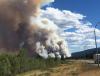
This picture was taken yesterday overlooking the valley that the town of Clinton is located. Thick black smoke over our cabin at Watch Lake yesterday evening

 1 point
 -
Looks like Brownsville hit 104F on April 26th of this year. Monthly record high and second highest spring temperature behind the 3/27/1984 reading. It's funny we were just talking about this last fall.1 point
-
It was predicted to be clear/sunny with potentially record setting heat and strong outflow, but a major forest fire in the Coastal Range went nuts and threw an incredible amount of thick smoke into the outflow. It was by far the worst smoke event I've ever experienced and was downright nasty with bits of ash falling for several days. http://www.vancitybuzz.com/wp-content/uploads/2015/07/nasa-metro-vancouver-fire-smoke-satellite-954x500.jpg This is what it looked like on the island underneath: http://i.imgur.com/NF8UiE3.jpg1 point
-
25.8C was the maximum sounding at SLE in August 1981, although 850's could have maxed out between the soundings. July 2006 had that number beat with 27.0C on the afternoon of the 22nd. Too bad we couldn't keep a clear sky that day.1 point
-
Well, I had Arctic Circle Restaurants and Natural Ice Beer all lined up to sponsor my contest submission, but both pulled out at the last minute. So I'm not able to contribute anything at the moment.1 point
-
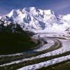
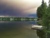
Winter surroundings above Lake Tahoe Squaw/ Alpine
 1 point


This leaderboard is set to Vancouver/GMT-07:00