
Leaderboard


Popular Content
Showing content with the highest reputation on 02/27/21 in all areas
-
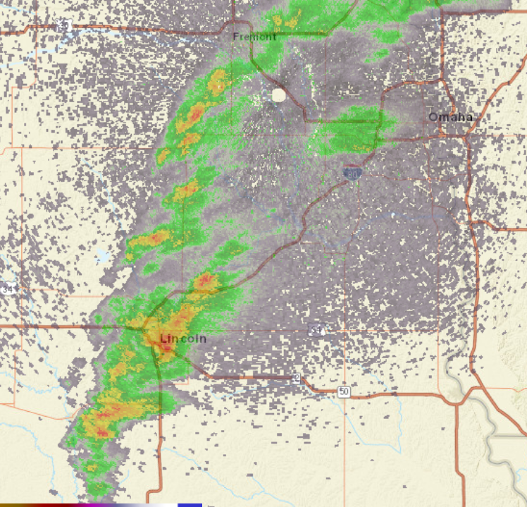
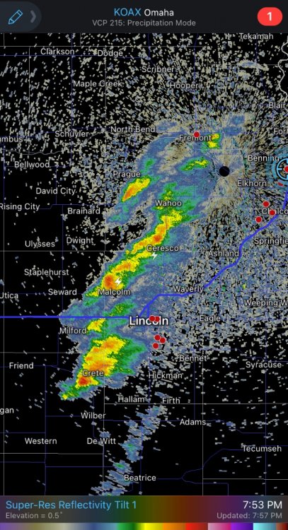
It's unbelievable have this kind of radar look just 11 days after LNK was -31 degrees
 4 points
 -
Heavy rain with occasional lightning and thunder! Still piles of snow on the ground here and there too. February 2021 is going out with a bang.3 points
-
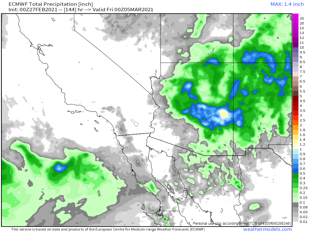
00z Euro slowly playing catch up with regards to the system mid week that will bring much needed moisture and appreciable mountain snowfall.
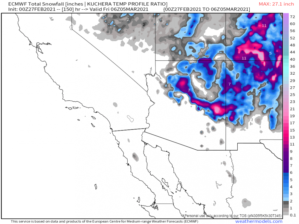
 3 points
 -
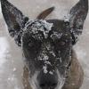
Quite a bit of snow here still..
 2 points
 -
I might be crazy but I swear I just saw lightning lol2 points
-
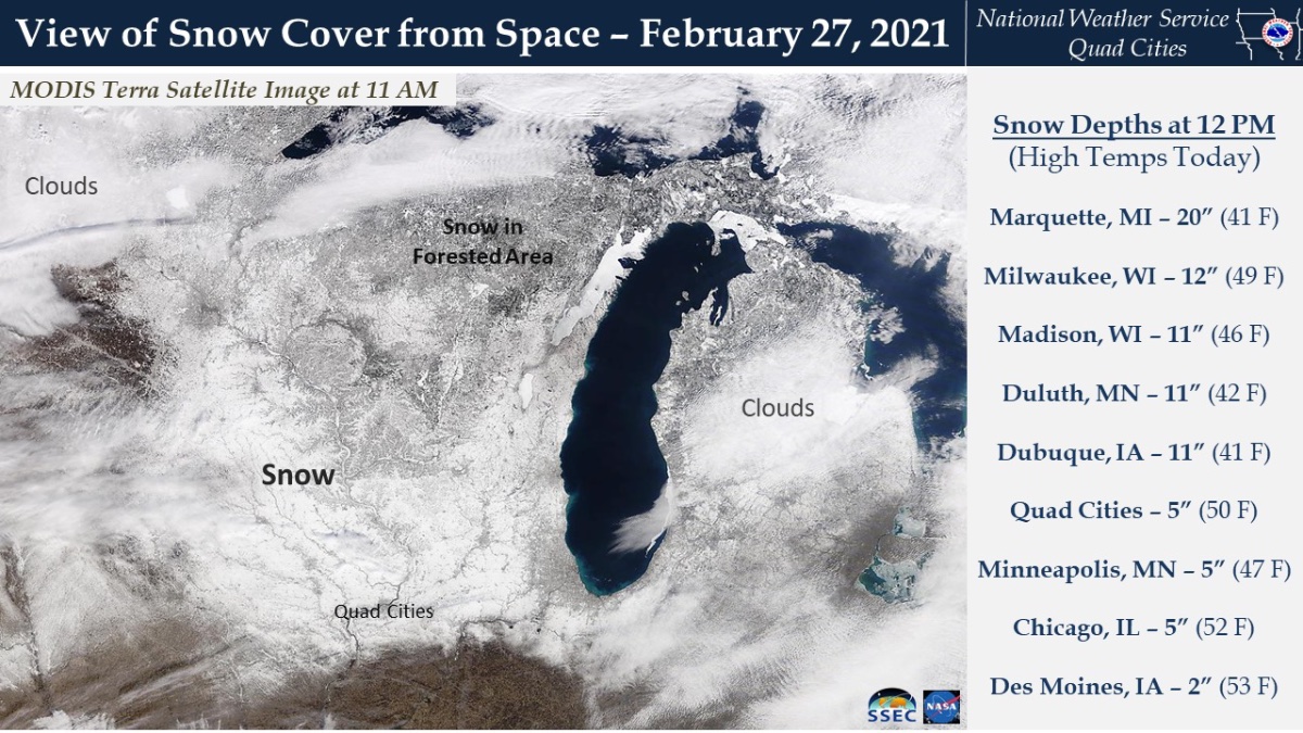
Satellite shows the snow cover gone south of Des Moines. That part of Iowa is rising into the 50s this afternoon.2 points
-
Also first chance of thunderstorms in the forecast for 2021 tonight!! Showers likely and possibly a thunderstorm before 9pm, then a chance of showers and thunderstorms between 9pm and midnight. Some of the storms could produce heavy rain. Mostly cloudy, with a low around 28. East southeast wind 9 to 16 mph becoming west after midnight. Winds could gust as high as 25 mph. Chance of precipitation is 70%. New precipitation amounts of less than a tenth of an inch, except higher amounts possible in thunderstorms.2 points
-
Overperforming again today. Already up to 55 when the forecast was for 52.2 points
-
I found myself being frustrated at moments when it would repeatably become inconveniencing in some way. I catch myself and am I like “no snow good”1 point
-
Well, on Wednesday I had my first ice-related injury lol. I sprained my elbow. So yeah, I'm DEFINITELY ready for Spring. Amazing how it took a full 5 Winters in the Midwest.1 point
-
Good news! You’re not crazy!
 1 point
 -
might score my second wsw if it goes well!1 point
-
Twin cities area could get a few inches tonight into tomorrow according to several models.1 point
-
It's looking like warm wx is here to stay. 60s are in the forecast for next week. Hardly any below freezing temps except briefly in the mornings. I hope the big rainer the GFS is advertising for the region pans out. Question is if this is false spring or not. We're past the point of getting sustained cold and snow of course but late March can still get very snowy even if it melts in 2 days.1 point
-
The new 30-year climate normal are scheduled to come out in May. Will be looking as to how much change there will be. My guess is that the temperatures means will be higher for most if not all months and I would not be too surprised to see the average snow fall here at Grand Rapids go up a little.1 point
-
After a cold overnight low of 15 here the temperature is now up to 30 with clear skies. The official overnight low at GRR looks to have been 18. There was no snow or rain yesterday, the February snow fall remains at 29.6" and for the season it remains 44.8" As of yesterday at 7 AM the official snow depth is down to 6" here in my yard there is around 5" on the ground but there are spots of bare ground showing and of course there are the snow piles that will take some time to melt. For the month the mean is now at 19.0 and that is a departure of -7.4.1 point
-
Lol omg wtf humidity is 3-4% in SW kansas right now.0 points
-
Onshore flow kicked in this afternoon with a cool breeze.0 points
-
Northwesterlies getting strong here. Edit: Did I really post in here thinking it was the weather thread?0 points
-
Near as I can figure from online sources, my location has failed to reach a 12" snow depth at any time during met winter in the following years winters since 1988 : 2015-16 2011-12 2006-07 2002-03 2001-02 1999-00 1997-98 And joining the list soon....2020-2021? Unless something changes drastically in the next 13 days. It's going to take at least 4-6+" inches of snowfall to do it and the forecast and models don't give much realistic hope. I had a hunch it was a bad sign entering winter with drought conditions developing throughout the late summer and fall (similar to 2011-12) Despite the warmth of December and January, my latitude allows for snow retention through some major positive temp anomalies in Dec and Jan. There just hasn't been any moisture. If the dryness continues through spring it's going to be a heck of a spring fire season around here. I know back in late winter 2015-16 the mn dnr was running extra fire training in anticipation of a bad fire season due to lack of snow. Luckily there was a wet 10" snowfall the third week of March that kept the ground wet enough until green up. The 2011-12 mid March torch was followed by a cool and wet period in late March here that knocked fire danger down until things greened up in April.0 points


This leaderboard is set to Vancouver/GMT-07:00