-
Who's Online 16 Members, 0 Anonymous, 1512 Guests (See full list)
-
Activity Stream
-
273
September 2026 Observations and Discussion
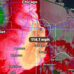
This is also the anniversary of the longest tracked tornado on record for Indiana. It was on the ground for 112 miles and a total of 2 hours and 21 minutes straight! Not necessarily a record that you would think would have occurred in September. September usually brings tranquil weather to Indiana. Not so on September 20, 2002, when several tornadoes struck the state. The biggest tornado rampaged through rural and urban parts of Indiana for 112 miles, becoming the longest tornado track in Indiana history. The long track tornado reached F3 intensity in Ellettsville, Martinsville, and Greenwood, with winds of at least 160 mph. The tornado began in Ellettsville at 12:59 PM EST and roared northeast through Martinsville, the south and east sides of metropolitan Indianapolis, Anderson, and finally lifted near Hartford City, 2 hours and 21 minutes later at 3:20 PM EST. No deaths occurred, despite $156 million in property damage and 130 injuries. The tornado was enshrouded in rain for much of its life. The same thunderstorm that produced the long track tornado also produced other tornadoes. One of them was an F2 rated tornado that struck near Poseyville, and another was also rated F2 and struck near Monroe City. The tornado warning issued for the Indianapolis area contained "Tornado Emergency" wording. More here: https://www.weather.gov/ind/sept20_2002tor -
1215
PNW September Weather Discussion
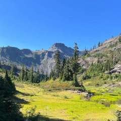
Beautiful day at Capilano Suspension Bridge yesterday. Perfect, perfect weather: the sun isn’t scorching hot, no inversion, low humidity, temp in low 70s. only downside was Vancouver traffic as it takes 1.5 hrs to travel 47 miles. P.S. Capilano was our first unofficial date in mid-December 2009. I asked her out after that outing. We then went as an official couple to their Christmas light display. The strong El Niño then allowed for December visits where you didn’t get drenched nor freeze. We go about three times/year.- 1
-

-
1362
2026-2027 California and Southwest Weather Thread
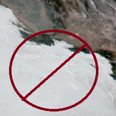
Big bad trough season is back. -
60
CartoSky - Interactive Weather Viewer * Lots of Updates *
Humm I am not seeing it, is that supposed to be available in viewer? Edit: nevermind, found it. I was looking for it in variables but just saw that you added it to the total precipitation visualization -
1215
PNW September Weather Discussion
Another good sign is that Seattle is clear at dawn.
-