All Activity
- Past hour
-

May 2024 Pacific Northwest Weather
Port Angeles Foothiller replied to snow_wizard's topic in West of the Rockies
They got arrested/fined for this. -
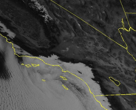
Maybe our actual rain gets here on Sunday. looks like its still in the forecast, we need it
-
lol looks like we'll get skunked, Again
-
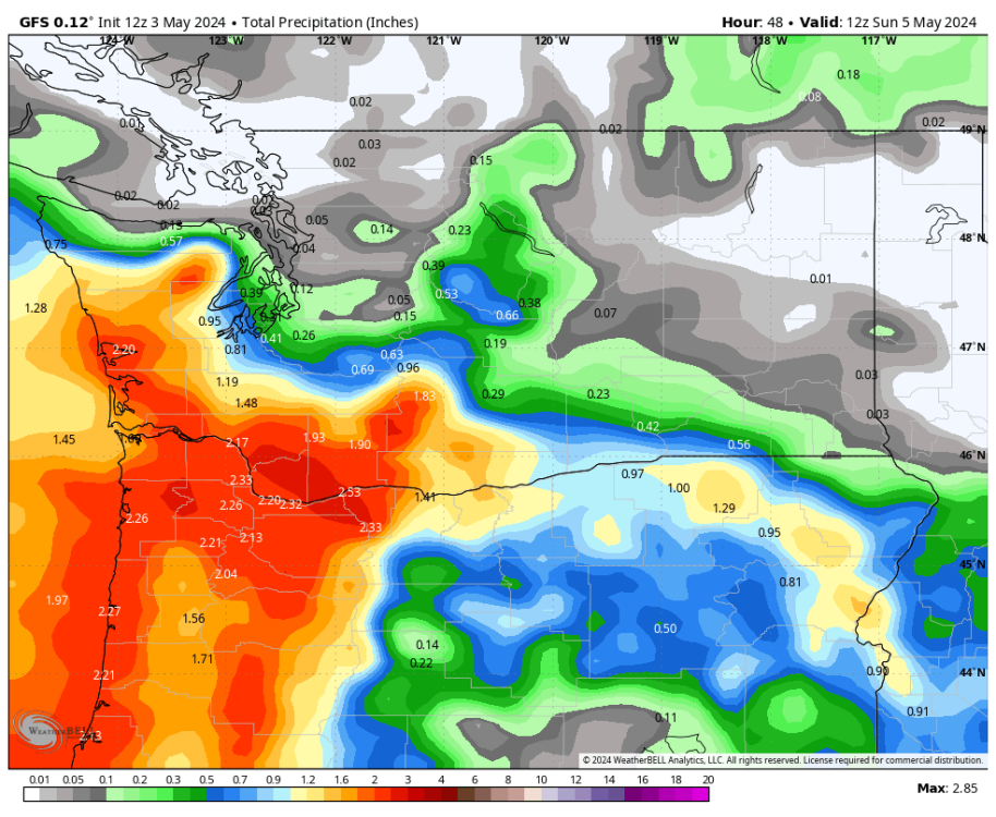
Unbelievable precip gradient on the 12Z GFS.
-
 NOAA forecast high for Fullerton: 74 F @Anti Marine Layer forecast high for Fullerton: 66 F We'll see who's closer
 -
January February Maruary Apruary Mayuary
-
But if you say it enough, it becomes true.
- Today
-

May 2024 Pacific Northwest Weather
RaleighHillsRunner replied to snow_wizard's topic in West of the Rockies
Agreed, glorious and cool out there. Rain looks to start early afternoon for us, curious to see how wet tomorrow ends up. Happy Friday all!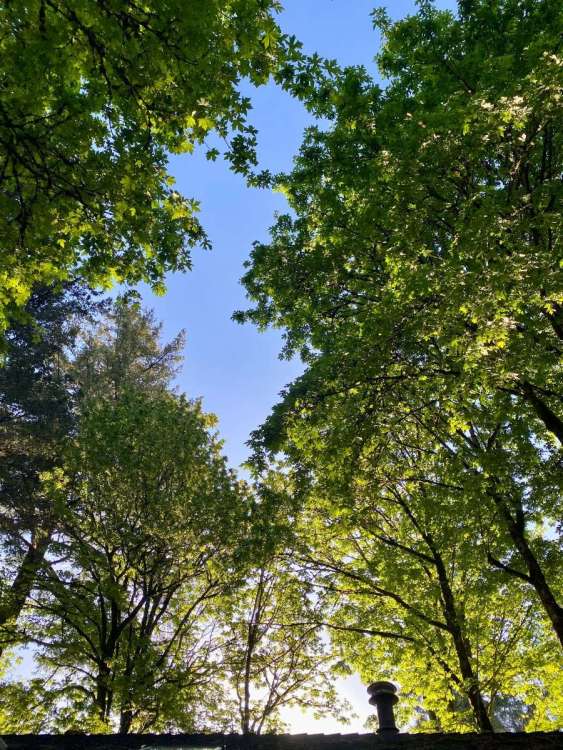
-
DRIZZLE.
-
Yes, when Israel supporters talk about Israel’s “existential crisis,” they have it exactly backwards. Palestine is the nation experiencing an existential crisis. Has been for about 75 years Israel’s continued existence is not in immediate jeopardy; they have a nuclear arsenal and the strongest military in the region. Israel does sometimes suffer security crises (see Oct. 7th), but those, bad though they may be, fall short of threatening the continued existence of Israel and thus are not existential crises by any common definition of the word “existential.”
-

May 2024 Pacific Northwest Weather
the_convergence_zone replied to snow_wizard's topic in West of the Rockies
We’ll see. Light precipitation events in spring almost always go the opposite way, the models have over predicted every single storm this spring at my location. The bigger one in late April was the only one that came close to the forecast. -
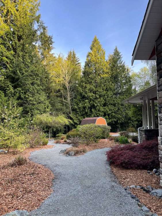
Spectacular morning!
-
I’m in the darkest shade of grey!
-
Its essentially a deformation zone tomorrow on the north side of the ULL to the south... and deformation zones often end up farther north than the models indicate.
-
May 2024 Pacific Northwest Weather
the_convergence_zone replied to snow_wizard's topic in West of the Rockies
So close to getting some drought relief, but it is increasingly looking like the Seattle area will get skunked this weekend.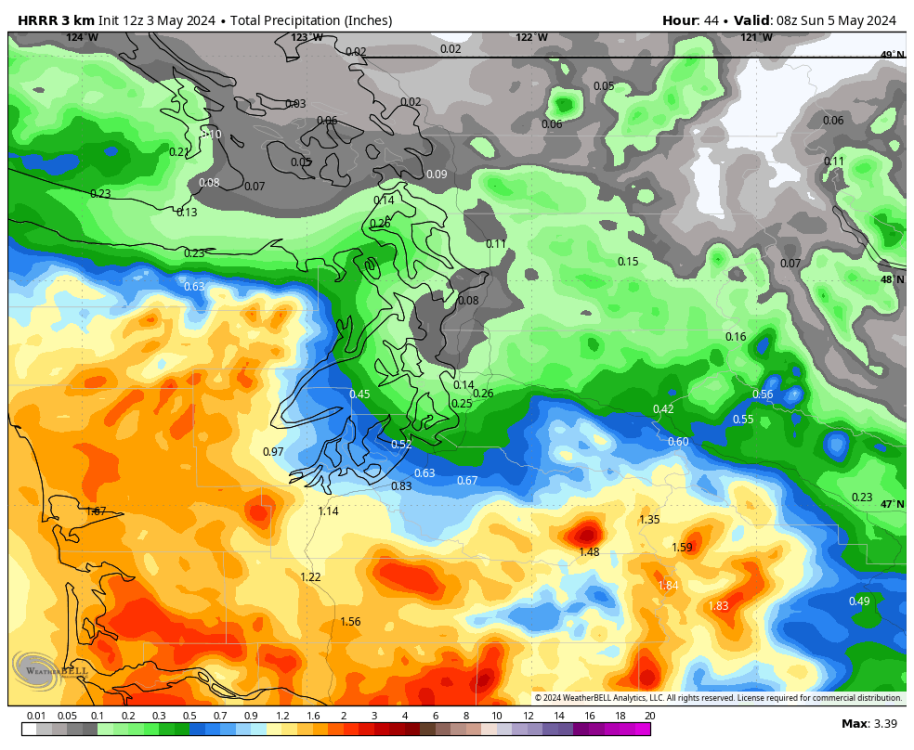
-
The next two systems, Saturday and Tuesday, appear to be poorly timed for eastern Iowa. Models show the good rain and storms to the west, but weakening as they move in here. After that, the flow changes and quiets down.
-
West Coast Sports Talk and Other Banter
Anti Marine Layer replied to Anti Marine Layer's topic in West of the Rockies
Nice to see the Astros having a bad year -
West Coast Sports Talk and Other Banter
Anti Marine Layer replied to Anti Marine Layer's topic in West of the Rockies
How many games have the Mariners lost so far? -
Garbage has deepened to at least 3500 ft here solely due to the stupid eddy.
-
I thought the rain had ended last evening, but more showers (a narrow band) popped up and trained over my area. Ended up with 2.28" total rainfall yesterday. The evening showers actually had the highest rain rates of the day. It's getting soggy, and the local river is actually flooding a little for the first time in probably a couple years!
-
Models are not in agreement on timing but another 3 day severe weather outbreak looks likely across the country next week and sharp cool down to follow as we go into Mother's Day weekend.
-
The official H/L yesterday was 76/47 there was 0.17” of rain fall. The highest wind gust was 36 MPH out of the S the sun was out 54% of the time. For today the average H/L is 65/44 the record high of 87 was set in 1938 and 1955. The record low of 26 was set in 1971 and the most rain fall of 2.03” was in 1919. The most snowfall of 1.3” fell in 1954. Last year the H/L was 58/40. Here in MBY I recorded 0.51" of rainfall. The overnight low here was a warm 60 and at the current time it is 61 with some light rain falling.
-
Big widespread rains where it was needed, good improvement on the drought monitor forsure! Still need more rain in SE Nebraska through NE Iowa.
-
The front has moved through the area and temps today will be about 15 degrees cooler than yesterday with highs near normal in the upper 60's. We turn colder than normal for the weekend with high temps struggling to escape the mid 50's for higher spots and upper 50's in lower locales. It will be cloudy with some showers possible most likely on Sunday into Sunday night. We warm back up again by the middle of next week before we cool back down for the week of the 12th with a stretch of below normal readings. Chester County records for today: High 95 degrees at Phoenixville (2018) / Low 28 Devault 1W (1957) / Rain 3.00" Devault 1W (1985)