-
Who's Online 24 Members, 1 Anonymous, 169 Guests (See full list)
-
Activity Stream
-
36
April 2026 Weather In The PNW
Can’t do much worse than what we just had to endure…I’ll take my chances with a Nino at this point. -
36
April 2026 Weather In The PNW
Driving to Spokane in about an hour and then los cabos tomorrow for 5 days. -
36
April 2026 Weather In The PNW
I get if you're in the East Coast you probably like El Nino. Definitely confusing if anyone on the West Coast likes it... Soggy weather for @Anti Marine Layer, and warm dry torch all winter for the PNW with limited snow. -
61
April 2026 Observations and Discussion
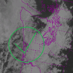
LOT certainly not downplaying things for tomorrow. I would say that I am kind of concerned about that higher tornado threat maintaining itself a bit farther east into Chicago metro as if anything, there is a bit of an uptick in low-level shear around/after 00z (it's already pretty strong prior to that though) Thursday Afternoon and Evening: Focus then turns to the threat for severe weather. During the afternoon and evening hours, the core of the upper-level shortwave will eject northeastward into the Upper Mississippi River Valley as the surface low lifts from near Kansas City, Missouri to La Crosse, Wisconsin. Steepening mid-level lapse rates by virtue of differential cyclonic vorticity advection atop the continued moistening boundary layer (surface dew points rising toward the mid 60s) will support the development and northeastward advection of an uncapped instability plume characterized by MLCAPE >1000 J/kg into the Mississippi River Valley by mid-aternoon. At the same time, a 500mb speed max will arc northeastward toward the Great Lakes atop the already strong low-level wind field. Conceptually speaking, the synoptic pattern including the expected path of the surface low across eastern Iowa during peak heating matches analogs for significant severe weather events, including tornado outbreaks, across the region. At this point, there appears to be two windows for severe weather tomorrow afternoon. The first window will be during the early afternoon hours (call it noon to 4 PM) as any residual elevated warm-air advection convection, or newly forced convection along a prefrontal trough, attempts to become rooted to the eastern edge of northeastward-moving instability axis. Often, this can lead to supercell structures that are nearly but not fully surface-based owing to relatively cool, or at least not primely unstable, storm-relative inflow originating off the main instability axis. Should a supercell manage to become surface-based during the early afternoon window, a threat for tornadoes could emerge. Though in most cases, these kinds of early-day supercells do struggle to latch onto the surface and largely present a threat for lightning and downpours. (The hail threat should be mitigated by strong low-level storm relative inflow beneath weak shear above 3 km). The more concerning time window for severe weather will be during the late afternoon and evening hours (4 PM to 9 PM) ahead of the cold front where low-level moisture will be greater, mid-level lapse rates will be steeper, and synoptic-scale forcing will be strongest. With semi-orthoginal orientations between deep-layer shear vectors and the cold front, initial storm mode will favor discrete supercells with strong mean-flow supporting east-northeasterly storm motions of 45 to 55 mph. The impressively sheared low-level environment characterized by 0-1km shear/SRH of nearly 40kt/275 J/kg, moisture-laden instability axis supporting LCLs beneath 1000m, and strong southwesterly flow to support frictionally-generated turbulent near-surface vorticity streams will lead to an environment uniquely favorable for strong and long-track tornadoes. Based on the current arrival time of the instability axis, the favored area for such a threat for tornadoes appears highest from eastern Iowa through northern Illinois extending toward I-39, though perhaps as far east as I-55 in the most aggressive destabilization scenarios. Some upscale growth into clusters may transition the primary threat to damaging winds toward Lake Michigan and northwestern Indiana with time. And, the strong low-level storm relative inflow beneath weak shear above 3 km should tend to limit the threat for damaging, or at least giant, hail. So, the main threat tomorrow could very well be tornadoes. As is often the case with severe weather set-ups, a regional tornado outbreak tomorrow is hardly set in stone. One very easy to envision failure mode is for morning and early afternoon shower and afternoon coverage to be expansive, limiting the ability for meaningful destabilization in the northeastward- moving instability axis by late afternoon. In such a scenario, new thunderstorm development along/ahead of the cold front could be kept to a minimum or lead to low-topped "stringy" convective elements that struggle to deepen within the strongly sheared low-level environment. Or, thunderstorms that develop upstream in Iowa could fall apart while moving into northern Illinois if the northeastward movement of the instability axis is impeded. This is all to say, the occurrence of severe weather in our area tomorrow is not a guarantee. When put altogether, the Storm Prediction Center has upgraded much of our area to a Level 3/5 threat level for severe weather (driven by tornado probabilities). Tomorrow will be a day to stay very weather aware, especially if west of I-39, between 4 and 9 PM. -
61
April 2026 Observations and Discussion
There sure is a lot of discrete or semi-discrete convection on the 18z HRRR for tomorrow.- 1
-

-