-
Who's Online 19 Members, 0 Anonymous, 193 Guests (See full list)
-
Activity Stream
-
309
April 2026 Observations and Discussion
Madison, WI area got blasted with some pretty large hail. -
922
April 2026 Weather In The PNW
Some decent wind and wave action at Chambers Bay this afternoon. Also no waiting to get on at the golf course. IMG_1665.mov -
922
-
309
April 2026 Observations and Discussion
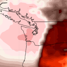
LOT mesoscale update .MESOSCALE... Issued at 505 PM CDT Tue Apr 14 2026 Convection has taken off over IN in advance of that subtle shortwave that brought some scattered showers and storms to our southern CWA. In the wake of this shortwave, there has been evidence of subsidence, both in satellite imagery and in the ILX 12z to 18z soundings. The 18z soundings from DVN and ILX both have MLCAPE over 2000 J/kg, but with a pronounced capping inversion on both soundings. That strong cap suggests that we it will likely be another couple-few hours before the threat of convection makes it into our area. Convection has been increasing in coverage across Wisconsin closer to the warm front as well as across central/eastern IA near the sfc low and south along the dryline. Strong deep layer shear and strong instability will continue to support supercells with potential for large to very large hail with this activity in the near term. Given the intense nature of the convection already, plus a glancing shot of synoptic ascent associated with a shortwave pass well to our northwest, this convection should survive and break through the capping inversion as it progresses east toward and across the MS River early this evening. As sunset approaches, developing nocturnal low level jet should result in a rapid increase in low level shear in advance of this convection across northern IL and southern WI. This will result in storms moving into a much more favorable environment for tornadoes, potentially strong as they get into southwest WI and northwest IL. By this point, there are uncertainties regarding storm mode, but the strong cap in advance of these storms could slow the upscale growth into a QLCS. If any well developed supercell(s) move into this environment the potential would exist for strong tornado(s) for at least a couple of hours. Eventually, there are indications that this convection should congeal into more of a QLCS with severe threat transitioning to more of a damaging wind with an attendant QLCS tornado threat. Given the very strong low level shear, the threat for a strong tornado or two could even persist even after the convective mode transitions to QLCS. It still appears the areas most at risk in our CWA is near/north of I-88/I-290 corridors. Given its current motion, the storms over IA may not reach our CWA until after 0100 or 0130z. - Izzi -
922
April 2026 Weather In The PNW
Cold and blustery. Great for the blooming stone fruits.- 1
-

-