-
Who's Online 17 Members, 0 Anonymous, 2967 Guests (See full list)
-
Activity Stream
-
403
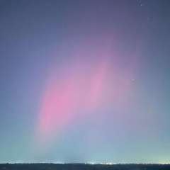
June 2026 PNW Weather
Tragically, the decadal theme of western focused summer warming with more eastern troughing and storm activity is likely ending with the establishment of the new low frequency mean state (current niño notwithstanding). We’re not looking at a phase reversal, but future summer-focused warming and extreme heat events are likely to be centered over eastern North America more frequently than not. And summer precipitation/storm activity may decline markedly as well. I’d love to be wrong about this but I don’t think I am. -
403
June 2026 PNW Weather
This is pretty interesting regarding the AMO: Decadal AMO is correlated to SE ridge/trough patterns in the wintertime: -AMO ibb.co/bR3LvKW +AMO ibb.co/KctZCPm -AMO ibb.co/wKX4YCC +AMO ibb.co/sFSwm0j -
403
June 2026 PNW Weather
Yes I do! But only SSTs relevant to higher frequency ocean/atmosohere coupling (i.e. tropical convection). So the leading modes of SST variability I care about are ones like ENSO, PMM, IPWP/warm pool structures, etc. I don’t have any use for PDO, AMO, etc. -
403
June 2026 PNW Weather
Didn’t Tim did try to warn Hitler about those SST’s as well? -
83
2026-27 ENSO: Return of El Nino?
In a nutshell, an El Niño means a cooler and wetter fall and winter season for Texas as warmer ocean waters impacts atmospheric conditions. Already, meteorologists and climatologists are forecasting a very strong El Niño beginning in late spring and lasting through the end of the year. At least we’ll get rain. We need it.
-