-
Who's Online 23 Members, 1 Anonymous, 321 Guests (See full list)
-
Activity Stream
-
1713
August 2026 PNW Weather
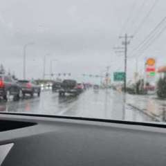
Or it could be the first signs of the much ballyhooed ice age that is expected to flash freeze us in early September. -
1713
August 2026 PNW Weather
By the time this arrives it will be a fraction of what is shown. -
1713
-
-
1713
August 2026 PNW Weather
Yes — both Creswell and Cottage Grove generally get more precipitation than the Eugene Airport, although the difference is modest for Creswell and more noticeable for Cottage Grove. Using long-term climate normals: Location Annual precipitation Compared with Eugene Airport Eugene Airport (Mahlon Sweet Field) 40.8" — Creswell ~44.4" +3.6" / 9% Cottage Grove ~45.9" +5.1" / 12% The Creswell 0.4 SE station has a long-term normal of 44.42 inches, while Cottage Grove 1 NNE is 45.90 inches. Eugene Airport's 1991–2020 NOAA normal is about 40.83 inches. (Climate Charts) There's an interesting gradient It isn't simply that "farther south = wetter." The local geography matters quite a bit: Eugene Airport → Creswell → Cottage Grove Eugene Airport: ~40.8" Creswell: ~44.4" Cottage Grove: ~45.9" So by the time you get to Cottage Grove, you're getting roughly 5 extra inches of precipitation a year compared with the airport. And Cottage Grove's surrounding foothills get substantially wetter still. For example, Cottage Grove 6.8 SSE is around 48.3", while locations farther into the foothills approach 50"+ annually. One reason the airport is relatively dry is its position on the northwestern side of Eugene in the broad Willamette Valley, whereas moving south toward Creswell and Cottage Grove brings you closer to the foothills and more terrain-induced precipitation. NOAA describes the airport as being on the valley floor, with the Coast Range west and Coburg Hills east. (NOAA Institutional Repository) So if you're thinking about the weather differences between Eugene, Creswell, and Cottage Grove, your intuition is right: Cottage Grove is noticeably wetter, and Creswell is somewhat wetter than the Eugene Airport. If you want, I can also show you how rainfall changes from Eugene → Creswell → Cottage Grove → Drain → Roseburg, which gets pretty interesting as you move south down the I-5 corridor.
-