
Leaderboard


Popular Content
Showing content with the highest reputation on 09/28/20 in all areas
-
It started raining just before I hit the sack last night around 9:00pm and it has continued steadily throughout the night. Perfect stratiform rain you'd expect in the Fall. Local reports of about 0.59" which is about how much the models were showing. It's the first precip we've had in over 2 weeks!4 points
-
2005 reached Zeta.2 points
-
Des Moines NWS still talking frost: The potential for frost/freeze conditions is also increasing for Thursday night and Friday night. Still some questions on when and how much winds will decouple, along with mid/high level cloud cover. Have kept the forecast lows in the 30s - and have included patchy/areas of frost in the forecast.2 points
-
That NW breeze is really starting to pick up. I love seeing leaves flying off the trees. Mostly cloudy and 54.2 points
-
Wow, didn't realize the Nina was going to that strength. I remember some research showing that the extreme ENSO states {both + & -} were not too friendly for SMI. Having said that, recent winters have pretty much tossed any notions of expecting a traditional outcome when adding up all the "drivers" within any given ENSO state. I've seen a full on Nino deliver a cold and snowy winter (09-10), and a winter with a raging +AO bring the historic cold n snow (13-14). We even had a Mega-Nino deliver an above normal snowfall winter with (4) major storms (15-16). Then there's the past 2 winters when the weak Nino failed us miserably. I know there have been some strong Nina's deliver for this region, so I'm not considering this one a "toss". Regardless, I'll take my chances with a strong Nina over a strong Nino any time.2 points
-
Here at my house I recorded 0.47" of rain fall overnight that is the most rain to fall here since September 9th. At this time it is cloudy and 53 here.2 points
-
LR clues why I believe the Eastern CONUS will have a Winter this season: 1) CFSv2 trending towards a stronger La Nina and especially holding the colerd waters near ENSO 3.4 region (-2C peak in Dec) 2) NE PAC Ridge will be a driving influence across North America 3) Scandinavian/Ural Blocking (models trend stronger with blocking as we get closer in time) 4) Sub Surface cold pool is positioning itself across the central/eastern PAC... Lastly, the question remains, if and when we will have a Sudden Stratospheric Warming (SSW) Event. This is the biggest unknown and one that can really bust a forecast. I'm not sure when we will see one this year, but if/when we do, I think it'll be massive given low solar and what I'm seeing already evolving at 10mb/30mb. There also appears to be a signal that the Snow Advance Index (SAI) across Eurasia to be on the rise in October. Next month is surely to provide some important clues. I'm excited as I'm sure you are to see what transpires. Of course, there is the risk that the models are wrong on the SST forecasts and therefore all of the above mentioned is completely wrong. We'll have to see the trends as the seasonal model data continues to come in later this week.2 points
-
Talk about flipping a pattern switch! Overnight we go from endless summer sunshine and benign repeat to active, active, active. Things that are in my AFD for this week: Up to 1" rain, classic autumn stratiform type Brisk north winds High temps 10-15F below normal Cold core thunder Likely waterspouts Lows in the 30s Possible frost2 points
-
Wed-Th timeframe should be a lot better for you in terms of receiving beneficial rainfall and for my area as well. Then comes the first real cool airmass of the season. Get ready! I would not be surprised, if frost and freeze advisories are out. I just hope its not windy by that time.1 point
-
Attm, getting a steady rain w temps at 52F. Hello Autumn!1 point
-
Nice!! Happy real Autumn!! Bringing it in with a bang! It literally hits every "classic" thing right on the button if you love this season. Gotta see what the models keep trying to do with the PNW ridge. I just can't see it doing what 12z had it doing and migrating east over the plains.1 point
-
I picked up about .40” yesterday. I didn’t get my new digital rain gauge out until just after the rain started so this is an approximation but based on reports nearby this is pretty close.1 point
-
From Hermosa Beach to PV saw only partial clearing, and it’s trying to roll back in here too.1 point
-
Same for me. Looking like this first round of rain will end up on the lame side. NBD really since this is the time of year that a small batch of liquid can be stretched a lot further. Besides, as Tom posted several more chances in the near term for SWMI.1 point
-
Currently getting some rain w temps in the 60s, as I am enjoying a delicious "Dragon Fruit Juice." Hopefully the whole fills in. Looks like a dry slot has developed per radar.1 point
-
We had a heat wave at the very beginning of September 1988 here in Southern California. Short but potent, 110F in Downtown L.A. on the 1st.1 point
-
Constant highs in the mid-60s near 70 some days with a Northwest wind and full sun are totes awesome, yo.1 point
-
#RealAutumn....has arrived! It's going to be a busy week around these parts as I see a couple more good chances of precip besides today's stratiform/post-frontal rain event. A rotating piece of energy around the backside of the monster trough in SE Canada looks to bring a wave through on Wed/Thu along with LE rain showers. The clipper type system showing up over the weekend is interesting to say the very least. Very amped up pattern around here which is a great sign...finally... 00z Euro the wetter of the bunch through this weekend...1 point
-
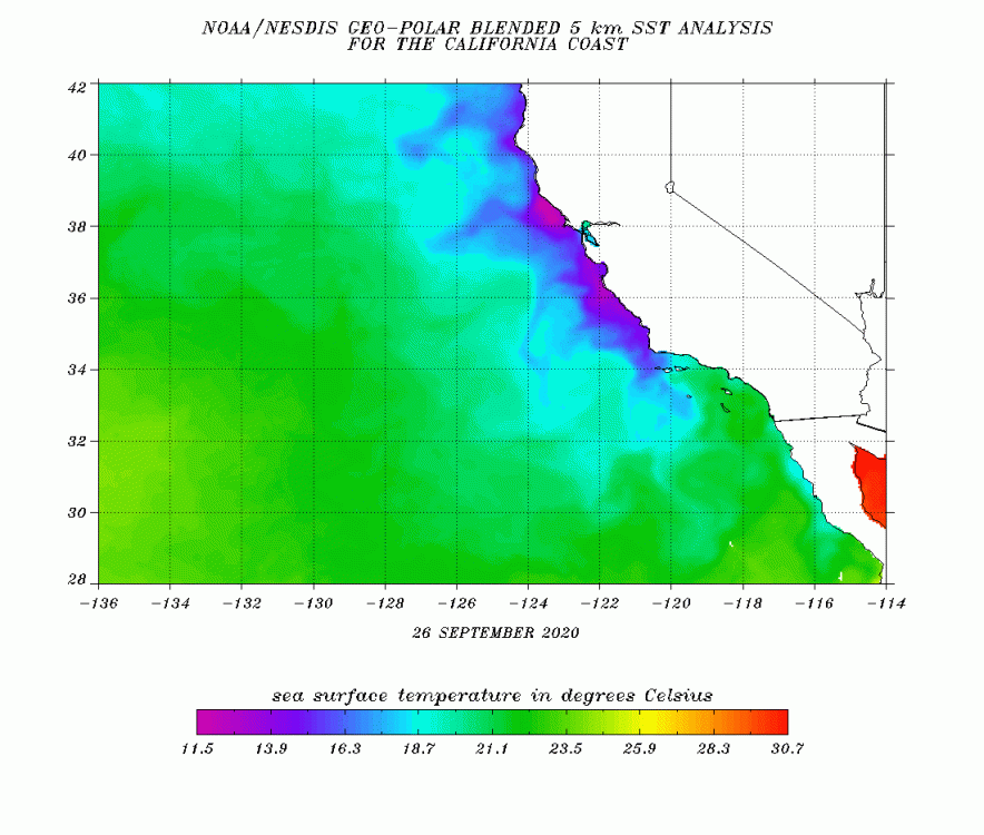
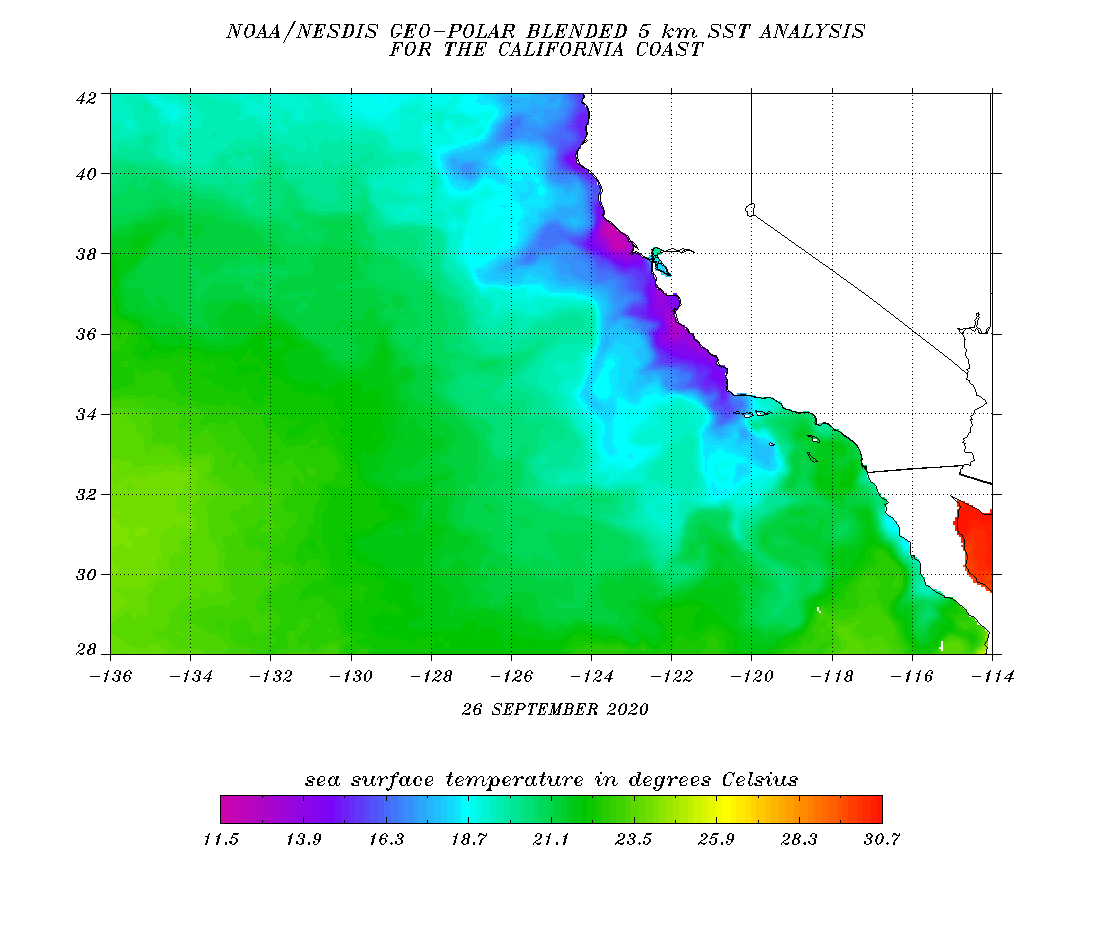
Seems our sea surface temps are up a bit, for LA and Ventura County coasts particularly.
 1 point
 -
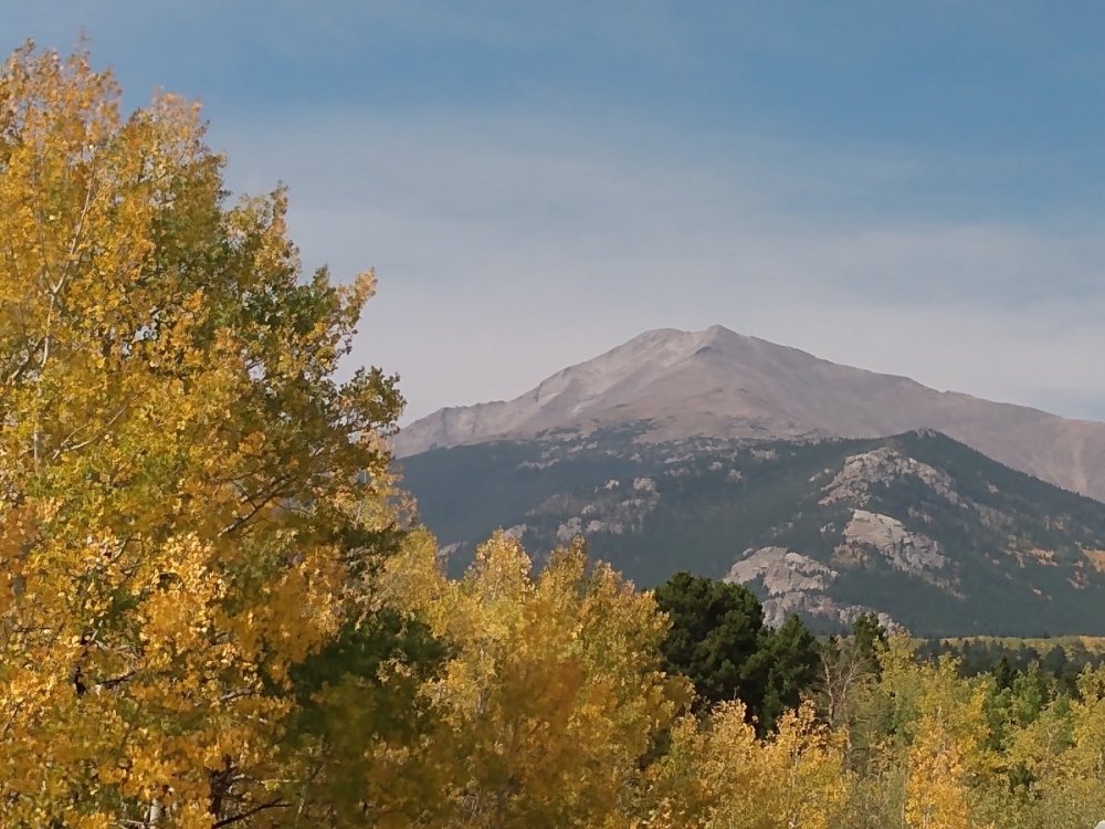
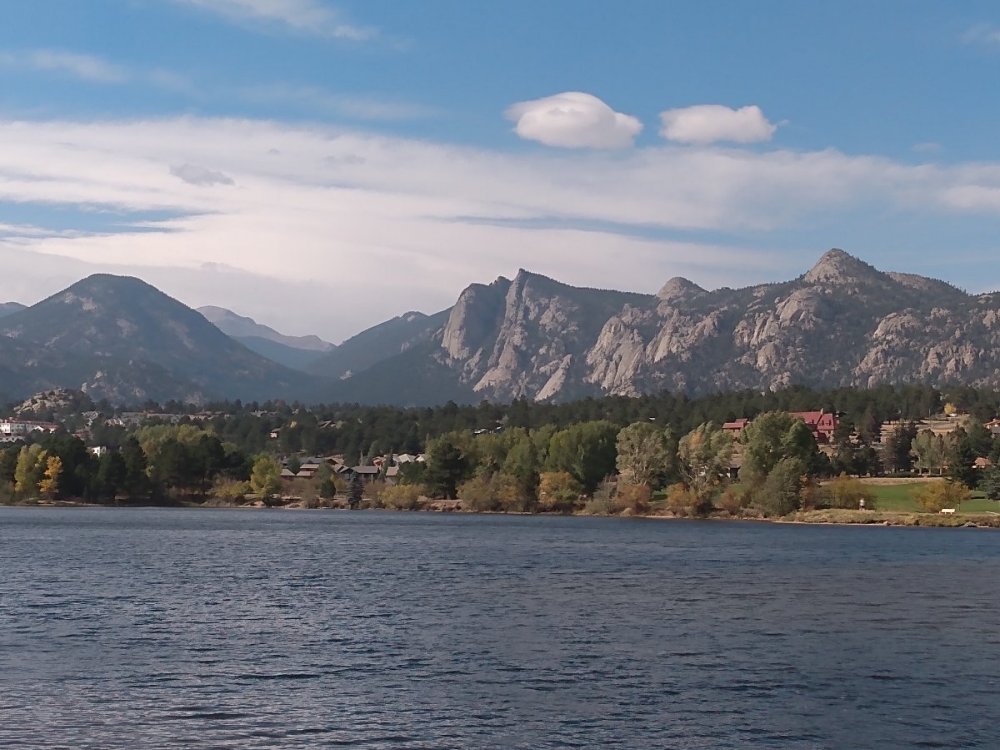
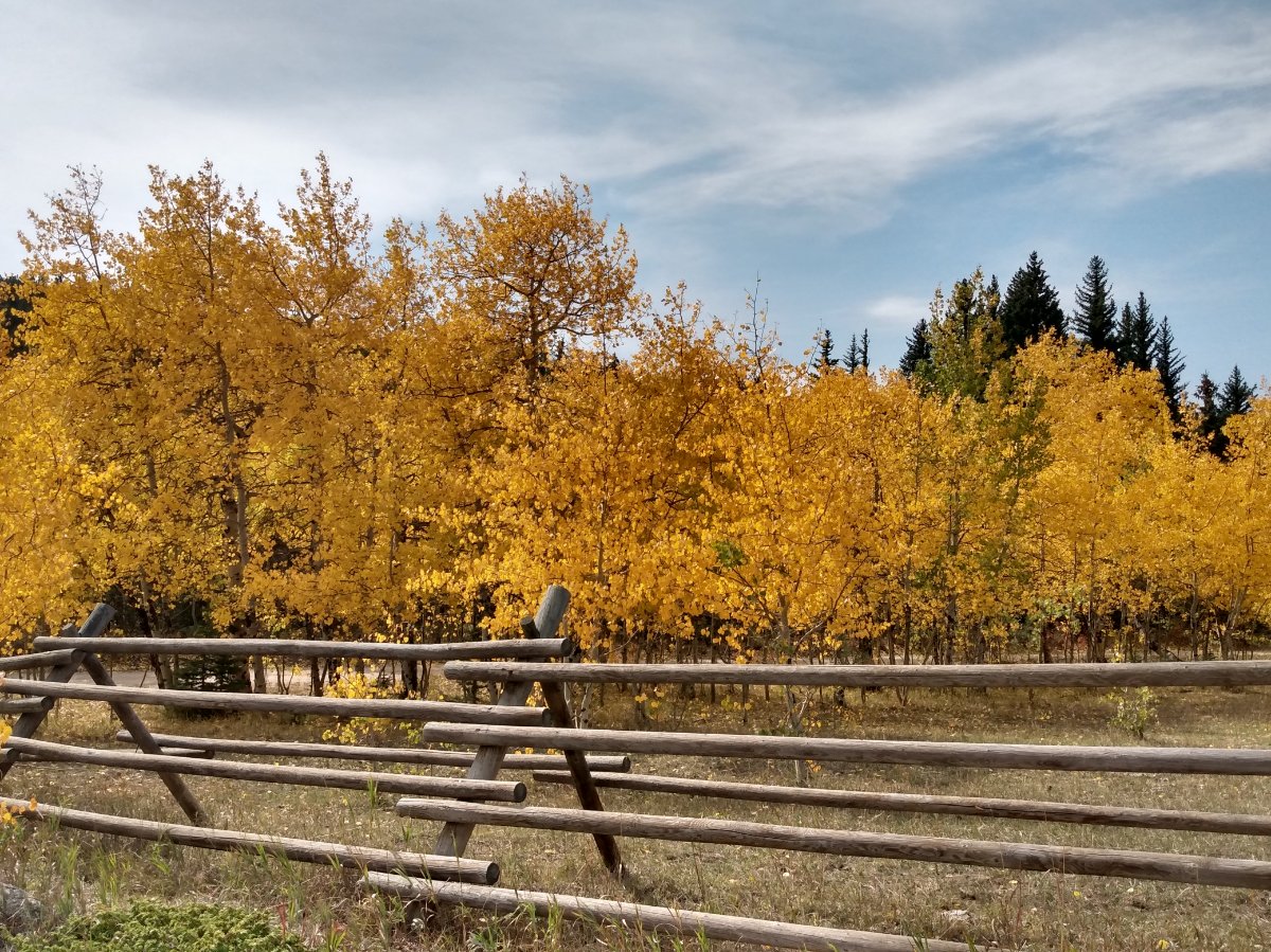
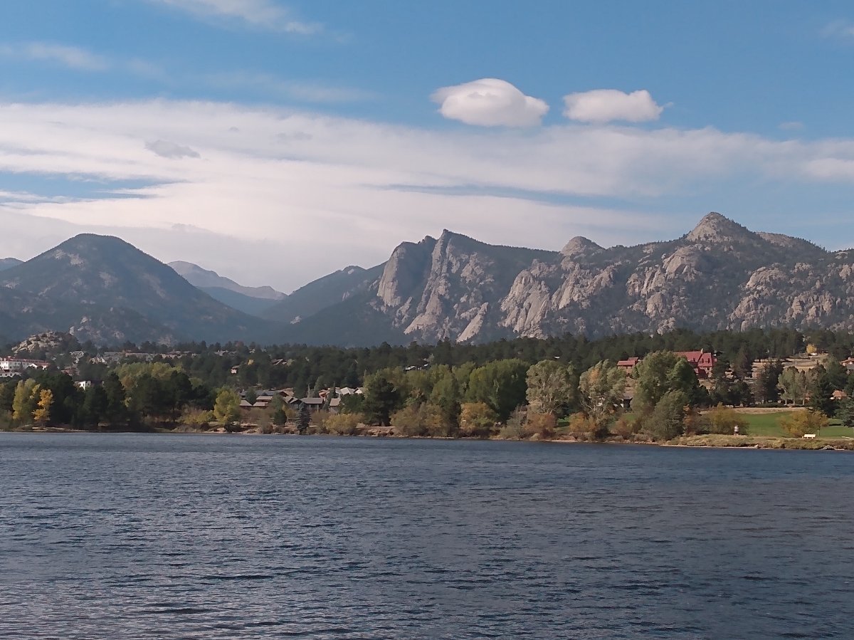
Went for a drive on the Peak to Peak highway between Boulder and Estes Park yesterday, scoping the falliage.

 1 point
 -
Yeah, basically just enough to wet the ground here, picked up .01 here as well... it was nice to wake up to the sound of some thunder this morning, however we need more than just light rain showers and sprinkles to bust the drought.1 point
-
Why we really need one over our way..
 1 point
 -
Sky starting to get that yellowish cirrosmokus look here again.1 point
-
What was the setup of the 1988 heatwave and is it any different then the current one which seems very similar? Both had hot starts and ends to the month though 88 didn't have the thunderstorms associated with it. Here is Salem's version where the heat on the west was most intense. The first link above also has a summary of September of that year. It seems pretty similar minus the thunderstorms that brought all the rain this year. This feels more El Nino then a La Nina. I wonder if the oceans may be 'venting' out a lot of heat in addition to whatever outside forces may be controlling our weather? Oh and here is the only GFS chart I can find for this and it was hard to find as I had to remember the exact place. https://www.wetterzentrale.de/reanalysis.php?jaar=1988&maand=9&dag=29&uur=1800&var=2&map=2&model=noaa It feels very similar in a creepy way. PS: Is it something I said or is something on my face? Statesman_Journal_Sat__Oct_1__1988_.pdf Statesman_Journal_Sun__Oct_2__1988_(1).pdf0 points
-
Eddy 1, offshore flow 00 points
-
Cleared out here. And we’re usually one of the last places to clear out.0 points
-
Other countries have DEW which were used in the fires of CA. There are certain signs of it is all I'll say as I'm tired. We have been being played with. The space force was 'not created by Trump he isn't that much of a genius! Firefighters have come forward with this saying about microwave effects being used where houses are burnt to ashes while plastics around survive untouched!-1 points


This leaderboard is set to Vancouver/GMT-07:00