
Leaderboard


Popular Content
Showing content with the highest reputation on 03/12/17 in all areas
-
Got 2.5 here in Waterloo...snowing hard!2 points
-
Just crushing here. 3.4" now 1.3" in past 45mins2 points
-
Local Grid Forecast calling for 4-7" under WWA and 4-8" with Lake Effect...hoping for a middle ground 8-10"....up by Lake county they are forecasting 8-16"....2 points
-
Amazing how much cooler, cloudier the Puget sound region has been the last few days. They have mostly missed out on this taste of spring.1 point
-
Sure, but I'm betting it's pretty normal to see a high or two in the 60s at some point in any given March. Except for the very coldest ones.1 point
-
TWC is actually playing TV shows instead of making live reports on the "Big Blizzard" that is going to take place. Unfortunately, TWC is not what is used to be. I remember during the "93 Superstorm", they were on top of the storm constantly. They had done a great job during that time.1 point
-
5" here. 7" report 15miles north of me Waerloo 5.51 point
-
Beautiful day. Shot baskets outside for the first time in months.1 point
-
It began snowing at 8pm and we already have over an inch. It's really dumping.1 point
-
Thanks Tom. Enjoy the action down there. It's been way too long of a wait for you.1 point
-
It does not feel like March. Whatever it feels like, feels GREAT!!! Also went from freezing fog and upper 20's earlier, to this wonderful afternoon. High 63 degrees today. I hope the frogs broke free of their ice cubes.1 point
-
Dmx said dry slot should stay out there. Let's hope so!1 point
-
It's knocking on your door step. MKE and points south along the lake seem to be the theme of heaviest accumulations on the RPM. The convergence zone takes over Monday night into Tuesday as winds shift more northerly over the land up your way. The Lehs that hits on Monday is MKE's best stuff until the winds veer more N/NE.1 point
-
Looking like a 4-7" event here in SMI. Will see how this turns out. For something this extreme in snowfall, you bet.1 point
-
It usually does not add up this far West of the lake but maybe this could be the exception. Tom, you should do well with setup. Hope it exceeds 12" for lakeshore areas1 point
-
Looking forward to it Tom. I remember a couple of times getting the lake effect this far west. Always a cool thing1 point
-
I climbed Shine Mountain, elevation 11,888 feet, on showshoes yesterday. It was a very nice winter day. Here is a photograph: http://images.summitpost.org/original/995709.JPG1 point
-
LOT has my grid at: Tonight: 1 - 3 Monday 2 - 4 Monday night 1 - 2 Tuesday 1 - 2 That would be impressive if it reached the high end of that!1 point
-
That is a nice convergence band setting up that hugs the lakeshore...LOT must be impressed with the higher rez modeling...6"+ of lake effect would be...#Awesomeness1 point
-
No matter how you slice it we are due for a number of very cool summers. It will be interesting if the huge pattern shakeup is able to deliver cool summers like we used to have. I'm hoping for a spring / summer with a lot of 140W ridging. We can have delightful weather with that.1 point
-
This makes November-March mossman very happy, but April-October mossman very sad.1 point
-
@ Tom Hope yby gets dbl digits buddy, you've been way more patient with this season than I have! Good Luck!1 point
-
2011 was a good year1 point
-
I'm not sure how to upload but it shows 7-8 for you1 point
-
Friends and family there are telling me that supermarkets are all emptied out. This might be a HECS for them. An incredible storm on the way for NYC-BOS. 12z Euro is a beast for entire region. 2'+ looking likely. Btw: my totals suddenly show 9"+!!! Not sure if its an echo or not.1 point
-
On my phone but looks.better than the gfs synoptically at least 6+ from around herr through southern wi. Along the lake chicago does well 8 or so. More as you head north with of an 11 inch max near mke1 point
-
At least not this side of the lake LOL!!1 point
-
Kind of nice to get all of this heat release over with quickly. Should be a huge crash somewhere along the line.1 point
-
Now that the time went 1 hour forward, I am really into Spring mode. After this snowstorm, I am done with snow and ready for Spring.1 point
-
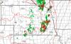
Map of seasonal totals so far thru March 11th. https://pbs.twimg.com/media/C6sdc-QWsAAbm7R.jpg1 point
-
I am thinking an advisory should be issued for my area this afternoon. I am forecasted for 3-6"+. Surprised they have not issued anything yet.1 point
-
LE doing work in MKE/Chicago after that: http://maps1.pivotalweather.com/maps/models/gfs/2017031212/054/snku_acc.us_mw.png http://maps1.pivotalweather.com/maps/models/gfs/2017031212/054/qpf_012h.us_mw.png1 point
-
The 00z WRF had a broad band of heavy snow from S MN/N IA/S WI into N IL... http://www.tropicaltidbits.com/analysis/models/wrf-nmm/2017031200/wrf-nmm_apcpn_ncus_48.png1 point
-
Looks like the sun is really dead this time. x-ray flux down to A0.0 and the radio flux down to 70. That's getting into rock bottom territory.1 point
-
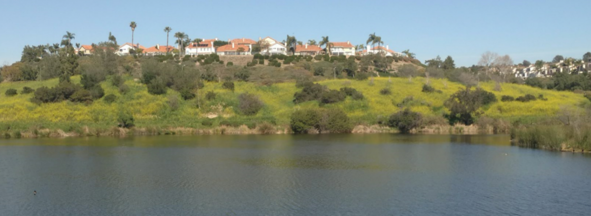
PIctures from Laguna Niguel Regional Park. Sun was quite hot today even though this is about 3 miles from the coast, which was foggy. Gotta love those microclimates.


 1 point
 -
The nam at 60 hours on a coastal... Good luck1 point
-
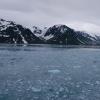
Anchorage at 61N is bad enough with regard to the daylight hours. Longyearbyen at 78N must be quite jarring. In 2009 I visited Deadhorse, AK (70N) in early September and the days were getting darker 16 minutes each day. It was pretty weird.1 point


This leaderboard is set to Vancouver/GMT-07:00