
Leaderboard
.thumb.jpeg.e3014abf99ef08a9f9ac2c0cd31b485b.jpeg)


Popular Content
Showing content with the highest reputation on 12/02/22 in all areas
-
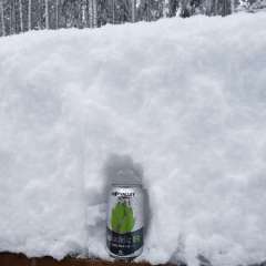
Best birthday present possible.
 31 points
 -
50 years old today!!! CRAP23 points
-
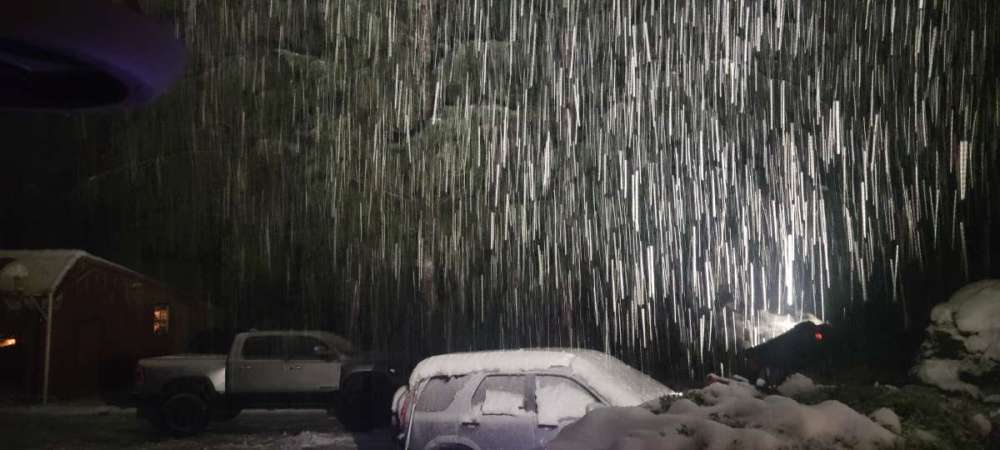
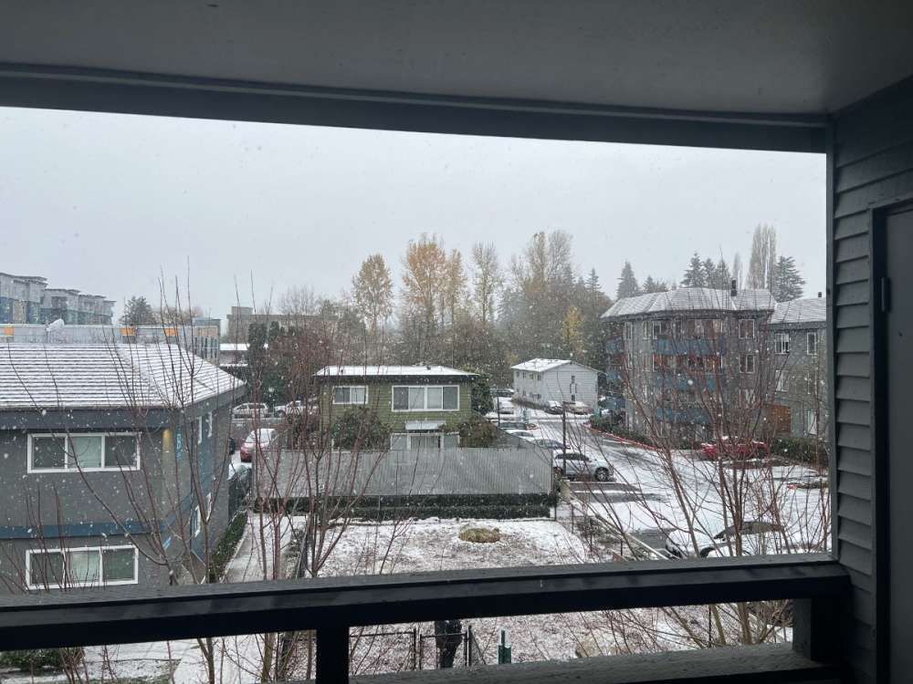
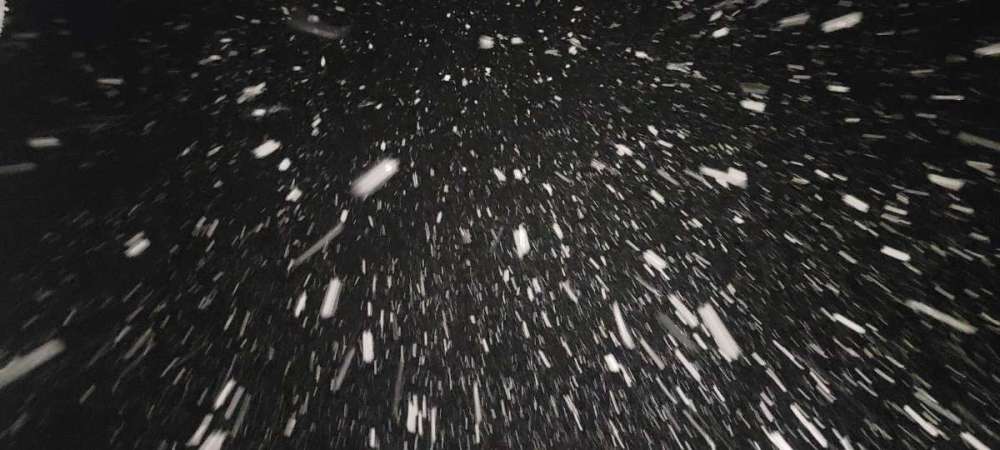
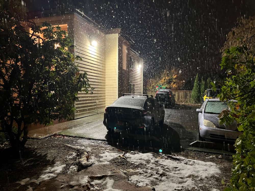
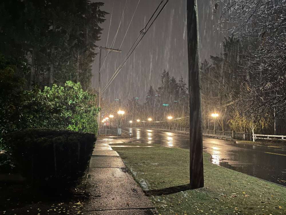
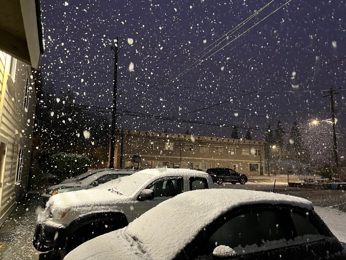
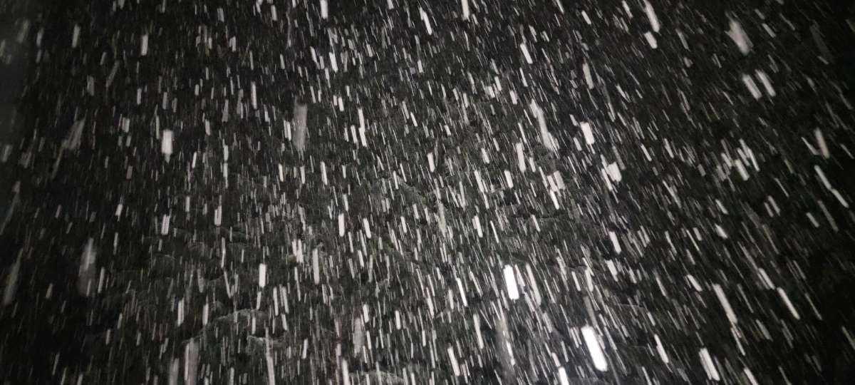
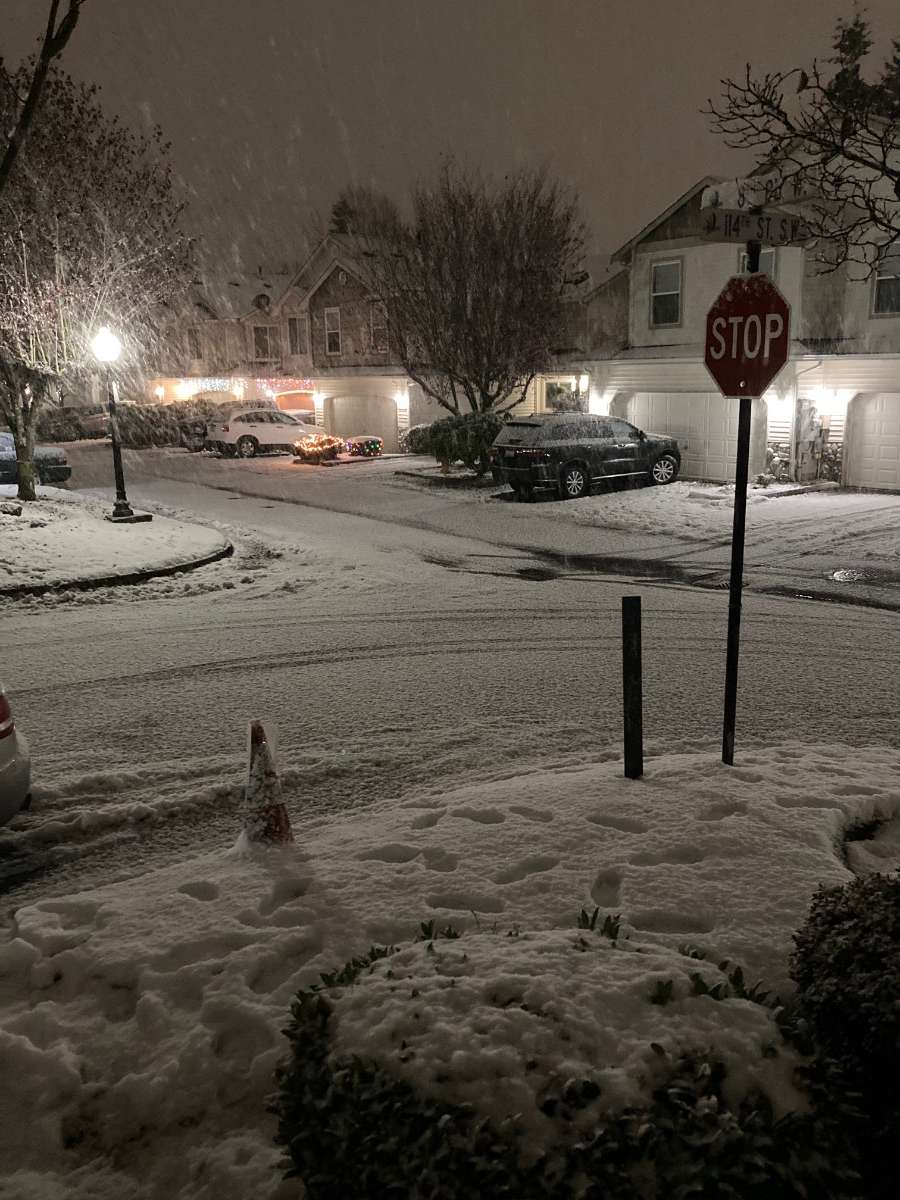
Getting some holy sh*t snow here.
 20 points
 -
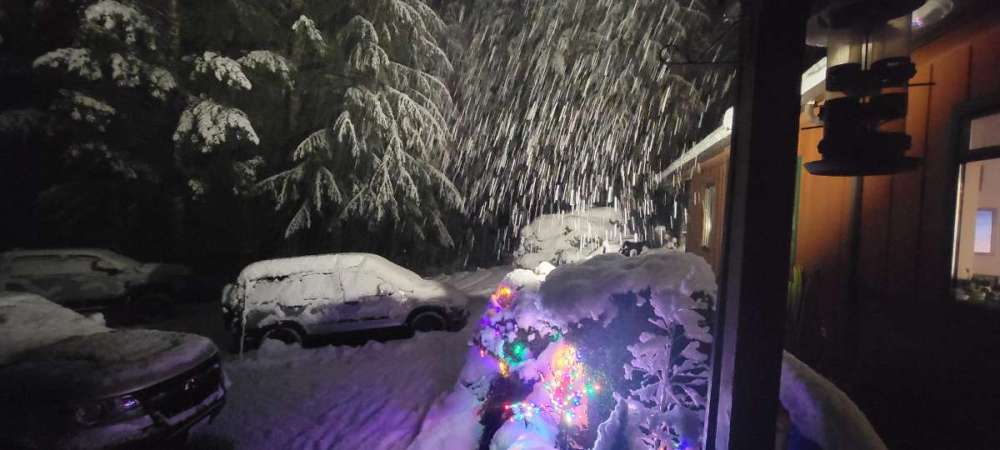
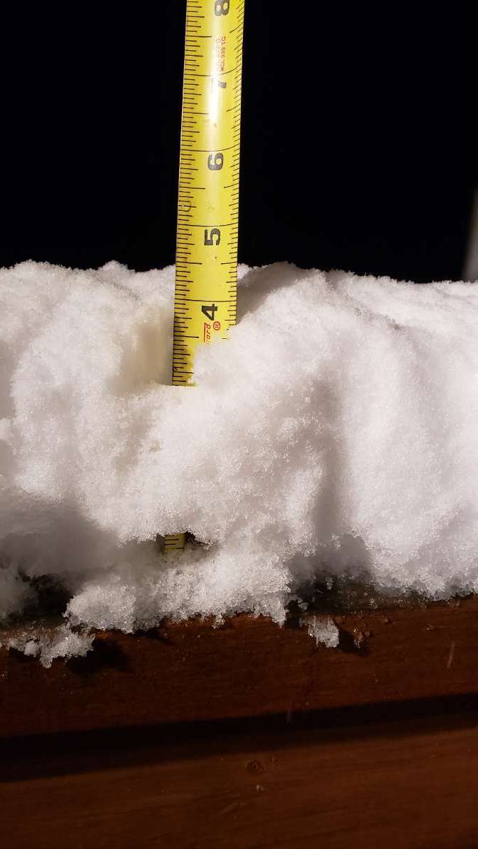
Pounding snow pretty hard now. I set a snow measure board outside at 6:40 so I can check it in 1 hr. We are getting well over 1 inch per hr rate right now.

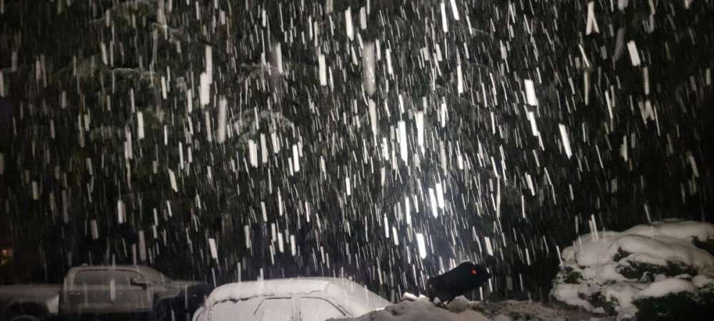
 16 points
 -
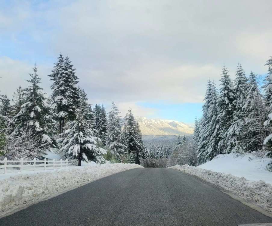
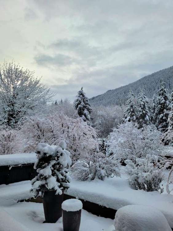
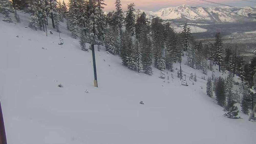
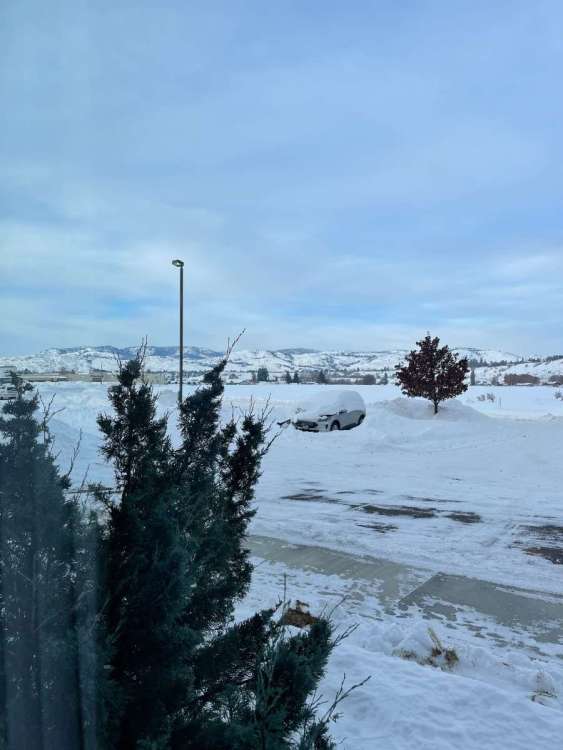
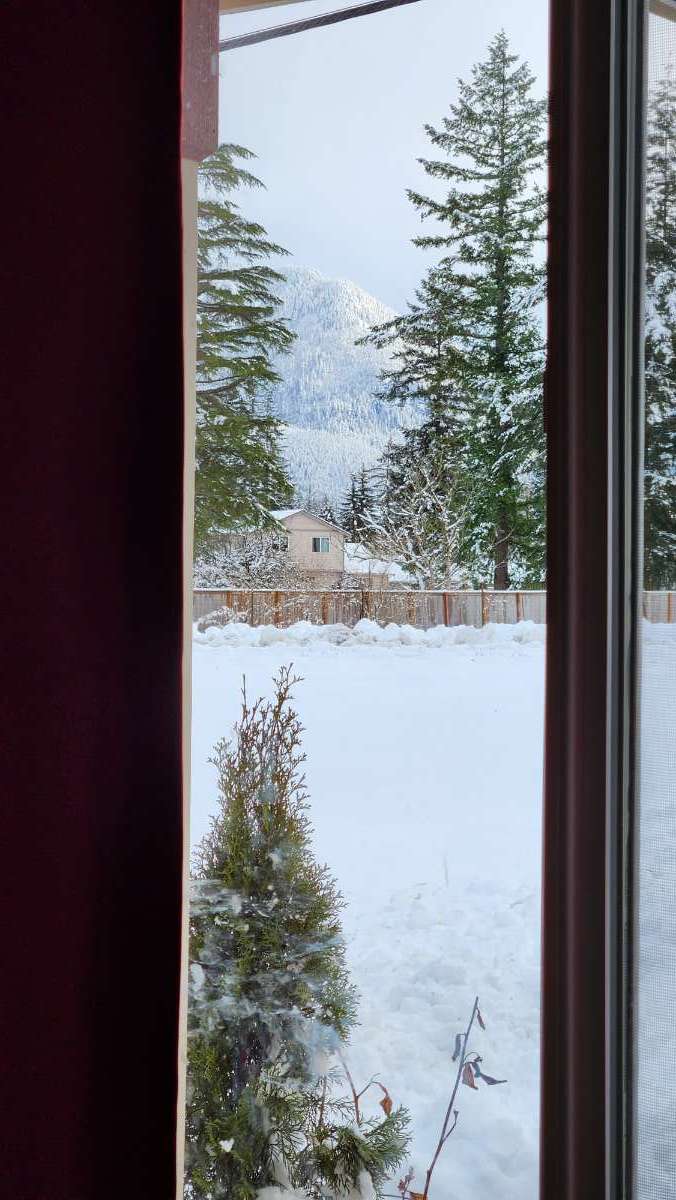
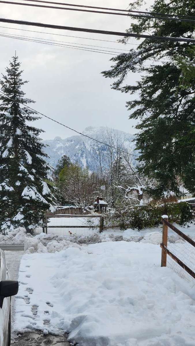
Mountains are finally out here. Really adds to the ambiance.
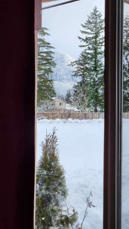
 15 points
 -
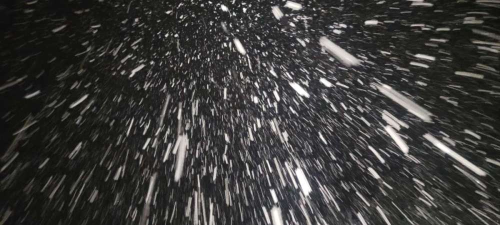
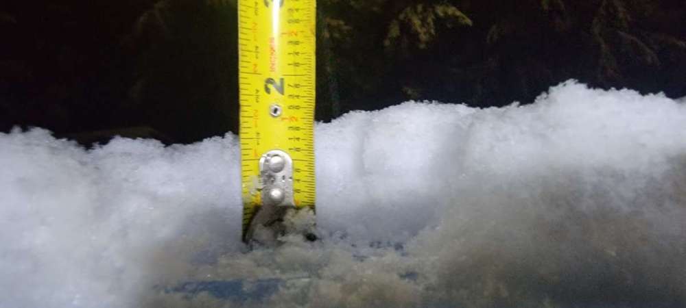
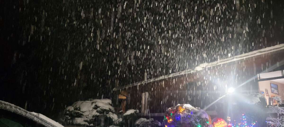
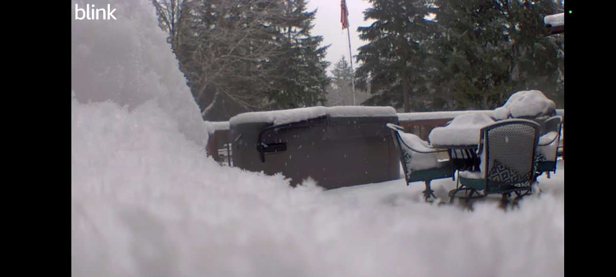
Dumping and roads went from wet to white in 10 minutes here. Still have 4” on the ground too so it’s been a really snowy feeling week.
 14 points
 -
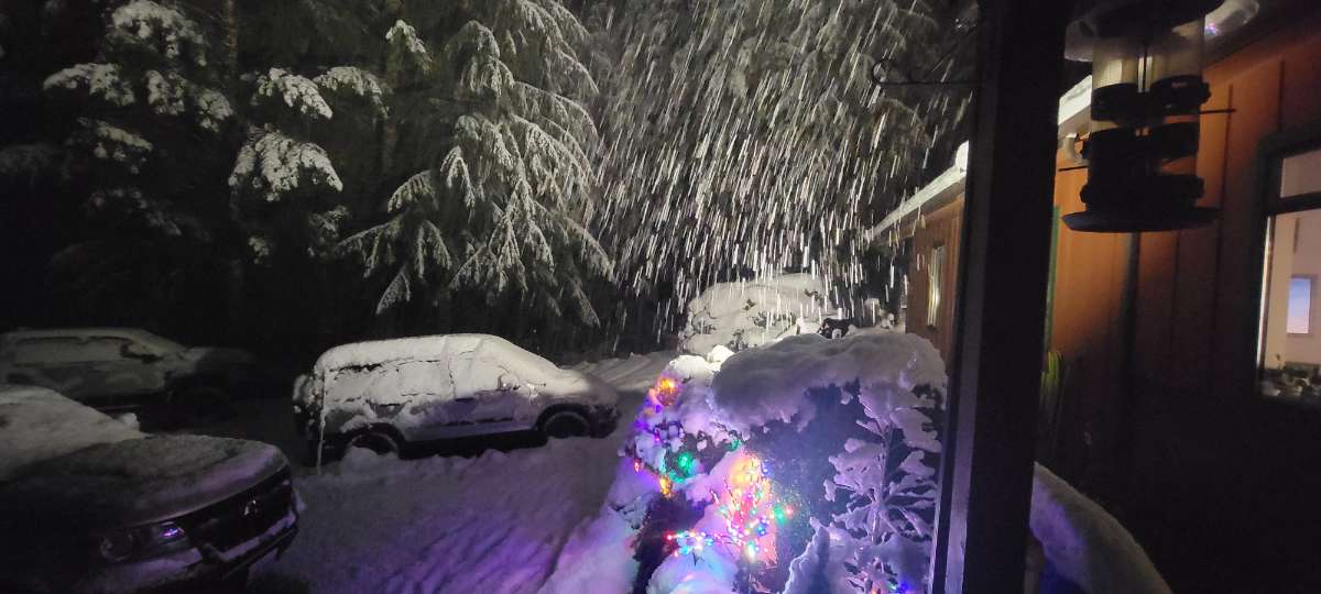
Moderate snow now. Covering everything! Since this morning stuff is largely a surprise for the meteorologically-uninitiated, none of the de-icing tactics were used. No salt, sand, anything. Piling up on the roads.
 14 points
 -
Moderate snow and back down to 32. No rain mixed at all now. Showtime!12 points
-
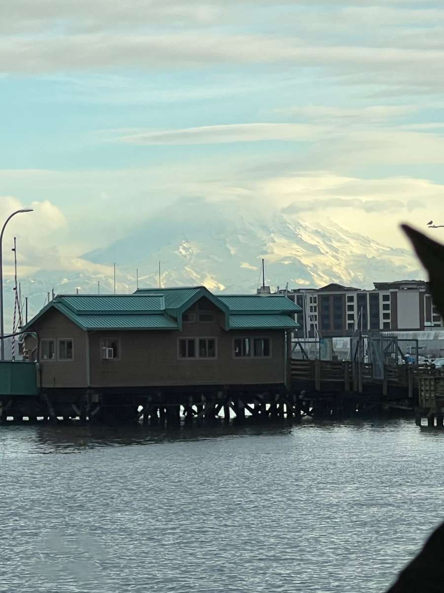
Rainier through the window at Anthonys in Tacoma.
 12 points
 -
Some patches of blue sky out here...
 12 points
 -
Getting deep! This is turning into a awesome event. Going to be a big one out here. A widespread 3-8 inches west of Puget sound and 2-5 east look like a good bet.
 11 points
 -
Reporting from Shelton. The 34 rain is now snow11 points
-
Absolutely dumping here now. Temp down to 31.8.11 points
-
Mostly sleet and wet snow now, not sticking yet, temp is hovering between 34-35.11 points
-
You’re gonna be popular here11 points
-
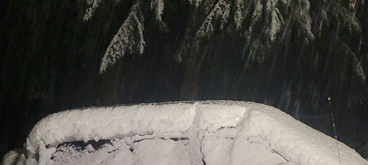
Sky getting brighter here. Still no wind as you can tell by the perfectly caked trees.
 11 points
 -
Back in Bozeman! Lot more snow here than in Northern Sweden. Picked up 6" of snowfall here last night. Snowpack is already very deep for this time of year. About 20" on the ground now with more snowfall on the way Sunday night and Monday. Currently 15F.11 points
-
Wow. A lot to catch up on! Moderate snow and 32F. Right north of the boundary. Sticking on everything. A rare GFS verification in progress.10 points
-
Wow that was fast getting close to changing over to snow all the sudden. Getting bursts of big flakes on and off. It’s gonna try to do it.10 points
-
The flakes are 2 inches across lol. Wow. It has been dumping these huge flakes for about 15 minutes now.
 10 points
 -
This is just north of Chris... dumping something frozen!
 10 points
 -
Snapped this in Silverton today. Nice unexpected snowfall from a random shower yesterday. Doesn't take much, just have to have the cold air in play. That's the most important piece. Apparently they have now closed school for the day at my daughters school instead of just a 2 hour delay. Ridiculous and already her 3rd snow day of the year.10 points
-
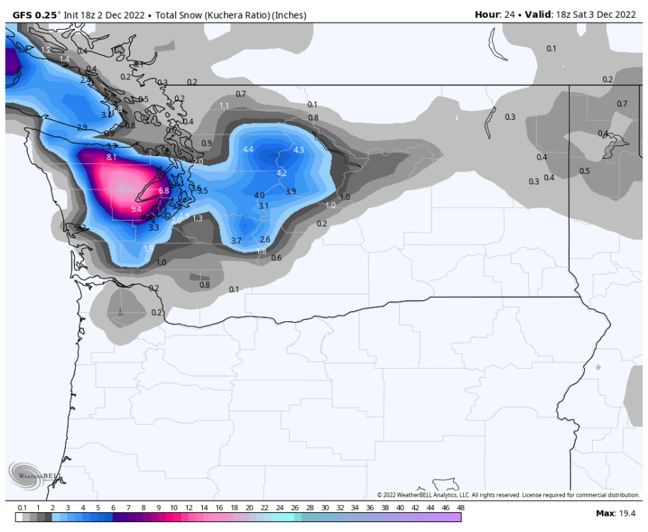
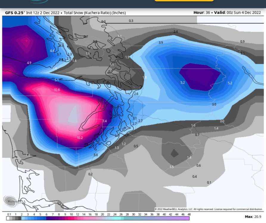
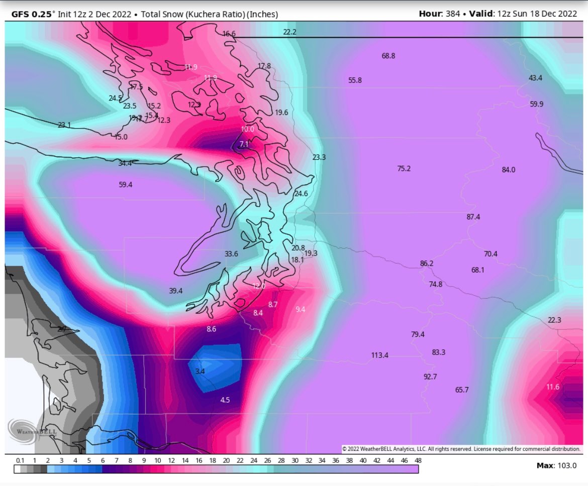
The GFS shows precip picking up substantially for the East Puget Sound Lowlands a bit later in the evening. Still some potential.9 points
-
Nws Obs. Map shows sea tac is reporting snow.9 points
-
C’MON PDX Snow event!9 points
-
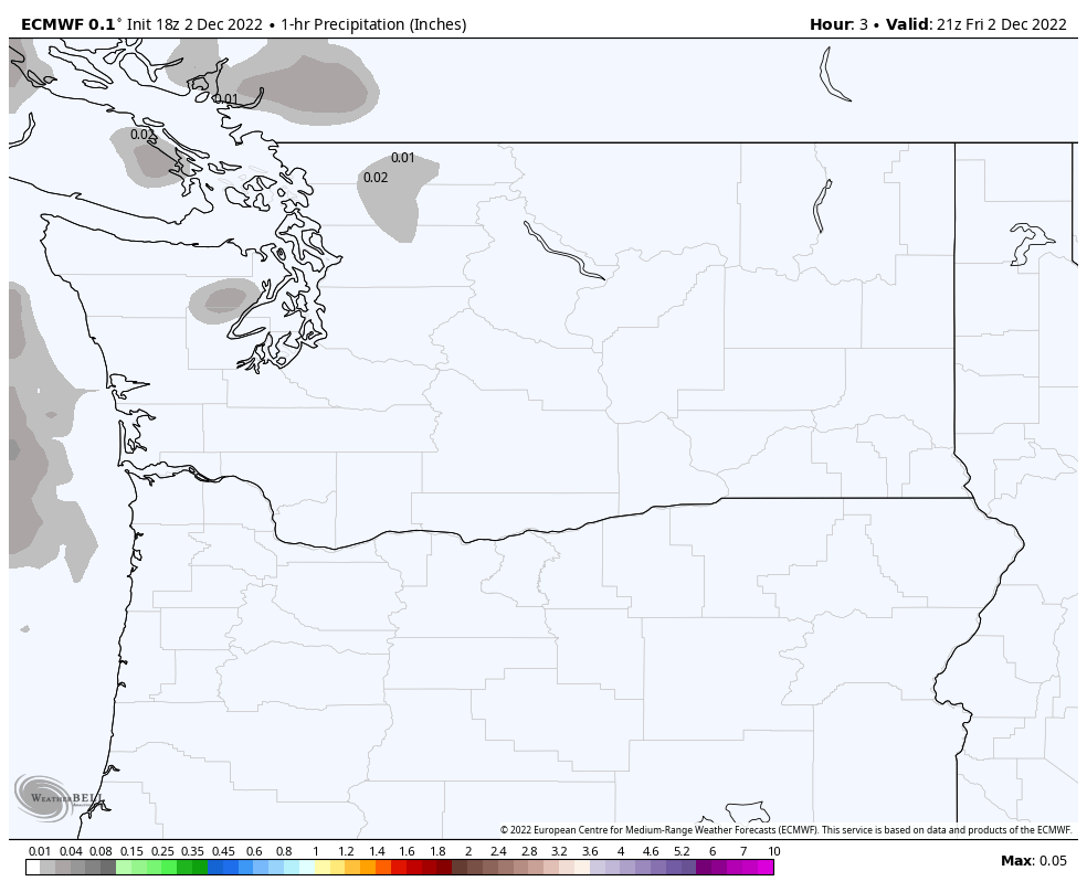
18Z ECMWF is back to showing precip making it all the way into King County and is more snowy than the 12Z run.
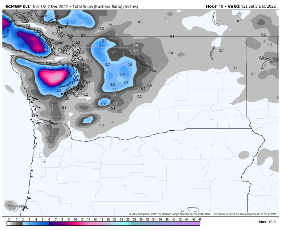
 9 points
 -
Currently 2 here in Omak, 31 and at home apparently. Looks like a WWA was hoisted for today/tonight at home. Also I have noticed the PNA was forecasted to head positive in the extended a few days ago, but each day that has been sinking further and further down!
 9 points
 -
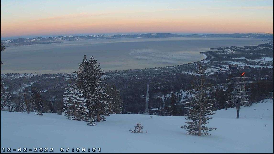
Love the smell of the air after a big snow storm. The lake and Mt Tallac from the Heavenly cams this morning.
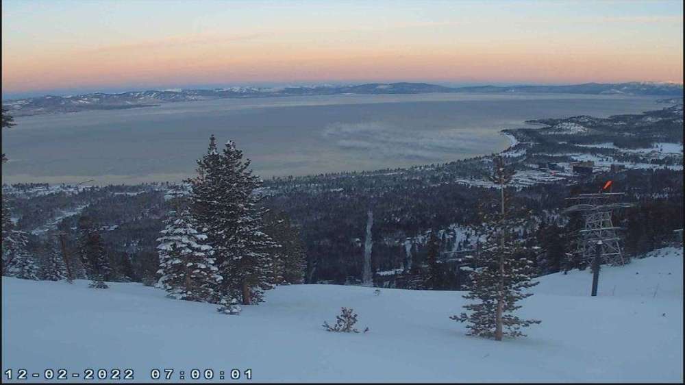
 9 points
 -
Heaviest snow of the morning so far.9 points
-
Been snowing here for almost 2 hrs. Maybe 1/2 new.9 points
-
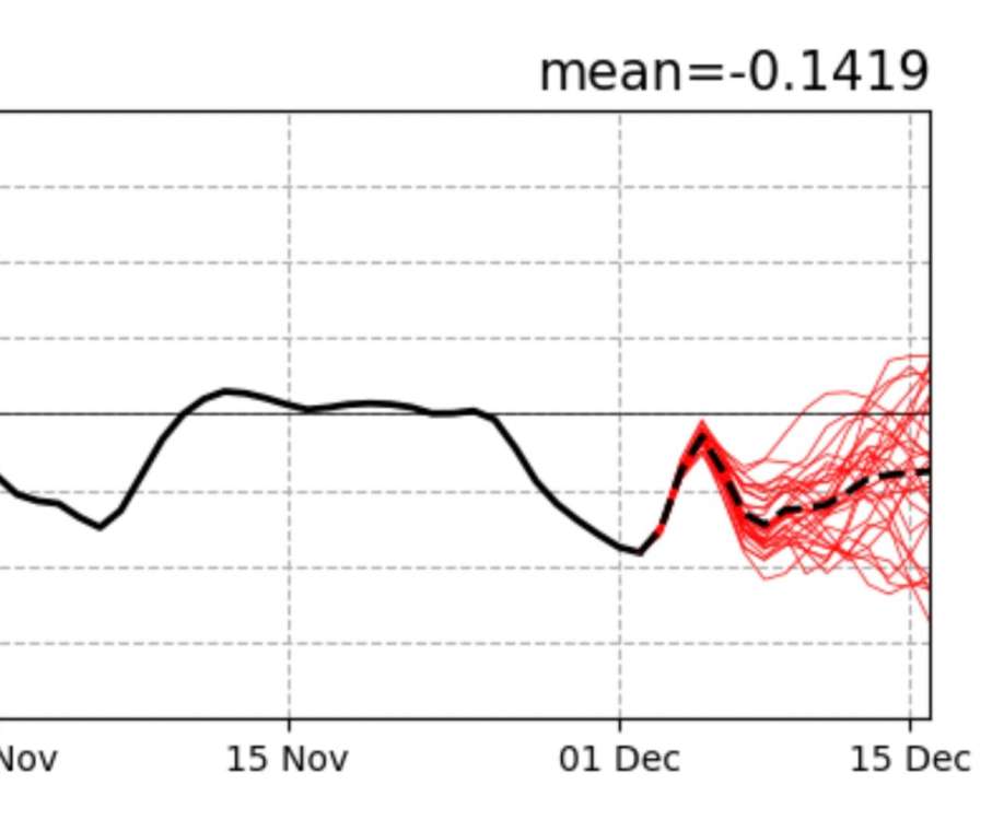
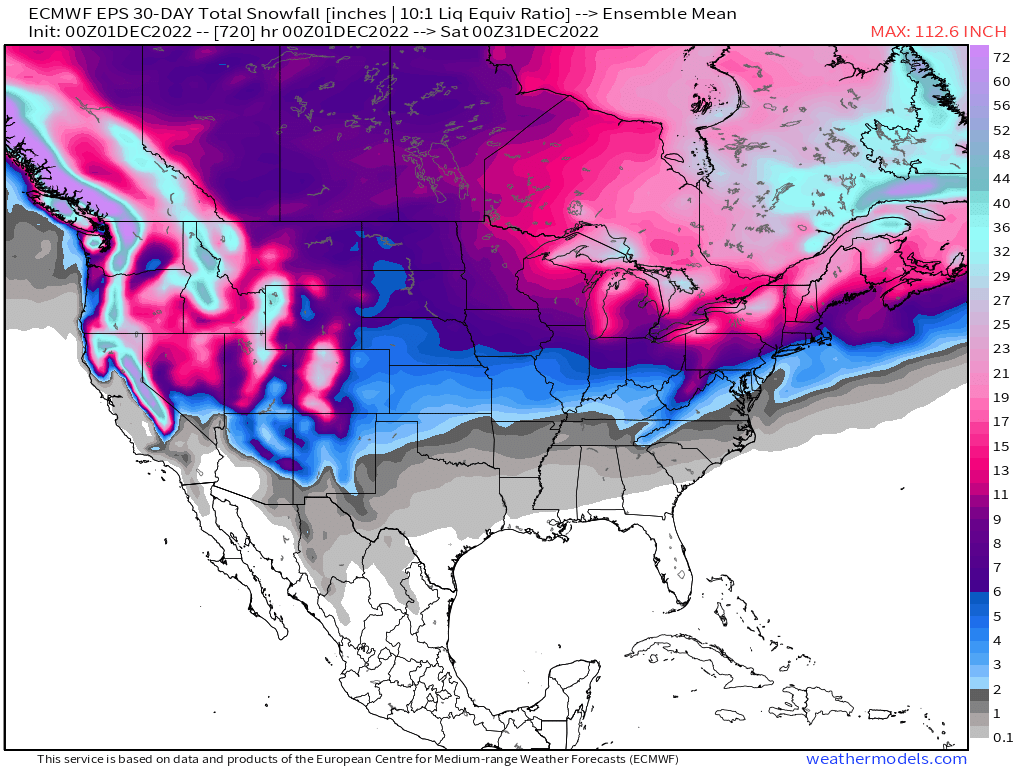
Looking ahead in the models I see a lot of cool weather on the way. No real signs of arctic air or a major cold snap, but just consistently below average weather. First half of the month could end up a lot like November in that we are running significantly below average without a major cold wave.9 points
-
Kona low and ridge bridge to greet the holidays on the 00z EPS
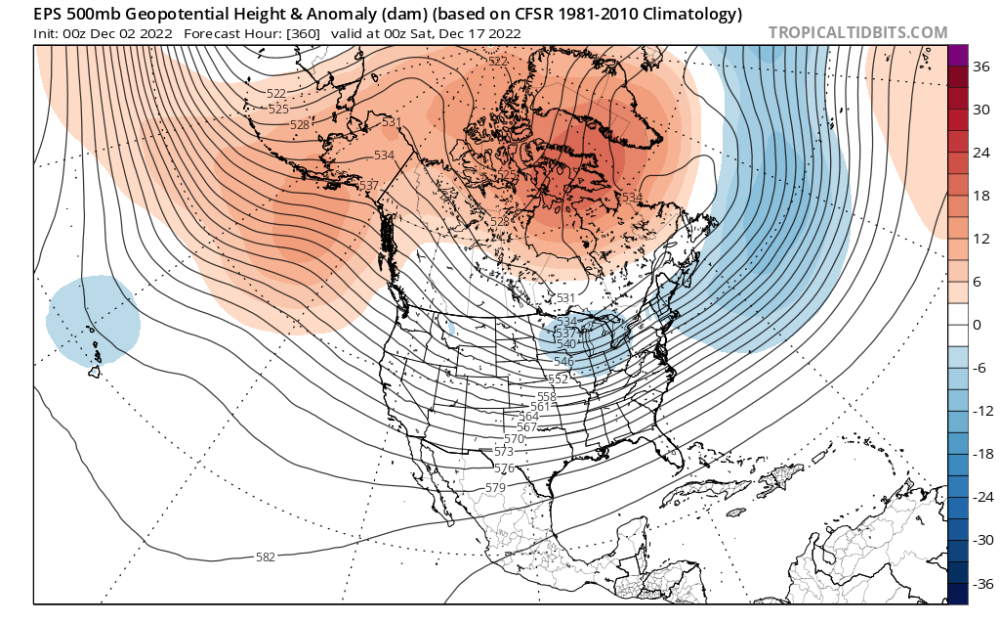 9 points
 -
Latest IR Loop To my untrained eye it sure looks like to me that there could be more moisture than modeled as the system slowly sinks southeastward offshore.
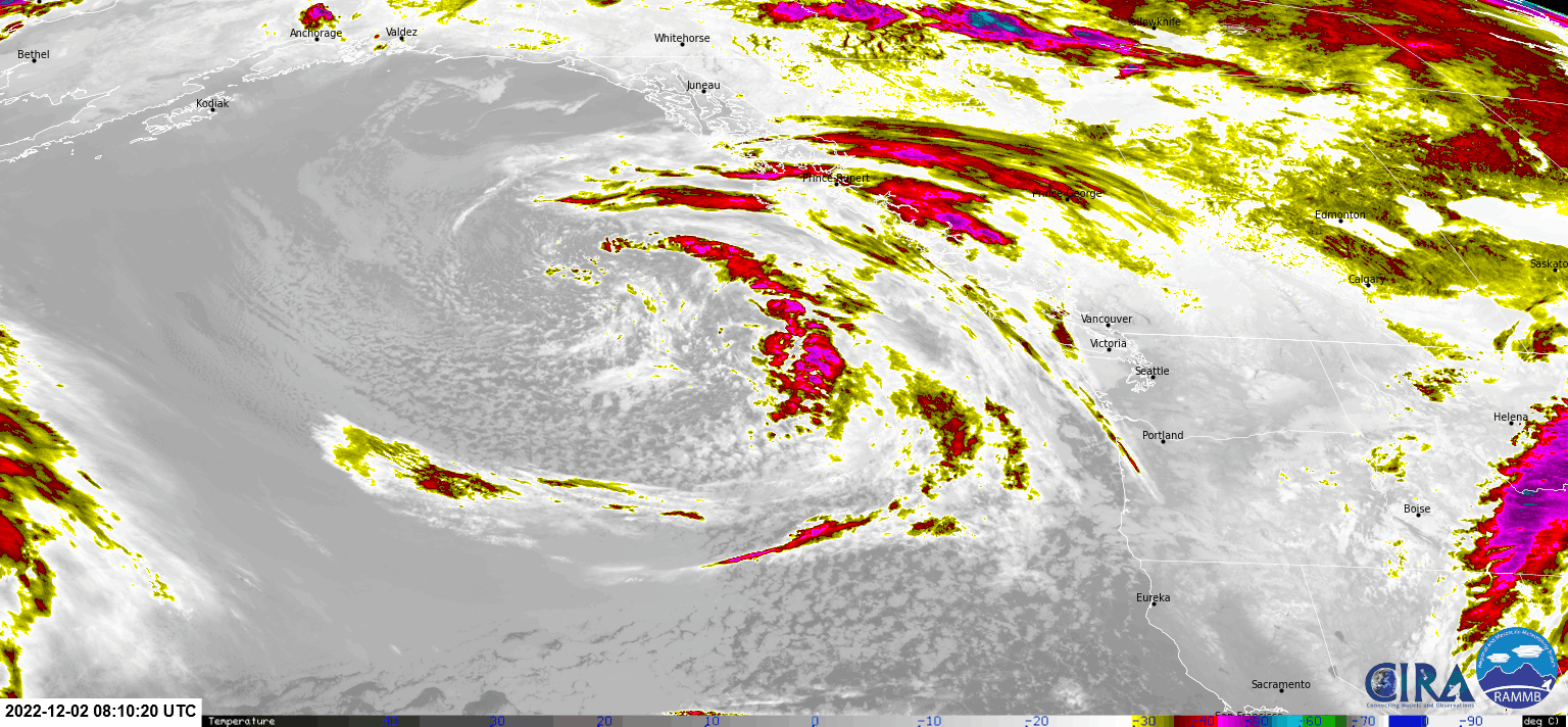 9 points
 -
Rogue snow shower just finished up here, picked up a surprise 1/2"!9 points
-
8 points
-
Very heavy very wet snow starting to accumulate here.
 8 points
 -
8 points
-
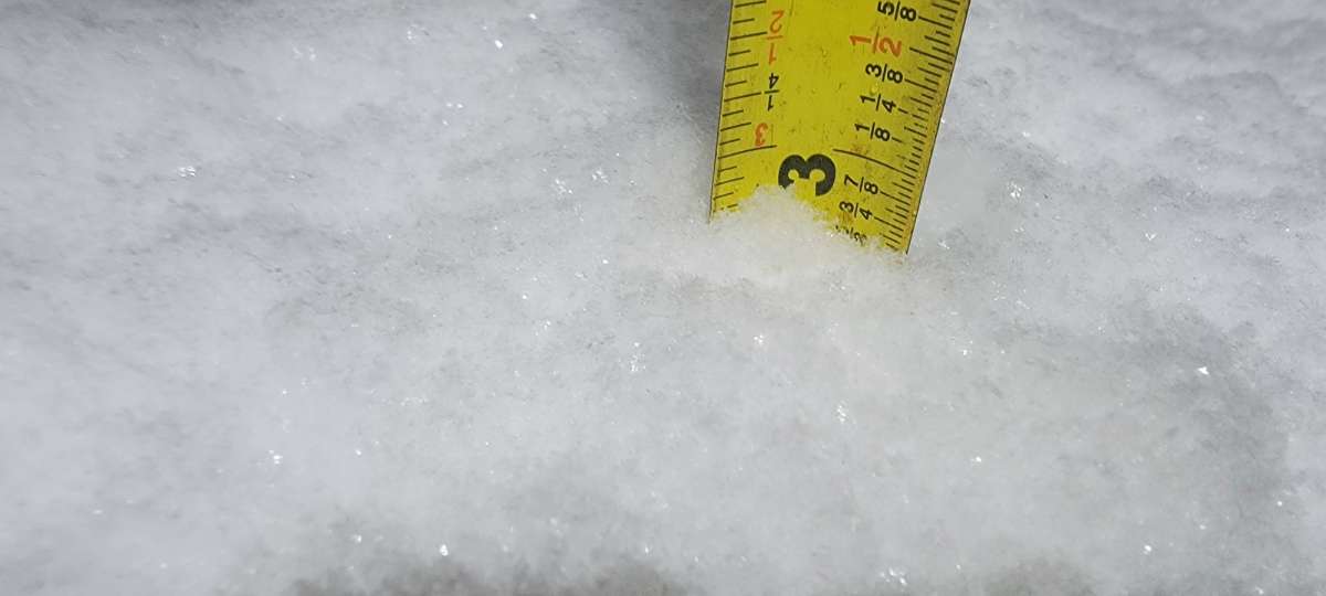
about 1.5 in one hour. 3 today ao far. 10 inches total depth on ground.
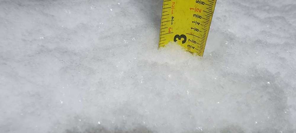 8 points
 -
The precip mostly of the frozen variety here!!8 points
-
You should probably relax and enjoy the ride more... Gonna be a long winter if you focus on all the disappointments. This is coming from a place that has been within 5 miles of heavy snow twice in the last week!8 points
-
18Z GFS has spoken... and of course its very snowy tonight. Somehow we are going to get 3-4 inches even out here despite the ECMWF showing the precip never makes it this far.
 8 points
 -
8 points
-
The Euro Weeklies basically corrected to showcase the high lat blocking and an active storm track....cold and snow, let's do this...
 8 points
 -
Good morning Omak from my motel room. Up to 4 degrees! It’s over.
 8 points
 -
This could be a really nice band of snow for the southern/central Puget sound coming in from the SW. Today might actually end up the snowiest day of the whole event here.8 points
-
This looks a lot snowier all of a sudden
 8 points
 -
Snowing pretty good here and roads are white again. Surprised this little impulse had this much coverage. Good example of how unpredictable snow is. This shower would be a blip that was barely noticed normally with under 0.05” of rain.8 points
-
I am looking at traffic cams down there and its hard to tell what is going on because there is already snow on the ground. Even Puyallup looks very white!
 8 points
 -
Snows coming down pretty good here and the band is intensifying. Looks like it could be a pretty nice surprise snowfall for a lot of people in the Puget sound this morning!8 points


This leaderboard is set to Vancouver/GMT-07:00