
Leaderboard


Popular Content
Showing content with the highest reputation on 02/11/23 in all areas
-
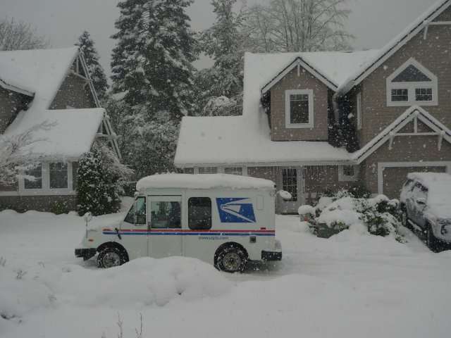
Four years ago today I was wrapping up an insanely snowy spell on Bainbridge Island.
 13 points
 -
11 points
-
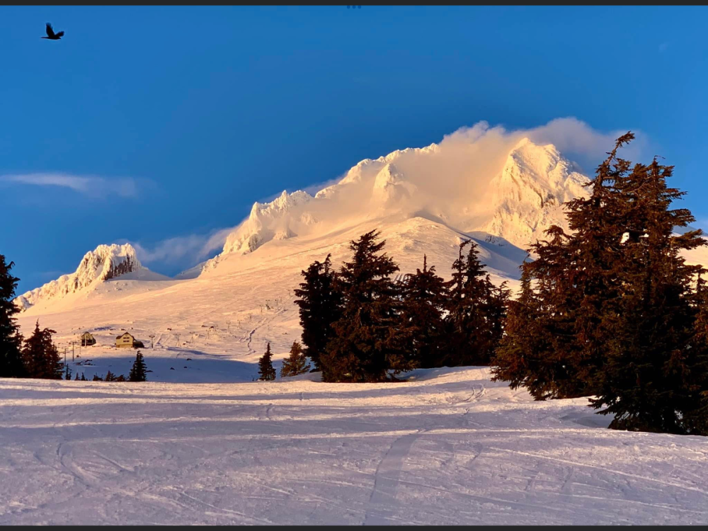
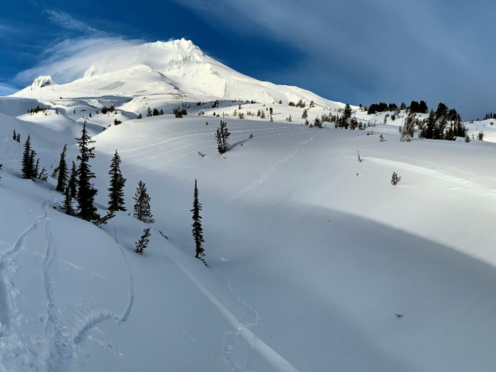
Mount Hood Friday evening….always love the rocky frozen Craig’s!
 10 points
 -
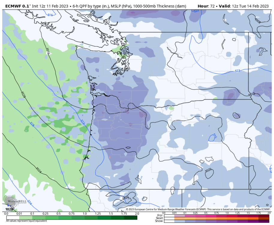
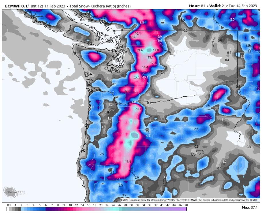
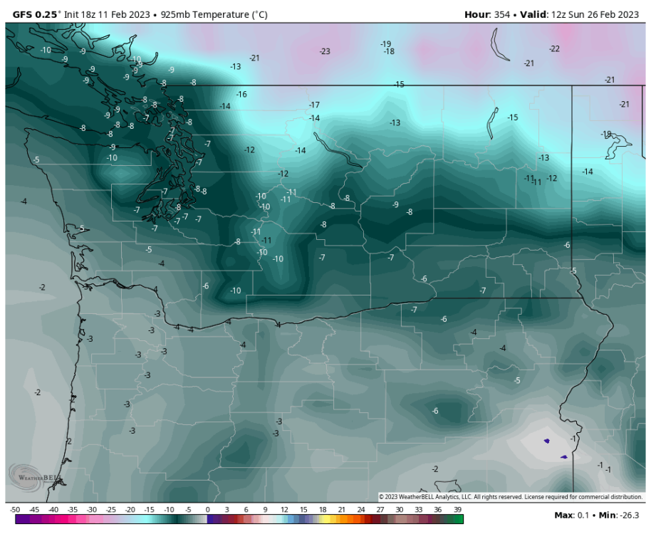
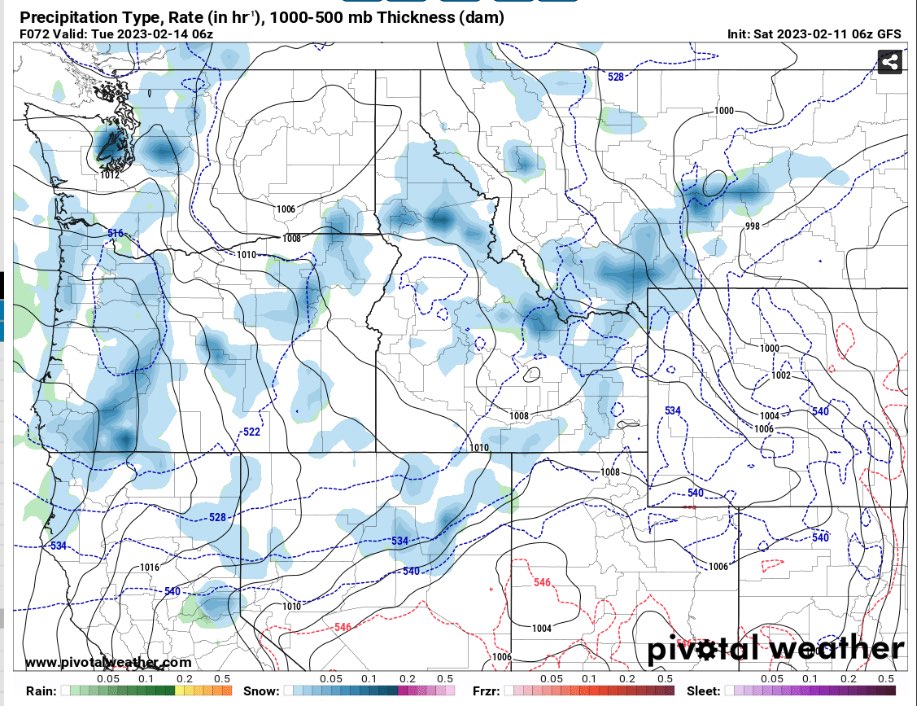
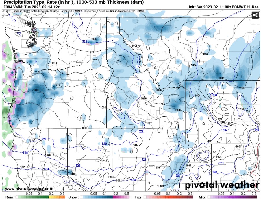
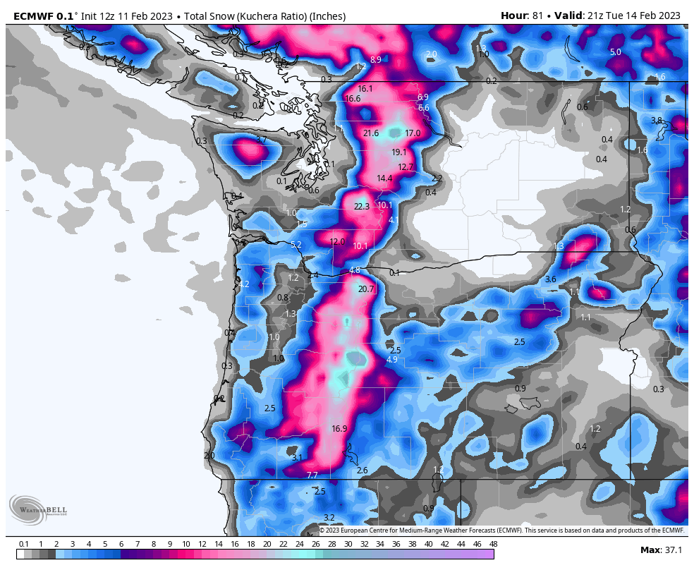
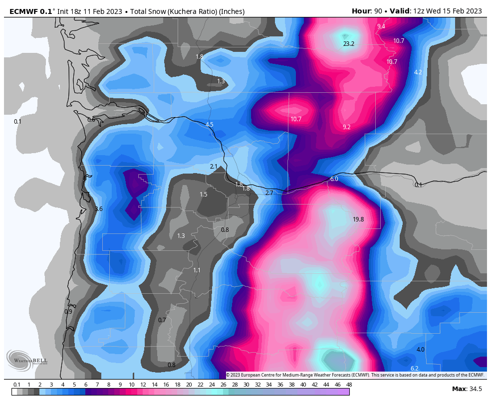
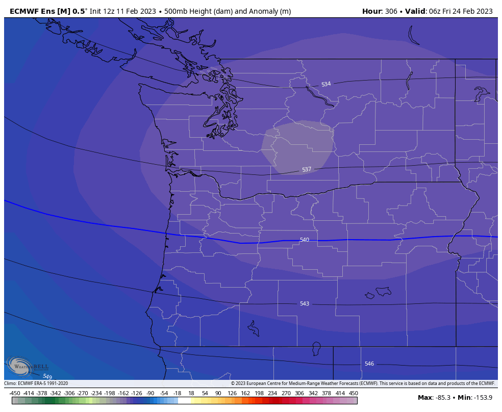
Euro looks good for the WV! Kinda skunks puget sound though
 10 points
 -
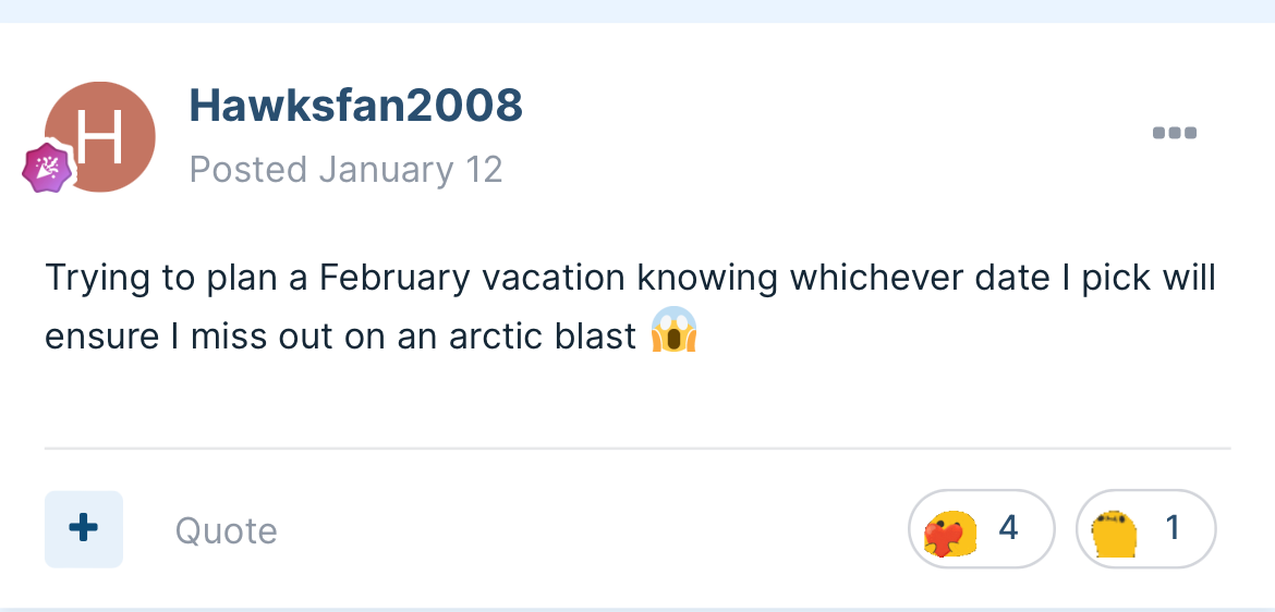
We chose the 19th-25th. The sacrifice has been made.
 8 points
 -
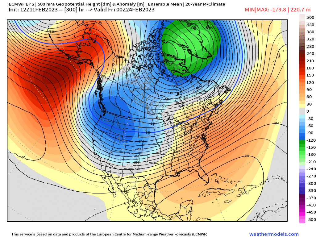
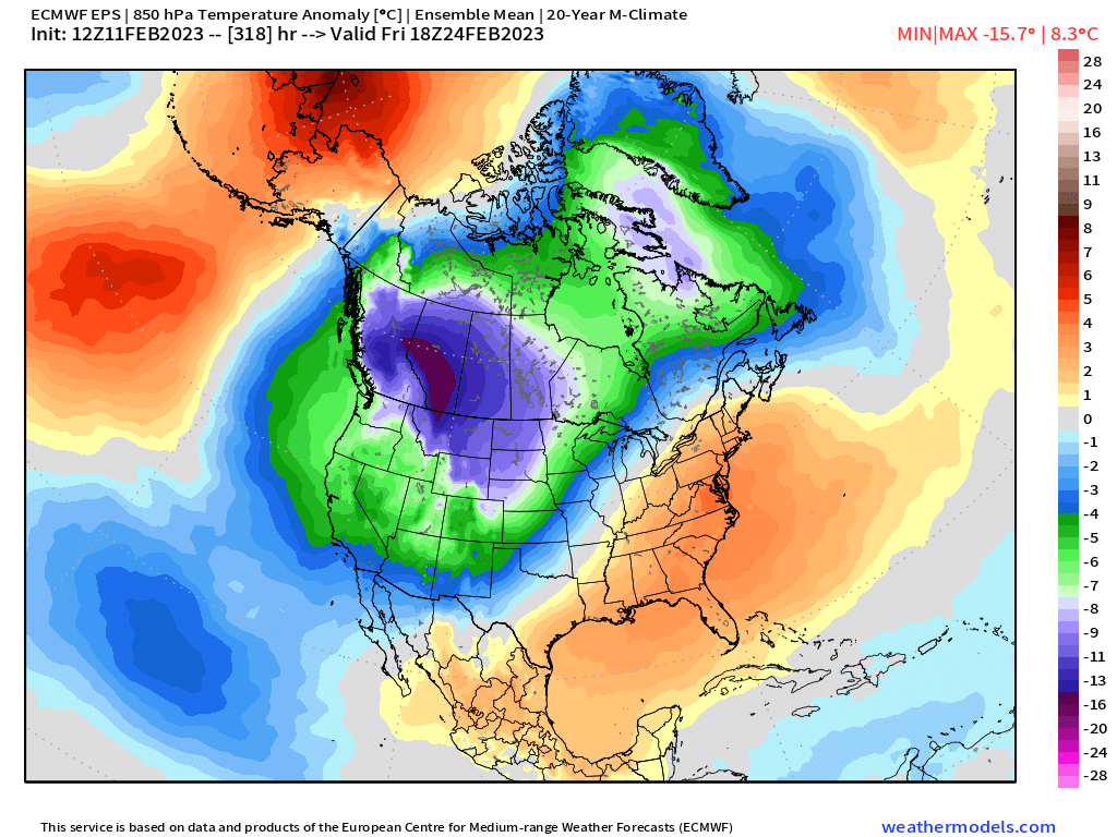
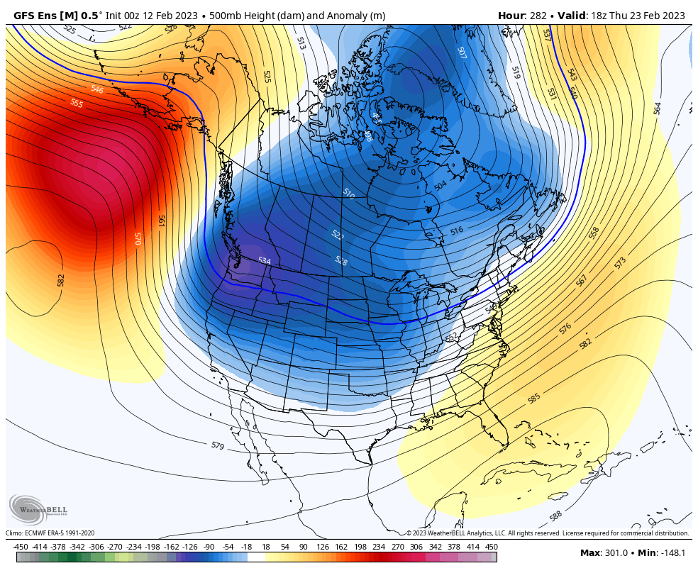
Lots of cold and snowy solutions on the EPS. No frigid blasts but I think (almost) everyone on here just wants some non marginal snow to finish the season. Long way to go. Lots can change. Lots will change. Lots lots lots lots8 points
-
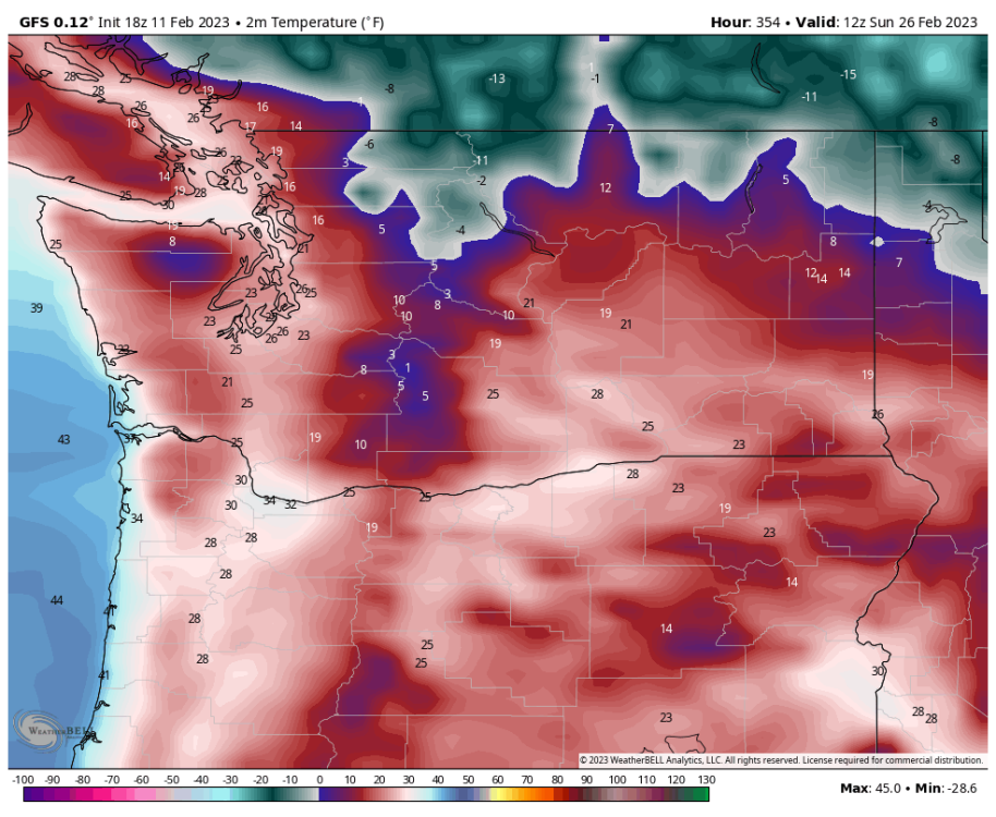
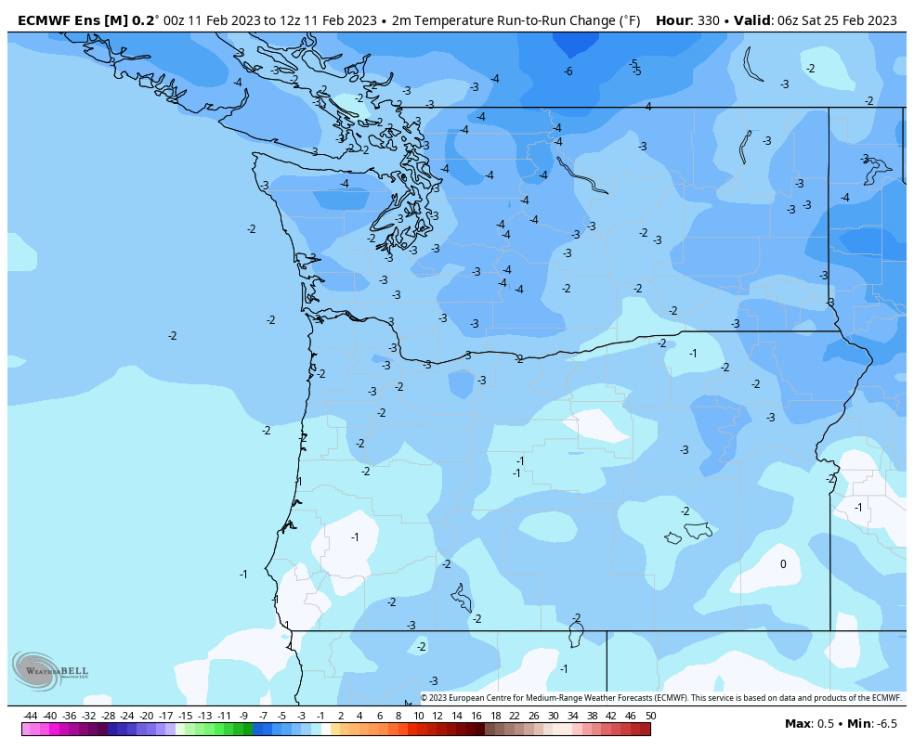
Correct me if I'm wrong, but timing is certainly moving ahead with the second much colder arctic trough digging south.7 points
-
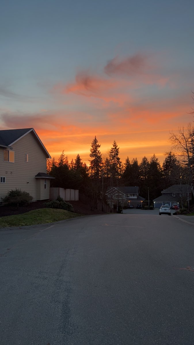
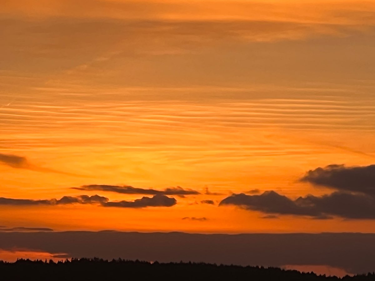
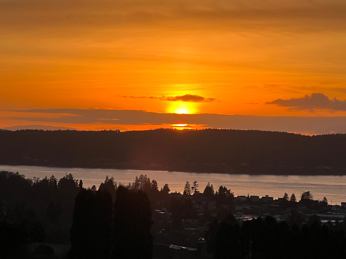
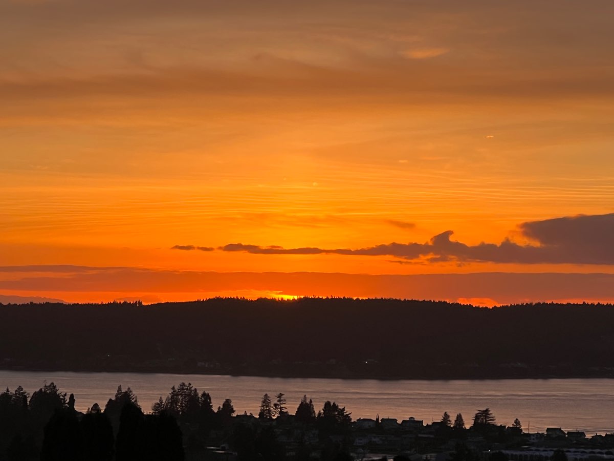
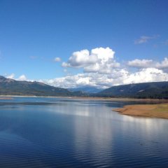
What a lovely sunset! Currently 44.2.
 7 points
 -
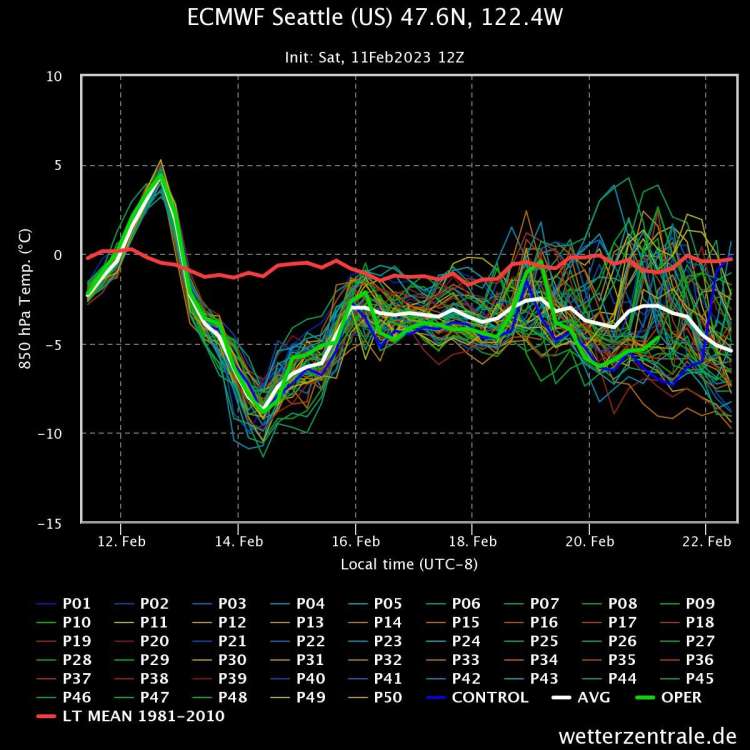
Bloody impressive! Figure probably half of the ensemble members are even colder.7 points
-
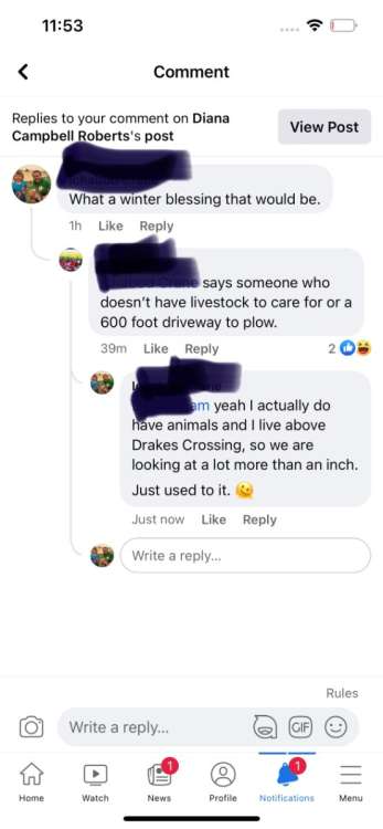
Talk of potential snow is getting contentious on Silverton Connections.
 7 points
 -
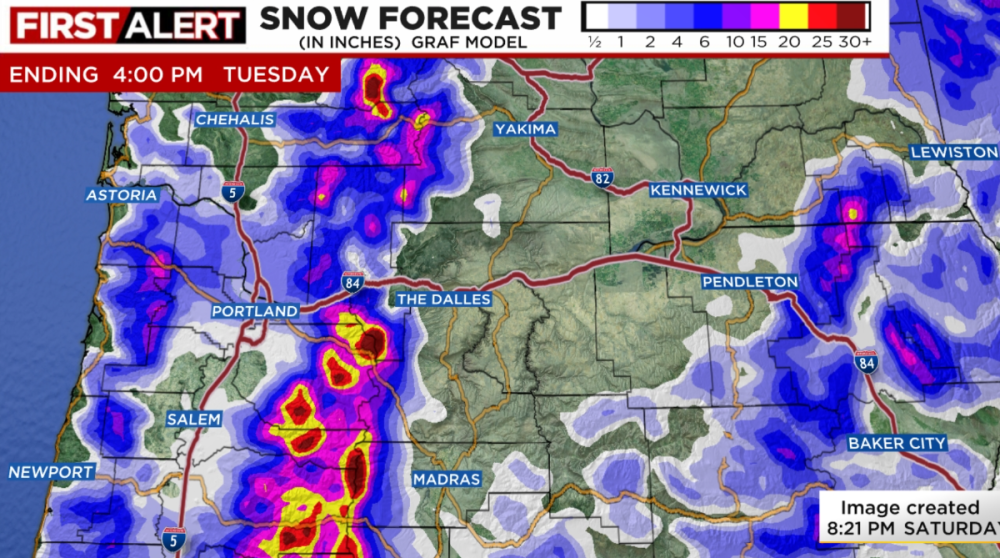
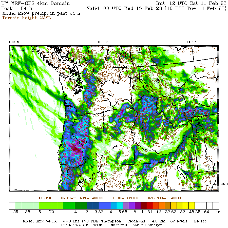
The WRF GFS looks pretty great

 7 points
 -
7 points
-
So you’re saying there’s a chance.7 points
-
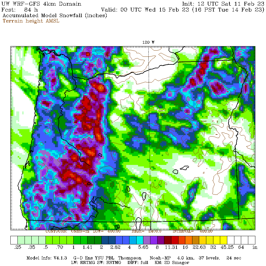
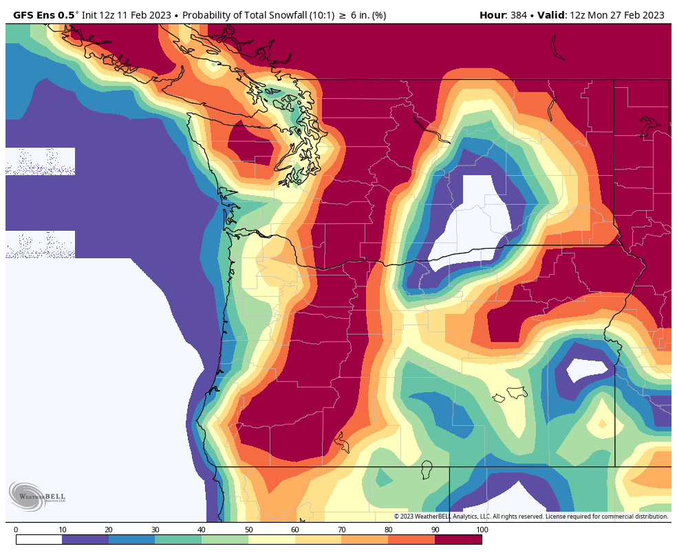
6z GEFS total snowfall7 points
-
6 points
-
Nice to see the models trending juicer and in favor of accumulating snow down to the lowest elevations down here. Would be pretty great if the Willamette valley could score a decent little event out of this. Still some time left over for the models to trend a bit wetter with that development. 00z GRAF came in at 2.4 inches for PDX.
 6 points
 -
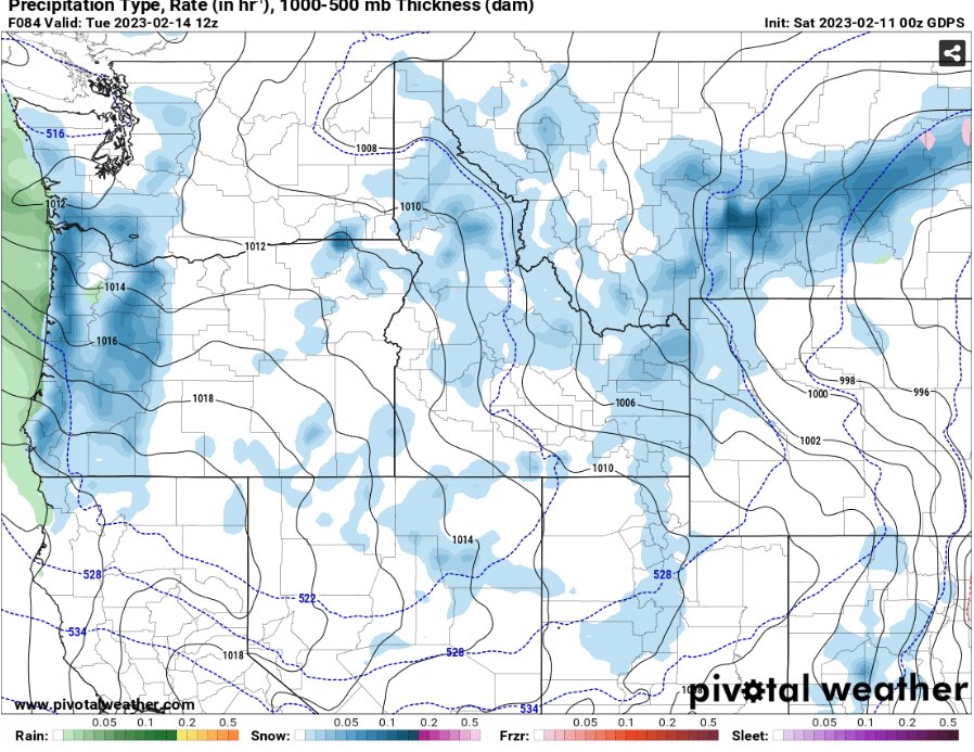
Why is there any green on this precip map at all


 6 points
 -
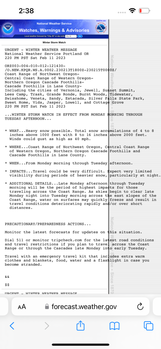
Winter storm watch posted!
 6 points
 -
We are barely in La Niña already. Will be neutral very soon.
 6 points
 -
I’d guess we start seeing more interesting euro runs tomorrow or Monday at the latest
 6 points
 -
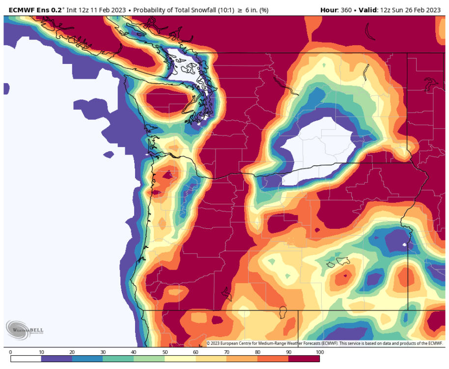
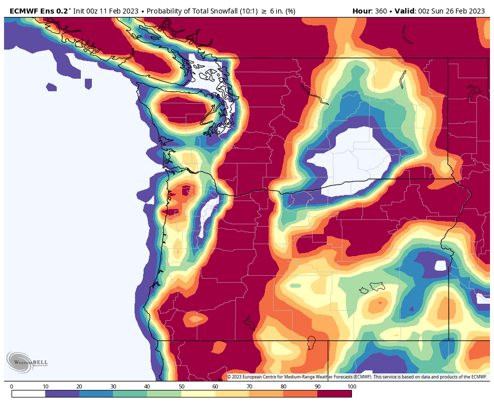
Chance of over six inches is now 10-20 percent. Chance much higher on GEFS.
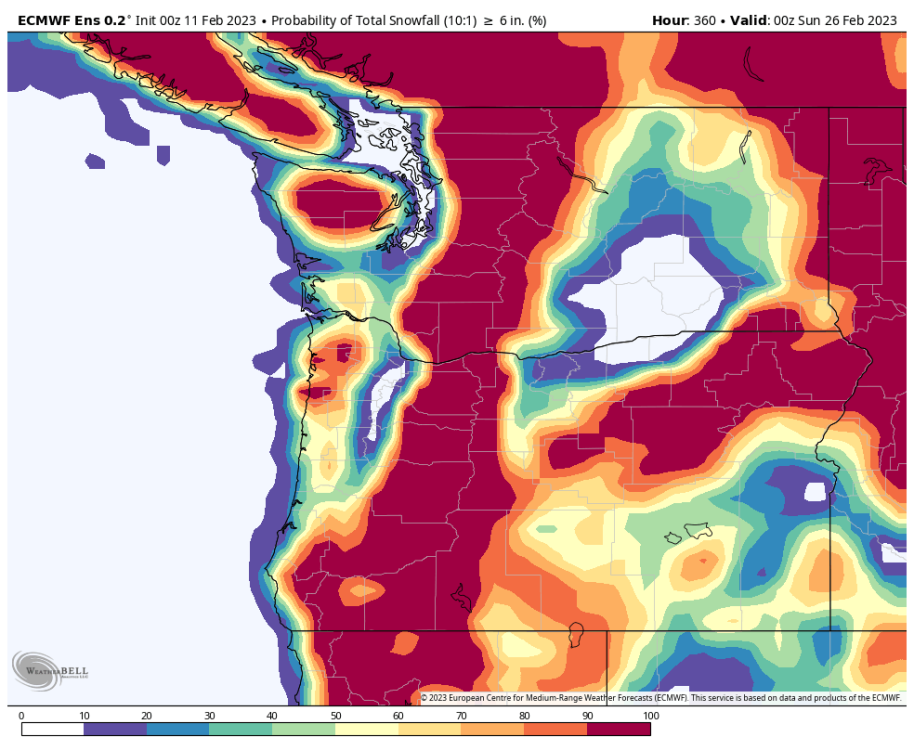
 6 points
 -
6 points
-
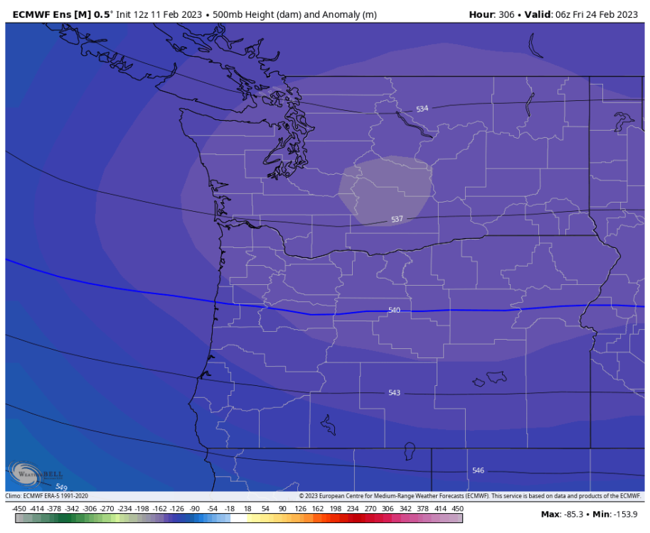
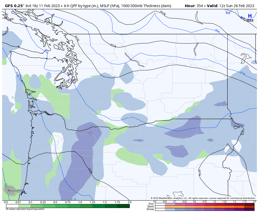
Doesn't get much better for a mean this far out in late February. That's the real deal.6 points
-
April 18, 2008Edit On April 18, 2008, a strong and very unseasonable snow-producing Puget Sound Convergence Zone storm formed around Everett, and spread south throughout the course of the afternoon and evening.[6] By evening, the Zone had spread into northern King County, dumping 3.5 inches (89 mm) of snow in Shoreline, and 6.5 inches (170 mm) of snow in Woodinville.[7] As the Zone slowly sank south of Shoreline into Seattle (past NE 145th Street), snow amounts began to taper off. The snow-producing part of the Zone ended abruptly at Roosevelt High School, a mere ten blocks north of the beginnings of the University District and the University of Washington community. Just north of Roosevelt High School, an inch of snow coated the ground, and due west of the school in the Green Lakeneighborhood of Seattle, an inch of snow had also fallen. In line with the known "abrupt edge" of the Puget Sound Convergence Zone, areas to the south of this Green Lake-to-Roosevelt High line (marked by NE 68th Street), including the U-District, witnessed only a dusting of snow.6 points
-
Let’s reel in the pessimism. I’ve had snow in April before in western Washington.
 6 points
 -
Andrew (me) tried to warn you.6 points
-
I really hope you guys down there can get a decent event out of this. There really hasn’t been a good event for the WV this winter. It feels like that one is kinda sneaking up on you guys.6 points
-
Probably better for the South Valley but I'm l liking what the GFS has started to show. The AFD is pretty interesting But, if this low does materialize and move across the coast range as some models are showing, areas near the low and just to its north could find themselves in the sweet spot for enhanced snow, even at low elevations.6 points
-
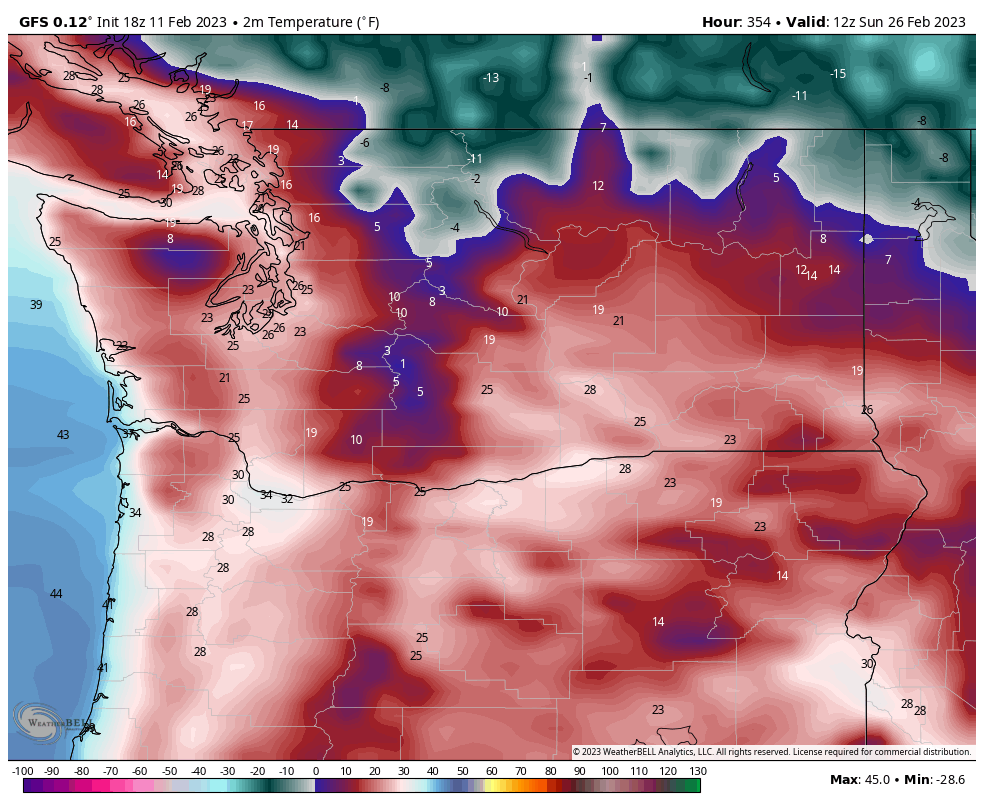
Based on the models…wouldn’t be too surprised to see some lowland snow Monday/Tuesday in some places.
 6 points
 -
Made it down to 31. Nice and frosty too. Wishing you all a great day!6 points
-
Because of how much we have been burned!5 points
-
I know over the past 10 years we've scored in February quite often, but can y'all believe this? Can you? CAN YOU? C'MON!!!! I am seriously hyper jacked and pumped up right now!5 points
-
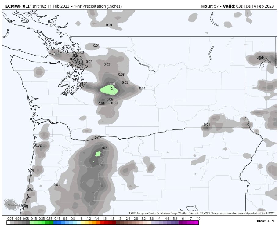
1 AM Tuesday looks pretty fun on the 18z Euro. Should be particularly great in the Coast range and Cascade foothills especially over 1000ft.
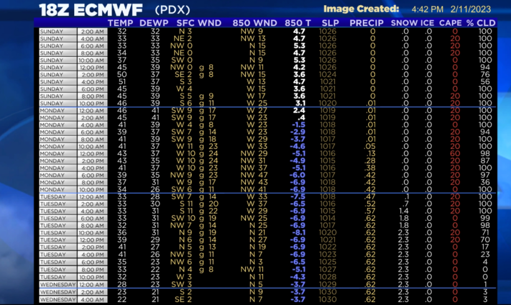 5 points
 -
ECMWF shows a double c-zone on Monday evening
 5 points
 -
18z was a nice run, that is for sure.5 points
-
EPS control is sure on board!5 points
-
PDX and downtown Portland last year had 2" of snow in April. Both sites are less than 100ft ASL as well. If that can happen then we can probably get a good event in this time frame. Just 4 years ago Eugene had 15-20" of snow in late February.5 points
-
Would be neat to see some sticking V-Day snow. It’s been a good holiday for snow lately. In 2021 we had 10” or so on the ground, and we picked up a slushy half inch or so the morning of 2/14/18, heading into that cold pattern.5 points
-
New CFS. Hopefully a sign of a good EPS?
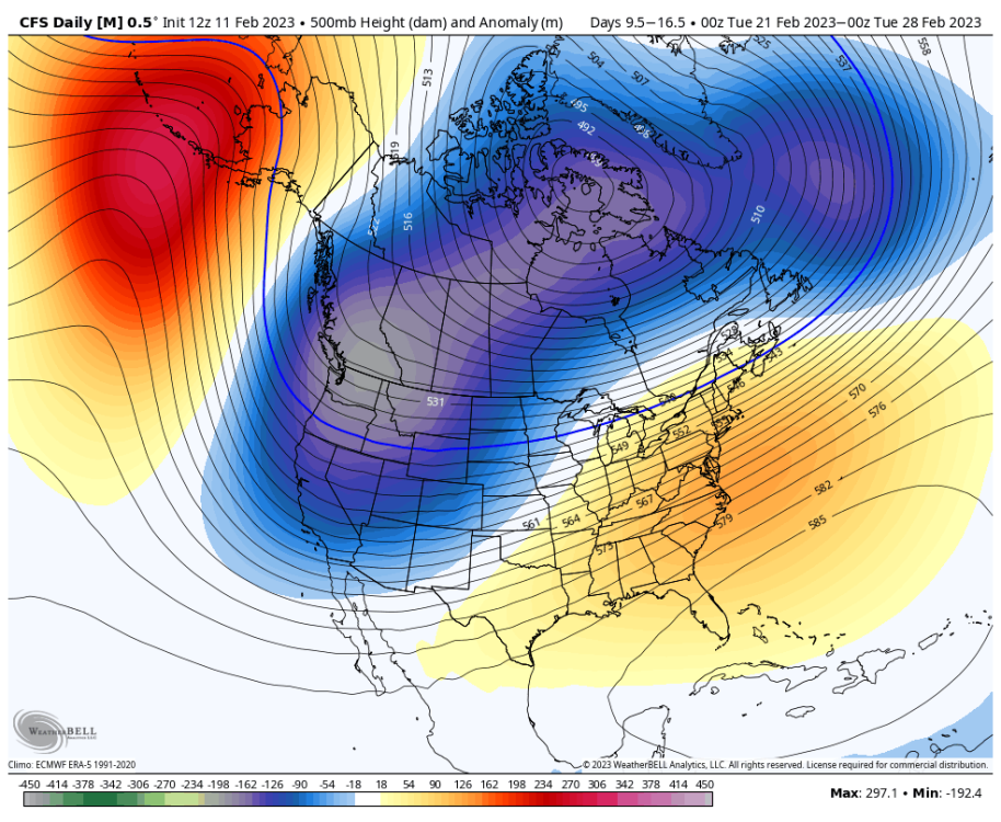 5 points
 -
5 points
-
For what it's worth the NAM shows it too.5 points
-
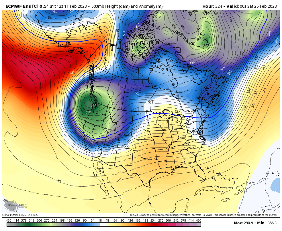
Hopefully we look like this in 2 weeks.5 points


This leaderboard is set to Vancouver/GMT-07:00