
Leaderboard


Popular Content
Showing content with the highest reputation on 01/28/17 in all areas
-
WOW!!!! Tom Skilling added 3 new photos.18 hrs · Here are some phenomenal CoCoRahs total snow tallies from a series of Colorado locations: Crested Butte, CO 81" Pagosa Springs, CO 66.5" Manios, CO 66" Pitkin, CO 53" Silverture, CO 45.2" Steamboat Springs, CO 41.5" Granby, CO 30"

 4 points
 -
Looks like the refugee ban was just put on pause by the ACLU and a federal judge.2 points
-
Jim was looking at alternative facts.2 points
-
George Soros was born in 1930...he was 14 when the Holocaust ended.2 points
-
Would be nice if he northern and southern stream would throw some mike tyson's at each other. This little cat fight bullshit is annoying.2 points
-
This last minute change to a colder outcome may have much to do with the current MJO wave. Never underestimate how much of a player that is when it's up and running.2 points
-
Build that snow pack up north snowmobile trip coming up!2 points
-
06z GFS....looking better for MI posters...even WI2 points
-
It took a lot of time to dig up data (two of my biggest hobbies are mountain and weather), but I revised and expanded the Fact Sheet Interesting Weather Statistics for US Mountain Summits: http://www.summitpost.org/interesting-weather-statistics-for-us-mountain-summits/171585 Added were a Mt Spokane in eastern Washington; Mount Fanny in the Blue Mountains of Oregon; White Mountain Peak in the White Mountains of California; Mount Baldy in the Wasatch Range in Utah; Blowhard Mountain in southwest Utah, not far from Zion National Park; Berthoud and Fremont passes as well as Mount Evans, all in Colorado; Grandfather Mountain and Mount La Conte in the Southern Appalachians; Haleakala on Maui in Hawaii; and Mount Locke in Texas. Also, since it came up on another thread, I was able to do some digging on the Mount Rainier data. Apparently there have actually been several studies on the summit climate of Mount Rainier, dating back to at least 1960. Some studies used actually data and some interpolations. The latest study just ended in 2016 and the page has a link to it. I hope that you find it interesting.1 point
-
The 0z ECMWF goes a little further south with the cold air at the start of the week but is much more aggressive with the low by Thursday. At face value this would be better for an overrunning snow than the previous run or what the GFS shows, and then there's this: http://www.tropicaltidbits.com/analysis/models/ecmwf/2017012900/ecmwf_z500a_nhem_9.png1 point
-
Euro looks nice, just need a little more moisture midweek.1 point
-
Everyone gave up on winter.1 point
-
Wow, this place is busy.1 point
-
The 0z GFS has trended slightly further north again after the 18z; not a bad trend for the Puget Sound/SW BC if it keeps up. Still good enough for a brief transitional snow. The ECMWF, unlike the GFS, has been relatively consistent and I wouldn't be surprised if the GFS trended more toward the ECMWF solution. Tonight's ECMWF will be interesting.1 point
-
Can definitely agree there.1 point
-
Ya for sure. No matter what some of this could of been avoided at least partially if there was a plan for that in place1 point
-
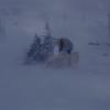
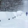
Crazy pics. Simply insane amounts of snow.1 point
-
Nancy Pelosi?1 point
-
The d*ckless wonder won't like this.1 point
-
Just because it's common knowledge, doesn't mean that more casual users(majority, and including me for the most part) of the forum understand things more complicated than indices like PDO, NAO, ENSO and the blend of models NWS offices use to forecast mid-range.1 point
-
I can buy your thinking. This could of been way better thought out. This puts a larger target on our country while further dividing it1 point
-
1 point
-
Fairly seasonal 44/31 here today. Overall on the month, Shawnigan is at 33.4 and Victoria is 36.1. Looks like most if not all stations around here will end January warmer than December. Still solidly below average for the winter to date.1 point
-
He can't respond to that honestly. Also before someone else says or agrees that they won't wait 2 years to commit these attacks, the post above clearly disproves that.1 point
-
Wrong, it was super cold but now it is warming up big time due to strong westerlies. For N.A., the flow is northerly and it has filled up with Siberian airmass.1 point
-
Yea further north and stronger will likely be better for us. The good GFS runs have been the ones where the modified arctic boundary has been able to tap into the moisture associated with the offshore low. If that low dies offshore it seems likely that the air mass will moderate by the time we have another precip chance.1 point
-
Negative reaction is one thing. I'm very concerned about Trump's insecurities and tendency to act on impulse, not to mention his many blatantly racist/sexist statements (whether they be intentional or not). However, deliberate misrepresentation(s) for the sole purpose of generating headlines is something that needs to be avoided because, as Jesse noted, it creates and/or worsens the very divisions that allow people like Trump to rise to power. It's also a self-amplifying process, in that people become emotionally invested at the expense of logical reasoning, which not only increases the desire for media propaganda, but pushes people towards radical, destructive political leaders who thrive on the anger and fear generated by this propaganda. It's dangerous.1 point
-
I actually hope the low trends weaker and dies over the ocean on future runs. Not out of the question. That would allow a stronger intrusion of cold and might give us a snow chance a bit later on.1 point
-
http://www.wpc.ncep.noaa.gov/lowtracks/lowtrack_ensembles.gif Imagine that! A strengthening storm in the GL's1 point
-
Currently light snow and temp is @ 28F. Everything is white. Looks more of a dusting and approaching half an inch. Man, its been awhile since I saw the white stuff and it sure looks great seeing it OTG and also falling from the sky.1 point
-
Your looking good for advisory snows.... 18z GFS...1 point
-
Most of the early/mid Holocene from 13,000 to 9,000 +/- 1000 years before present, and 7000 to 3500 +/- 500 years before present, was dominated by the +ENSO long term mode. The long term -ENSO mode dominated from 9000-7000 +/- 1000 years ago, and starting around 3500 +/- 500 years ago, the long term ENSO state began to decline again, and high frequency amplitude began to increase. There was a prolific +ENSO stretch about 1000yrs ago, however long term we're now headed down, and that increase 1000urs ago appears to be a mark of the increasing instability since then. This is a great paper: http://adsabs.harvard.edu/abs/1999GMS...112..373C The long term +ENSO mode tends to be more stable and feature a reduction in high frequency (yearly/decadal/centennial) variability, while the long term -ENSO mode tends to be more unstable and feature increased high frequency variability. The more stable, +ENSO mode tends to precede the termination of ice ages and rapid warnings into stable interglacial states, while the unstable -ENSO mode tends to precede the termination of interglacials and marks the initiation of glacial states.1 point
-
How about President P*ssy Grabber, Fake President, Delusional Fool, etc?1 point
-
Civil War? I agree that the media is largely to blame for the plight we are on. And leaders like Trump feed off of the extreme division like parasites.1 point
-
Still plenty of snowcover in The Dallas and Selah Creek which is just north of Yakima. http://images.wsdot.wa.gov/airports/Dalles.jpg http://images.wsdot.wa.gov/sc/082VC02240.jpg1 point
-
I am liking my snow chances. Looks like January might end up adding some snow in the snow gauge before leaving. So far, 4.8" for the month of January, so maybe topping off at near normal levels or even above. We will see. All depends how much snow I receive.1 point
-
Models will always struggle during a PV degradation because they often underestimate and/or misinterpret how it affects the tropical convection and subsequent waveguide. The model swings will only increase in amplitude over the coming week, in my opinion.1 point
-
Where's is Tim and his snowfall maps that's the only thing that I will appreciate front him on this forum?1 point
-
Is this a humidity-related post?1 point
-
Oregon could use some snow.1 point
-
1 point
-
12z looks farther south with the cold air.1 point
-
A little more juice on the 12z GFS run...might even be some warning snows up near GRB/DTX...1 point
-
Did donnie just flip a coin when deciding which countries to ban immigration from? Saudi arabia and turkey off the list? probably business related.1 point
-
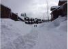
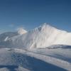
CA Sierra mountains have nicknamed this month "Januburied"...after seeing these pics, no questions as to why...who wants to go??? These houses are completely covered to their roofs with snow... Kirkwood Mountain Ski Resort...1 point
-
Wow this place sure died. Euro sounded better but I guess not good enough?1 point
-
1 point
-
Very windy today. It made a big mess in my backyard. Good thing the hills are still moistured from the recent storms.1 point
-
00z GFS came in a touch south and looks like Snowshoe/Money and north side of DTX get hit...1 point
-
12z GFS looking better for N WI/MI posters...strong 990mb clipper swings through...1 point


This leaderboard is set to Vancouver/GMT-07:00