
Leaderboard


.thumb.jpeg.e3014abf99ef08a9f9ac2c0cd31b485b.jpeg)
Popular Content
Showing content with the highest reputation on 02/09/17 in all areas
-
Simply stunning images from Whatcom Co, Scott Sistek did a great write up and lots of images! http://static-11.sinclairstoryline.com/resources/media/0c452cba-5623-431c-a829-6dd9a2288076-large16x9_lynden_snow.jpg?148660490536411 points
-
Meanwhile in Sumas....this picture was taken this morning and is circling FB and Twitter. (credit to Sumas PD)
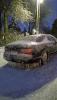 7 points
 -
Back edge of that line and the drainage of water down by street
 4 points
 -
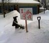
I wish that was my driveway and my legs sticking out of the snow!
 3 points
 -
Plain old 32F rain now, I see a few icicles forming off the side of the house. It was a pretty crazy day though, almost non-stop snow morning-to-evening with some very heavy snow later on. It looks like about 6" in total for the day, so with the 7" that fell on Monday and 1.5" last Friday, the first week of February has more than tripled my snow total this winter. I think it's safe to say Victoria has exited the "screw zone". Could be another 5 years before this city sees an event like this again with good transitions going into and coming out of the cold (hopefully not). I took some pictures on my way home today: http://i131.photobucket.com/albums/p286/jemeric/IMG_4083_zps6zhraymw.jpg http://i131.photobucket.com/albums/p286/jemeric/IMG_4087_zpsug3wvpcq.jpg http://i131.photobucket.com/albums/p286/jemeric/IMG_4089_zpsqidaildi.jpg http://i131.photobucket.com/albums/p286/jemeric/IMG_4109_zpsq0ituwxp.jpg http://i131.photobucket.com/albums/p286/jemeric/IMG_4111_zpsilovb3ne.jpg http://i131.photobucket.com/albums/p286/jemeric/IMG_4112_zpsfiwxz8ia.jpg http://i131.photobucket.com/albums/p286/jemeric/IMG_4115_zpsmp79kogg.jpg3 points
-
If you factor in that a significant proportion of staff, faculty and students commute from points north of the Smith Rd. and that those points this morning were a solid sheet of ice and impassible, it was probably in the interest of safety that those classes were cancelled. We did not make it above freezing until about 2pm.2 points
-
Still 34F here with a north wind, the cold rain took some of the snow out of the trees and compacted the snow but otherwise didn't seem to cause a lot of melt. It's pretty drippy out there right now, but hard to imagine we'll hit the forecast high of 50F if we're still under north winds by noon. The first 8 days of February are running 6.6F below average at YYJ. http://i131.photobucket.com/albums/p286/jemeric/IMG_4154_zpsmt2hkusl.jpg2 points
-
Ensembles picking up on a better pattern near the Lakes/Midwest heading into next week. Would not be surprised to see a decent clipper or possibly even have a storm to track. The one showing up around Valentines Day or just after may be close enough for you to get something. Amazing similarities to the storm back on Dec 17th-18th. Here was the 500mb pattern... http://vortex.plymouth.edu/gifs/170209151328.gif 00z Euro...starting to trend that way http://www.tropicaltidbits.com/analysis/models/ecmwf/2017020900/ecmwf_z500a_us_7.png2 points
-
Impressive snow drift. https://m.facebook.com/story.php?story_fbid=1819584144965413&id=14169152318989752 points
-
I'm sure you'll get to see plenty of that over the next few years. I lived in the zone area for quite a few years and it can be fun sometimes. One of my favorites was in early January 1989...most places only had a little bit of snow during that time frame, but I got several in chances. When combined with what came later in the winter 1988-89 is still in my top 3 all time favorites. We need to see some WNW or NW flow action for it to really fire up. I have a feeling the lack of such activity is largely responsible for the normally snowy zone from north Snohomish County through Skagit County being screwed so hard the past several years.1 point
-
It's very interesting how the situations that really favor snow in WA normally involve the southern half of Idaho and Utah torching. Usually when the cold is restricted to the northern tier is when we get nailed. Worked out again this time.1 point
-
51 degrees today. Warmest reading since December 5th.1 point
-
Very impressive. Even without a true top tier blast your area pulled off some impressive cold. Let's hope this is the beginning of better times for us.1 point
-
Today was a perfect example of why i am moving in 5 years.1 point
-
Very windy, shaking house!1 point
-
Clear and really beautiful out here right now with the moon shining, temp falling down into the low 40s1 point
-
I think they closed once in November 2006 and once in January 1991. Two in 26 years.1 point
-
Yeah I'm fully expecting to start hearing frogs over the next night or two as well...tis the season!1 point
-
Been around 60 degrees here most of the day. Feels warmer than that. I just heard the first frog of the year. Ribbit!1 point
-
1 point
-
Not really, snow blower won't work with anything less1 point
-
easy Tom, I'm not blaming you. You always show us the maps and so forth that back your thoughts, it just hasn't worked out well this year and it's been that way since last fall when the winter discussion was started. I know not EVERYONE is going to get nailed, but it was said it looks like February could deliver to a large portion of us and now the pattern isn't looking favorable until the last week of the month. It's just the way it's been this year.1 point
-
Could be one of the wettest Februaries on record for parts of the Willamette valley.1 point
-
1 point
-
When you get a good temp gage.1 point
-
Jim Cantore has an awesome job...watching him on TWC getting pounded with Blizzard conditions...just #Awesomeness....currently having Blizzard withdrawals!1 point
-
That one is interesting because it takes the clipper energy and gulf energy and phases in the east. Could be an interesting system for the eastern Lakes.1 point
-
Double LOL and another chance at a big one next thrusday1 point
-
Just talked to my neibor and they got another ten inches lastnight and said the gate to my cabin is covered and that is 36 inches tall. Can't wait to go there tomorrow.1 point
-
LOL at the 974 bomb over the east coast on monday1 point
-
I agree my man...didn't think the torch of January would be so darn strong. The AO never played ball, but it is now, as well as the NAO so there is still a lot of winter left on the table. Heck, you many even see something deep down south if the cold overwhelms the pattern heading into March.1 point
-
Huge gust just ripped through here. Caused the window glass to pulsate back and forth.1 point
-
:lol: Tbh, when I first saw the Winterstorm Names in late Autumn, I said to myself, I wonder if "Winterstorm Niko" will affect the midwest or the EC and sure enough, it clobbered them.1 point
-
Ice started with the 9pm wave. I got up again at 4 and it was still icing. Where we are at between goodwin and hwy 9, maybe 1/2" but it is much heavier to the N and W of us, they are still hanging on to freezing temps. We are at 33 so are starting the melt. I think the outflow is finished though.1 point
-
That's the problem...there is soo much blocking developing that the individual op runs will have no clue how to handle it. Follow ensembles and I'm also using the LRC as a tool. It's going to get active around Feb 20th with larger systems.1 point
-
hopefully we can get something in late feb1 point
-
yea my parents got some thundersnow and are at over a foot in about 4 hours where they are. my dad is state patrol and he said its a mess1 point
-
Much rain. So flood. Very puddle. Wow.1 point
-
How does the saying go..."It ain't ova, till Mother Nature says its ova"....JMA Weeklies came in today and they are backing up the idea Feb 20th and on Winter is not letting go easy.1 point
-
We've had 4 separate ice storms in Portland this winter. That's the most in a long time here, maybe since 1978-79.1 point
-
I've really enjoyed your updates over the past week! Feels like this event has lasted forever, and it was just kicking off last friday.1 point
-
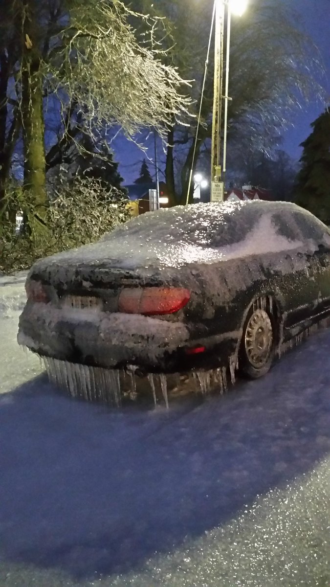
Freezing rain for at least 3 hours now. Heavy most of the time. Blowing sideways with the NE outflow still winning out. I keep staring out the window at my car parked along the street, wondering if I'll be able to open the doors in the morning, or if they'll be frozen shut. Kind of surprised the lights haven't flickered yet with the wind still blowing and a coat of ice on all surfaces, including tree branches and power lines. The drifting between Lynden and Sumas today was relentless, but with all the snow now coated with a layer of ice, I don't imagine we'll see much of that tomorrow.1 point
-
I'm not sure yet. Some of the predictive methodologies might also be erroneous in mistaking correlation with linear causation. I'm thinking Dalton type minimum now, but could be wrong.1 point
-
Oh dear, might have to ban your self for that language outside of the OT ! I feel for ya Fred. Right now I'd I'd sacrifice a newt on the altar of weather for freakin' rain !1 point
-
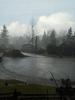
This is from earlier in the week near the Ryder Lake community in Chilliwack.
 1 point
 -
This sure has been a whacky winter 70s the past two days to snow tommore then back to warm.I still think the mid to late febuary period offers the best opportunity for this winter.as I stated earlier it makes you wonder if this is the calm before the storm the over all warm background the last few years.it going to make it I think the next few solar cycles even more interesting to follow to see if we do end up having a very sharp strong cooling trend and interesting to both sides of the thoreys and debate at hand1 point
-
Hoping for the Christmas Day Blizzard to cycle through around the 20th to deliver for our sub forum.1 point


This leaderboard is set to Vancouver/GMT-07:00