
Leaderboard
.thumb.jpeg.e3014abf99ef08a9f9ac2c0cd31b485b.jpeg)


Popular Content
Showing content with the highest reputation on 02/14/24 in all areas
-
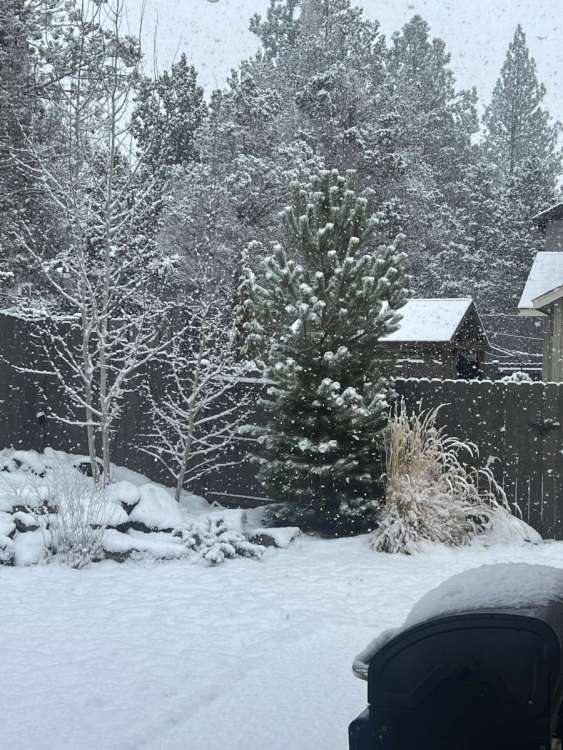
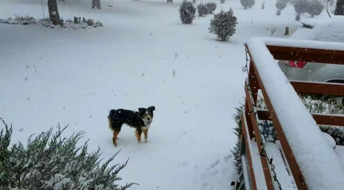
About 1.5” here in Bend. Very heavy snow with huge flakes right now.
 12 points
 -
Up to almost 3", currently 28 degrees.
 12 points
 -
100% snow now, right on schedule! Time to get just a tad colder and make tomorrows commute difficult!!11 points
-
Holy fukk it just started snowing here, light dry snowing falling and blowing around at 39 freaking degrees. I've always said never underestimate offshore dry flow. I was started to loose confidence but I never ever thought it would start as snow here I figured we'd have some rain at first. This is going to be a big event here tonight.11 points
-
Mostly snow in a rain/snow mix in South Hill11 points
-
Liquid snowstorm is almost here.
 11 points
 -
Moderate snow. BOOM!!10 points
-
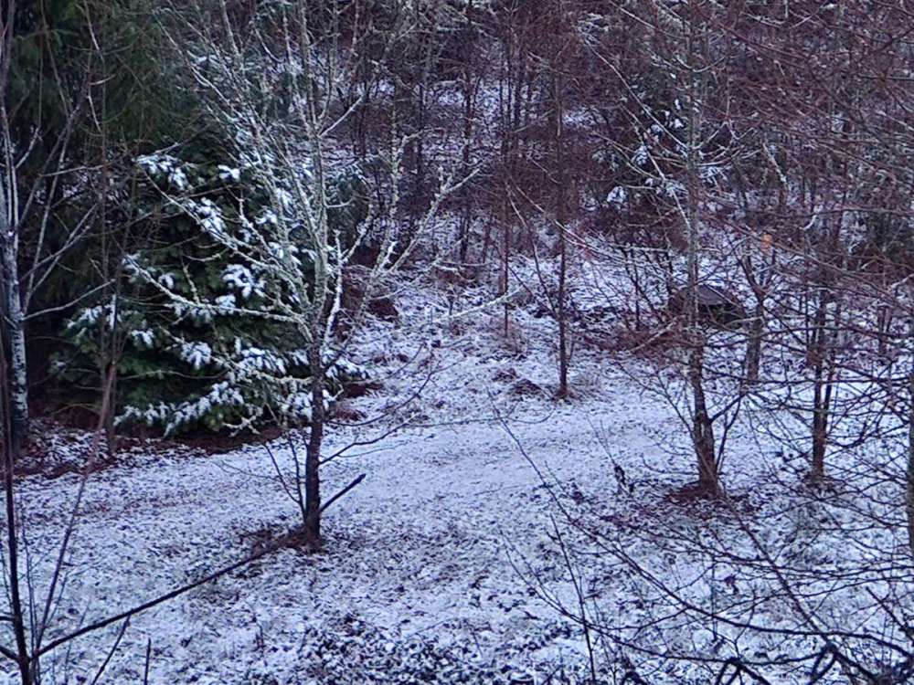
25 degrees, got 4.5 inches today. Precip should be done for a while but we might get occasional light stuff.
.thumb.jpg.0329c4a67c273545eca0db16848dc831.jpg) 10 points
10 points -
What fun is that? It's actually a lot better too BTW.10 points
-
Have to post just because there's pepto.
 10 points
 -
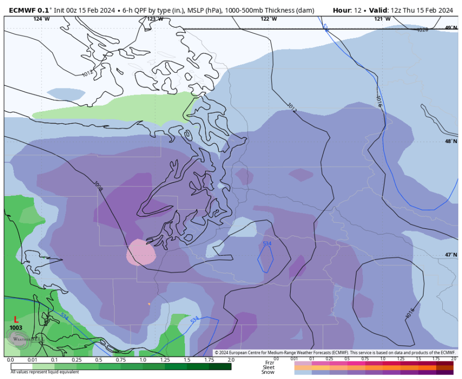
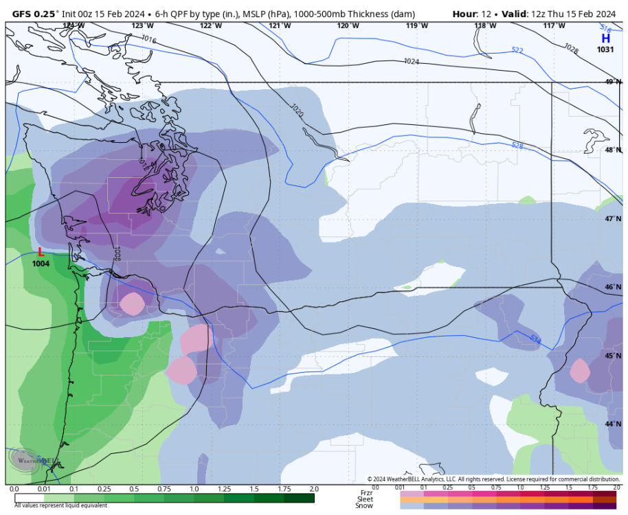
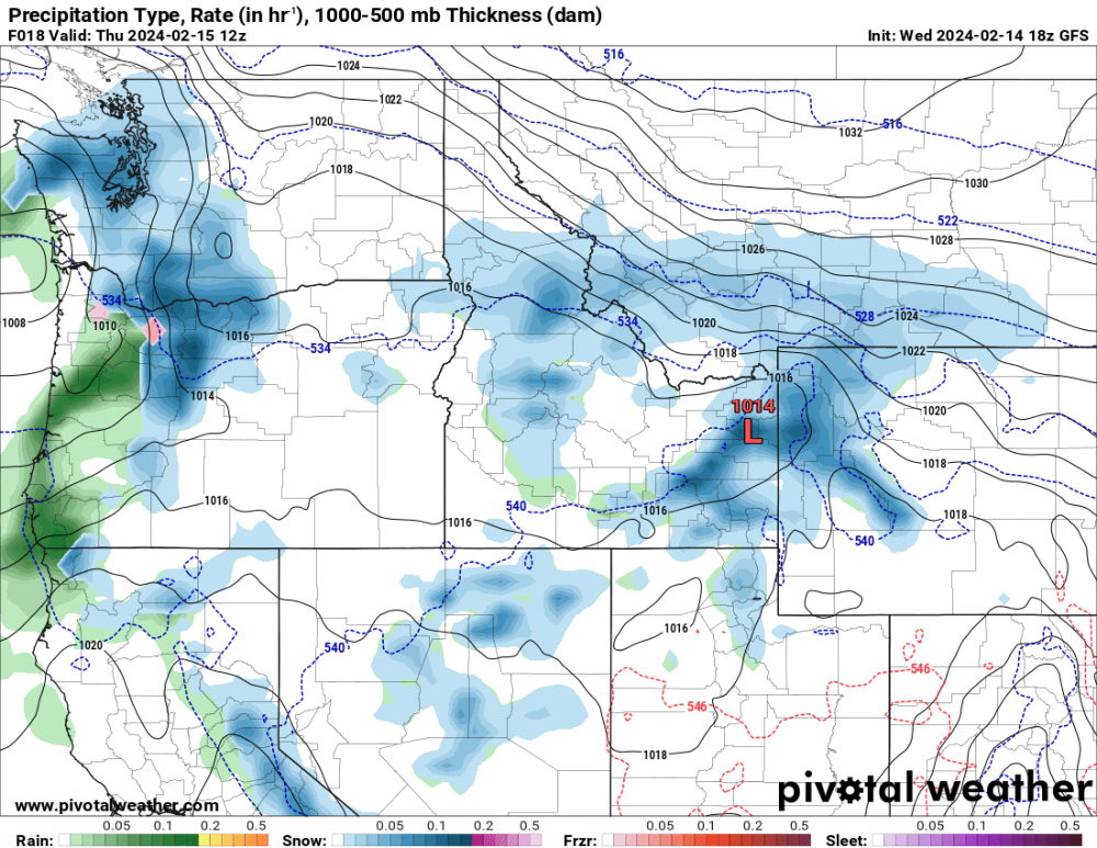
12z NAM was the snowiest run yet for Seattle. Kuchera map.
.thumb.png.362231006235fadec7979603862980d3.png) 10 points
10 points -
And euro goes towards faster precip rates on this run.
 9 points
 -
I was out hiking Poo Poo Point trail earlier in that area. Winds were blowing up on top! Sad news though
 9 points
 -
Tacoma narrows reporting snow now.9 points
-
About a 1/2” of slushy snow here9 points
-
Changed over to snow pretty low in the eastern Coast Range.
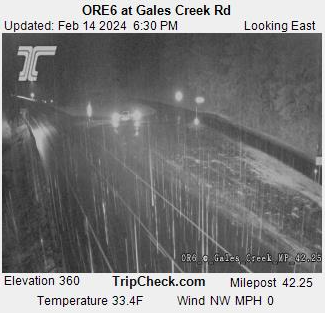 9 points
 -
18z euro coming in a notch snowier9 points
-
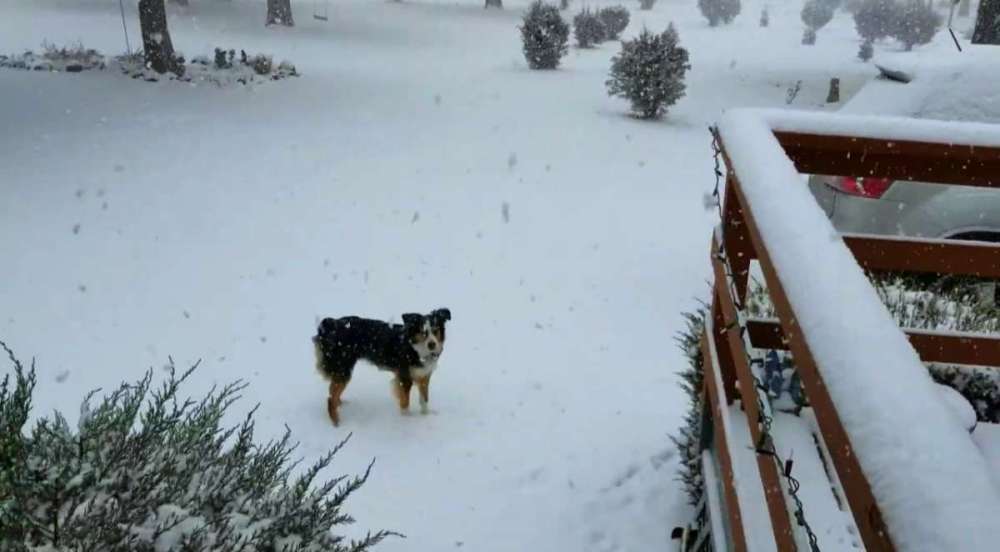
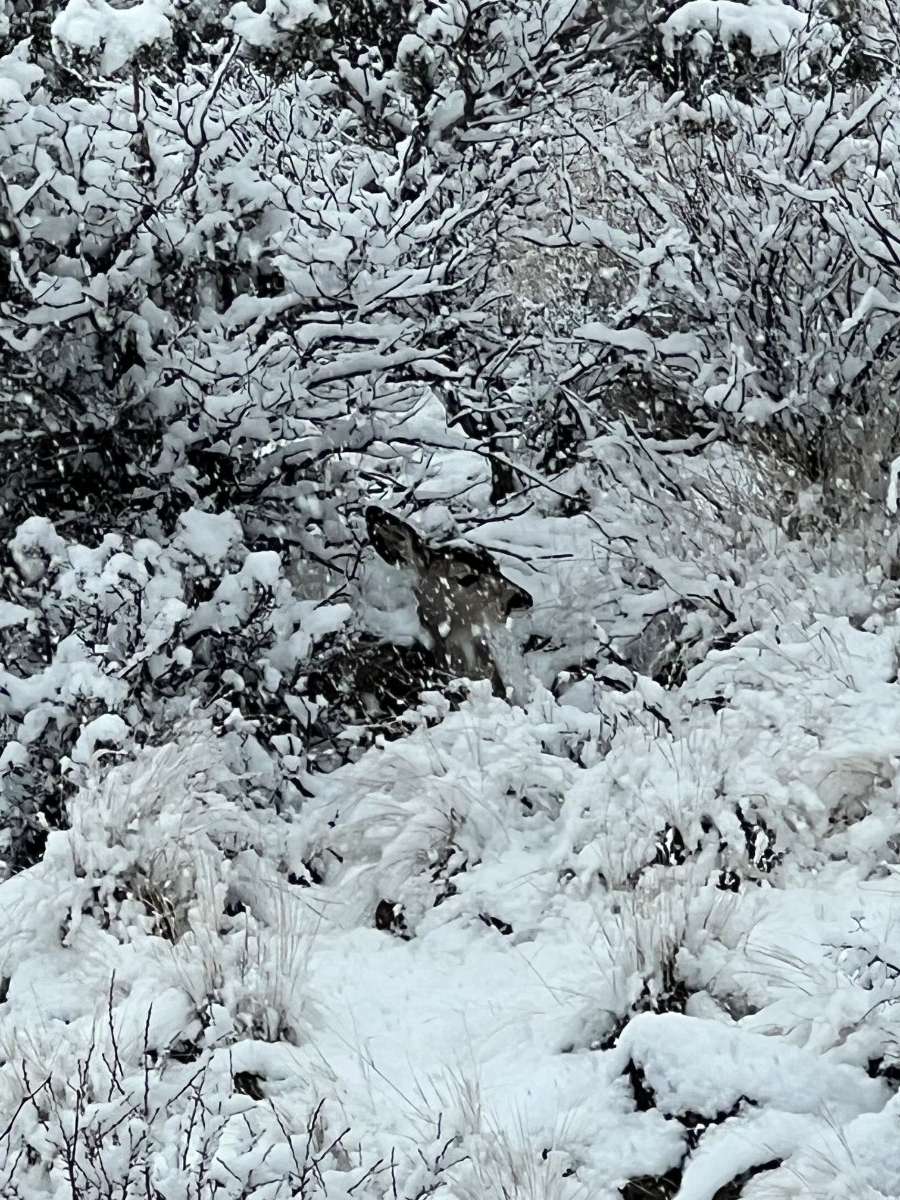
This deer is just hanging out behind my house waiting out the storm.
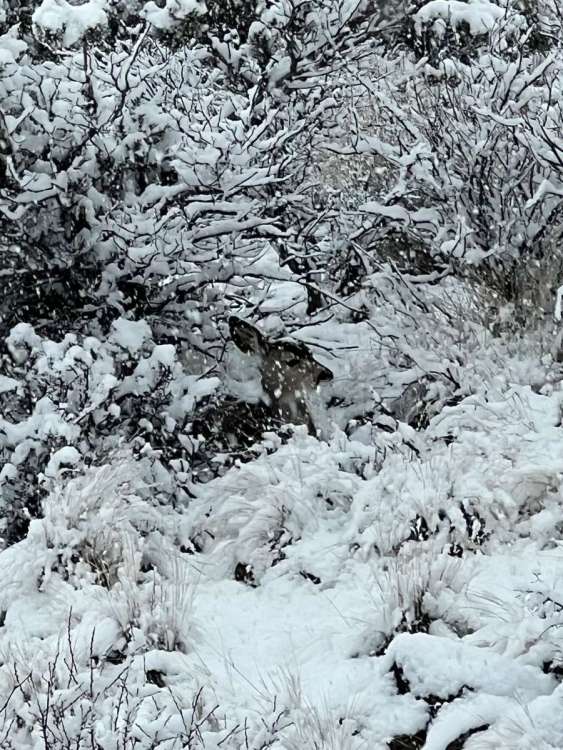 9 points
 -
I think we're in for a MAJOR snowstorm. Snow is super heavy in la pine, we just got our first flakes.
 9 points
 -
I'm not sick, I just had a annual check up.
 9 points
 -
Looks like a over performance in South Hill is going to happen RPReplay_Final1707978109.mov8 points
-
Officially now have the most accumulation of snow compared to the rest of this winter here.8 points
-
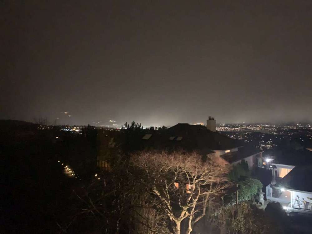
Friends in Olympia say it is dumping. It’s starting!8 points
-
Slushy accumulation starting now right on cue.8 points
-
Massive flakes here. Down to 35.8.8 points
-
You’re gonna make Tiger jealous. Nowhere is allowed to be worse8 points
-
LR GFS looks fun
 8 points
 -
The ECMWF is a bit colder at the surface, 925mb, and 850mb levels. Also wetter for the EPSL. You never know I guess.8 points
-
VID20240214225918.mp4
 7 points
 -
Moderate sticking snow and 34 degrees Very windy as well.7 points
-
Snow in Eastgate area of Bellevue. Lot's of wind. Waiting for NWS blizzard warning.7 points
-
View from Bellevue looking south, can see snow near the surface Kent valley/tacoma moving N
 7 points
 -
Huge flakeage! IMG_5791.mov7 points
-
New gfs run really up snow rates from last run! And is an overall stronger system that is a bit farther east.
 7 points
 -
7 points
-
Awesome line of clouds moving in I noticed on my drive back to work from lunch. And even though my truck says it’s 50 degrees it feels cold out right now.
 7 points
 -
hmmmmmmmmmmmmmmmmmmmmmmmmmmmmmmmmmmmmmmmmmmmmmmmmmmmmmm
 7 points
 -
I'm going with a trace to 1 inch east of Puget Sound and 4 to 6 inches for the Kitsap Pen / Hood Canal. The ECMWF has an acceptable temperature profile for the EPSL late tonight, but moisture is so limited. The late month / early March thing is certainly growing some legs at this point.7 points
-
There will definitely be some areas of the Hood Canal and Kitsap Peninsula that get 5"+. NWS Seattle is as stingy as NWS Portland is quixotic.7 points
-
Nice looking trough
 7 points
 -
We went from slush to road turning white in a all of the sudden moment, temp dropped to 32 and BOOM, stickage everywhere, its coming man, its coming!!!6 points
-
Up to almost 1" now. Just absolutely ripping right now and hours to go per radar!!6 points
-
This is what Mark Nelsen posted in PDX Weather analysis just now. 8pm "Crappy GFS" update: Now we know and can confirm that it still sucks and was a real outlier this time. Temps running 4-5 degrees warmer than it had been showing for this hour. And the 2-3" snow hasn't shown up yet...probably not in next 1.5 hours either. All other models did far better predicting no evening snow in lowlands. GRAF for next two days shows similar setup, but warmer overhead of course makes it harder to snow. I really think in the close-in time period (1 day out) it's safer to stick with the high-res models (WRF-GFS, GRAF, 3KM NAM, HRRR, etc...)6 points
-
Radar looks great. If this continues wet bulbing will put us in business.6 points
-
Huge wet snowflakes in Bonney Lake. This could possibly be an interesting storm.6 points
-
Surprising.6 points
-
Low DP's will counteract the daytime heating, assuming we get enough evaporative cooling. It's really going to come down to precip rates above all else. Timing is nearly perfect actually. A lot of what is being picked up on radar is actually virga. Not enough precip would mean light mix. If we get more than forecast, snow. Fun nowcast in progress!6 points
-
This event really isn't similar at all to 2017. That storm was being steadily suppressed with an arctic airmass advecting into it at 850mb , which gave it its frontogenic nature. This storm is effectively splitting and won't be phasing nearly as well with what is also a much weaker continental airmass.6 points
-
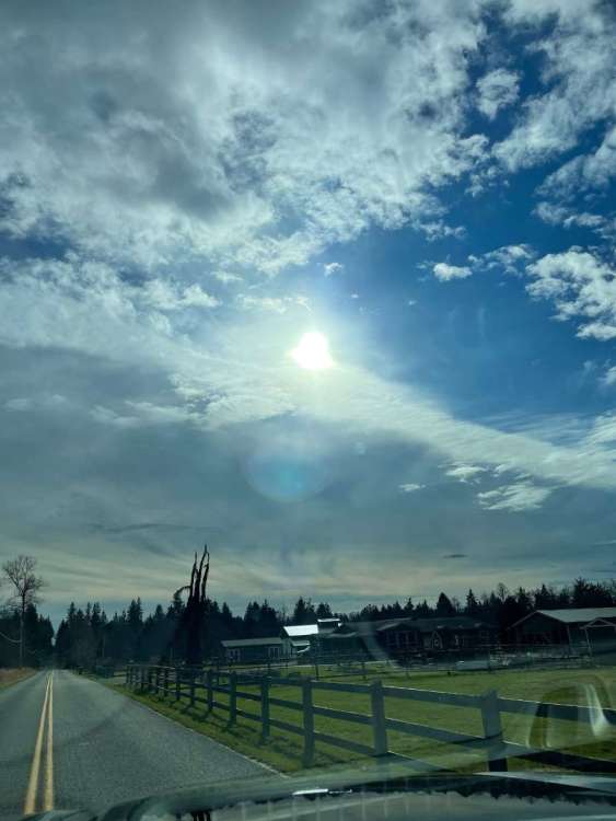
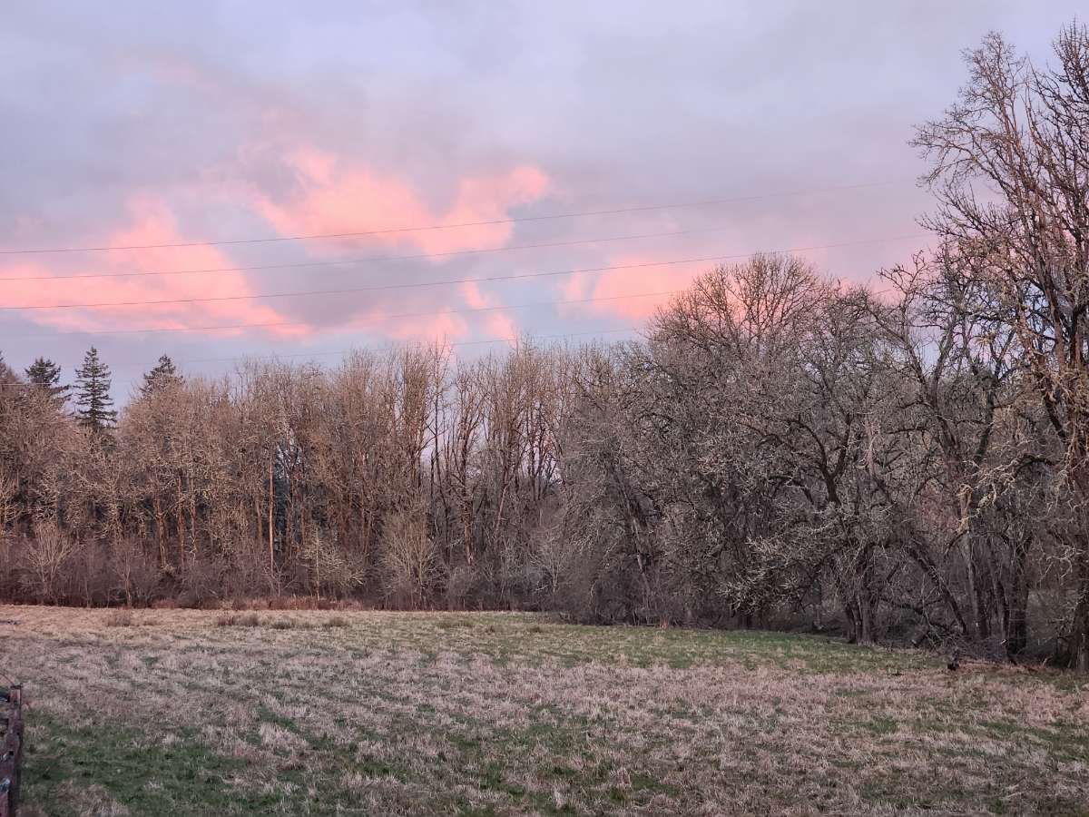
And a really nice sunset that day
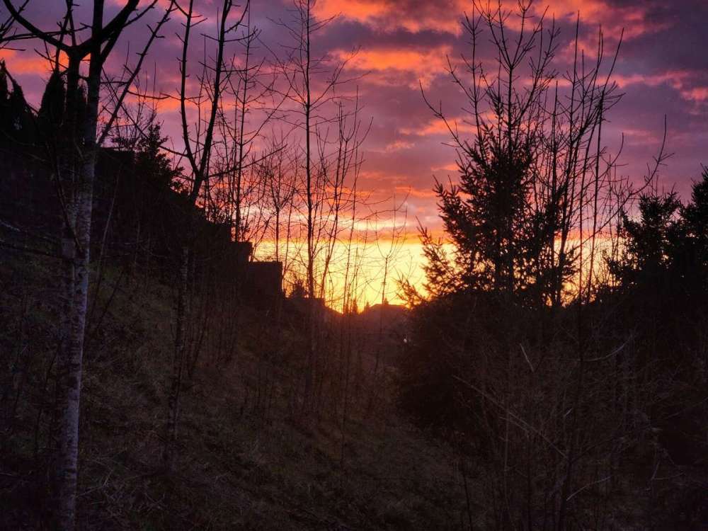
 6 points
 -
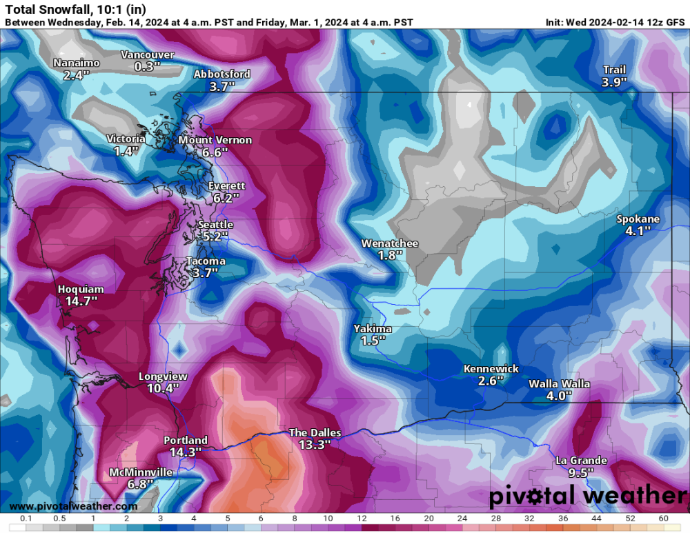
High-end (95th percentile) snowfall totals approach 8 inches for portions of the Portland metro. All in all, the setup with this system is very similar to the Jan 2017 surprise Portland snowstorm, where decaying low pressure failed to advect enough mild air to counter the lowering snow levels due to heavy precip rates. That event led to 8 inches of snow at PDX, with over a foot of snow in some portions of the metro area. With all this in mind, All this talk about snow should not mask the fact that there is still a 40-50% chance elevations below 500 feet will not see any accumulating snow. So don`t be surprised if wet snow mixes in from time to time but the p-type never fully changes over. While confidence in all the details of this system remain remarkably low for something that begins to affect us in Periods 1-2, confidence is high in THIS IMPORTANT DETAIL: If precipitation fully changes from rain to snow in your location, assume precipitation will remain snow for the remainder of this event. This could happen as early as this afternoon, but is more likely tonight into Thursday. If rain fully changes to snow, it means the necessary work has been done by latent heat processes to cool the column enough to bring snow down to your elevation. Therefore, with the lack of significant warm advection, the column should remain cold enough for precipitation to continue as snow until it tapers off.6 points


.jpg.b6f71d58295acde98f6bb982fae469ad.jpg)


.png.f3e725ca3c49822e9cf9494c626ba799.png)


This leaderboard is set to Vancouver/GMT-07:00