
Leaderboard


.thumb.jpeg.e3014abf99ef08a9f9ac2c0cd31b485b.jpeg)
Popular Content
Showing content with the highest reputation on 02/24/24 in all areas
-
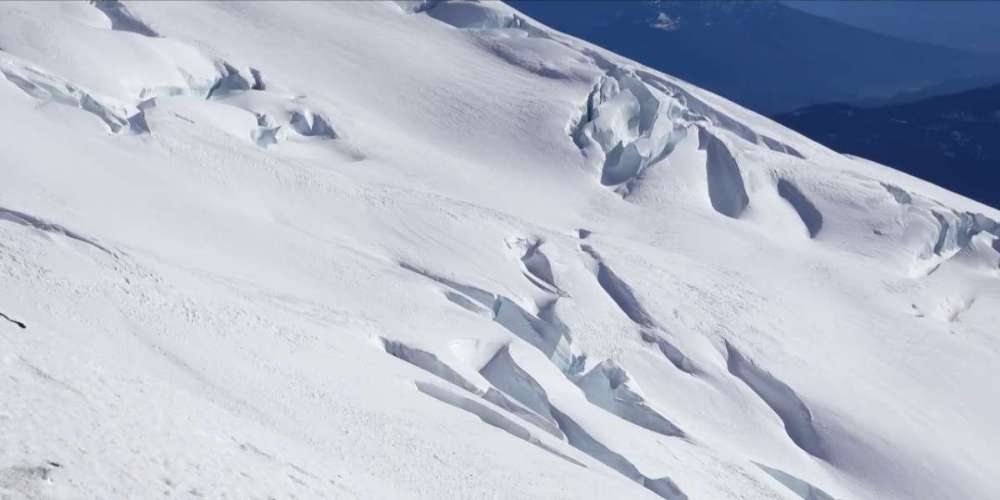
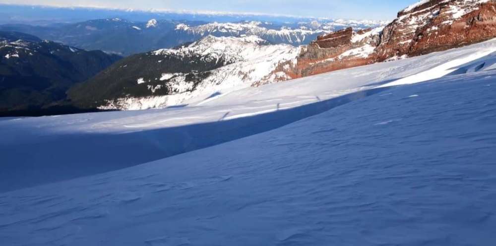
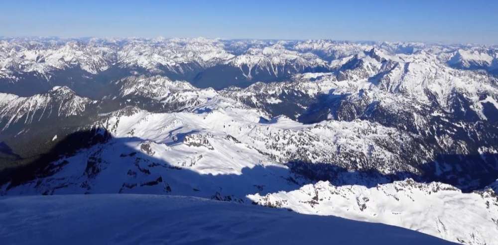
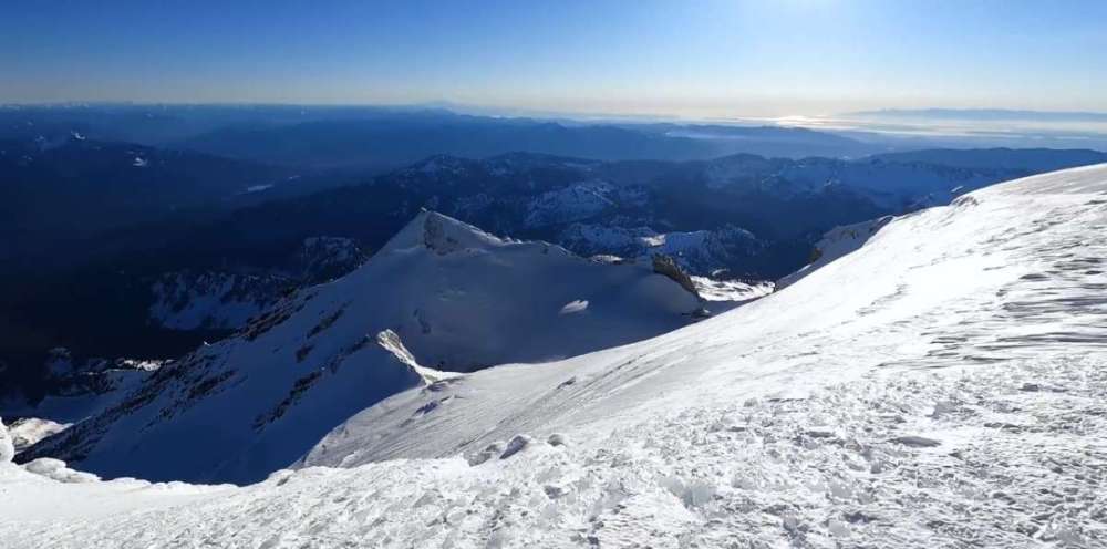
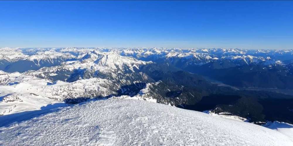
51 degres and sunny currently, low of 23. Was a great drive back to Oregon today, i know cascadiawx will downvote this but i think this weather is great! Went to Mt Baker yesterday for the first time in years, had a great climb despite the DISGUSTINGLY low snowpack, which left more open crevasses than I've ever seen up there in winter, you'd think it was late November with the current snowpack.
 13 points
 -
With regional onshore flow, there's not likely going to be much of a latitude difference. Coos Bay could be just as likely as Bellingham to score accumulating snow.8 points
-
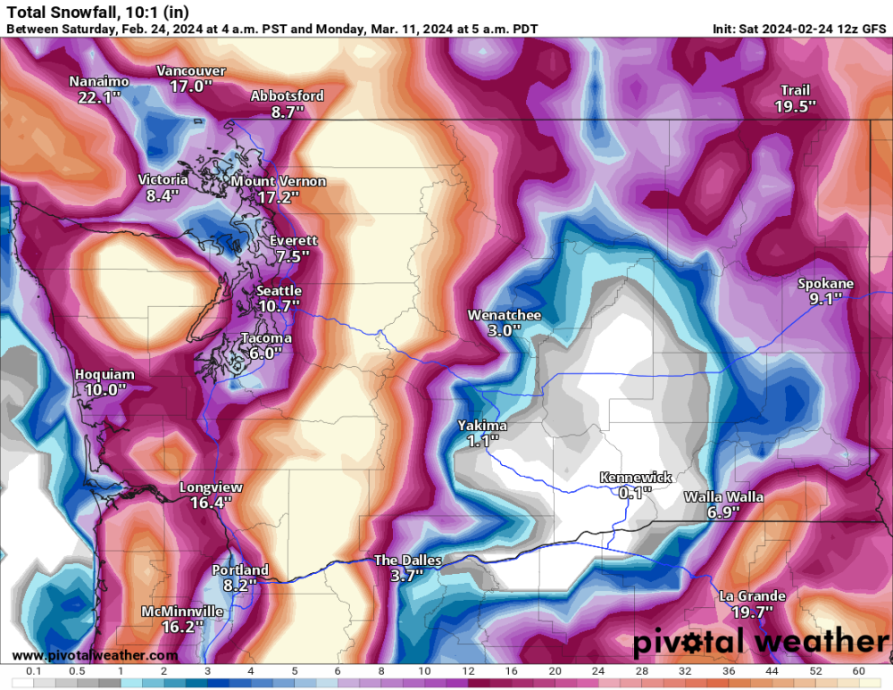
Huge change towards colder and snowier in the last 24 hours in the models. Much more interesting picture now for the next week.8 points
-
Breathtaking.7 points
-
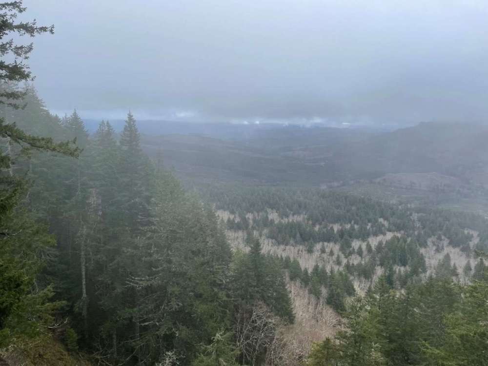
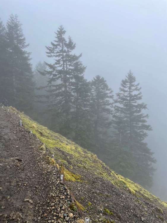
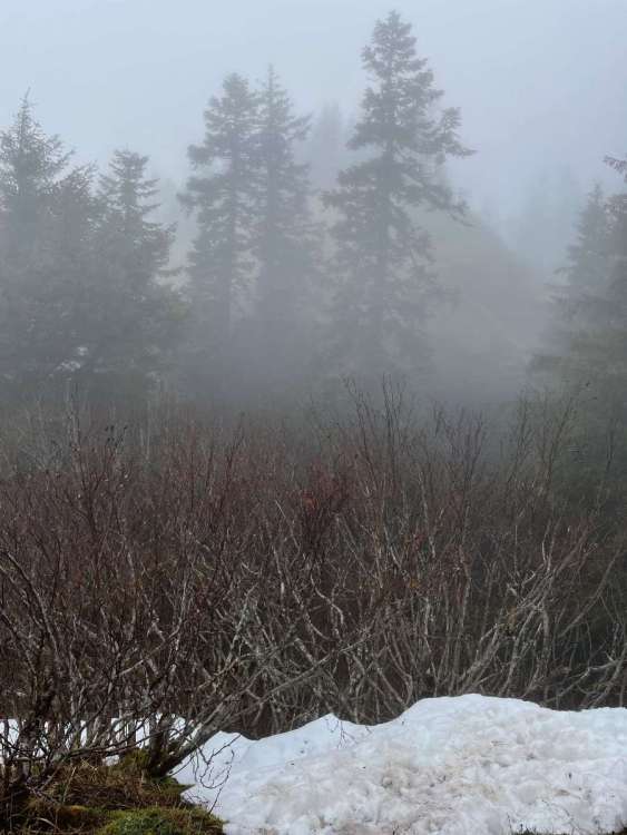
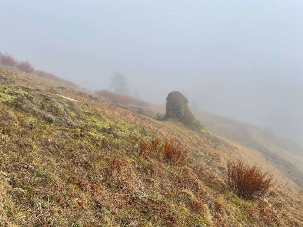
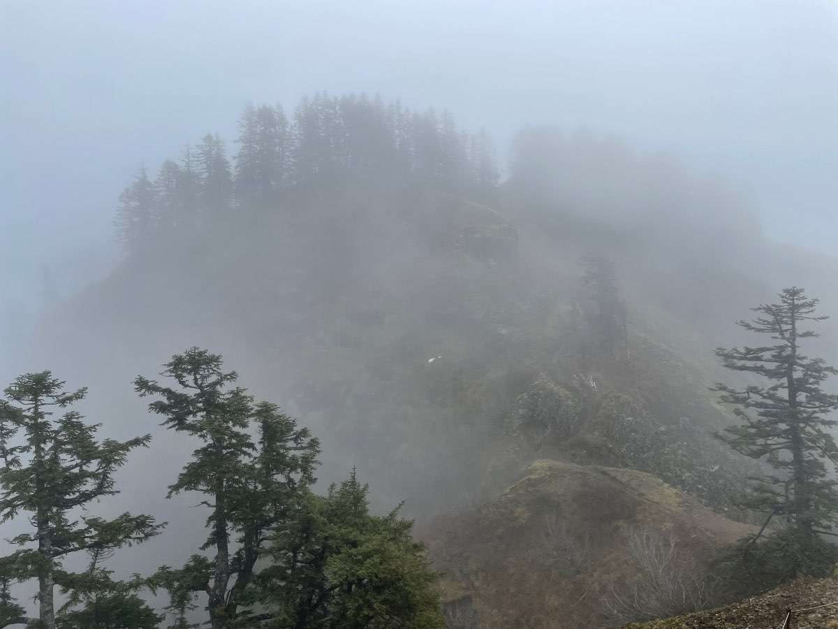
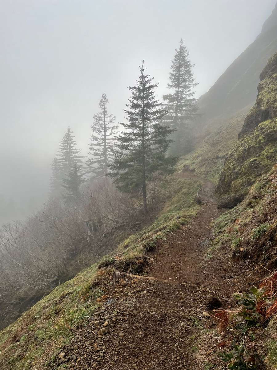
Some snaps of Saddle in all of its gloomy glory. Cloud deck was around 2,500ft or so. Temps were in the low to mid 40s and winds were relatively calm.

 6 points
 -
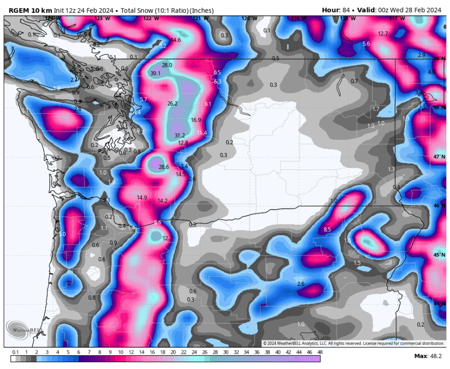
Seriously, the 3 km version is one I rely on as the time frame gets closer. But I think that’s a 12 km map. HRDPS also can be useful as the time approaches, though it does not look as far into the future as the NAM. Terrain bleed is a real problem here and the high-res mesoscale models really help in sorting out the terrain bleed from the actual snow.6 points
-
Nevermind NAM is a great model.6 points
-
6 points
-
No matter how you slice it spring is going to start out cold!6 points
-
I consider Seattle to be part of greater Canadaland. Real WA extends up to about the Tumwater Costco, and then the Ritzville Les Schwab on the east side.6 points
-
I got trashed on the local Facebook page this morning for saying we could get 1-2” Monday/Tuesday above 1500’. Folks are not buying it!6 points
-
Can’t believe you took Your Christmas lights down. Unless it was part of a scheme to make it snow.6 points
-
The EPS control picks up where the OP left off. Just plain cold for early March.6 points
-
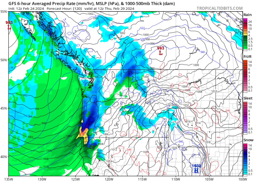
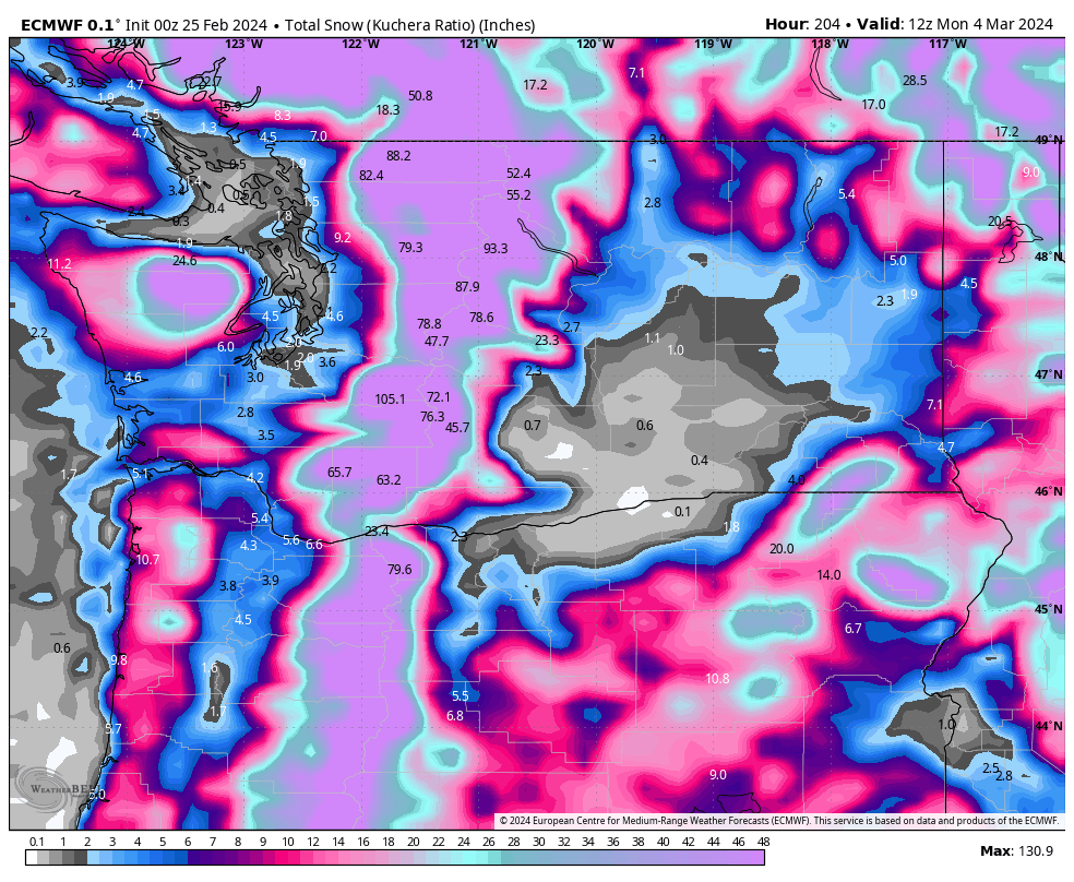
Euro shows this nice system Friday night/Saturday morning for NW Oregon5 points
-
5 points
-
5 points
-
Can’t recall ever thinking wow the NAM nailed this one.5 points
-
It's happening!
 5 points
 -
Somebody’s backyard is going to be white on Monday!5 points
-
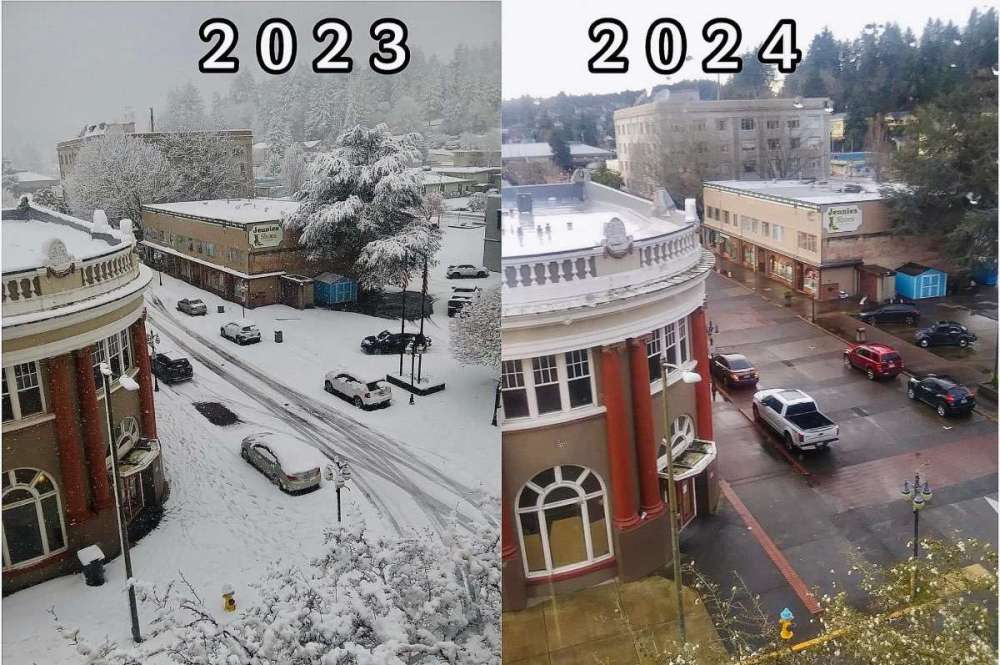
Coos Bay YESTERDAY and one year ago YESTERDAY
 5 points
 -
Nyberg of the North5 points
-
You might be surprised youngster! Chilly airmass heading into the area and snow levels will be near zero at times especially at night.5 points
-
13 years ago today!
 5 points
 -
Looks a little light to me.. I think we'll get more than this.
 5 points
 -
I think that’s part of it but also people are probably in wait and see mode given how poor the snow maps have performed in recent events.5 points
-
EURO is now running.4 points
-
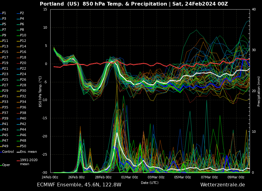
Incredible, this looks to be the longest period of low snow levels this season. Snow levels should stay below 2k feet for ten days besides maybe 24hrs where it is around 3k. A bunch of 500ft snow levels.4 points
-
OOz looks awesome4 points
-
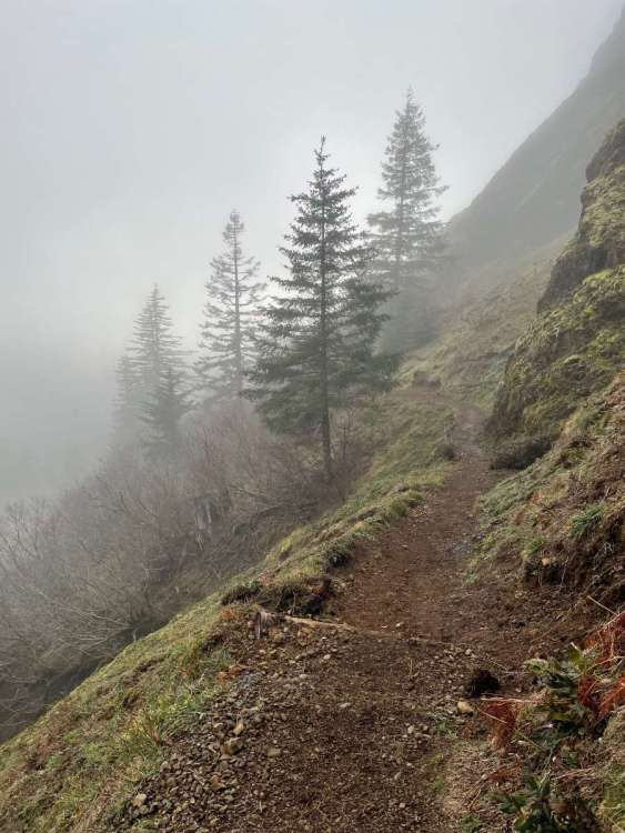
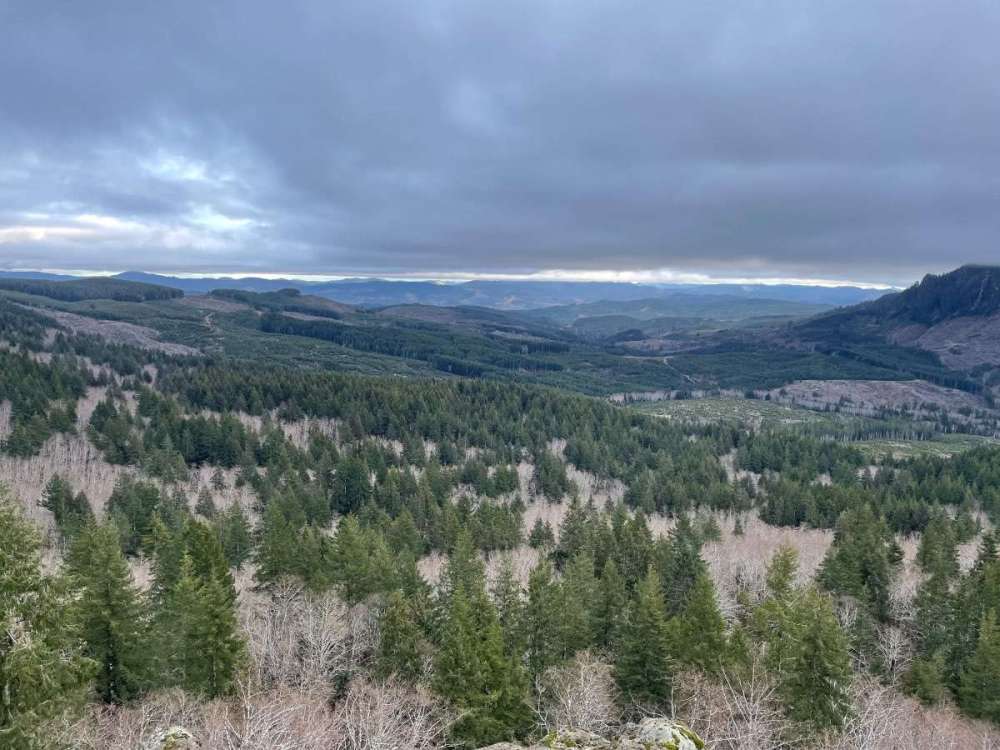
Lot of posts to catch up on today. Hiked Saddle Mountain near the coast earlier. Beautiful hike but the top was inside of a cloud. @Dave would have loved it Looks like a 55/34 day here.4 points
-
I feel like some places are going to get more than what the NWS is saying.4 points
-
4 points
-
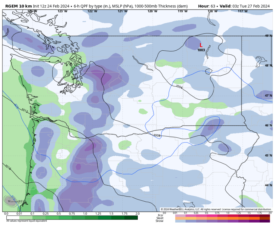
Rgem. Pscz special. Weird it’s pushed so far east, fix that and I get several more inches.
 4 points
 -
Your current location probably got nailed with the March 21-22, 2012 storm. Eastern side of the valley always does better with onshore flow and anafronts.4 points
-
Nice to see PDX hit 35 again this morning. They overachieved some on the lows the last few days, which kind of balances out how much they wildly overachieved on the highs Friday and Saturday. Low of 34 here with fog and some frost. Looks like VUO also hit 34.4 points
-
Five years ago today.
 4 points
 -
The CLIFF model is the best out there!
 4 points
 -
The temp sharply dropped just now. It was 45 an hour ago and calm conditions, now 36 w/ blowing wet flakes, occasional 30mph gusts.4 points
-
1.2" at Chicago O'Hare, which is the first measurable snowfall this month and the first measurable snowfall since January 19. A 34 day snowless streak that was nearly without precedent for Jan/Feb.4 points
-
The Euro is going to take Andrew to the next level.3 points
-
3 points
-
Very nice 0z gfs! Fun is really extended.3 points
-
3 points
-
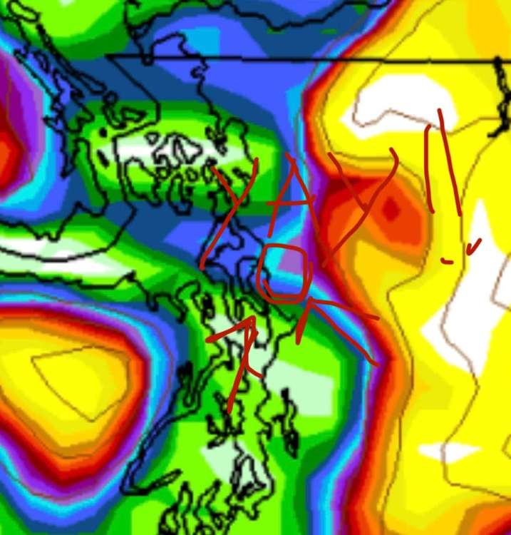
I’m in the blue!!!3 points
-
This pattern would of been money in mid December.3 points
-
3 points
-
3 points
-
What in the FUKK is wrong with the Seattle weather service. Hey buds let's go Camping in the Olympics looks good with no advisory or warning. 48hrs ltr they are trying to figure how to get out because 18 inches of snow just fell overnight. No warning and no advisory and every model I see shows massive snow there.3 points
-
Isn't this close to you??
 3 points
 -
One thing I really like about the 00z EPS is the longevity of the coming cold pattern.
 3 points
 -
This EPS run is about as good as I've seen this late in the season. Lots of lowland snow and well below normal temps. Looks like some continental cold may come into the picture.3 points


This leaderboard is set to Vancouver/GMT-07:00