
Leaderboard


Popular Content
Showing content with the highest reputation on 01/18/17 in all areas
-
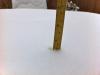
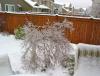
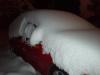
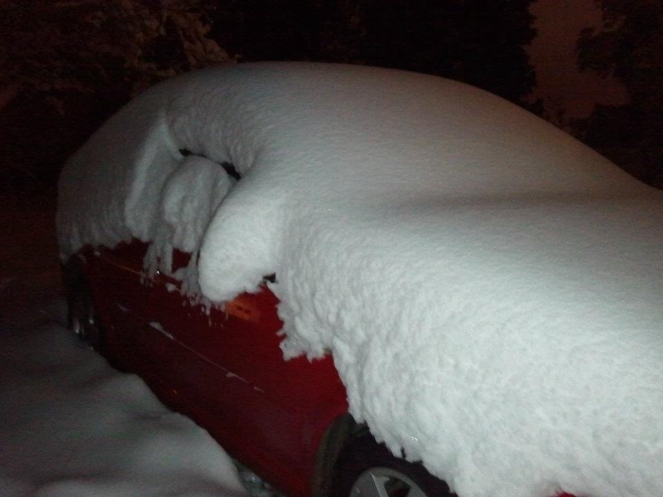
You are correct! That was the last time I have seen that much snow. Pretty much nothing other than a melting 1/2 inch since then... Here is are a few pics from my backyard. The good Ol'days! My daughter is now in College (second year) and son is graduating. A lot has changed but we are still rocken' the 1990 Astro Van you see in the background EDIT: it turned to freezing rain about an hour after those pics were taken (around 8am) and rained all day. So, yes it snowed but enjoying it was very short lived and we have gotten s**t since. Destroyed all of our trees too.
 4 points
 -
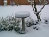
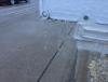
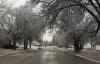
I forget how quickly 50+ and humidity gets rid of snow! Can hardly tell it snowed here. I have one little pile that I shoveled. High of 52 degrees. Highest temp since November 26th Here are pictures, the icy pictures are from last night in NE Portland. All of the ice was off the trees/cars when I woke up, but the ground is still pretty icy/snowy in spots.2 points
-
Certainly some indications early Feb is very much in play right now. Nice 12z GFS and the Euro ensemble continues to be bullish on an Aleutian ridge by then.2 points
-
Here's an interesting little stat - PDX just went 18 days without rising above 41 degrees, from 12/31 to 1/17. Longest such streak since 22 days in Dec 1978 - Jan 1979.2 points
-
Might have to bring a pair of shades to your desk!2 points
-
I am getting ready for a sunny cam tour of the greater Seattle Metro area on the forum starting in about a week.2 points
-
I love doing the cam tour on days like this. Someday I will be posting pics like this from my yard (somewhere in E. WA) to all you poor suckers in Western WA haha! http://images.wsdot.wa.gov/US2/ColesCorner/US2West/US2West.jpg?14847672167622 points
-
Looks like some colder ensemble members at the end of the 12z gfs2 points
-
Snowed here too...2 points
-
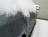
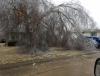
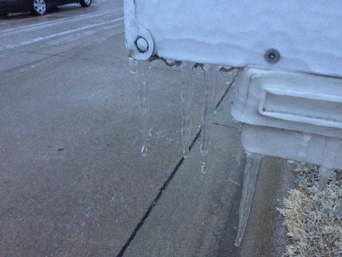
Well, with the ice storm officially over I can report I received .90" of liquid and up to .50" of ice accretion. The power remained for me throughout the storm but there was some minor tree damage around town. Here are some pics I snapped yesterday.
 2 points
 -
46 for a high today. I may keep some slushy snowcover going awhile, this is pretty rad.1 point
-
GFS is the only one on the north camp thus far while Euro/GGEM favoring southerly route.1 point
-
Yeah it's trending better. Earlier runs looked good on paper but the 2M temp was in mid to upper 30's- at least here in C.IA. The 12Z basically had no storm, so that it found it again ,, things could be worse. Most recent 00Z run for just W of DSM-- I'll post a snow map when it's doing running TUE 12Z 24-JAN -1.9 1.2 1006 94 53 0.00 543 539 TUE 18Z 24-JAN 1.4 -1.3 1003 88 98 0.10 541 539 WED 00Z 25-JAN 0.6 -3.7 1000 98 91 0.31 536 535 WED 06Z 25-JAN 0.6 -3.7 1001 96 89 0.18 532 532 WED 12Z 25-JAN -1.9 -5.1 1007 90 94 0.09 534 529 WED 18Z 25-JAN -2.1 -6.5 1013 84 92 0.01 539 5291 point
-
In reality the 0z GFS is already on the road to being good well before the end of the run. Nice to see after a good 12z.1 point
-
The ridge will be totally wrong for warm sunny days. Portland may not see 50 for a long time.1 point
-
1 point
-
It's not really a good hit for any of the posters here though. Most of them are from Omaha and Lincoln. Gives us in Central Nebraska a shot atleast but D**n that cutoff is too close for comfort.1 point
-
Got it. Just had to restart my phone I guess.1 point
-
We'll see ridging before we see retrogression and cold, just part of the progression1 point
-
We got hosed pretty good here. About 2.5 inches. Thank God it wasn't freezing rain.1 point
-
So far I've managed to avoid hitting 50 here. Hasn't been that high since late November. I'm really amazed how well Portland is hanging onto the cold. They could easily be going for the coldest January in decades.1 point
-
Smells like winter here....... Rain.1 point
-
You guys need faith Donald Trump will make America snow again1 point
-
The sun has mad an appearance, peaking in and out of the clouds here in Chitown. It's official, Pot Hole season has begun...dun dun dun...the big Jan Thaw is going to produce some nasty pot holes over the coming week or so.1 point
-
I know! .... it is rock solid. We got it used (in mint condition) when my son was three. It only had 27,000 on it. Was owned by an elderly couple who garaged it in Arizona and only used it for golf outings as they were snow birds. It was in excellent condition then and we bought it for only $3,400 and have had it for around 15 years. Many family trips and memories in it.1 point
-
That Astro van will probably live another 20yrs!1 point
-
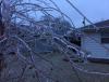
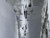
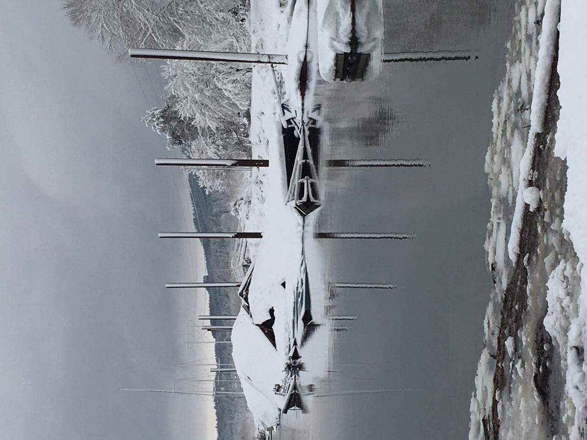
Life if finally slowing down, here is a picture from a week ago. The marina I manage collapsed under a foot of snow. I was standing on the small barge you can see on the left partially submerged. Lucky to be alive, definitely shouldn't have been out there at 3am, wasn't thinking clearly. I will take a "like" as you sympathizing . Needless to say I am done with rooting for snow this weekend. You can have it all western washington. edit: not sure why the orientation is like it is, it wasn't attached like that.

 1 point
 -
#PassiveAggressive20171 point
-
It's almost like you're taunting me to post pics of the feet of snow I had on the ground last month with this post.1 point
-
This winter blows.1 point
-
Toasty 47 degrees in Lake Oswego with very cool low level fog above melting mash potatoes snow. Last day here then back up to Federal way Side note.....bought a small generator three years ago and still have not got a chance to use it. I do however start it up around every 6 weeks to work it. It's only 2000 watt, just enough to run freezer and fridg ( alternating) and keep things charged. And now the sun just came out!1 point
-
The good ole days1 point
-
Wow the 12z GFS goes nuts with well over 3 inches of rain in a 9 hour period and over 4 inches total on Sunday in LA. When's the last time there's been a single day storm like that? 2010 didn't have anything like that. 2005? Models have been inconsistent with that storm in particular but what a run. Now that I think about it I remember there being a storm... a quick search brings up November 30 2007. It dumped 2-4+ inches throughout the inland empire, but didn't hit the coastal areas anywhere near as hard if memory serves me correctly. Wunderground says Riverside got over 2 inches but LA only got half an inch. That was an unusual storm.1 point
-
Yup .....Tbh.....we had so many sunny days last summer, which had me lost count at some point. One thing is for sure, overall, weatherwise last summer was great. Lots of great outdoor activities.1 point
-
If the GFS went out another frame or two past 384hrs it would show us entering the next ice age! Perhaps a fun first week of Feb coming up???1 point
-
Jan. 2012...That was a super fun week!
 1 point
 -
Puget Sound got a good 4-12 inches of snow five years ago today if my memory serves me right.1 point
-
I believe that acronym means "At or Below"...assuming you mean "Above" 32F, I haven't dug into the statistics for ORD. That is a good question for Tom Skilling..."Ask Tom Why"...1 point
-
GEFS is predicting a series of perturbations on the PV over the next 2 weeks. The strongest of the series is forecast by very late January which should displace the PV off the pole... http://www.tropicaltidbits.com/analysis/models/gfs-ens/2017011806/gfs-ens_Tz10_nhem_26.png The Arctic should block up to open February with a very warm Strat... http://www.tropicaltidbits.com/analysis/models/gfs-ens/2017011806/gfs-ens_Tz10_nhem_33.png1 point
-
That's three runs in a row that've trended poorly, FWIW. The control run out 15 days is meaningless, at least relative to the ensemble mean (and verbatim the control run is close to being problematic as well). A broad ridge along/south of the Aleutians is a wave dispersion regime. This loads the +EPO/+NAM very efficiently, especially at this time of year. Goes to show how unstable the upcoming transition will be. Really won't take much to screw it up, or to make it go big. All with consideration(s) to the short nature of the window (closes in mid-February).1 point
-
I could certainly go for about a week long fogversion and then a big blast.1 point
-
Things might be coming together for something very good.1 point
-
The ECMWF ensemble control model shows a textbook retrogression with a cold trough by day 13. The ensemble mean has a decent positive center around the Aleutians.1 point
-
A few very cold ensemble members showing up now. Let's hope something is able to come together for early February. At ANY RATE THE ECMWF IS VERY MUCH ON BOARD FOR A big inversion next week. Looks like it could be a good one. Another very interesting thing to note on the models is the amazing lack of cold air over the Eastern half of the country about 5 or 6 days from now. Even a huge chunk of SE Canada has 850s above zero. That could be a good thing after the block retrogrades there could be a treasure trove of cold air to tap into for us.1 point
-
The kiss of death, ha!!
 1 point
 -
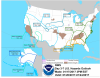
Write up by valley NWS. http://www.weather.gov/oax/event_archive_20170116 Write up by Hastings NWS. http://www.weather.gov/gid/jan152017icestorm1 point
-
Glad you caught the sarcasm!1 point
-
ATL is likely going to have more snow thus far this winter them DSM (3.8") come this weekend.... Can I bend over and grab my ankles yet???1 point


This leaderboard is set to Vancouver/GMT-07:00