Leaderboard
Popular Content
Showing content with the highest reputation on 01/31/17 in all areas
-
...Daffodil Alert canceled... The Daffodil Alert for the Portland Metropolitan Area has been canceled. The model runs that prompted the Daffodil Alert have given way to colder guidance. A Daffodil Alert is issued when model guidance suggests temperatures may reach 60 degrees for the first time during the late winter/early spring. A Lowland Snow Bust Watch has been issued for Thursday evening through Saturday for elevations below 1000 feet.6 points
-
Loving the trends. Heights get even lower on this run than the 0z. Quite a gift to have the models rethink the details of the block to such an extreme degree with the event this close. No doubt some places could get crushed with a pattern like or similar to what is being shown.5 points
-
That he can be obnoxious in multiple places online at once. It's a true gift.3 points
-
Definitely something to be proud of.3 points
-
Right. Why even focus on the middle of next week? 4-5 days of snow and cold is a big deal for this area. This isn't Bozeman.3 points
-
Got about 3.5" here today. Airport only 1", it's about 3 or 4 miles northwest of "my location". I think this is the rare case of local shadowing for the airport with the NNW winds. Usually I've been getting half an inch to an inch less than the airport this winter in big storms except one exception where there was a strong north/south gradient. Both locations are at the valley floor. I should say there are still a couple hours of life left in the deformation band.3 points
-
Whichever model gives the most snow.3 points
-
This might be one of my better calls of late. Remember the bolded and knock on wood.3 points
-
This looks to be the pattern that finally gives all the posters up in Washington a snowstorm. Great setup for up there.3 points
-
Sure would make it hard to complain about this winter. http://www.tropicaltidbits.com/analysis/models/gem/2017013112/gem_asnow_nwus_40.png3 points
-
Dude you need help. Ever one of your posts are negative bullshit. You dont contribute anything to the forum other then crybaby garbage.3 points
-
You should have maintained your negativity for longer. Mark should have listened to Dome Buster. NWS Portland should have smoked better weed. Lots of little mistakes.2 points
-
I blame Phil's self-congratulating earlier today.2 points
-
Mark better watch out for his job!2 points
-
You are speaking as if you are some kind of authoritative voice on forecasting when in reality most people would trust Phil's self reported address history before they'd listen to your analysis. You were basing those comments on absolutely nothing more than your little weenie gut feeling.2 points
-
That's why he gets paid. He is by far the best met in town and probably top ten in the country. He lives and breathes it more fanatically than any of us do. His passion puts him over the top.2 points
-
The 18z looks really good. If anything the block look more solid than earlier runs.2 points
-
Models picking up on the jet extension towards mid month brought in part by WHem MJO forcing that I mentioned earlier. We need this round to work unless we want to wait until end of Feb/beginning of March2 points
-
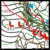
2 points
-
2 points
-
12z ECMWF ensemble mean through hr180 for PDX is in the 4-6 inch range. About 6 inches for SEA.2 points
-
Maybe this will be the thread of the ages for the Seattle area!2 points
-
Protest march. Pioneer Square to PDX. Be there.2 points
-
Rod Hill calling for 2-4" of snow at PDX on Friday morning...What the heck?!2 points
-
Pretty solid looking 12z ensemble.2 points
-
2nd gem run in a row to show 2 feet in the north sound.2 points
-
I couldn't think of a better way to finish Winter off than with a big regional event that we haven't seen since December 2008.2 points
-
Busy morning with travel snowy fun - ha! GRR's been slow to show many reports but I was up to a bit under 4.5" at 6 am and there was more to come down. I see IWX has a storm report out and with 4.9" reported near Litchfield about 25 miles southeast of Marshall. Looks like their (GRR's) map yesterday with some 4-6" jack-zones over here verified nicely. First and only plow-worthy snowfall for January for my place. Nice to hear city plows come by about 4 am Niko how'd you do over that way?2 points
-
Maybe 6" or so in open areas and approaching 10-12" in the woods. Hard and crusty base.2 points
-
I think 17-18 will suck compared to this winter but 18-19 should be a decent one. You know, the 8/9 thingy.1 point
-
Fun first snow storm since moving! Near whiteout conditions, dropping temps through the daylight hours (31º at sunrise, dropped to 15º by 1pm) is something I'm not used to coming from Portland! Looks like about 6-10" fell here but was pretty tough to get accurate measurements due to the strong winds most of the day. South of town where we are building there was nearly 12" when I was out there earlier this afternoon. Currently 10º and still snowing lightly so continuing to add to the totals. Looks like a little break during the day tomorrow with another 2-4" expected tomorrow night and Thursday.1 point
-
Sorry. If it can manage to do it on the weekend entirely or over spring break, I'm all for it.1 point
-
1 point
-
Yeah, I was thinking at best an inch but I trust Mark on his experience with these transition events. If the entire Metro area got 2" it wouldn't surprise me.1 point
-
I agree completely. I have absolutely no faith in either party's ability to compromise for the good of sensible progress.1 point
-
Current thoughts from Mark Nelsen right now. He thinks it will be cold enough for snow at first and up to 2 inches snow posdible but it could just be mainly freezing rain. "Thursday will likely be dry through at least the first half of the day too as the cold east wind continues. Right now it appears that solid precipitation arrives sometime later Thursday and continues through Friday. At first the cold air will be deep enough for snow, then as it warms above we should changeover to freezing rain sometime Thursday night. I see an inch or two snowfall before a changeover Friday AM, OR it could be a mainly freezing rain event…we'll see."1 point
-
I'm rooting for you guys, especially the puget sound folks who've been shafted for 5 years now. And yeah, that was a big one...3 feet in one day lol. I can't believe it's been a year already. The NWS employee living near me recorded 38". I measured about 35" but didn't clear the snowboard as often as recommended.1 point
-
I'm gonna pout. Its the American way apparently. If We miss out on snow, I'm gonna protest and make sure people can't go about their normal lives.1 point
-
I hope the event is insured. Lots of pothole-related injuries are sure to occur.1 point
-
Thank you very much. Let's hope, lol.1 point
-
The 12z EURO hammers you up there. The system on Monday takes too much of a northern path for PDX. The Northern OR and Southern WA coastlines get hammered and some snow reaches into Washington, Columbia and Cowlitz County.1 point
-
12z GEM on the WeatherBell maps confirm 12-25" of snowfall over the next 10 days on the I5 corridor from Salem to Bellingham. Impressive.1 point
-
Winter storm warning just posted for the lower Columbia Basin. 3-5" of snow expected.1 point
-
Looks like February 1990-lite.1 point
-
Feb 2014 redux except regional...bring it1 point
-
1 point
-
Solid clipper 3" imby. Just enough to get the snowmobile and x-country trails rolling again.1 point
-
1 point
This leaderboard is set to Vancouver/GMT-07:00




.thumb.jpeg.e3014abf99ef08a9f9ac2c0cd31b485b.jpeg)


