
Leaderboard


Popular Content
Showing content with the highest reputation on 03/03/21 in all areas
-
Once again, this is the time of year that I'm so jealous of Nebraska weather. It's always so much warmer than in eastern Iowa.6 points
-
Currently 68.2 in my backyard. Might crack 70 today! 2 weeks ago, I dropped down to -24 and some spots in the area were -30. Only a 100 degree difference in 2 weeks!5 points
-
Made it to 70 today!!!!4 points
-
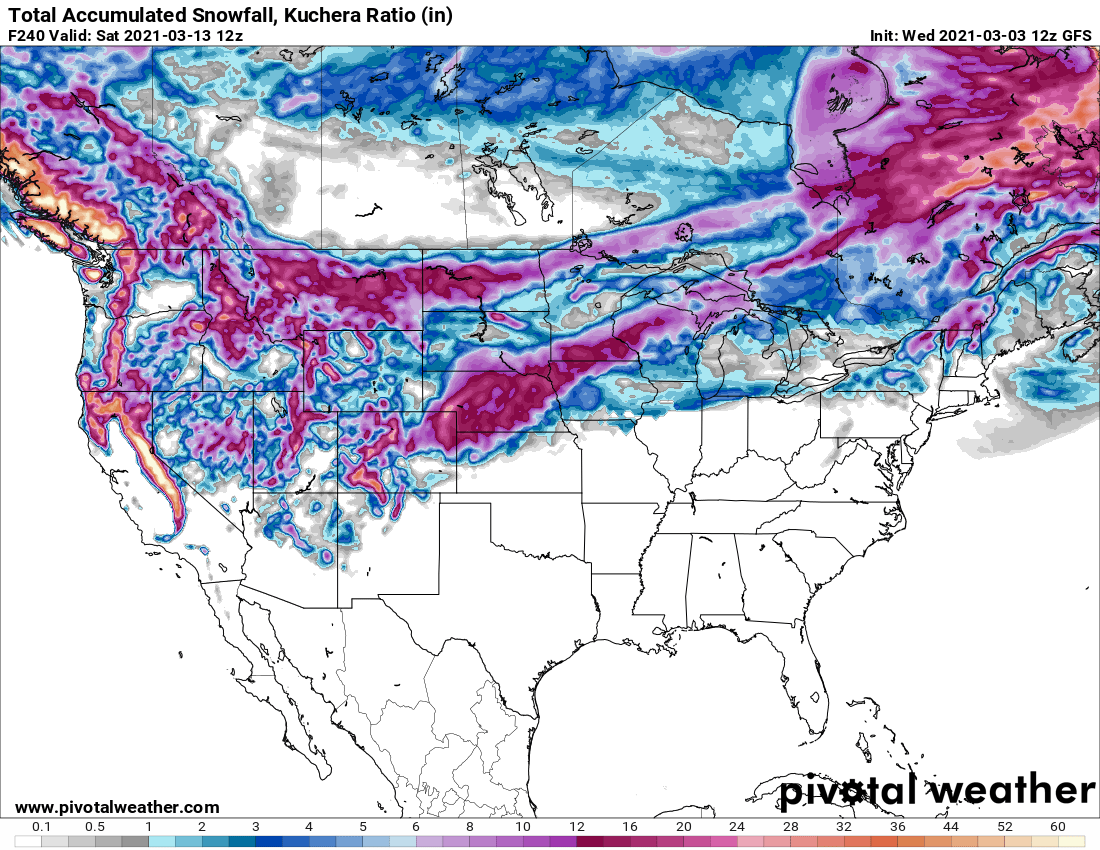
Holy blizzard by the 12z GFS. Winter might make a come back in 7-10 days. Long ways out but something is brewing in the long range; it fits the LRC also as Gary Lezak talked about it in his blog this morning.
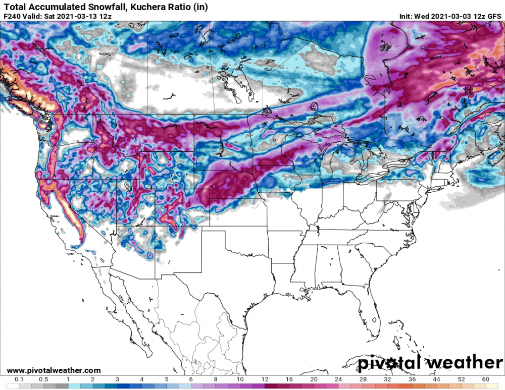 4 points
 -
High of 69 in Lincoln today.....niiice.3 points
-
I had to go downtown on my lunch break and it was 52 degrees over off H Ave and 380. I got back to work which is just down from the airport and my car said 42.3 points
-
GFS ensembles are saying Winter is not over. Mid month big dogs looking interesting. Here is the Mean from the 12th-15th3 points
-
67 here as of 3:55 pm. Nice.2 points
-
Eastern IA seems to be the ideal place if you want to hold on to snow cover forever lol.2 points
-
The snow-free region of southern/southwestern Iowa continues to easily soar into the 50s while the deep snow pack area east-central Iowa is stuck in the low 40s.
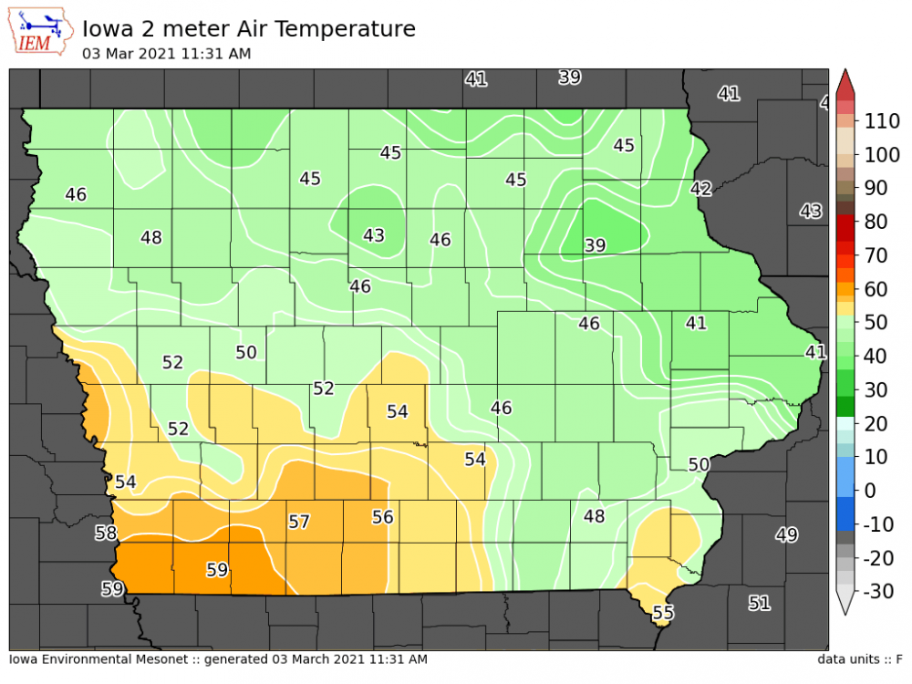 2 points
 -
February stats from my backyard. Average low: 8.2 9.9 degrees below average Coldest low: -23.6 (2/16) Average high: 27.2 10.9 degrees below average Warmest high: 57.4 (2/27) Average temp: 17.7 10.4 degrees below average .89" of precip and 12.6" of snow. Total snowfall through the winter so far is 38.3" Had 1 winter storm warning, 2 wind chill warnings, 4 wind chill advisories, 4 winter weather advisories, 1 dense fog advisory, and 1 aerial flood watch for ice jams!! Also had 11 nights at or below zero for the low and one daily high below zero.2 points
-
Just cracked 60 for the high today! Currently at 60.6 in my backyard.2 points
-
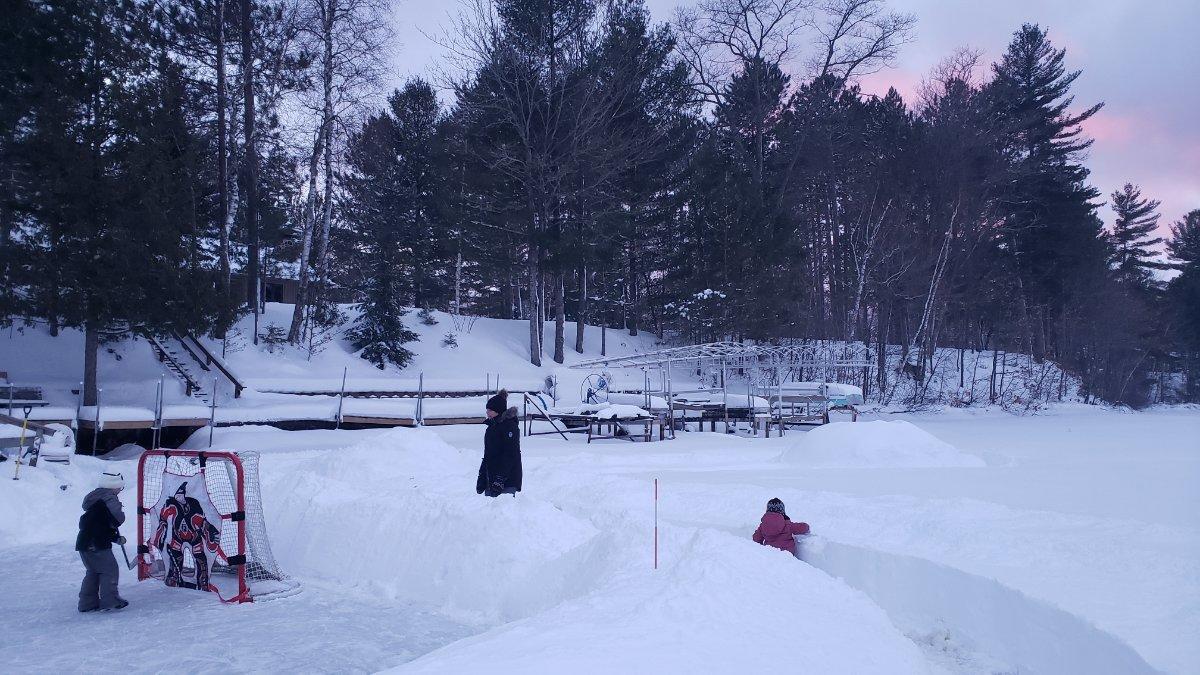
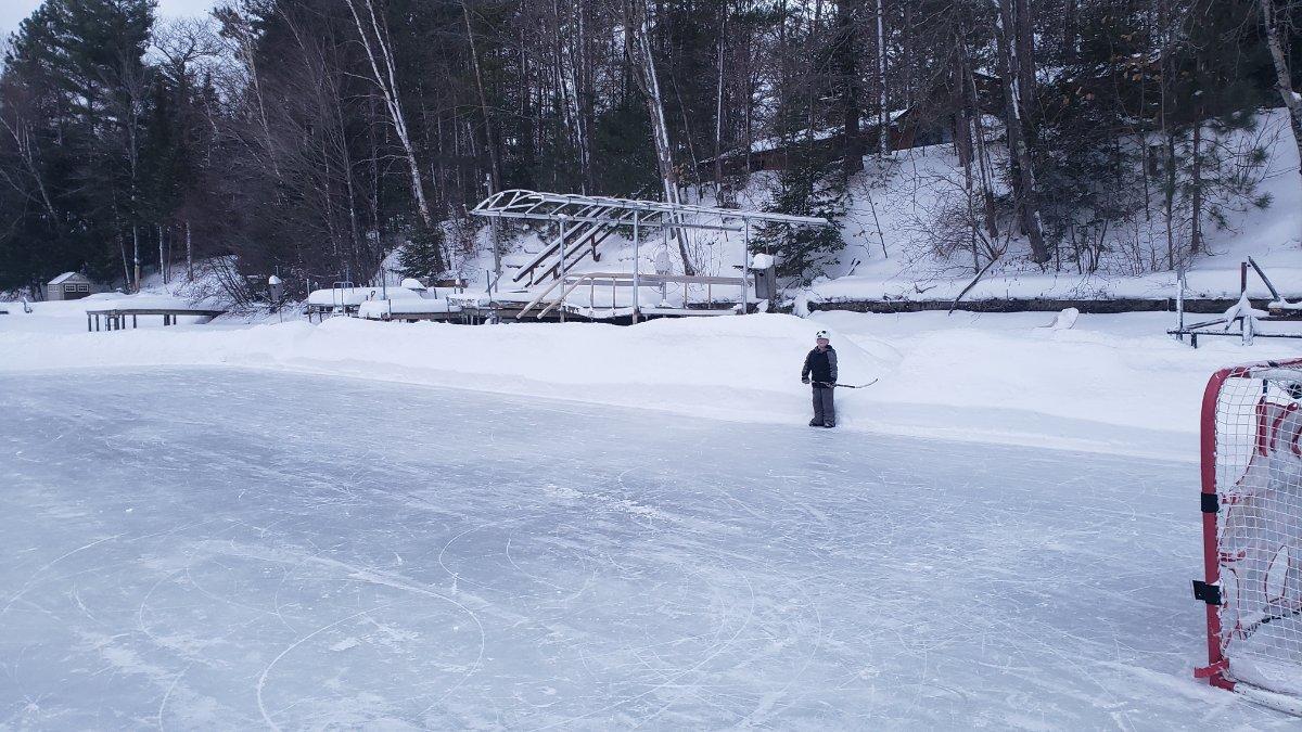
Finally some picture worthy snowbanks!
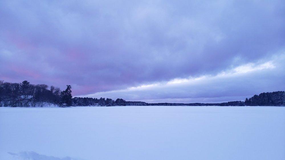
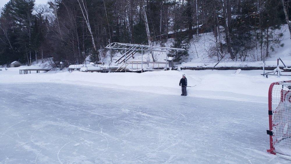 2 points
 -
0.52" here in Murrieta.1 point
-
He took it down. Will be back next winter or potentially if a storm would develop in the next month.1 point
-
My weather station reported a wind chill factor of 38F at one point during the rain (actual outdoor temp was 44F). Eastern escarpment of Elsinore Peak (3,575 feet above sea level) - while hard to make out from here due to passing clouds - snow appears to be visible on the mountain down to roughly 3,000 feet.1 point
-
Another round of rain has ended here, leaving me with 0.50".1 point
-
Hasn't been a truly cold March since 2014 and before that Maybe 2009? Can almost bank on a "non-wintry" month any more. 1982 was true winter1 point
-
Rain starting back up here. Temp is holding steady at 44F despite the rain. 0.34"1 point
-
Look at Nebraska today.
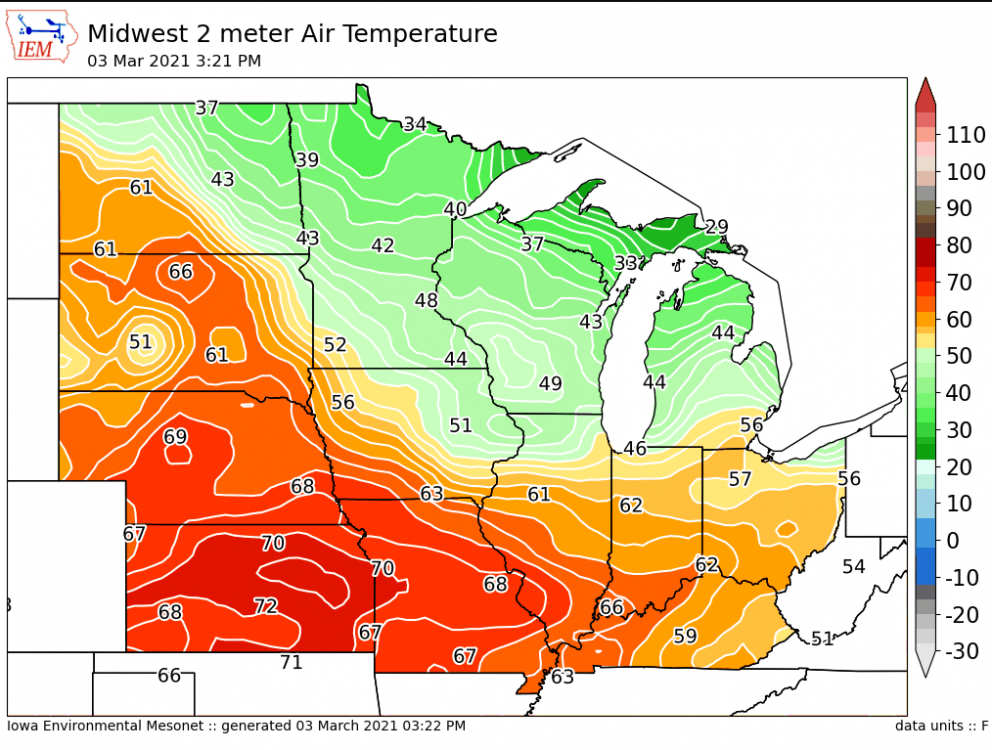 1 point
 -
Rain has stopped for now, temp is at a rather chilly 44F for the middle of the afternoon. 0.33" here.1 point
-
This is quite a cold system, rain is still coming down and only 46.5F here in the middle of the day. 0.14" so far. Hearing some distant thunder. I have not heard thunder in a long, long time.1 point
-
Big fat rain drops just began falling here. First time I've seen the weather like this since January.1 point
-
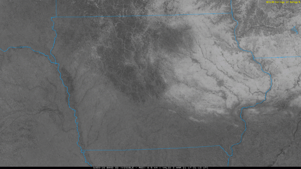
Somehow, the Cedar Rapids airport actually fell by one degree from noon to 1pm... now sitting at 41º. Here in the city it's near 50º. Satellite shows the city as a big dark spot because of all the snow melt. Meanwhile, the airport is still in the middle of a bright white area in between Cedar Rapids and Iowa City where there is still good snow cover.1 point
-
I'm kind of torn now. I am nearly in spring mode because I have flowers coming up already. One last blizzard would be kinda nice, but after the forecasted high of 60 on Tuesday.... Ugh1 point
-
Oh wow that was a big rainer a few days ago. I hope this turns out, it means at least an extra week of snowboarding.1 point
-
Today March 3rd is the earliest day of the year that it ever officially reached 70 or better. As stated above it reached 72 on this date in 1983 and it also reached 71 in 1974. The next March day with a record high of 70 or better is not until March 7th. Also of note it that as of today Grand Rapids has not had a thunder event yet. To bring you up to date any day that has a recorded lightning strike is considered a thunderstorm event. At this time it is clear here at my house and I have a temperature of 32 the overnight low was 31. I reported a trace of snow on the ground but there is between bare ground to around 5" in the yard and of course there are still a lot of big snow piles all around. But this is very typical for early March. On this date the snow depth at Grand Rapids has ranged from none in many years all the way up to 19" in 2014. And the high has ranged from that 72 in 1973 to 12 in 1943 and in 2014 the high was just 15. and the low has ranged from -9 in 1942 (it was -8 in 2014) to the warmest low of 40 in 1964 and 19741 point
-
I'am 100% in on this. Maybe not in iA, but dakotas' / N.MN is going to get clobbered. PP at Accu-Wx is all over it as well. Been watching the AO and NAO like a hawk since early FEB and yes, the AO is going to be go about as + as it went - , but forecasts show it going - again , probably not to Mid-FEB levels but this time it looks like the NAO wants to go - also. Fun times ahead - even if it's not in your own backyard.1 point
-
The current temperature here at my house is 12.4 I wonder it this will be the last very cold morning this season. Here are some official readings for Grand Rapids for this past meteorological winter. The average H/L at GRR was 33.3/21.0. The 30 year average is 33.1/20.5 The 3 month mean was 27.1 and the current 30 year mean is 26.8. So over all the winter of 2020/21 was a little warmer than the current 30 year average. Now in the snow fall department that was a different story as just 45.4” fell and that is -12.1” and for the season just 45.8” have fallen so far and that is -19.0” For the season there were 0 thunderstorm days. 1 day with heavy rain, 17 with light rain, 51 days with light snow 3 days with heavy snow. The there was 27% pf possible sunshine with 7 clear days, 17 partly cloudy days and 66 cloudy days.1 point
-
Lots of bare spots began showing yesterday, but today it didn’t melt much. The next few days will make it look much different. A few tulips are poking through on the sunny south side. I’m afraid we could have a swarm of Japanese beetles this summer since the soil didn’t freeze deeply with thick snow cover. It’s nice to have snow to insulate things, but another downside is the rabbits do a lot more damage to shrubs etc when grass isn’t readily accessible.1 point
-
I think the green in grass revealed immediately after snowmelt is left over chlorophyll in the grass preserved by below freezing temps and snow cover. The grass is dormant still until the soil warms up. If the snow melts but soil temps keep cold enough to keep the grass dormant, the residual chlorophyll eventually breaks down and the grass turns brown just like leaves change in the autumn.1 point
-
I've noticed that the grass looks pretty green here as well. That's pretty neat, I didn't snow cover provided an insulation like that. Even in the mildest winters in Memphis, I never saw green grass this time of year.1 point
-
I saw a post somewhere that our frost depth only got down to 5-6" I believe bc of that same reason. Wasn't cold and then it snowed, got really cold, and that insulated the ground. Should be a quick green up. We're mostly snowless here now1 point
-
12z Euro 10-day forecast for Cedar Rapids 29 42 41 47 52 50 52 57 60 621 point
-
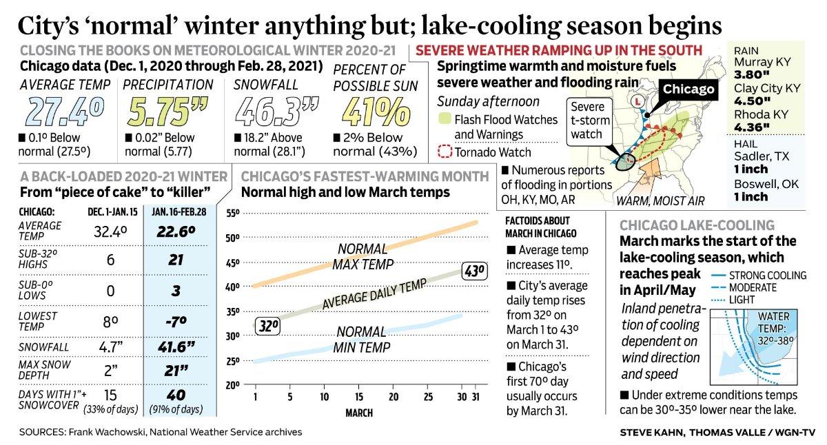
That's a wrap! This was the epitome of a "back-loaded" winter for Chicago and the most memorable comeback of Winter I've ever experienced. The numbers below say speak for itself. I was surprised to see that the avg temp ended up 0.1F BN after such a warm Dec and Jan. Interestingly, precip was BN while in the snow dept it ended up much AN! The brutal cold wasn't that much of a player over here as subzero readings at ORD were shy of the avg (12) days a typical winter season sees. Now, I'll be honest, as a winter wx fan I'm already paying attn to next winter and some similar ideas are already coming to mind with high late blocking (esp Greenland) next cold season. Low solar and cyclical patterns will be in the cards so there is hope for a good to great one next year without having to see so much warmth as the oceans cool this summer/autumn.
 1 point
 -
Ended up with 12" even!1 point
-
Chilly day today. Lake Forest got 0.40".0 points
-
LOTS of snow on Saddleback. Lower snow levels than expected?0 points
-
Still raining hard.0 points
-
Heavy rain has begun.0 points
-
We could actually get some rain today.0 points
-
DVN stated the frost depth was just 2" here due to the snow blanket.0 points


This leaderboard is set to Vancouver/GMT-07:00